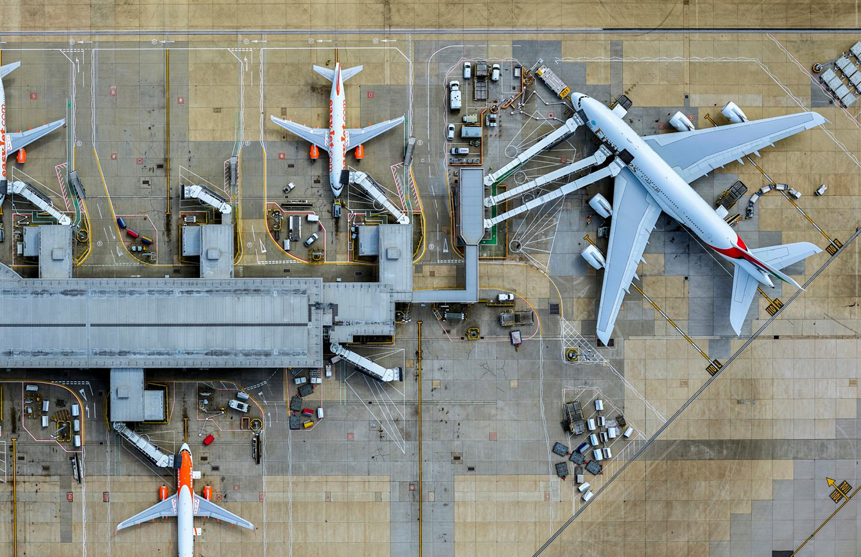
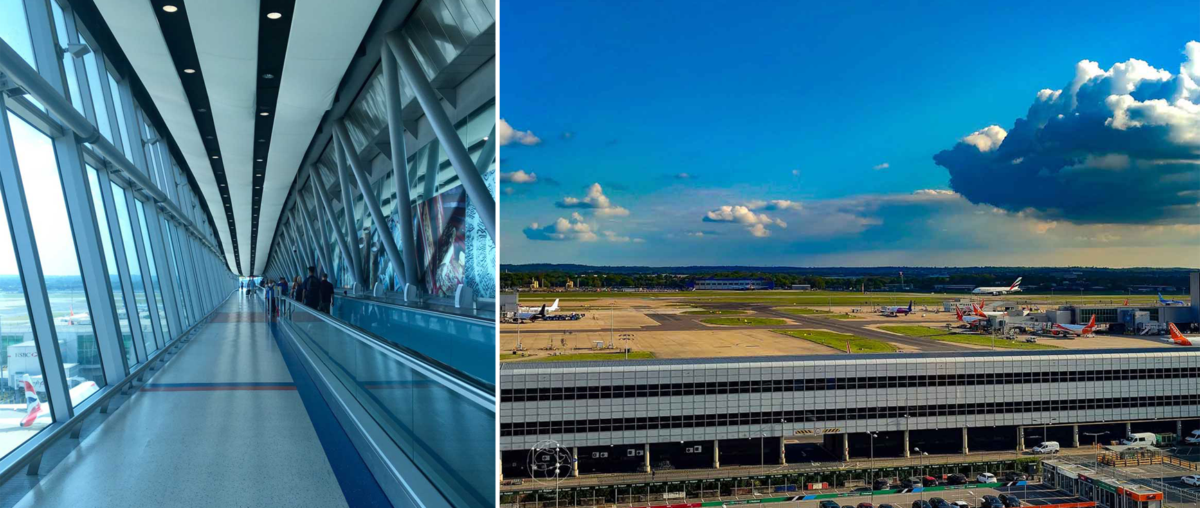
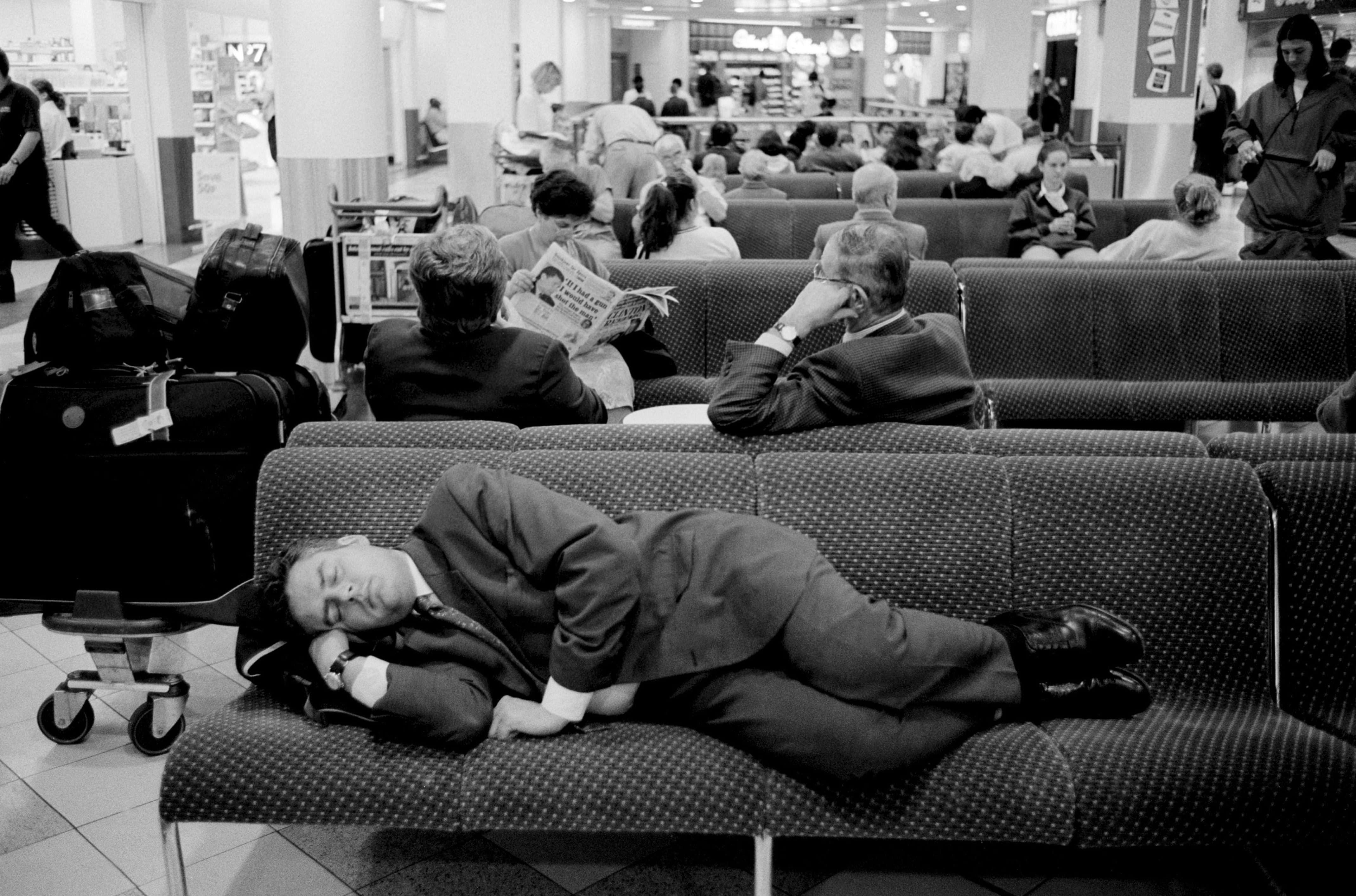
Gatwick is known today for being a busy airport that specialises in package holiday flights. It handles over 33 million passengers annually with an average of 700 flights daily.
However, gāt [goat] wīc [dairy farm]—as first recorded in 1241—was once famous for its horse racing. Gatwick Racecourse (1891–1940) had a dedicated train station built to cater for racegoers coming down from London and up from Brighton and hosted the Grand National three times.
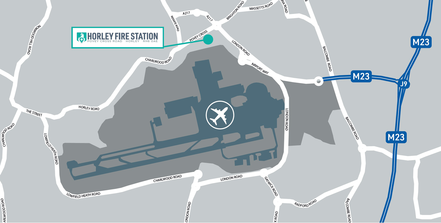
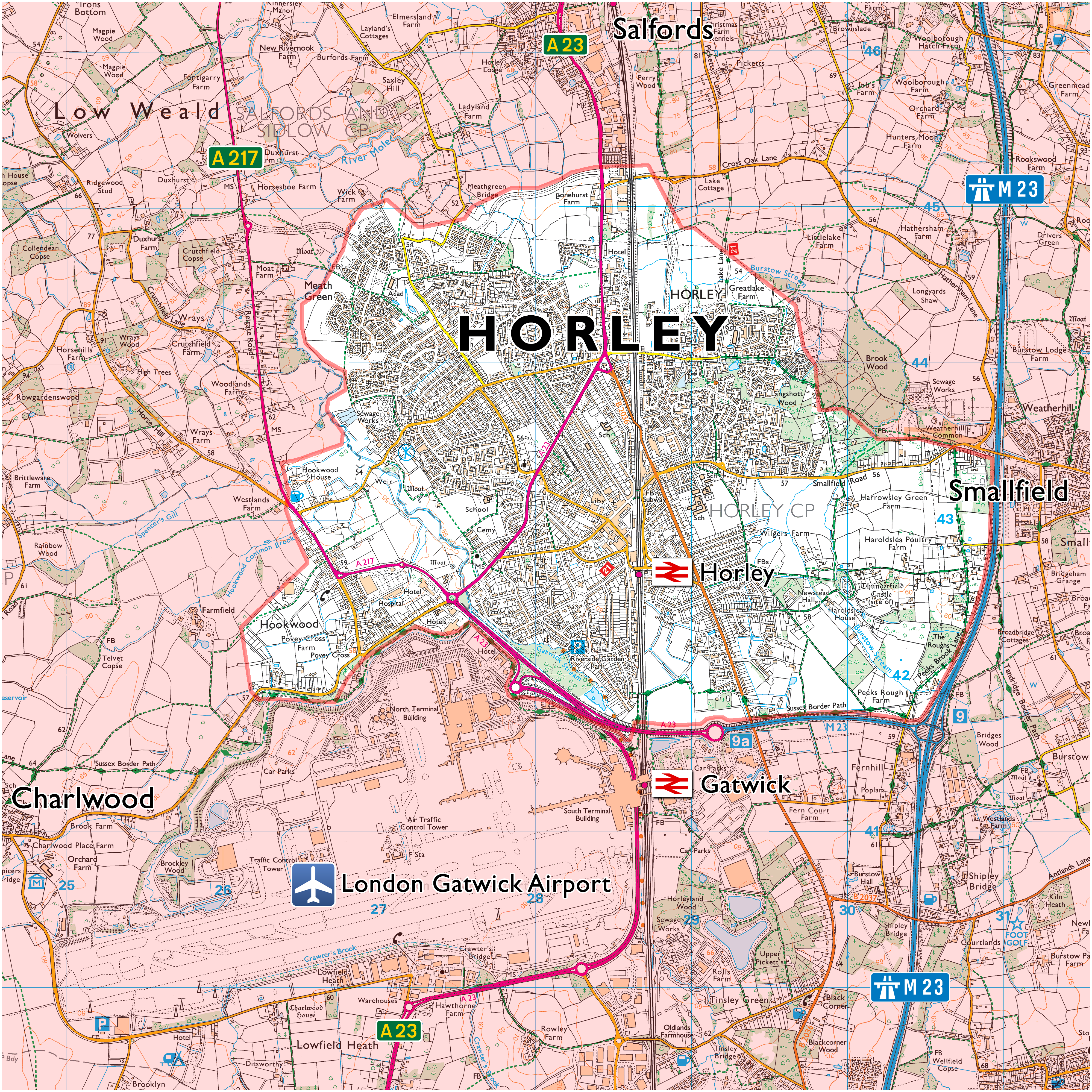
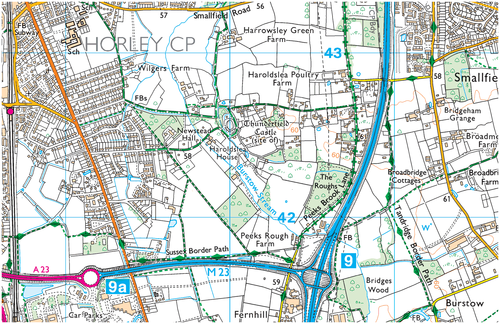
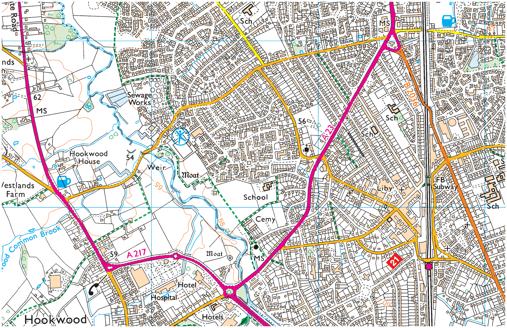
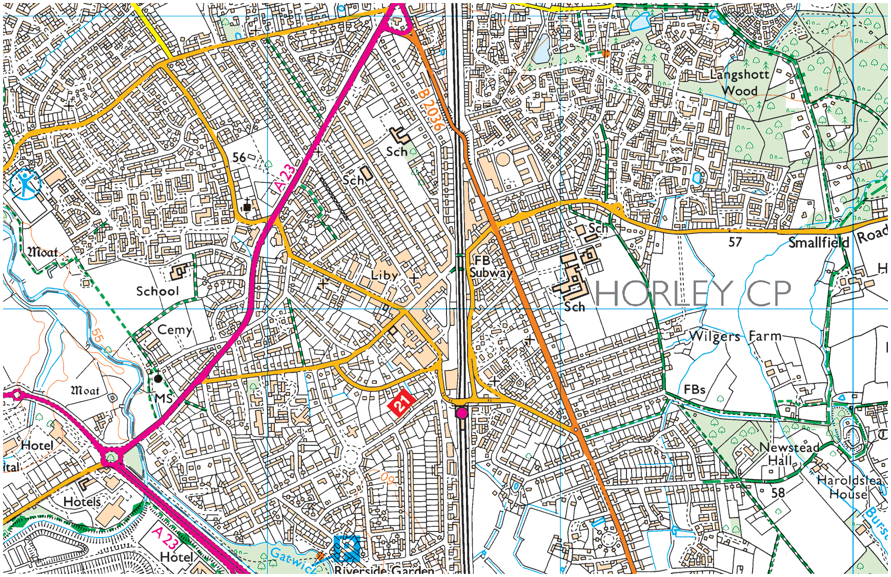
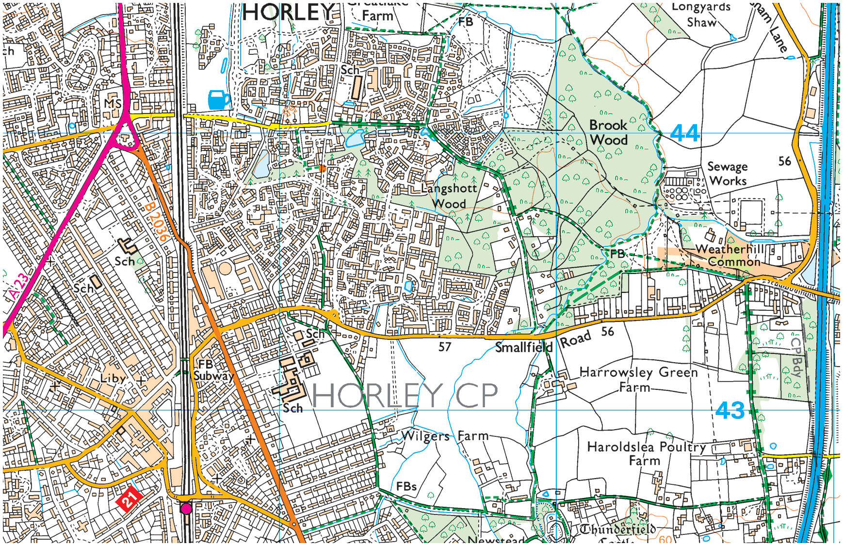
Map: Gatwick & Horley
Infographic: Horley & Gatwick
Then:– Then again:–
& Now:–
Page contents
- Gatwick Racecourse (1891–1940) →
- Gatwick Airport (1928 to date) →
- Horley, Gatwick & Controversies →
- Neighbourhoods of Horley →
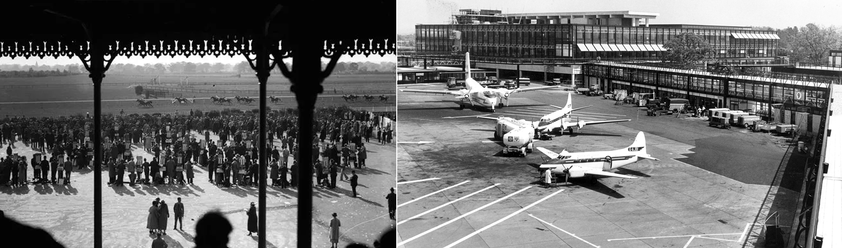
Gatwick Racecourse
(1891–1940)
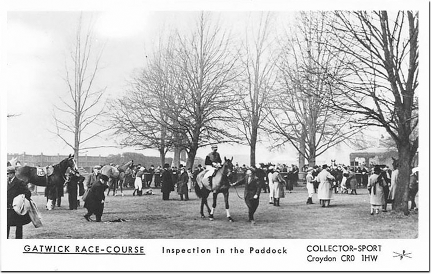
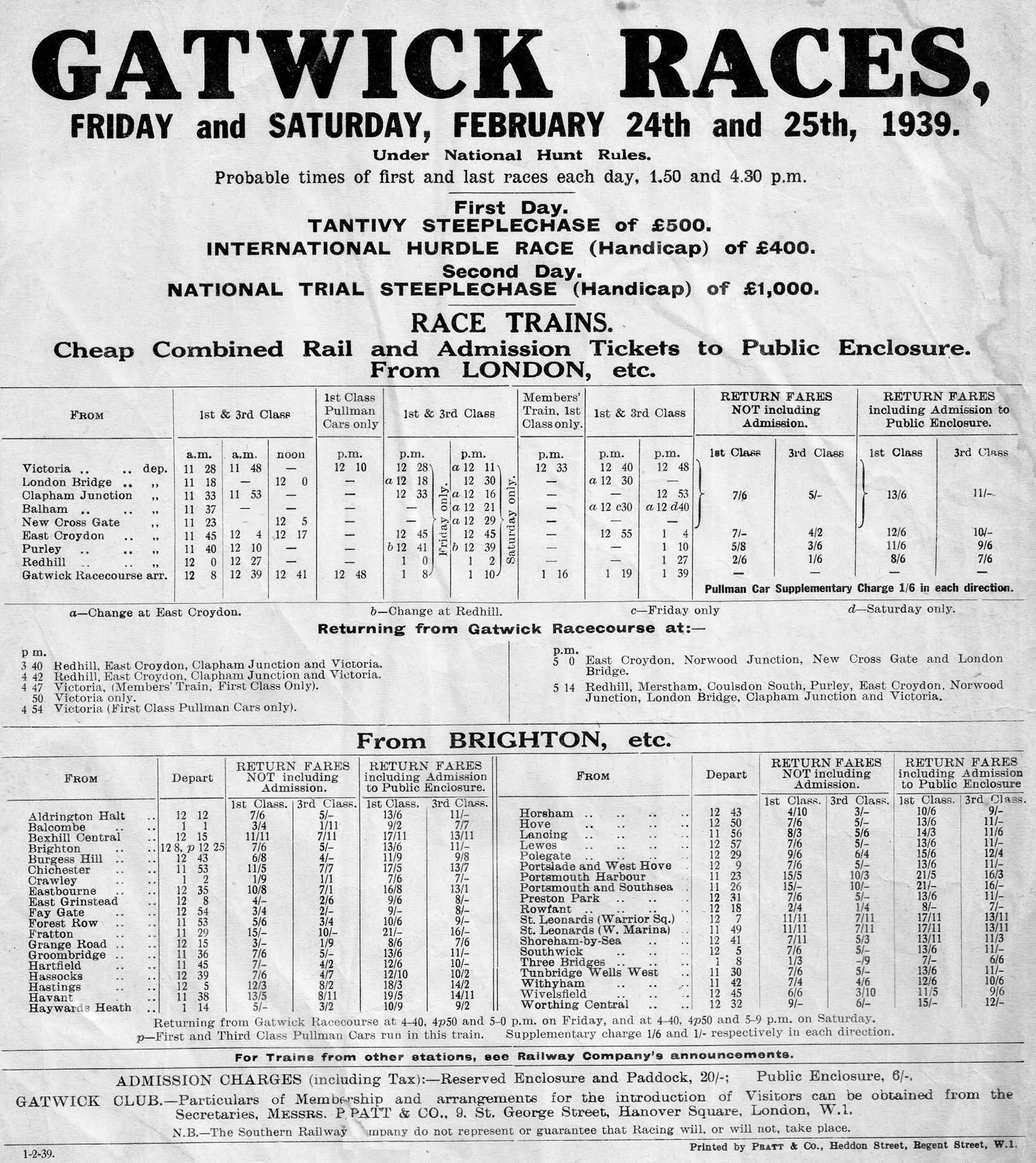
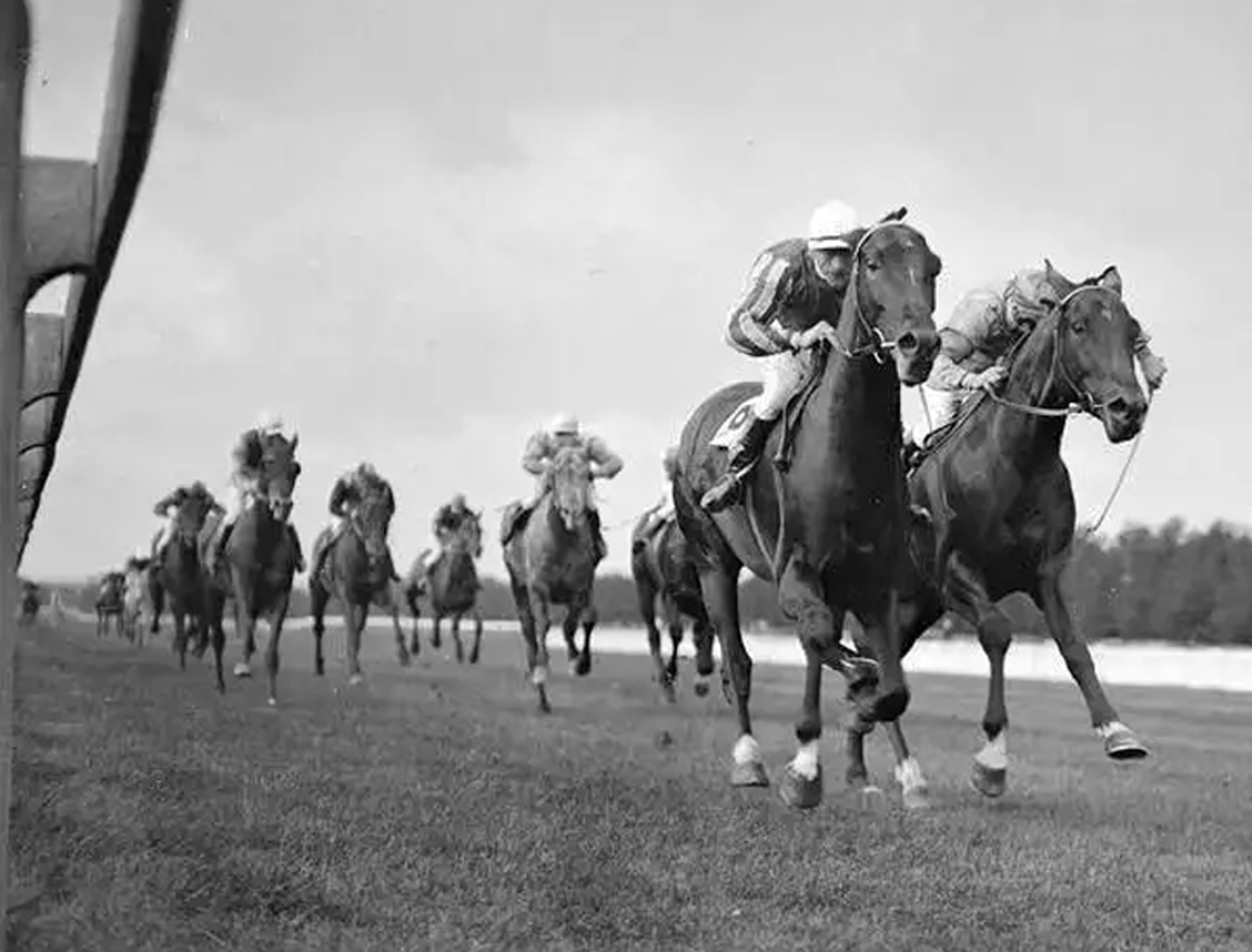
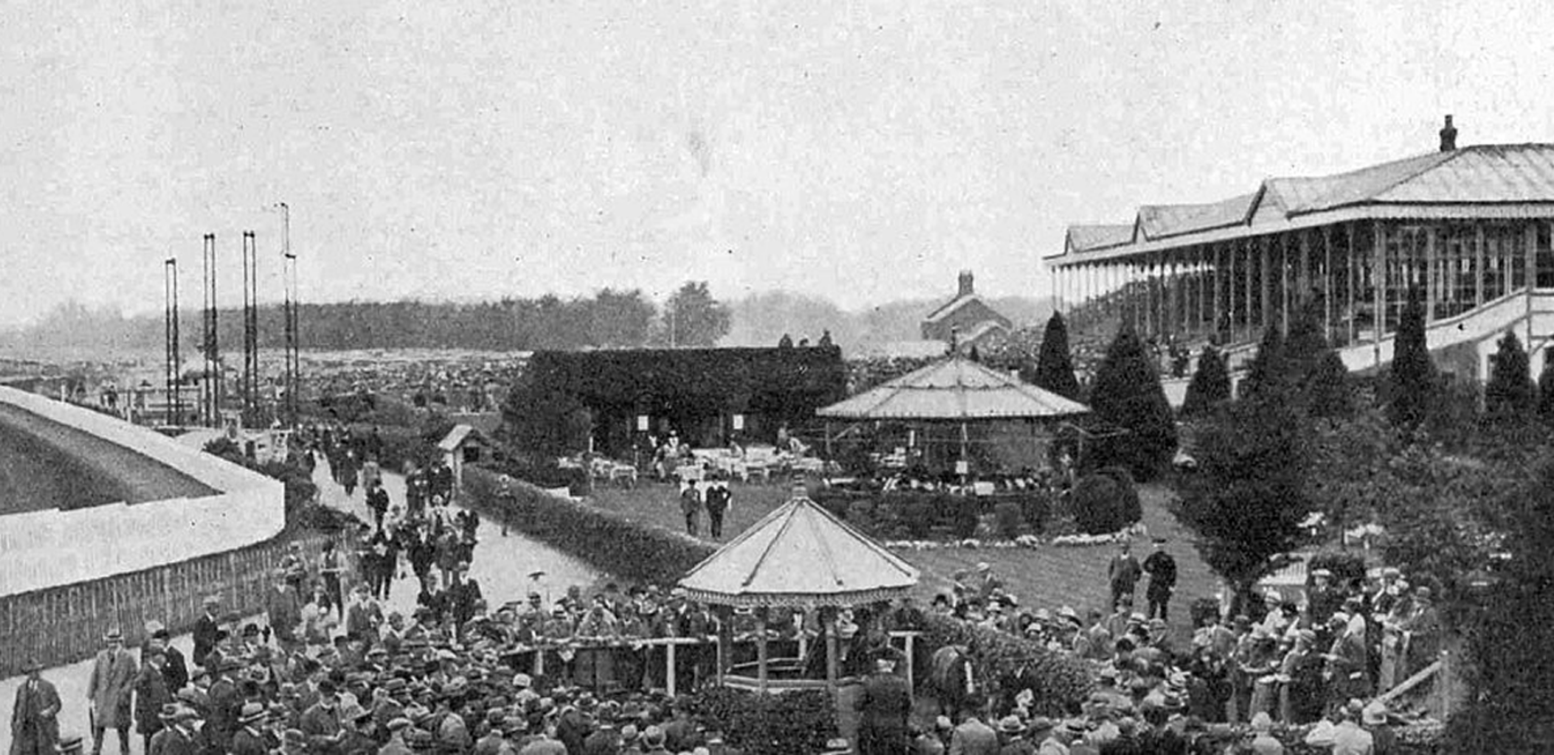
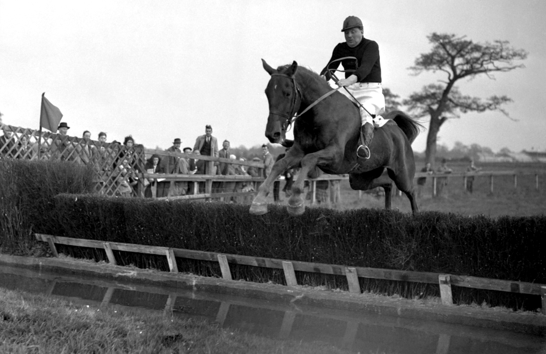
Gatwick Racecourse was situated midway between London and Brighton and first opened for racing on Wednesday 7th October, 1891. The Grand National was run at Gatwick on three occasions during WWI.
The course
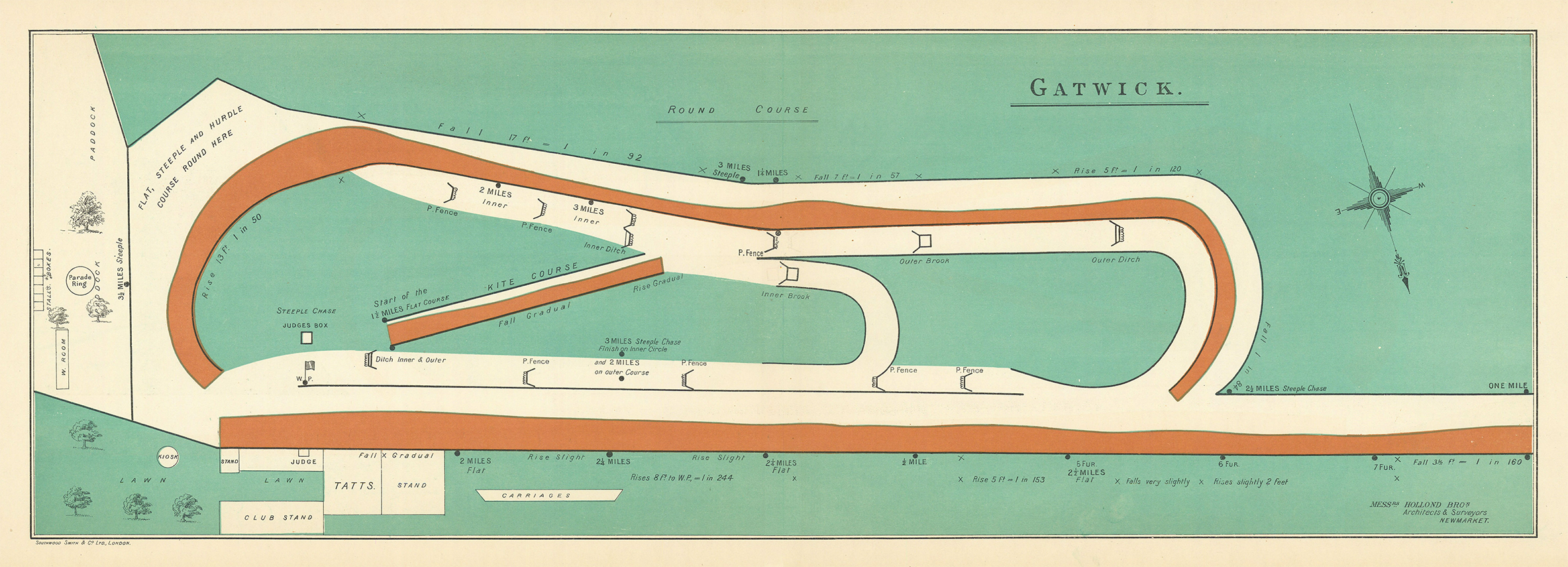
Clearly mapped
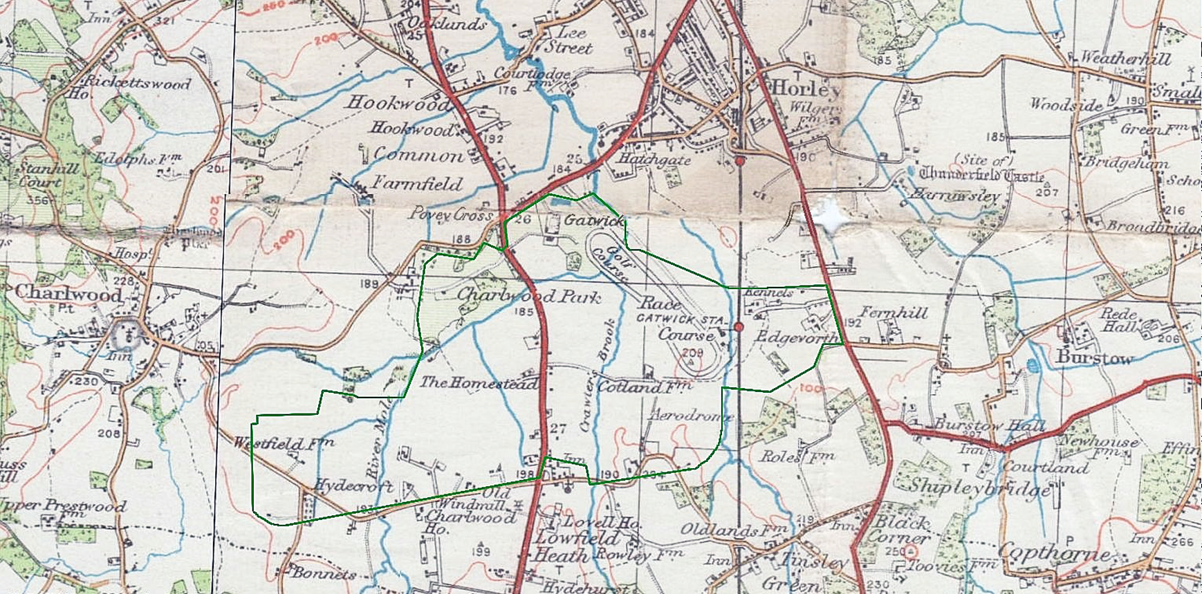
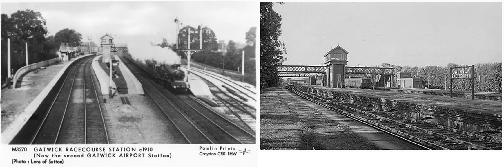
The owners of the land connected to Gatwick Manor opened a racecourse adjacent to the London-Brighton railway, to replace a racecourse in Croydon, and a dedicated station included sidings for horse boxes was constructed and named “Gatwick Racecourse Station.” The course hosted steeplechases and flat races. In Horley it was known as “Glorious Gatwick.”
Gatwick Racecourse Station
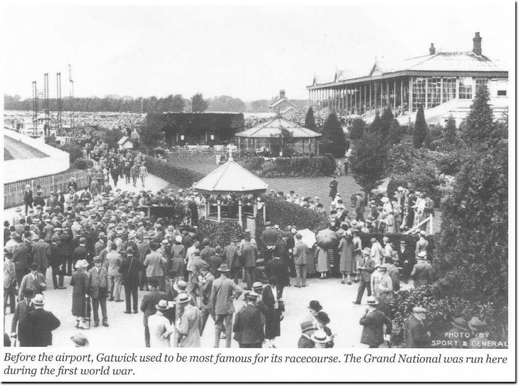
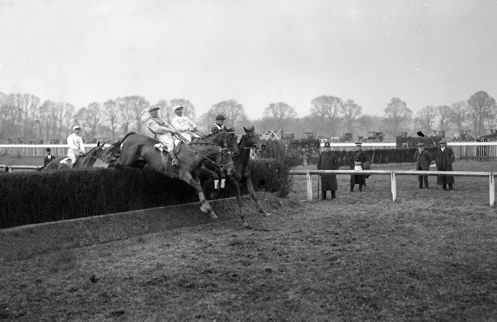
A day at the races

However, during its time as a racecourse, several events were cancelled annually due to fog. In time fog would cause problems for the airport including two crashes with fatalities (the only ones Gatwick has in fact ever suffered).
The first involved a plan with the then Turkish Prime Minister on board in 1959 (Grid Ref.: TQ214391), while some did die, the PM only had a few scratches to his face and, it is said, wandered off himself to a local farmstead to seek help and raise the alarm.
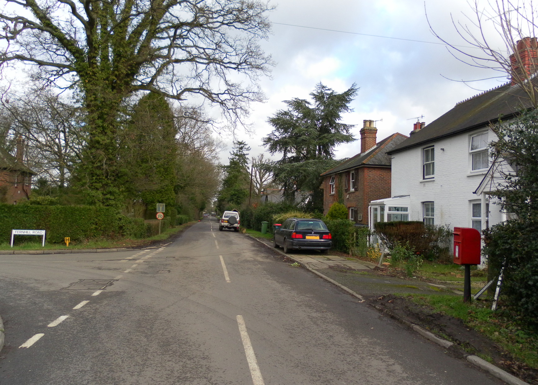
The second accident in Gatwick’s history was more tragic numerically. Ariana Afghan Airlines Flight 701 on 5th January, 1969 came down in a field adjacent to Fernhill Road, then part of Surrey and Horley parish (Grid Ref.: TQ3041), and a combination of fog and pilot error were given for the cause of the crash.
Peeks Brook Lane & Fernhill Road junction
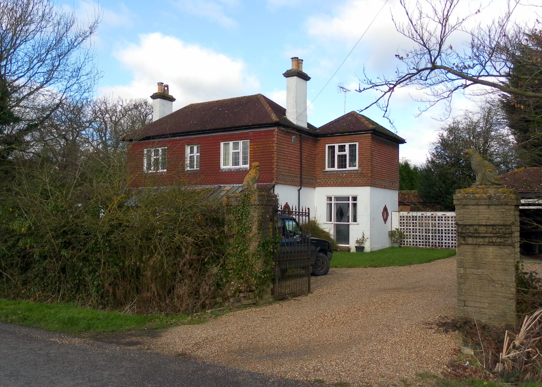
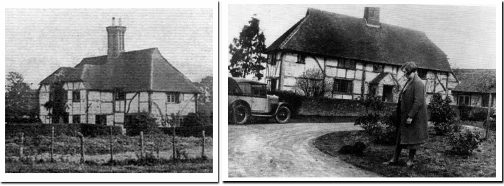
Yew Tree Cottage, Fernhill Road
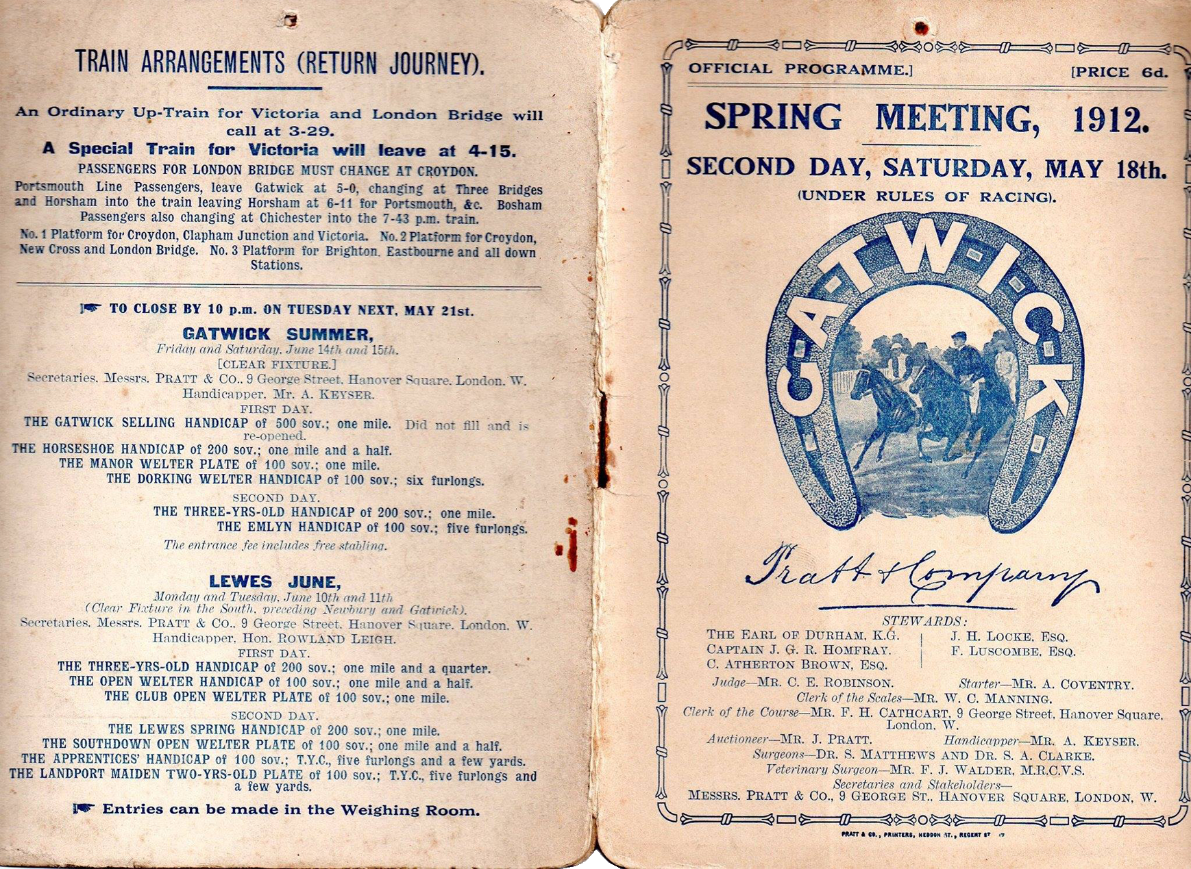
Gatwick Racecourse event programme
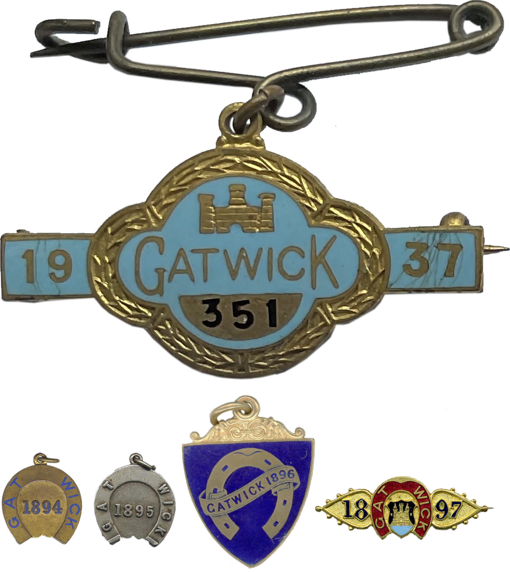
Sample race day souvenir pins
Final meeting: Sat. 15th June, 1940.
Hanging on

Glorious Gatwick
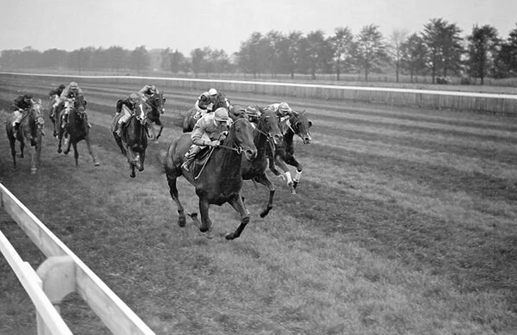
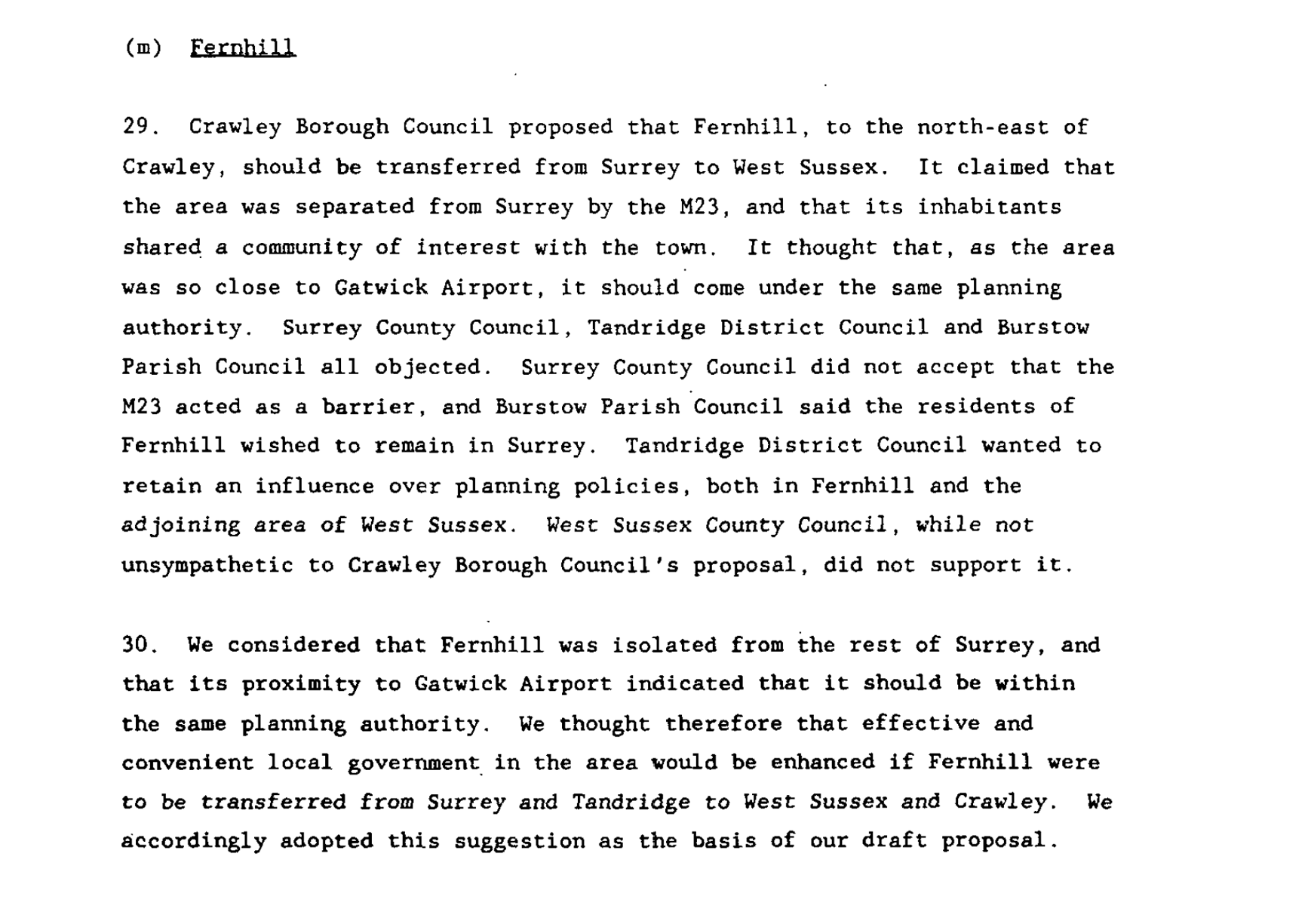
Chomping at the bit
It was considered by most that Gatwick would be requisitioned for the war effort in the lead up to WWII.
Train times etc.
Indeed it was; Gatwick’s final Flat race meeting took place on Saturday 15th June, 1940. After that the racecourse and the aerodrome immediately to its south was named RAF Gatwick and played a considerable role in the war effort.
That final furlong…
Horse racing never returned at the national level but Horley, to this day is surrounded by liveries, equestrian training centers and a fair few studs.
Gatwick Airport
(1928 to date)
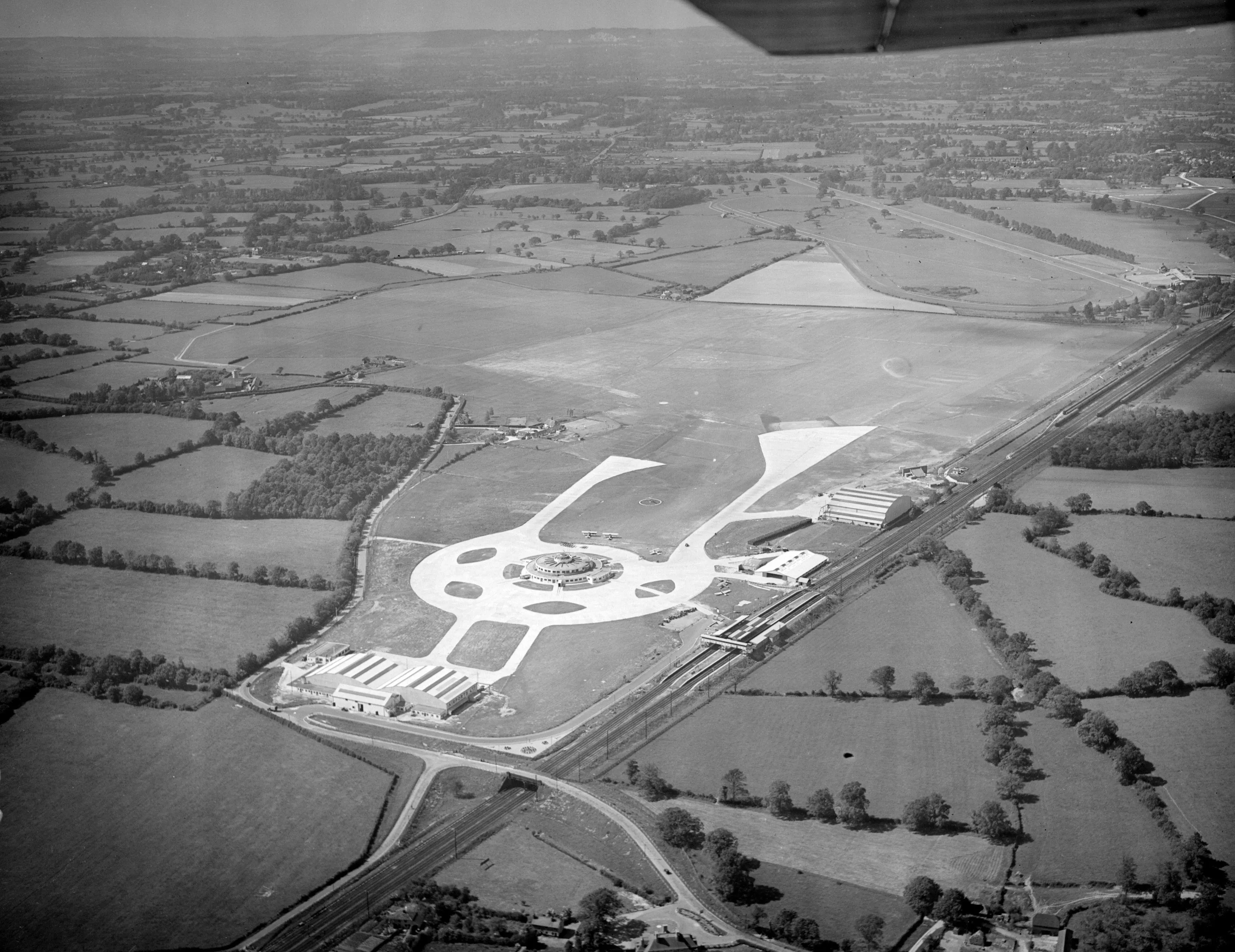
At the beginning Gatwick was not much more than a recreational aerodrome taking up a few fields of farmland between Gatwick Manor and Hunts Green farmsteads. As an airport, Gatwick began operations in the mid-1930s (at a time when Heathrow was still countryside) and has only been a commercial alternative to Heathrow since 1958.
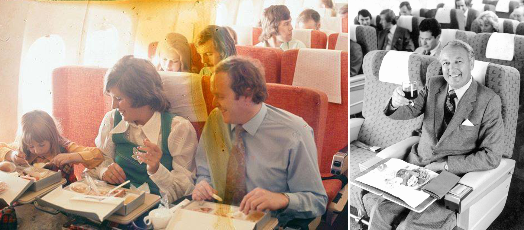
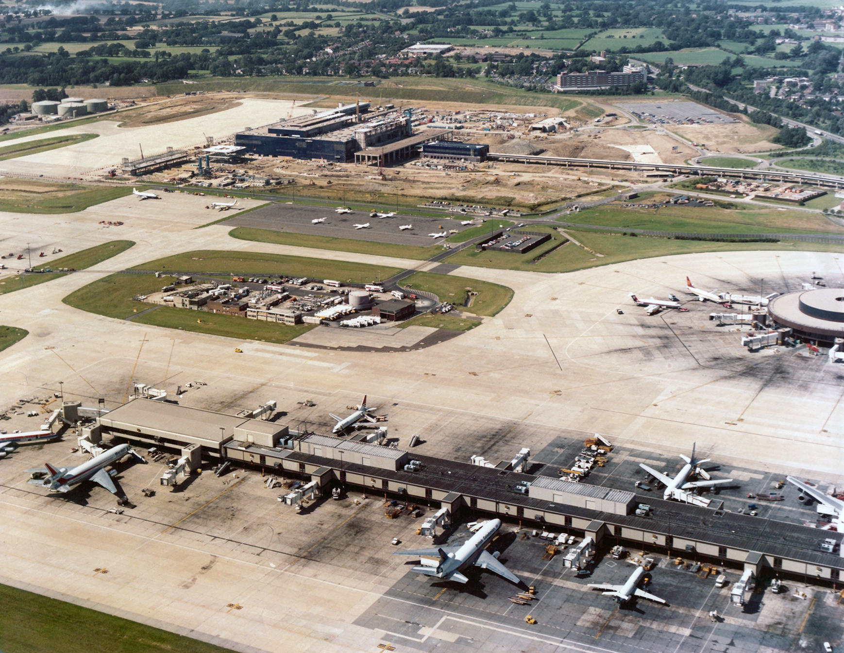
Gatwick was was renovated in the mid-1950s and reopened by the Queen in 1958. By the 1970s Gatwick had become host to many airlines that focused on the emergent package holiday trend and gained fame/notoriety for having the busiest/nosiest runway the world over. The second terminal was built in the 1980s and by the 1990s it was one of the busiest airports in the world.
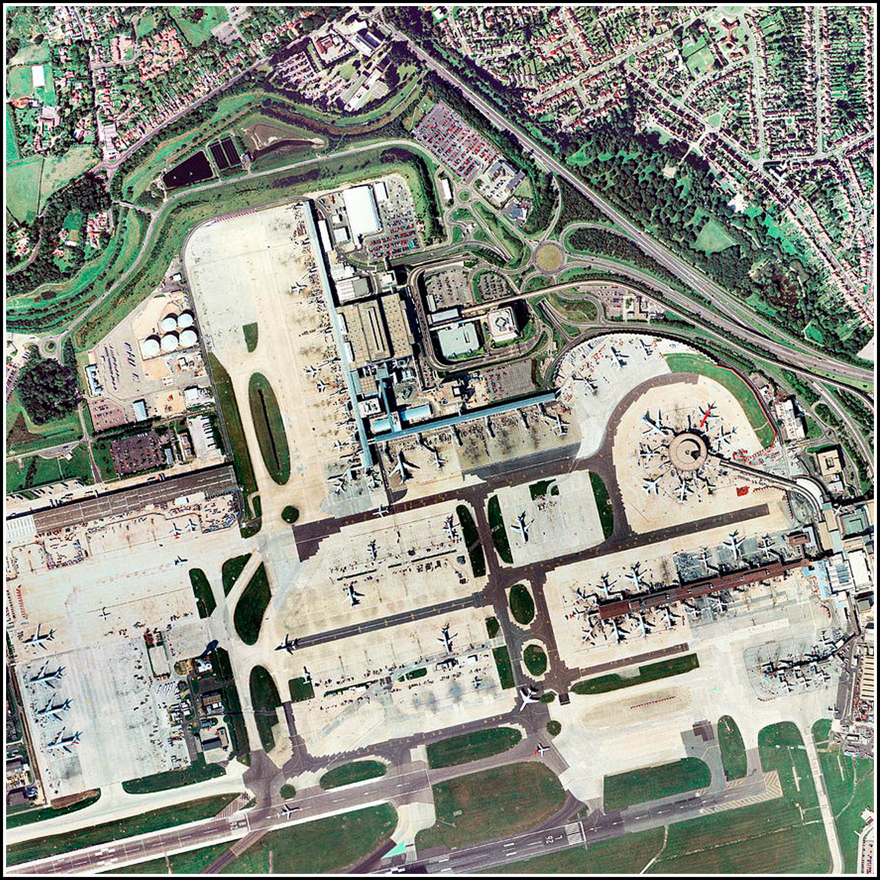
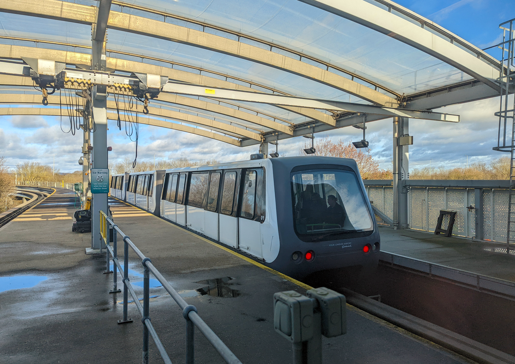
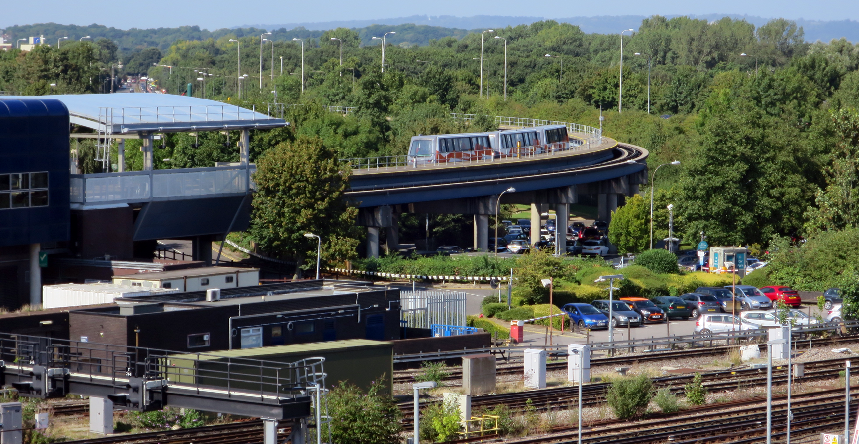
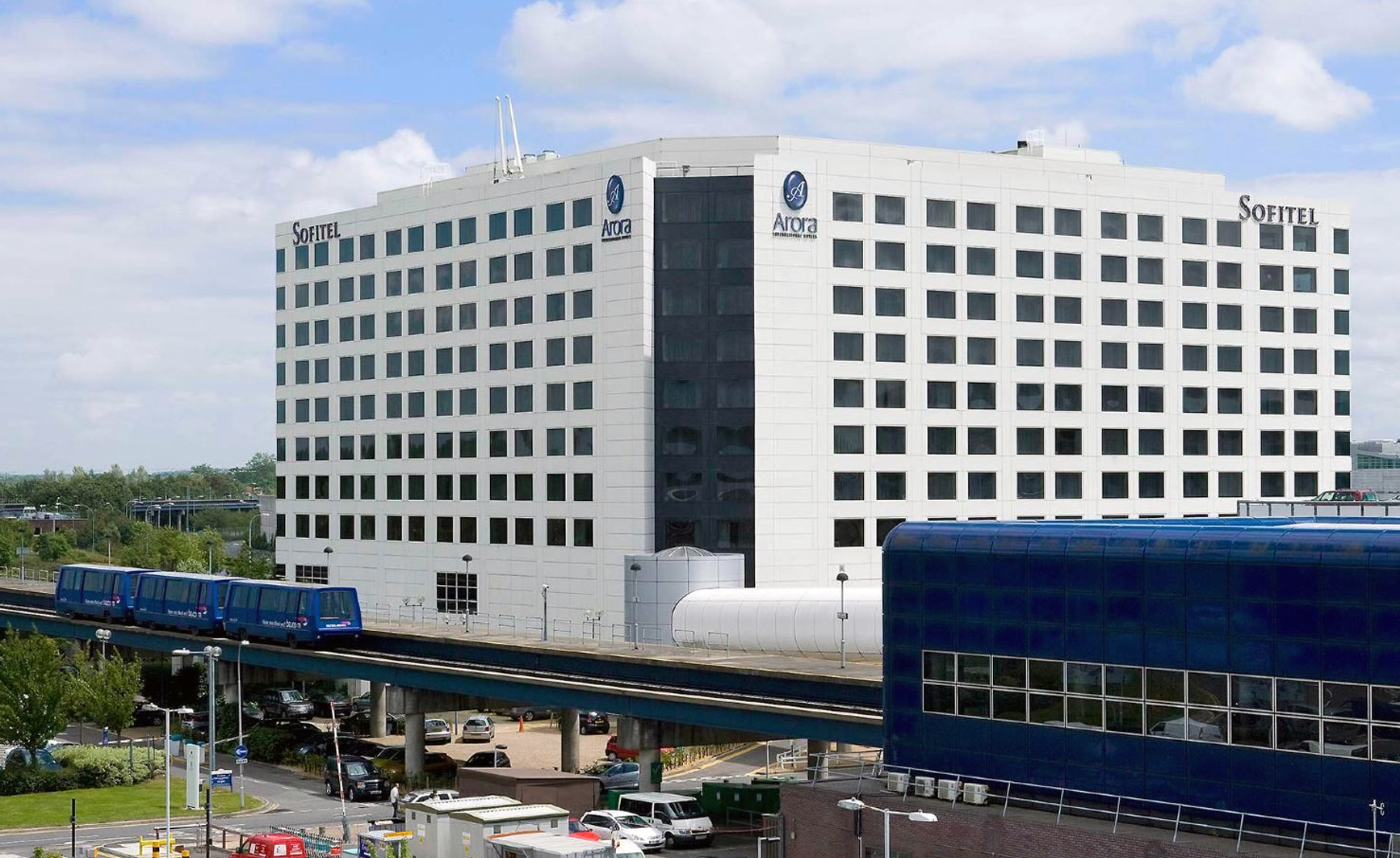
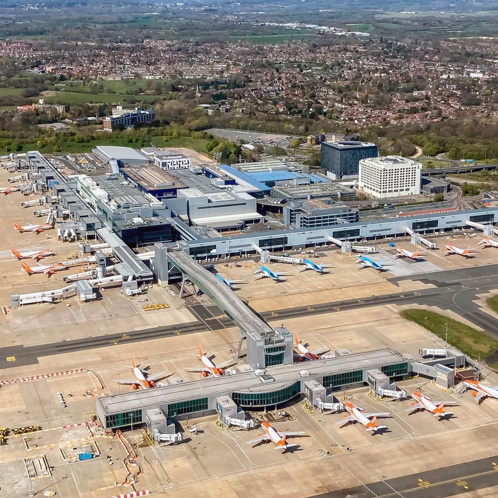
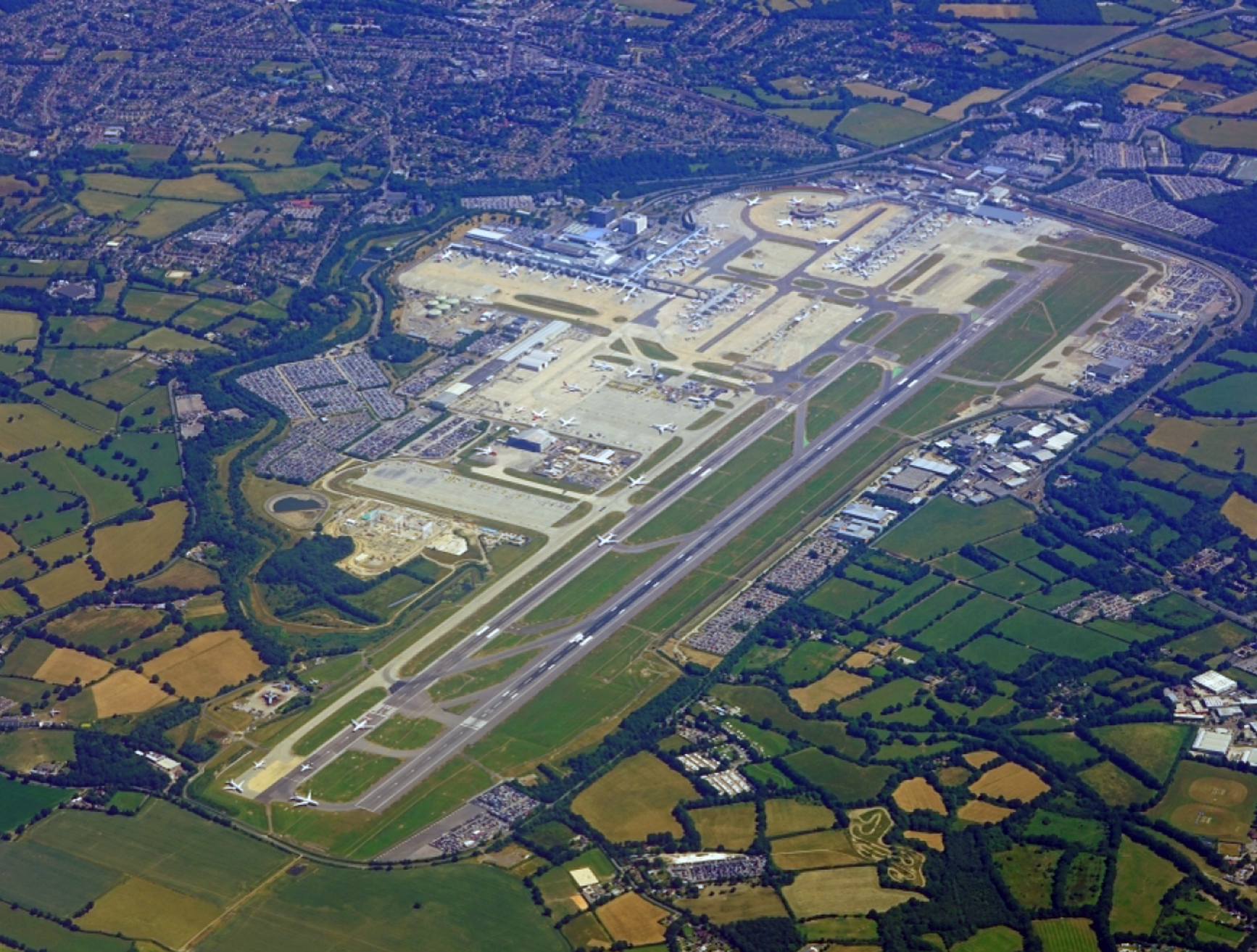
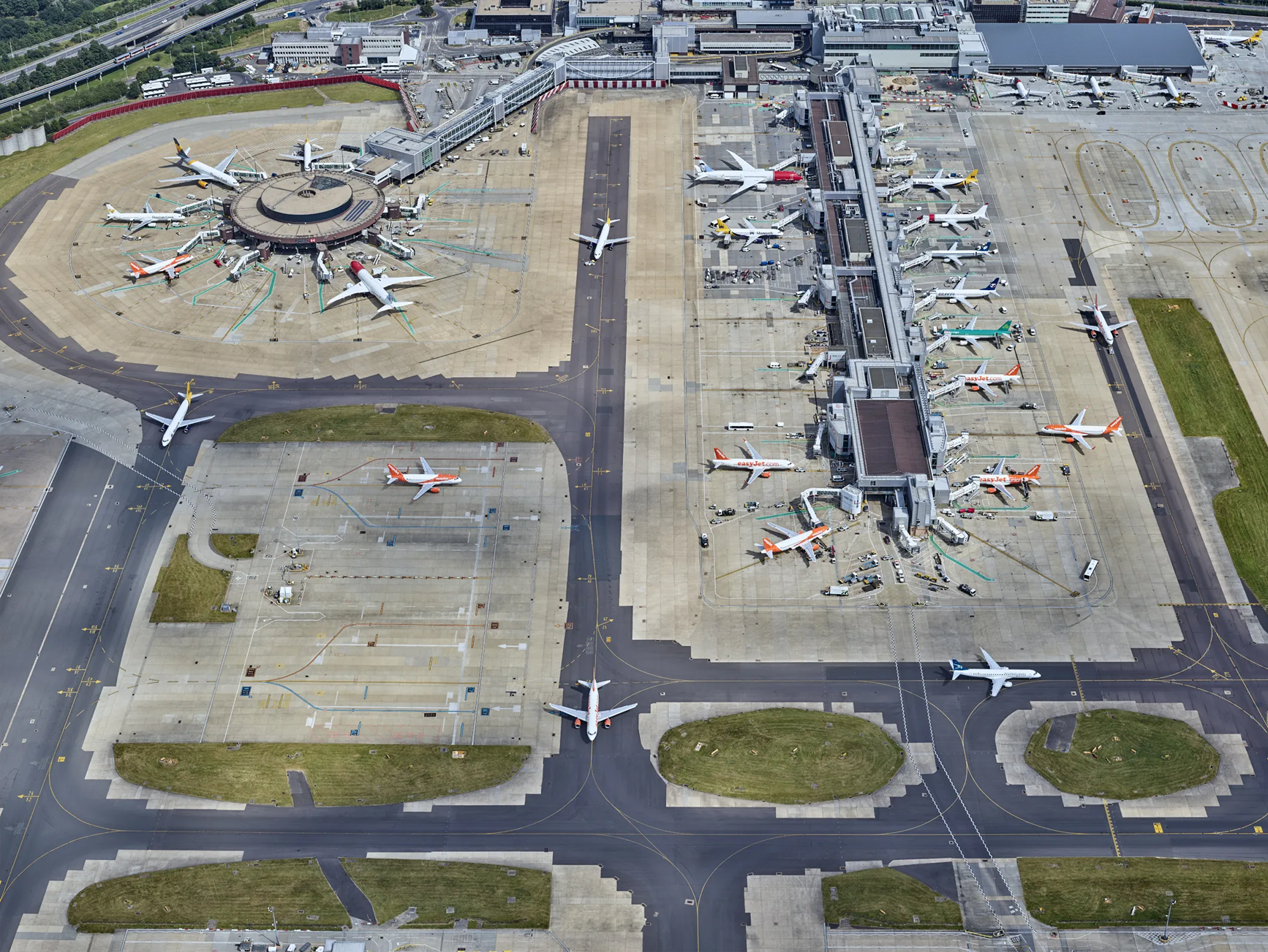
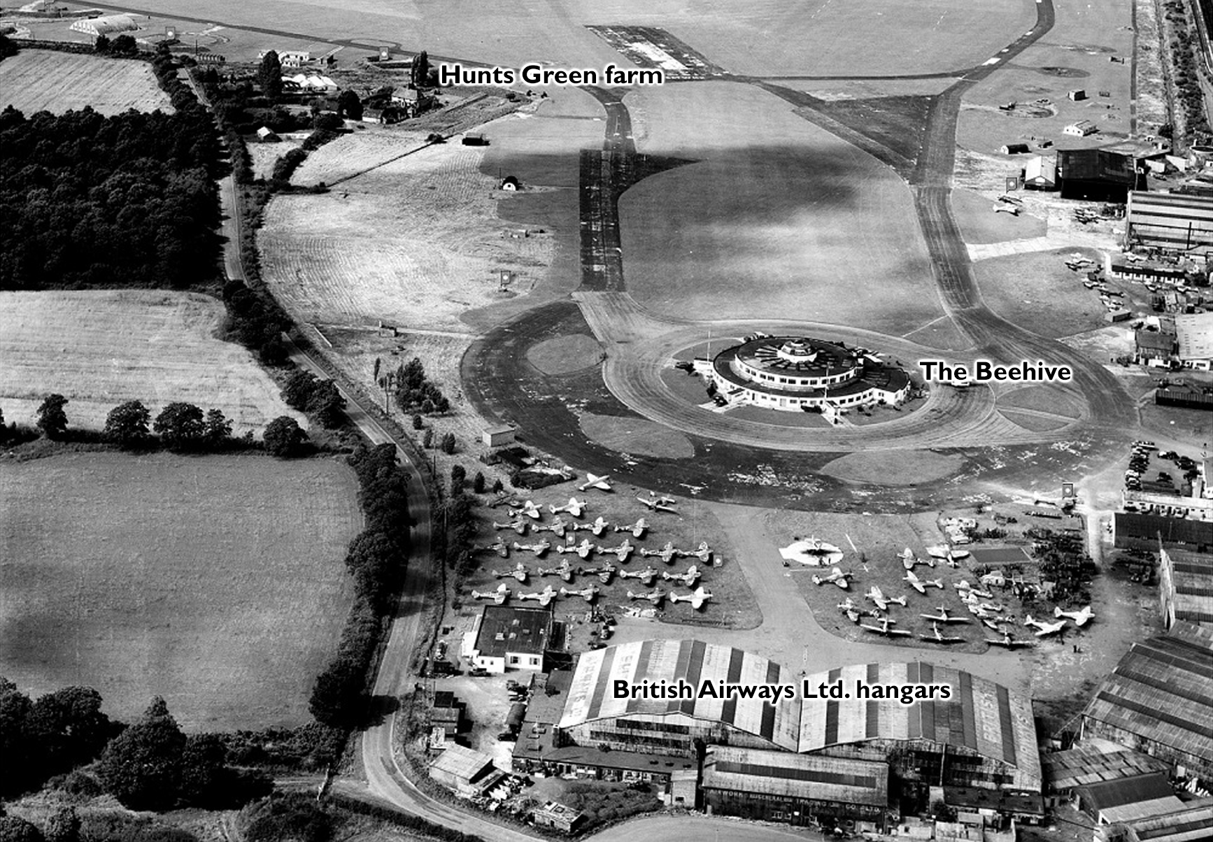
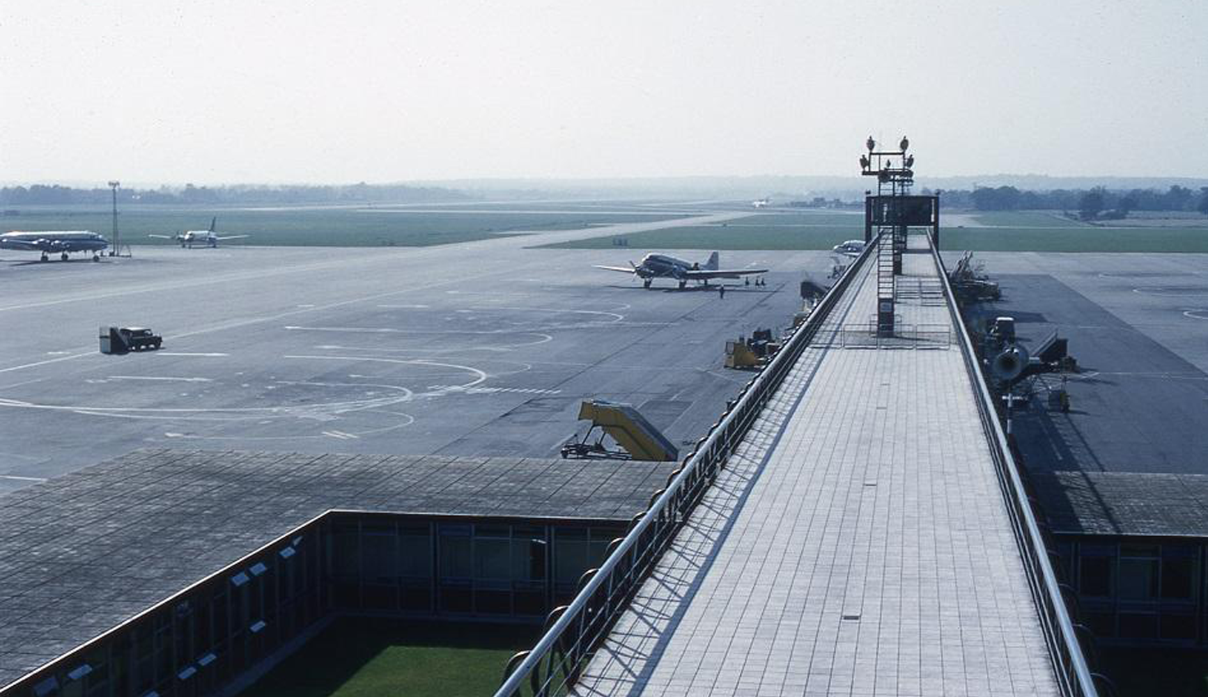
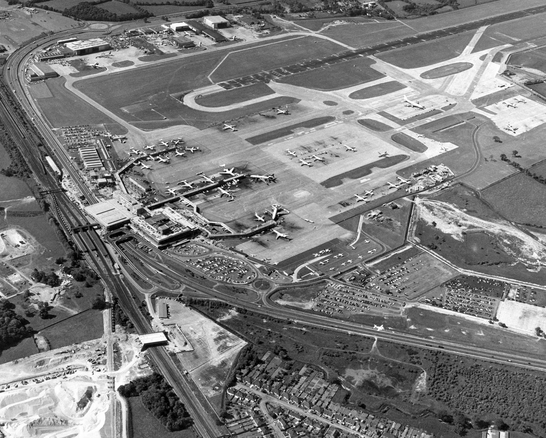
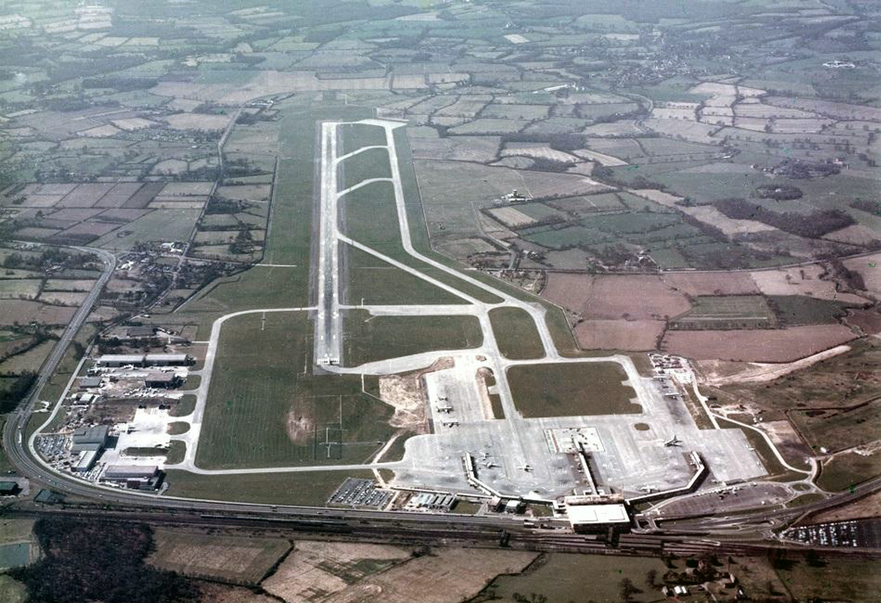
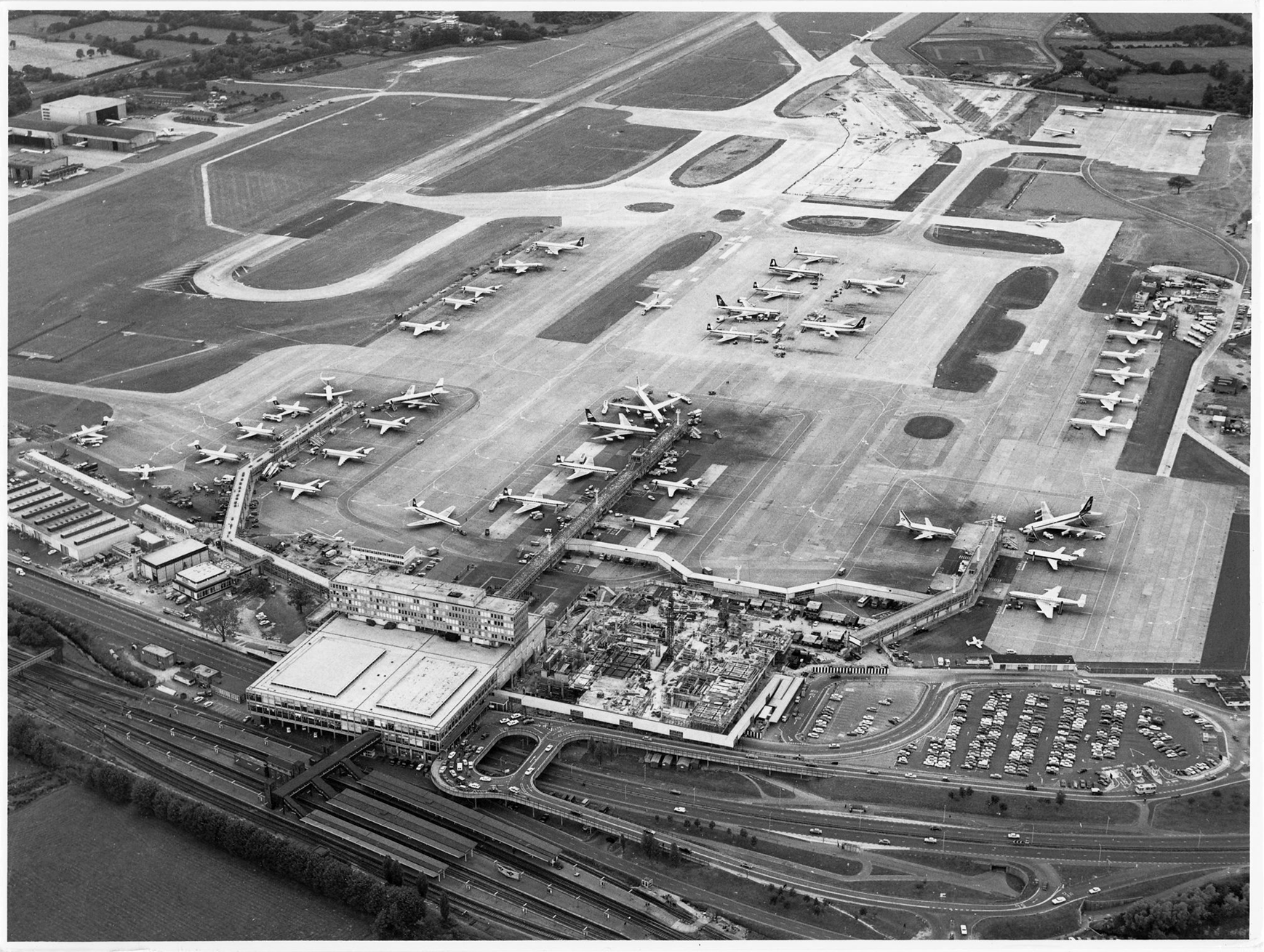
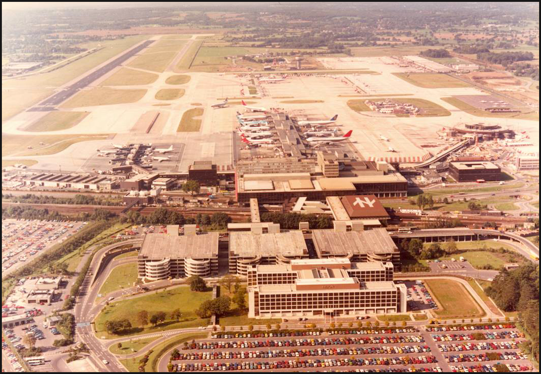
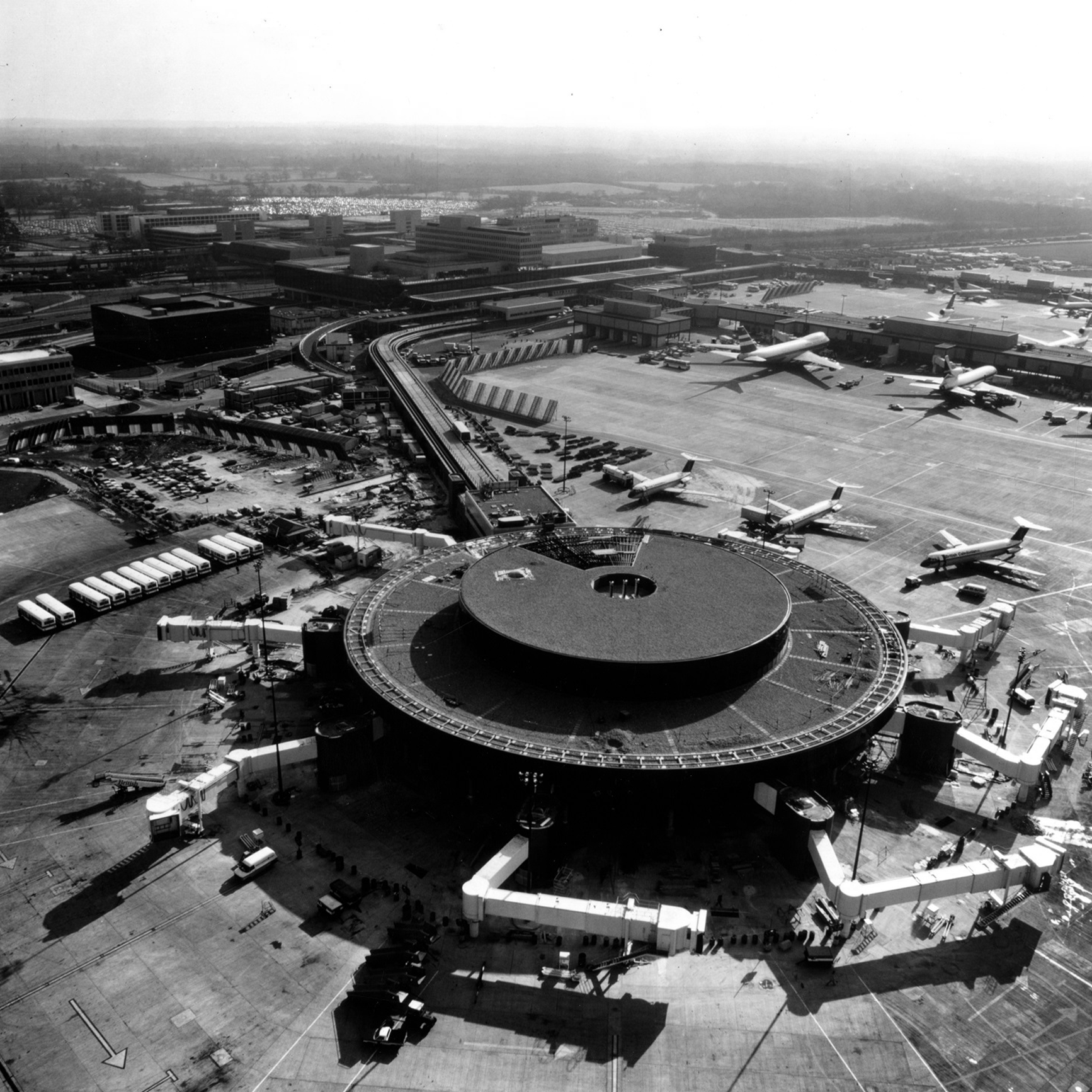
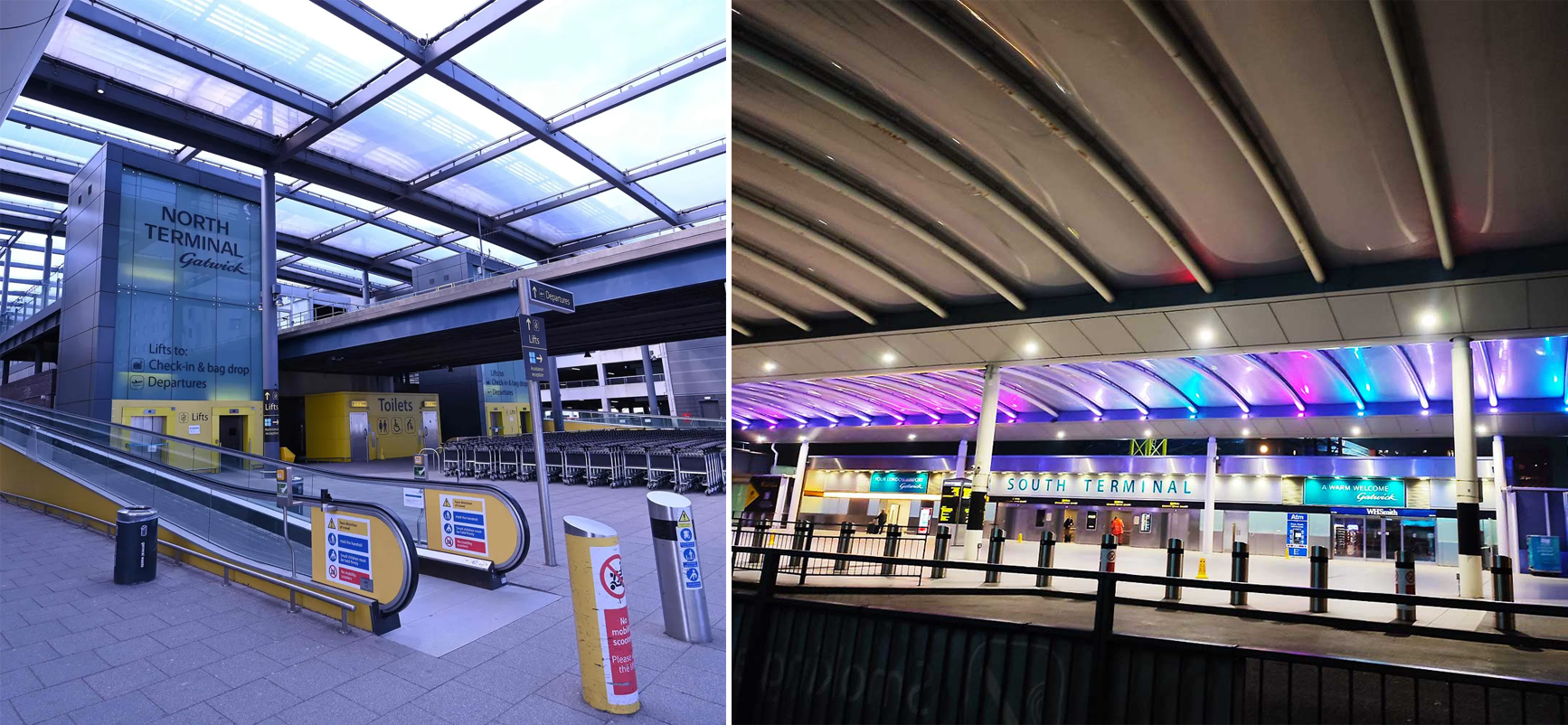
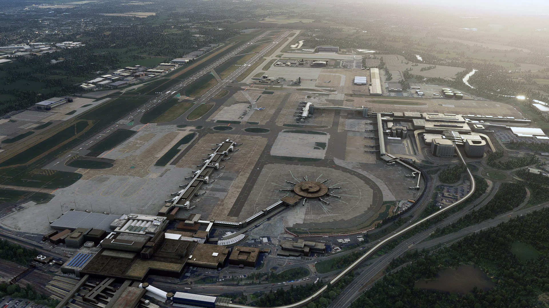
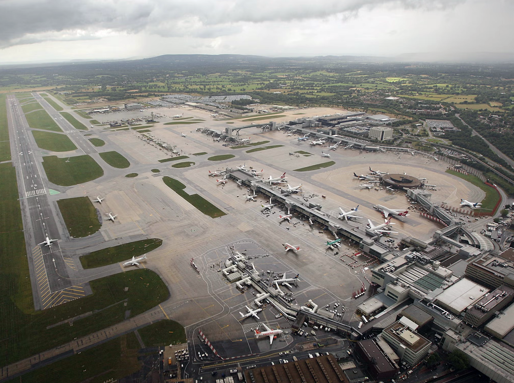
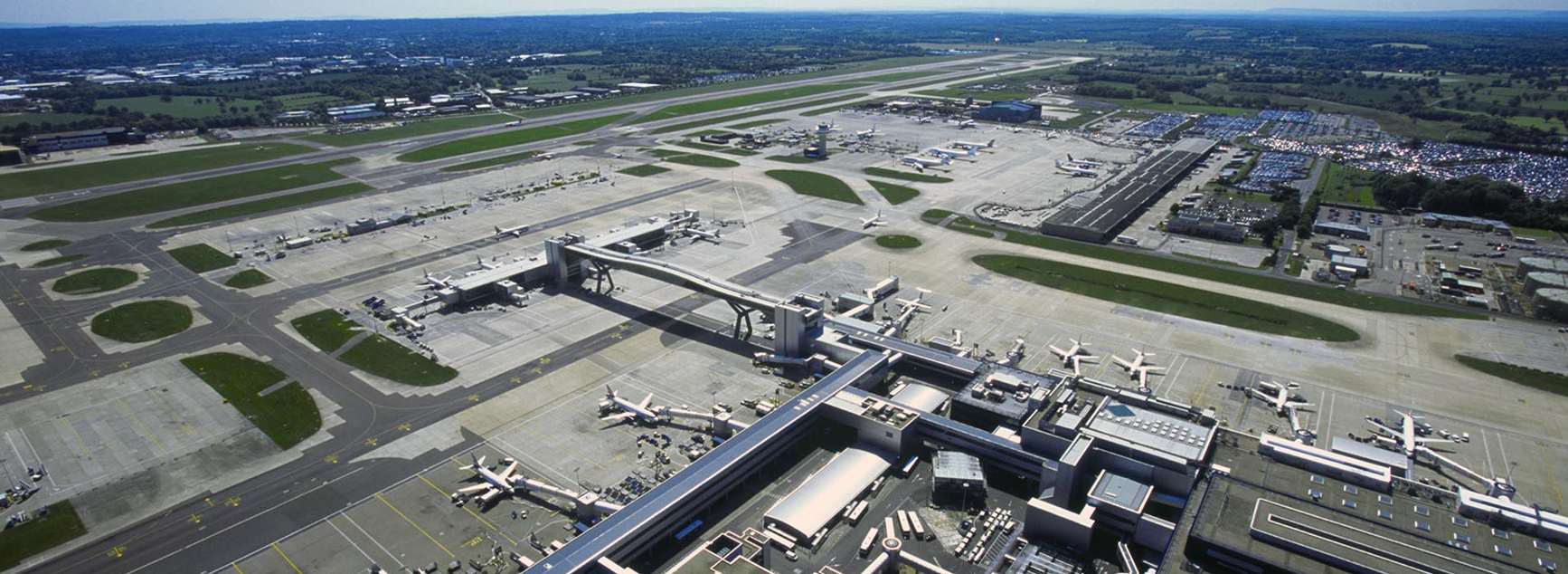
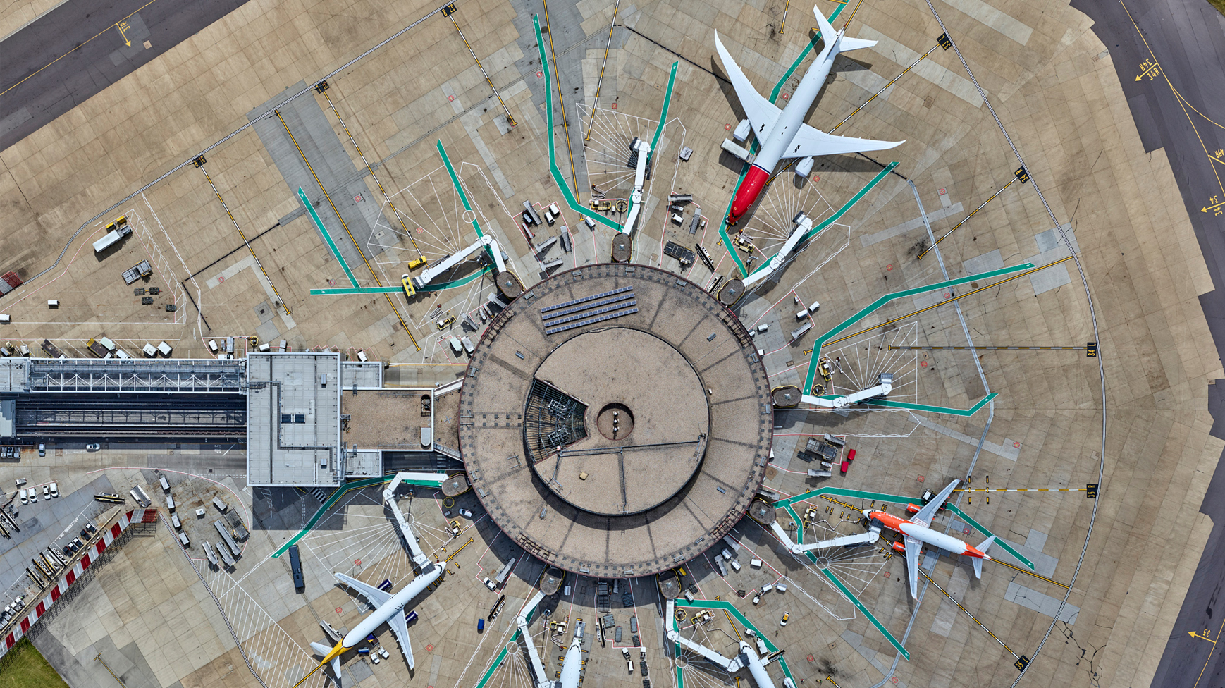
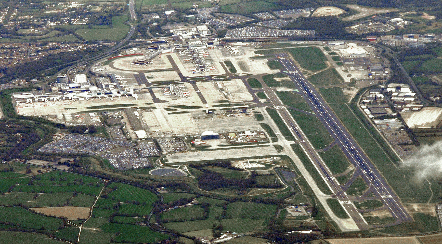
Looking at the satellite image below, North Terminal (upper centre, 1988) and South Terminal (lower third, right, 1958) are linked by the monorail (its tracks are highlighted yellow on the illustrated satellite image, see below).
Satellite image
Satellite image (illustrated)
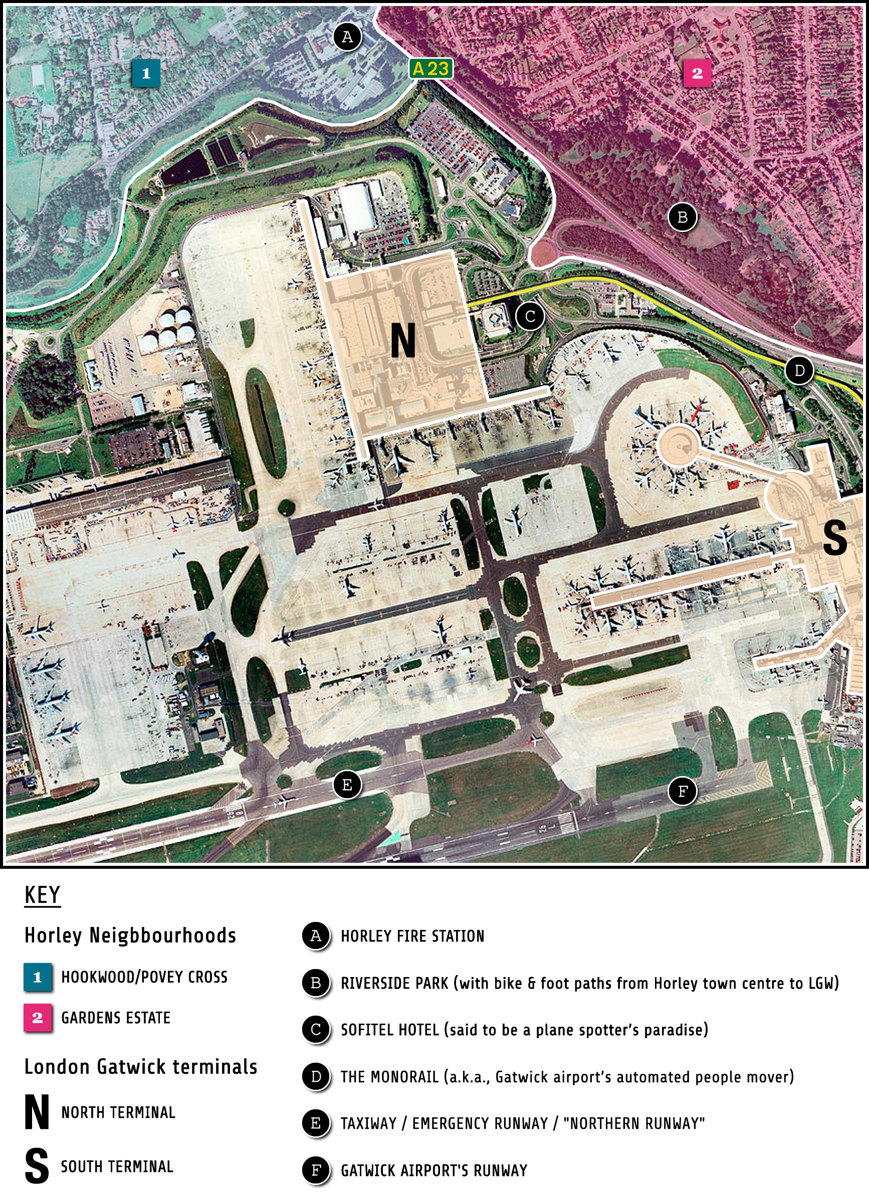
“The Monorail”
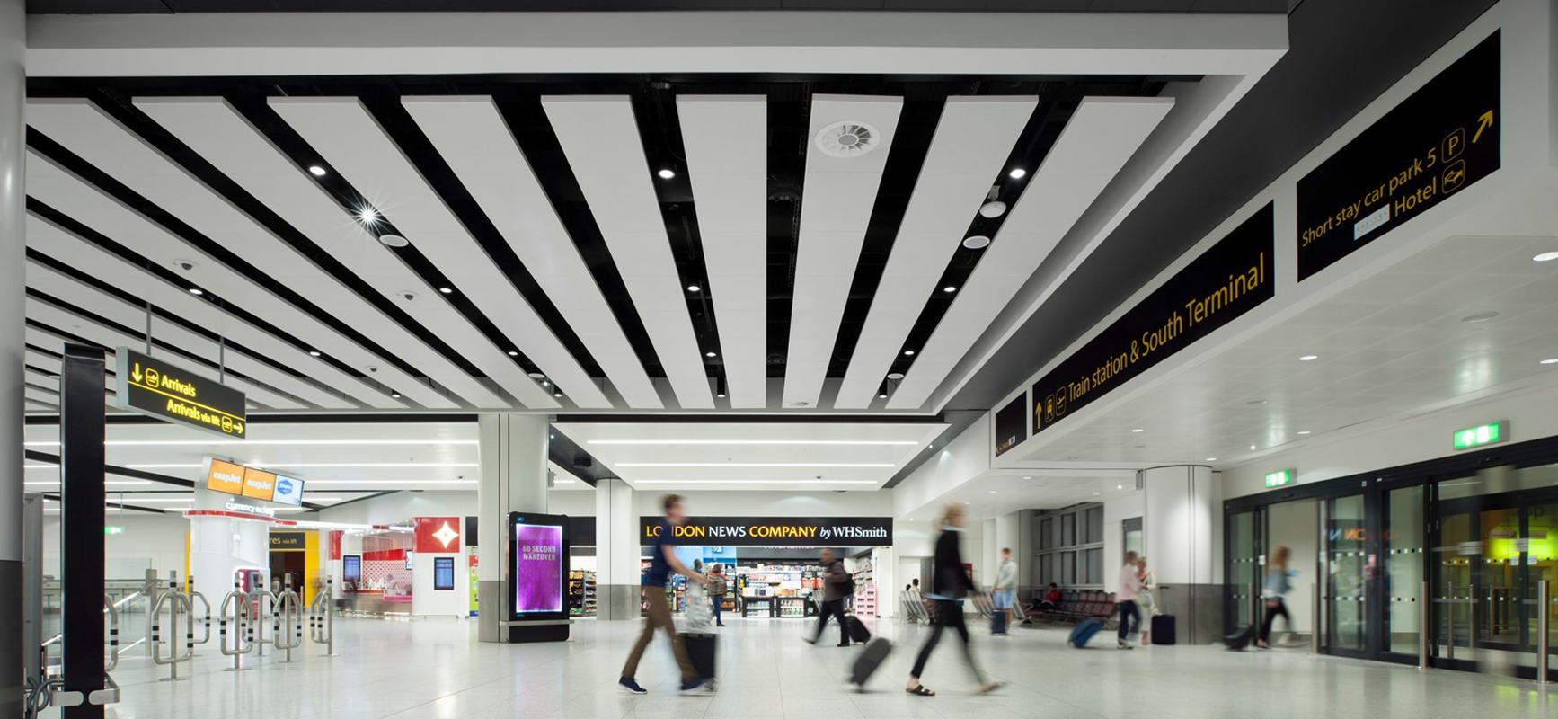
As the next two pictures demonstrate, Horley is quite literally adjacent to Gatwick airport.
This is very much a mixed blessing. The perennial fear/threat of compulsorily purchases and land grabs, coupled with the joys of being able to walk to work and, an airport that flies directly to 133 cities globally in countries such as Costa Rica, India, Iceland and South Africa.
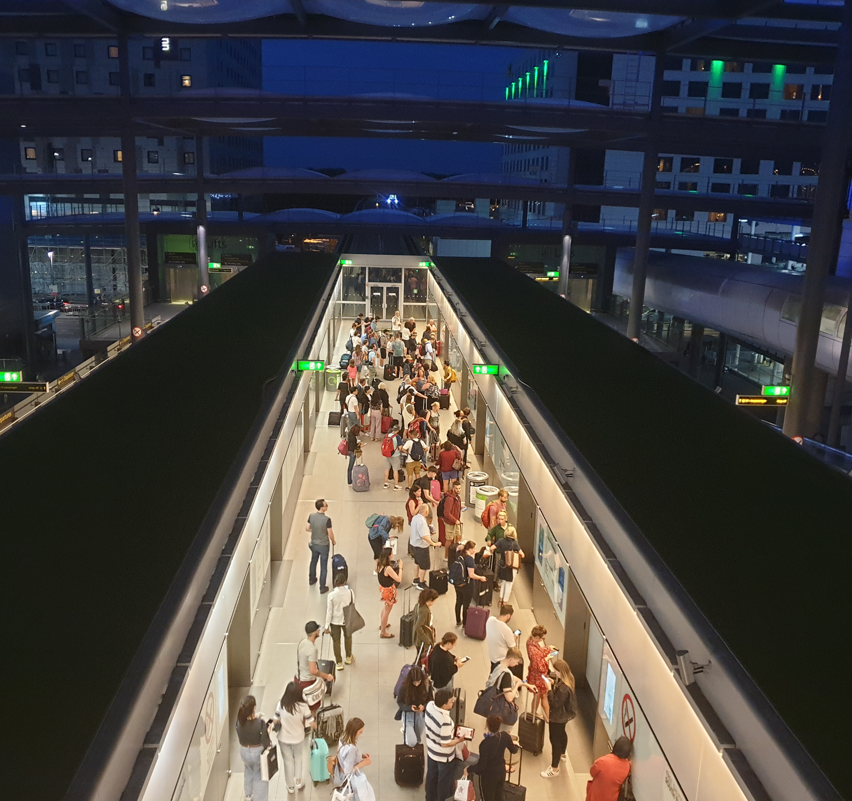
On the one hand there’s the noise, road congestion and pollution (local & global). On the other, the airport offers many employment opportunities for Horley residents and an avenue for global escape, that’s just a 5 minute bike ride or 15 minute walk from the town centre along dedicated cycle & foot paths.
Horley/Gatwick (a)
Horley/Gatwick (b)
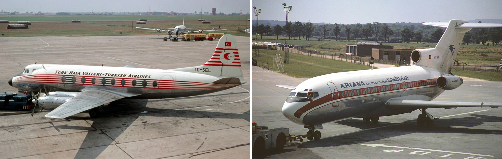
Gatwick is the UK’s second busiest airport (around 760 flights, arrivals/departures, daily). Until 2017 it was the busiest single-runway airport in the world. However, that mantle now rests with Mumbai airport in India which currently clocks over 800 flights per day. Noise-wise, for better or for worse, all of Gatwick’s takeoffs and landings are supposed to be between the hours of o’ six hundred and 11pm—a former empire-related law—whereas Bombay’s is a 24-hour operation.
LGW: hundreds of flights daily…
Through the decades
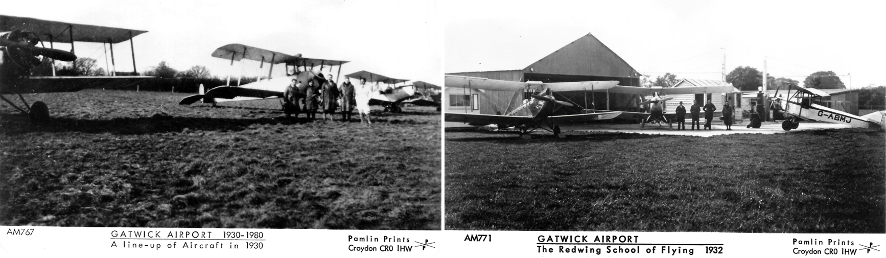
Initially known as the Surrey Aero Club, Gatwick airport began life as an aerodrome in the 1920s.
In 1934 the aerodrome was designated as a reliever airport for Croydon Airport, then the main airport for London (Heathrow was not on the radar at that point in history).
Biplanes Before Beehive
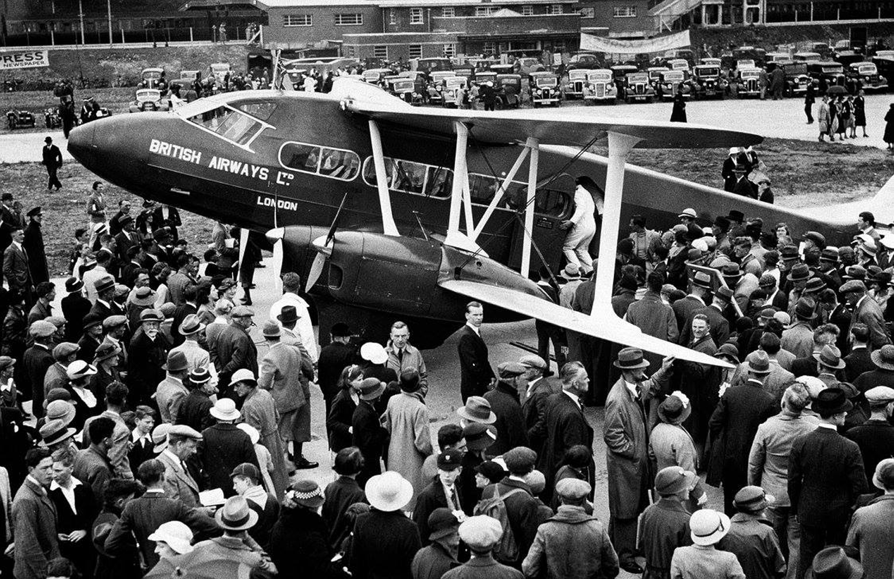
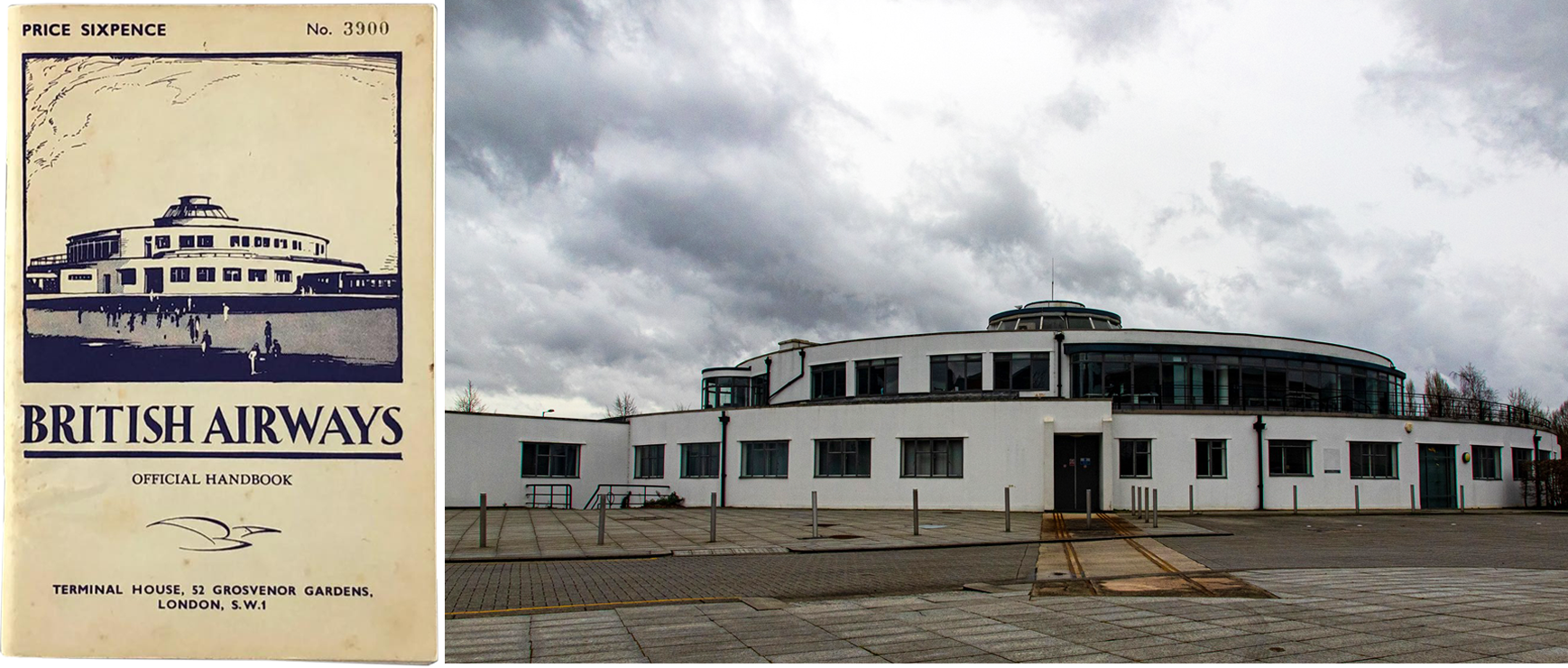
In 1934 Gatwick was granted a ‘public transport’ category licence and soon after, regular passenger services to Belfast and Paris were inaugurated by Hillman Airways. Edward Henry Hillman, who founded the airline unfortunately passed away that year aged 45, and would not have known that within a year, Hillman Airways was to merge with Spartan Airlines and United Airways to form British Airways Ltd.
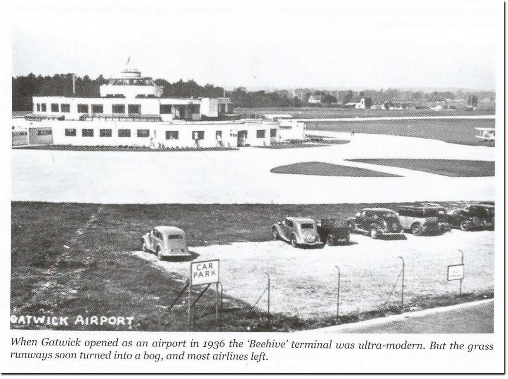
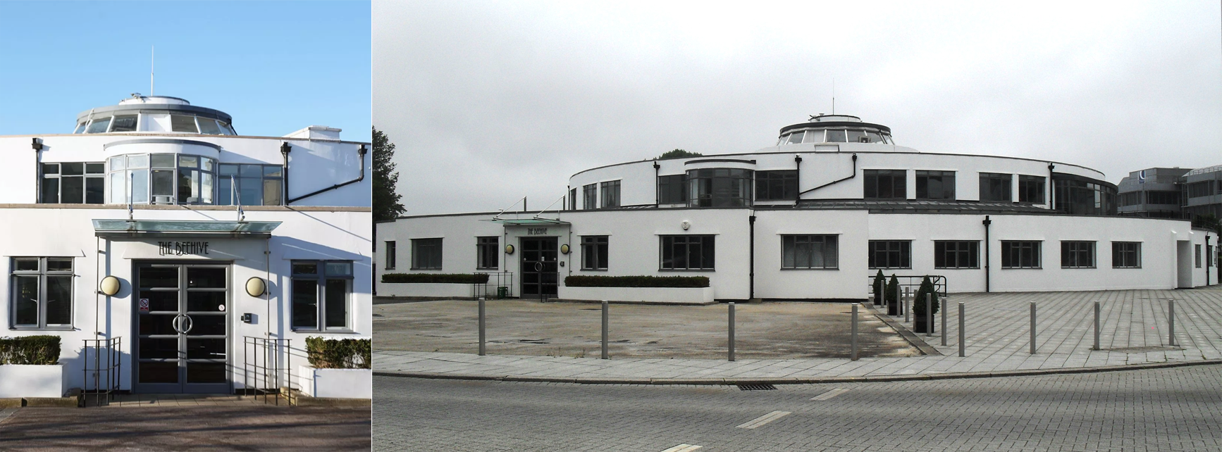
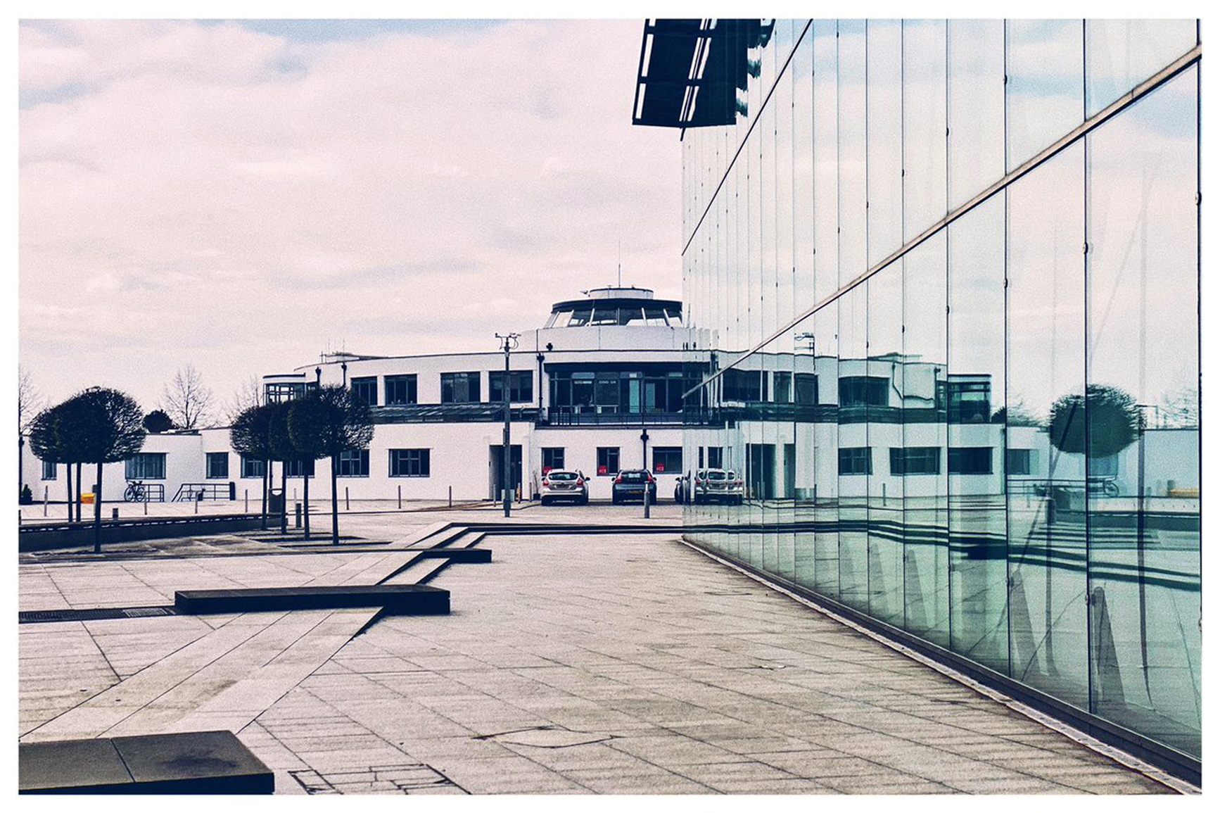
In 1935, plans were drawn up for a futuristic new circular terminal building and a concrete parking apron, and on completion the new facilities were officially opened on 6th June, 1936.
1935
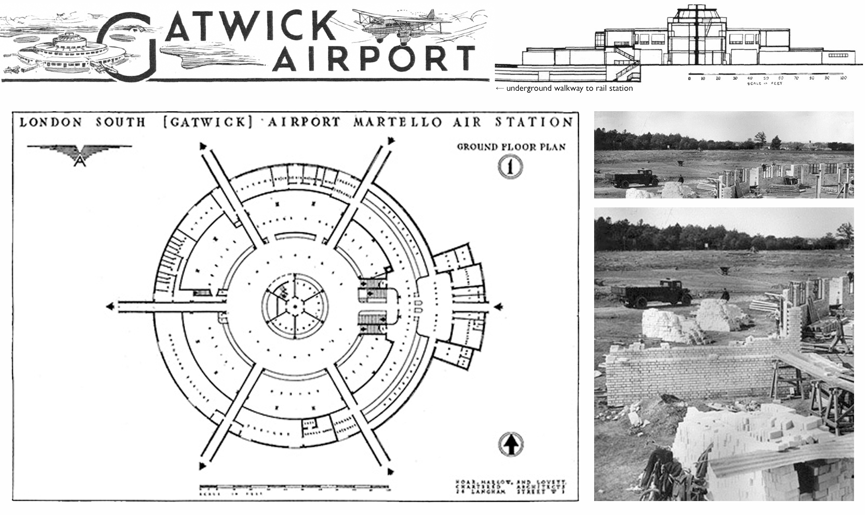
Early 1936
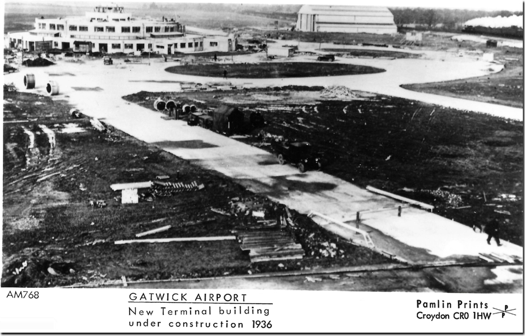
Open Day, 1936
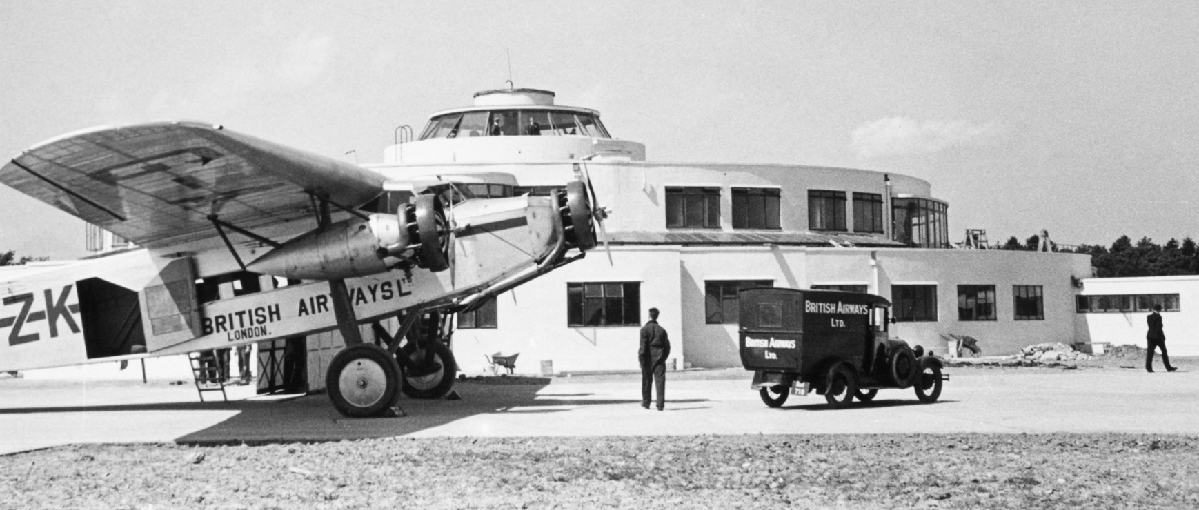
“The Beehive”
As the bird flies
High-resolution version →
A British Airways handbook & The Beehive today
In 1936 scheduled services to Germany and Scandinavia began, but the threat of war was looming, and in September 1937, Gatwick Airports Ltd bid for and was awarded a contract to operate a flying school for the RAF, using Tiger Moth and Hawker Hart biplanes.
1937
Signs of the times. . .
After war was declared on 3rd September, 1939 Gatwick was used for various military purposes, including the operation of Lysander and Mustang aircraft on army co-operation and ground-attack duties. During this time the site was known as “RAF Gatwick.” The servicing of Wellington and Liberator bombers also took place here.
In the aftermath of WWII, Gatwick’s future hung in the balance until the authorities were persuaded to allow it to remain open as a base for the numerous air-taxi and charter companies that had sprung up in the immediate post-war years. (Gatwick racecourse never fully reopened after the war and today the course has been fully consumed and buried below LGW’s 1988 North Terminal.)
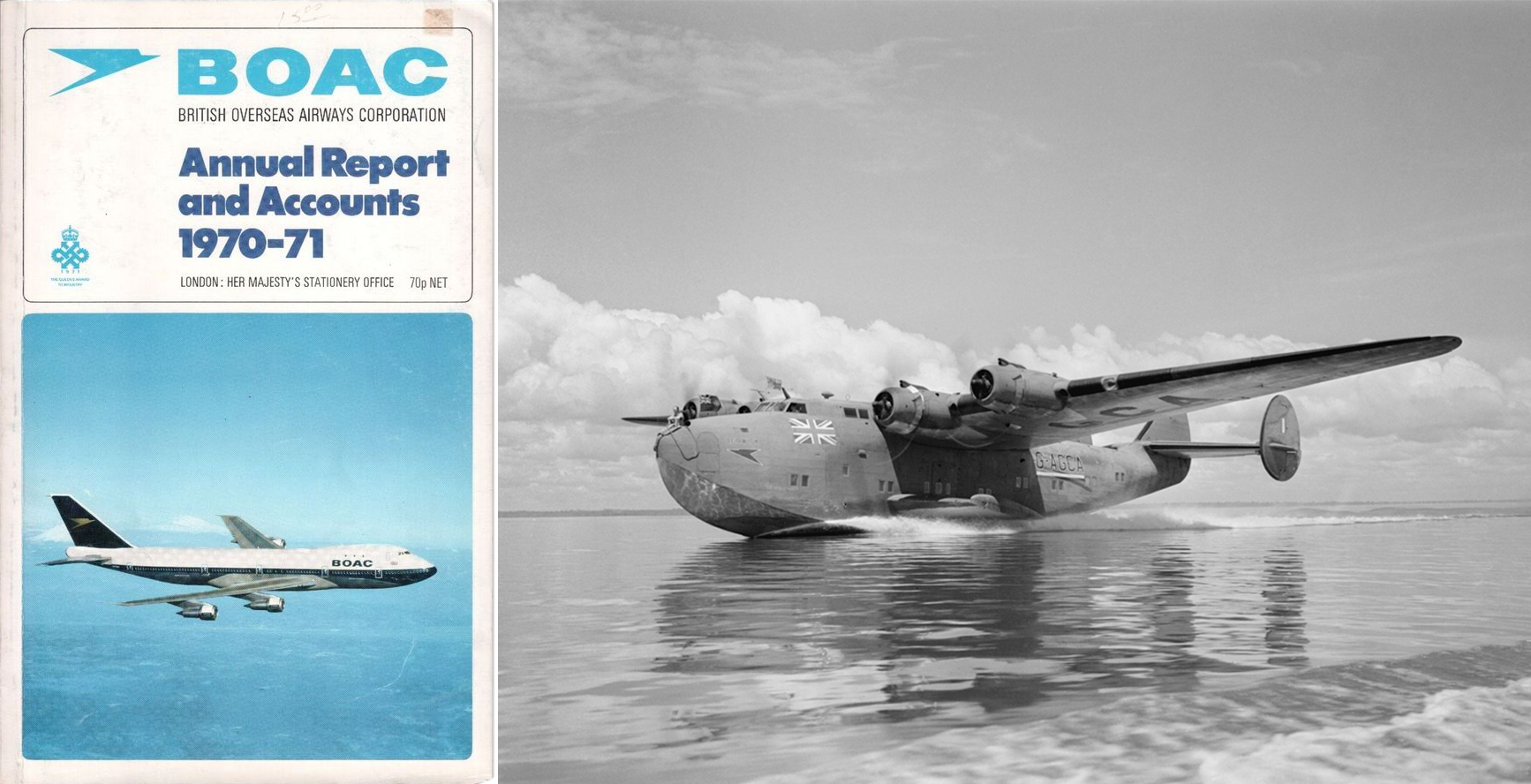
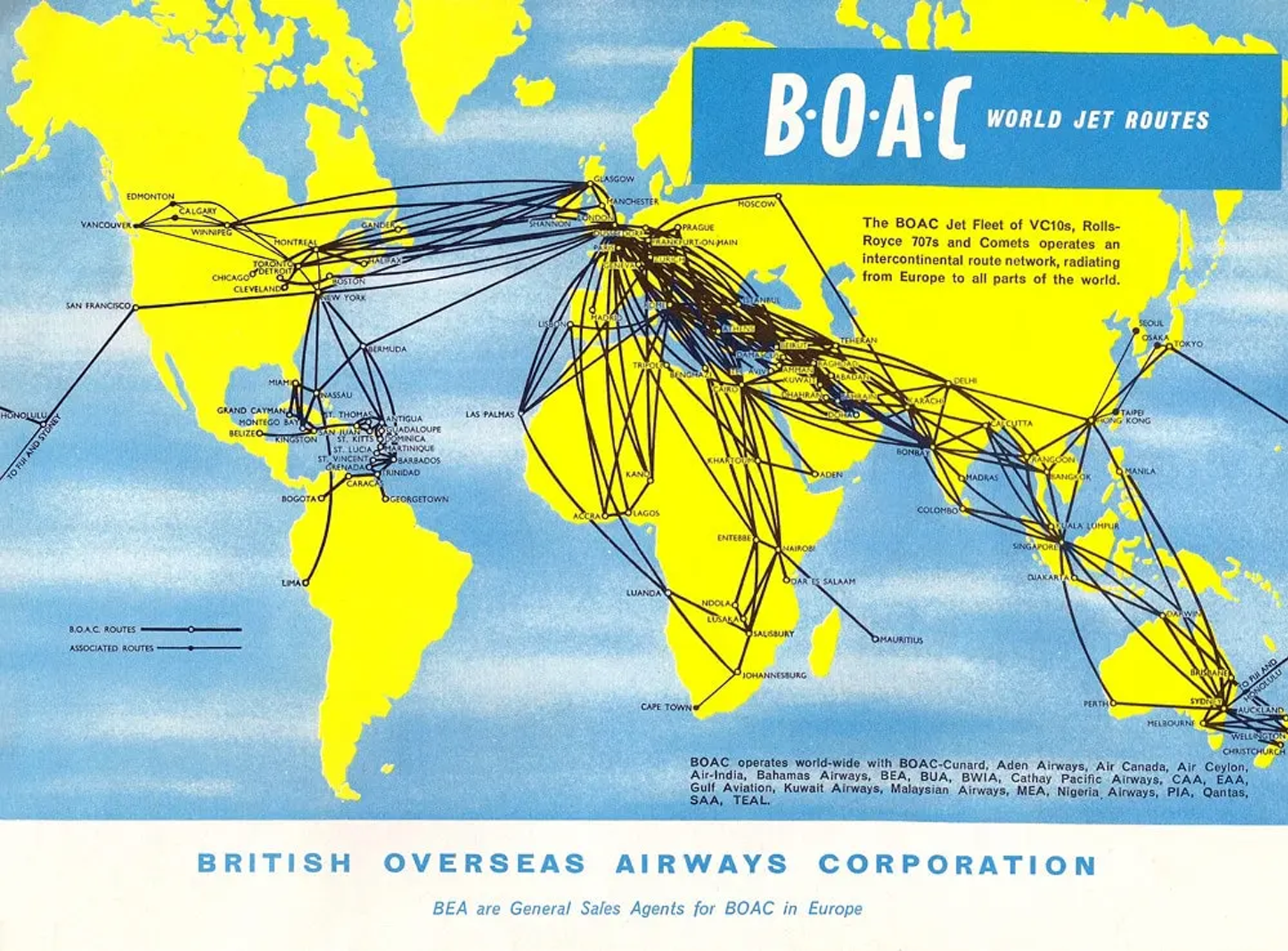
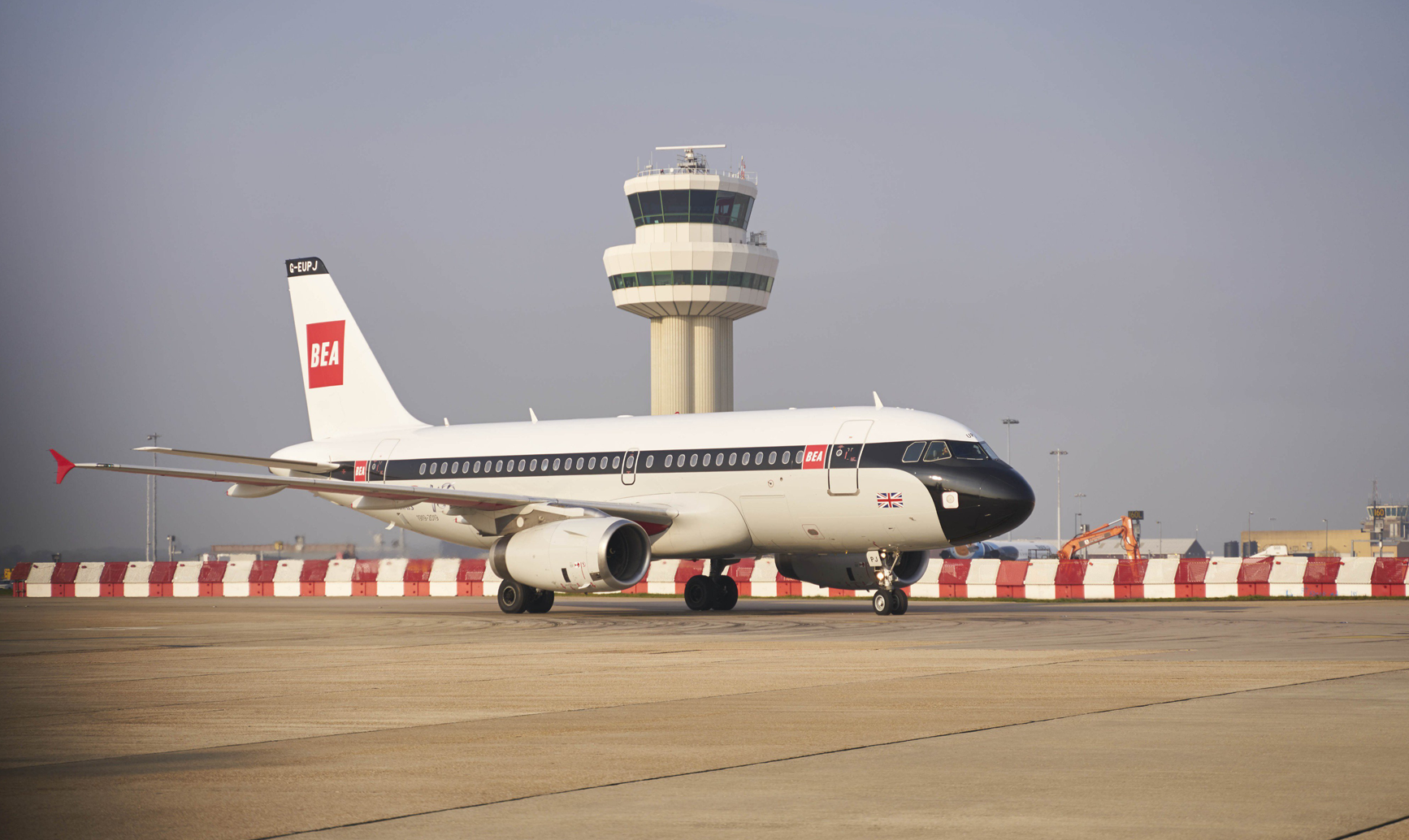
BOAC & BEA

Major airshows staged there by the Daily Express newspaper in 1948 and 1949 helped to raise public awareness of the airport, as did the inauguration of services to Alderney in the Channel Islands by state-owned airline, BEA in 1950.
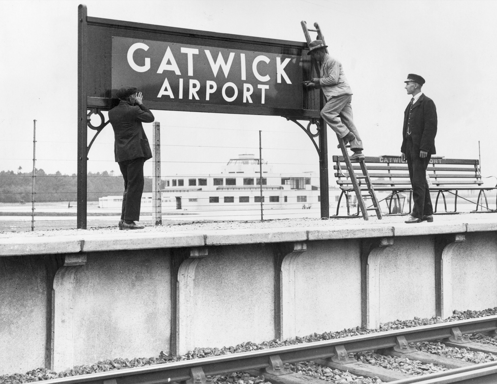
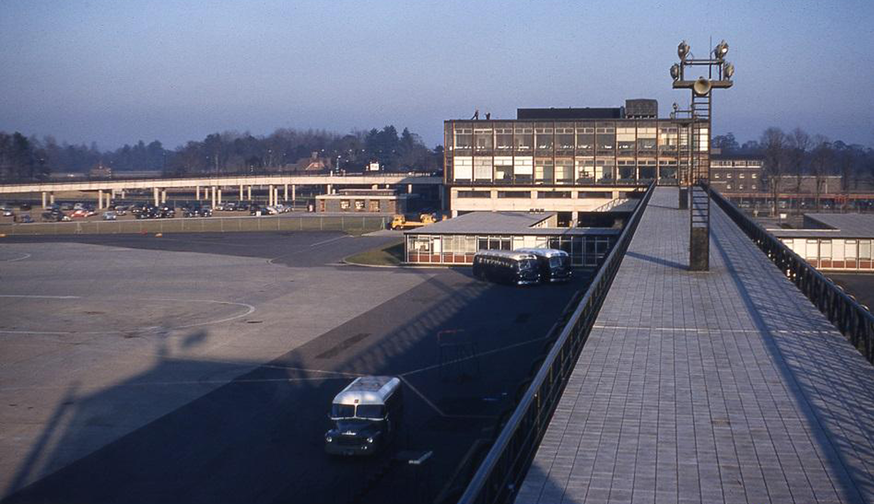
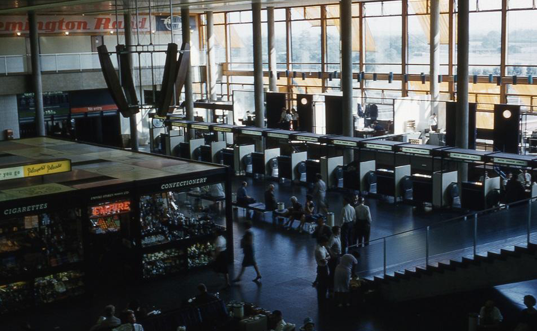
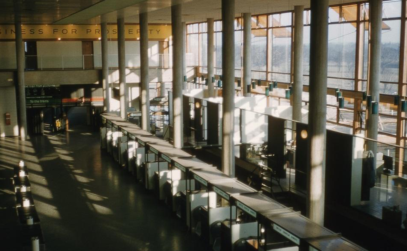
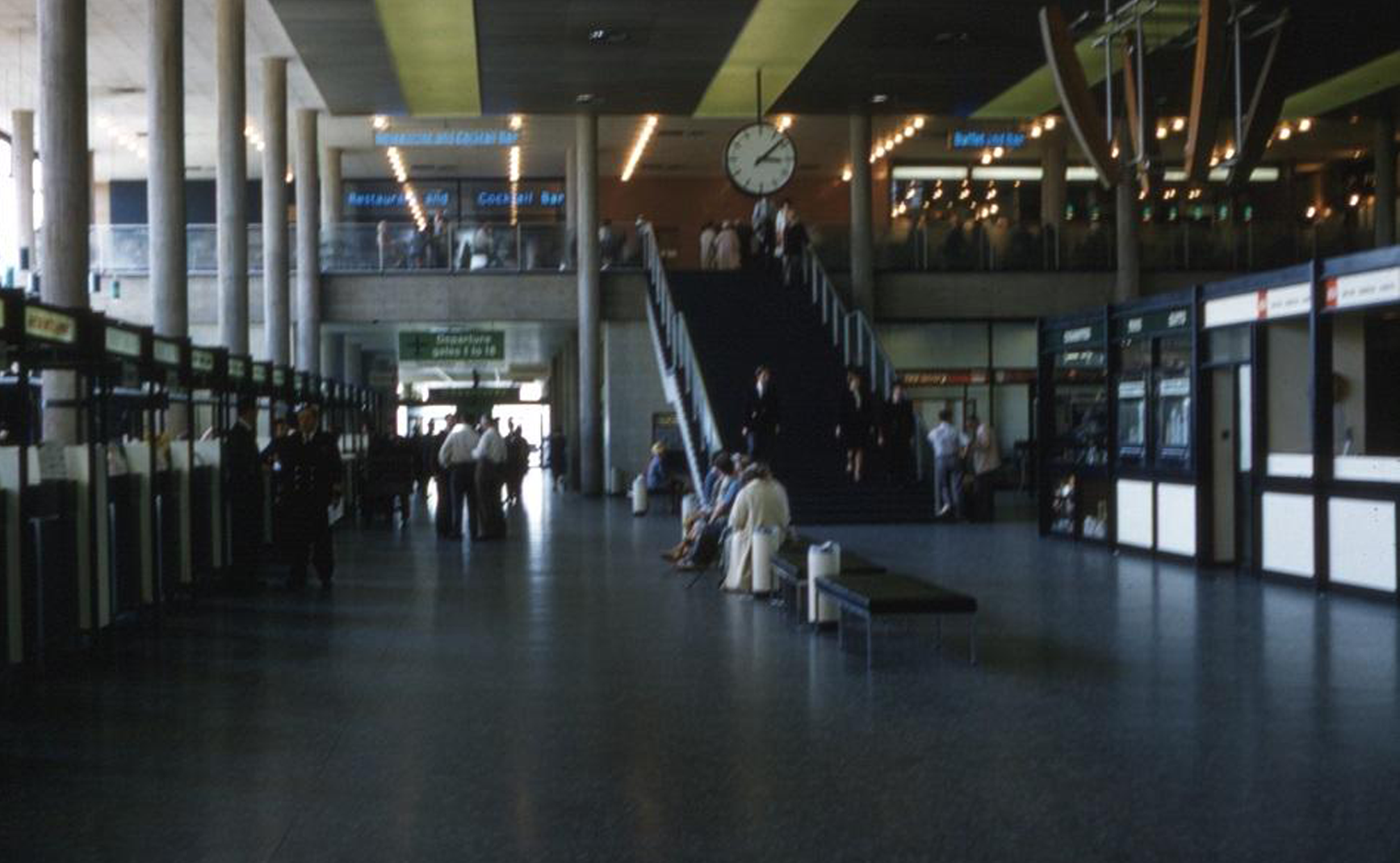
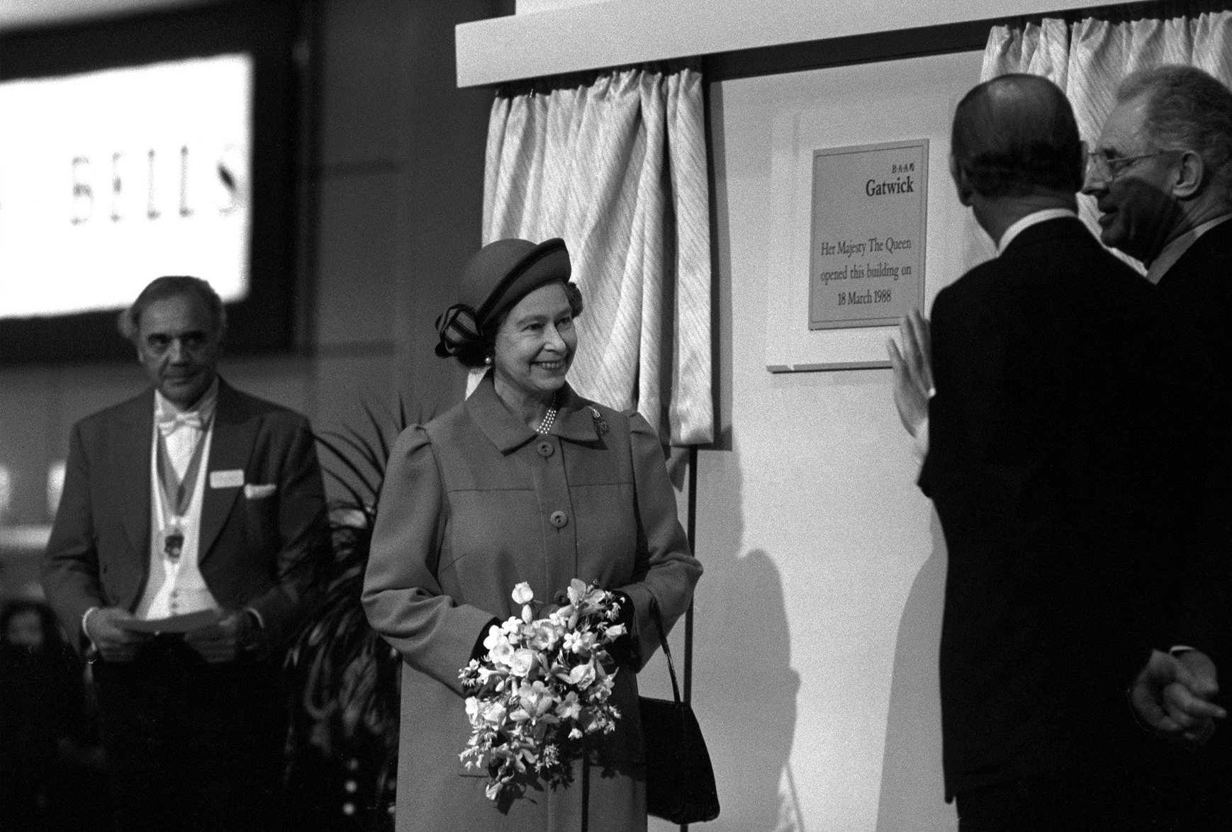
In 1952 it was announced that Gatwick had been selected for development as London’s second airport, with a new terminal building and a concrete runway. In June 1958, Queen Elizabeth II officially opened the new airport, the first in the world to combine air transport, mainline rail, and trunk road access facilities under the same roof.
Queen opens new south terminal, 1958
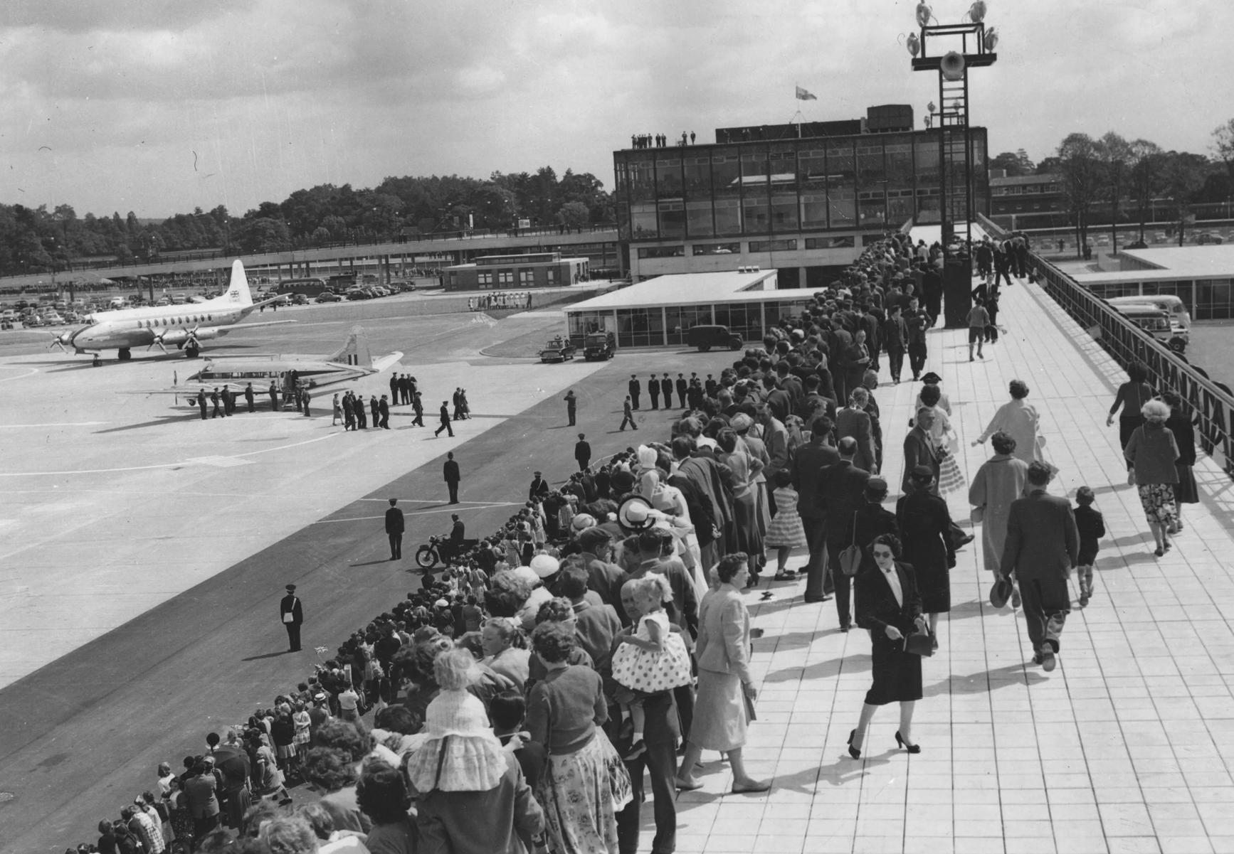
1958 Colour Series: 1 of 6
1958 Colour Series: 2 of 6
Fly B•O•A•C
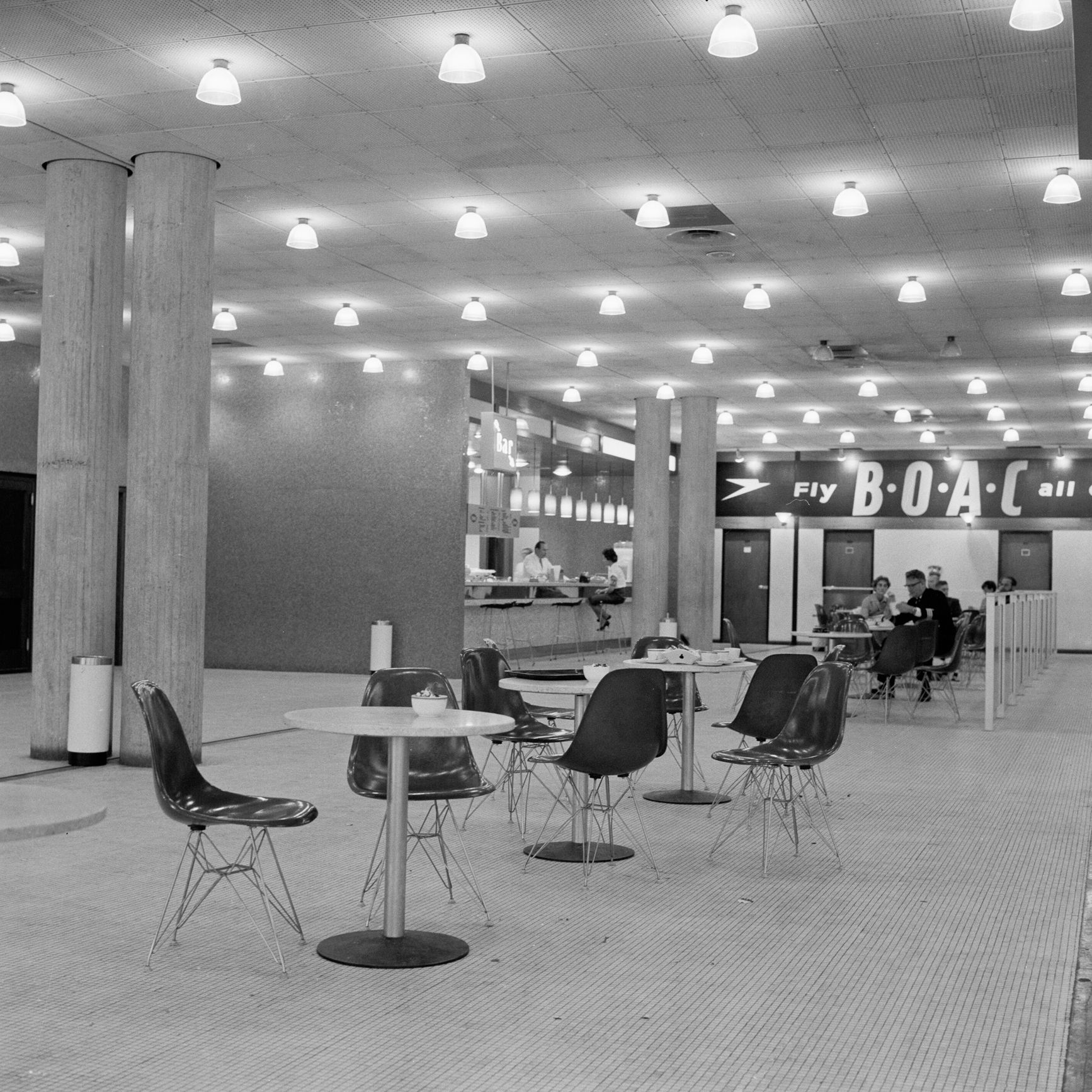
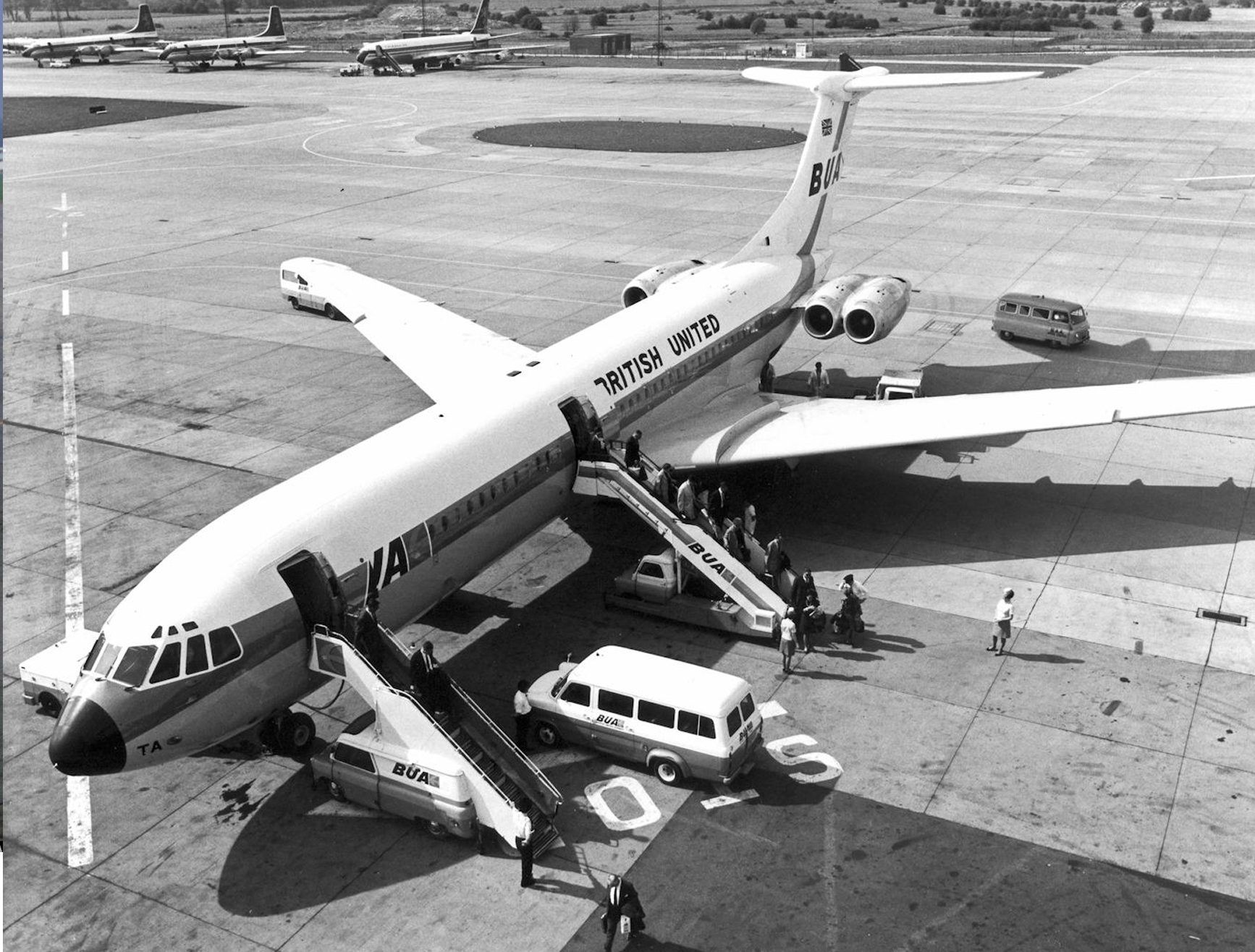
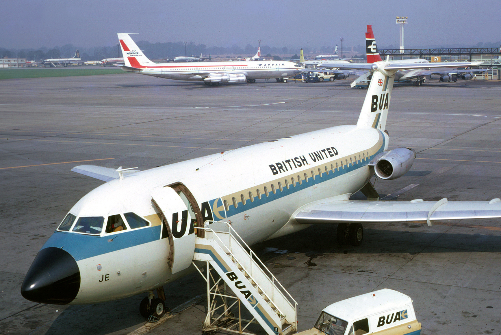
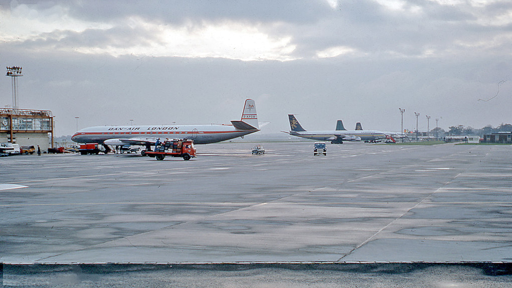
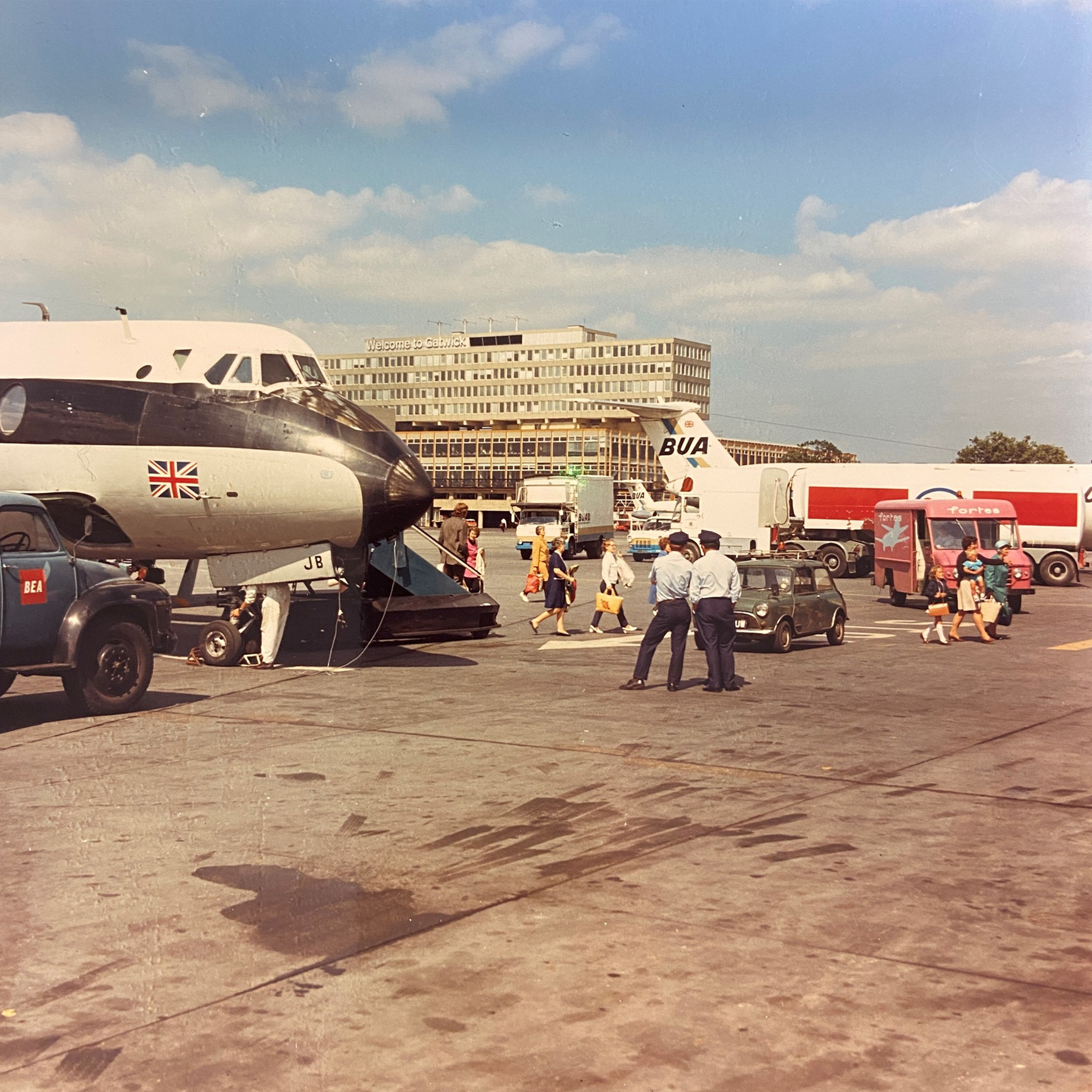
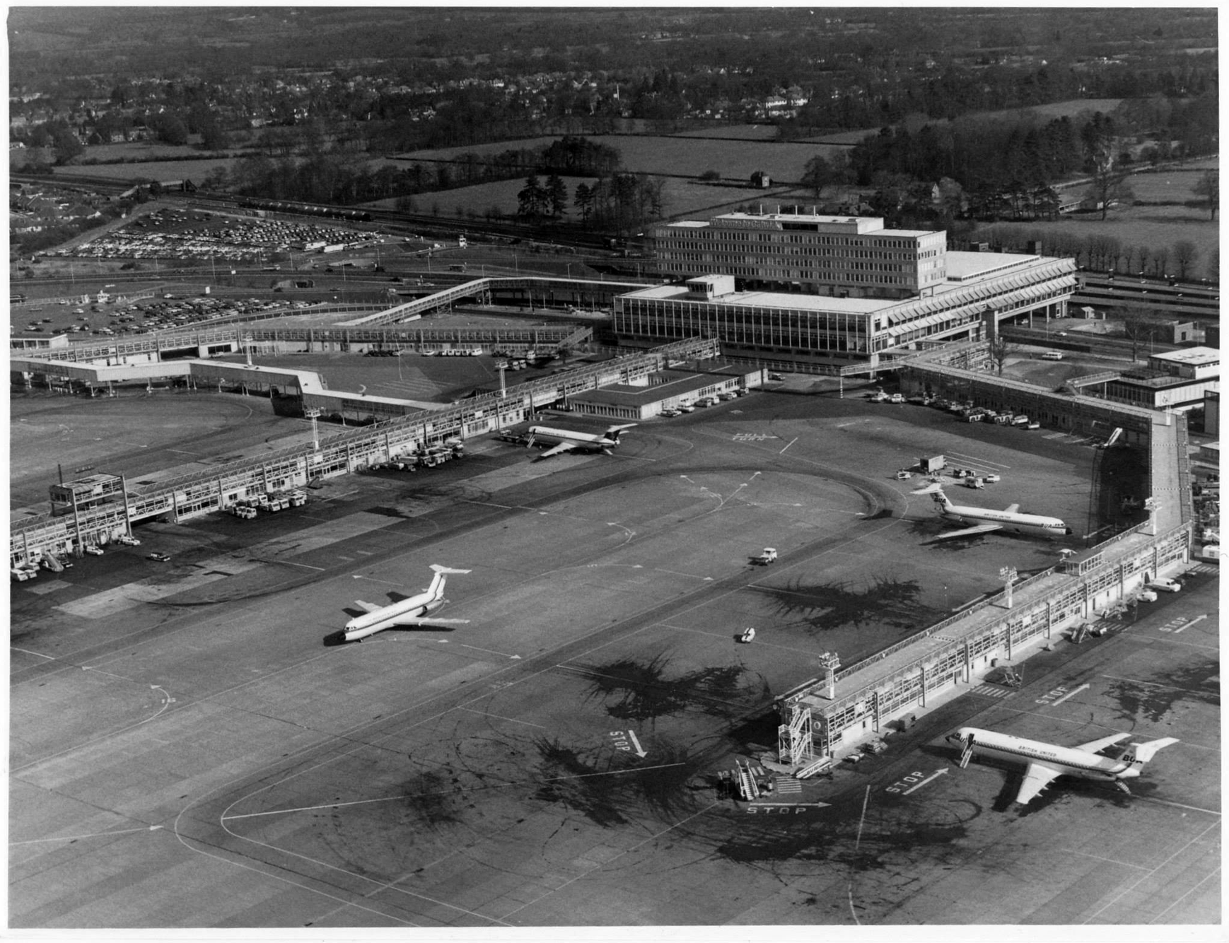
Despite its excellent links to London and the south coast, airlines were initially reluctant to transfer their services to Gatwick, and the airport remained quiet until 1960, when British United Airways (BUA) decided to make Gatwick its chief operating centre and Dan-Air8 also relocated its operations here.
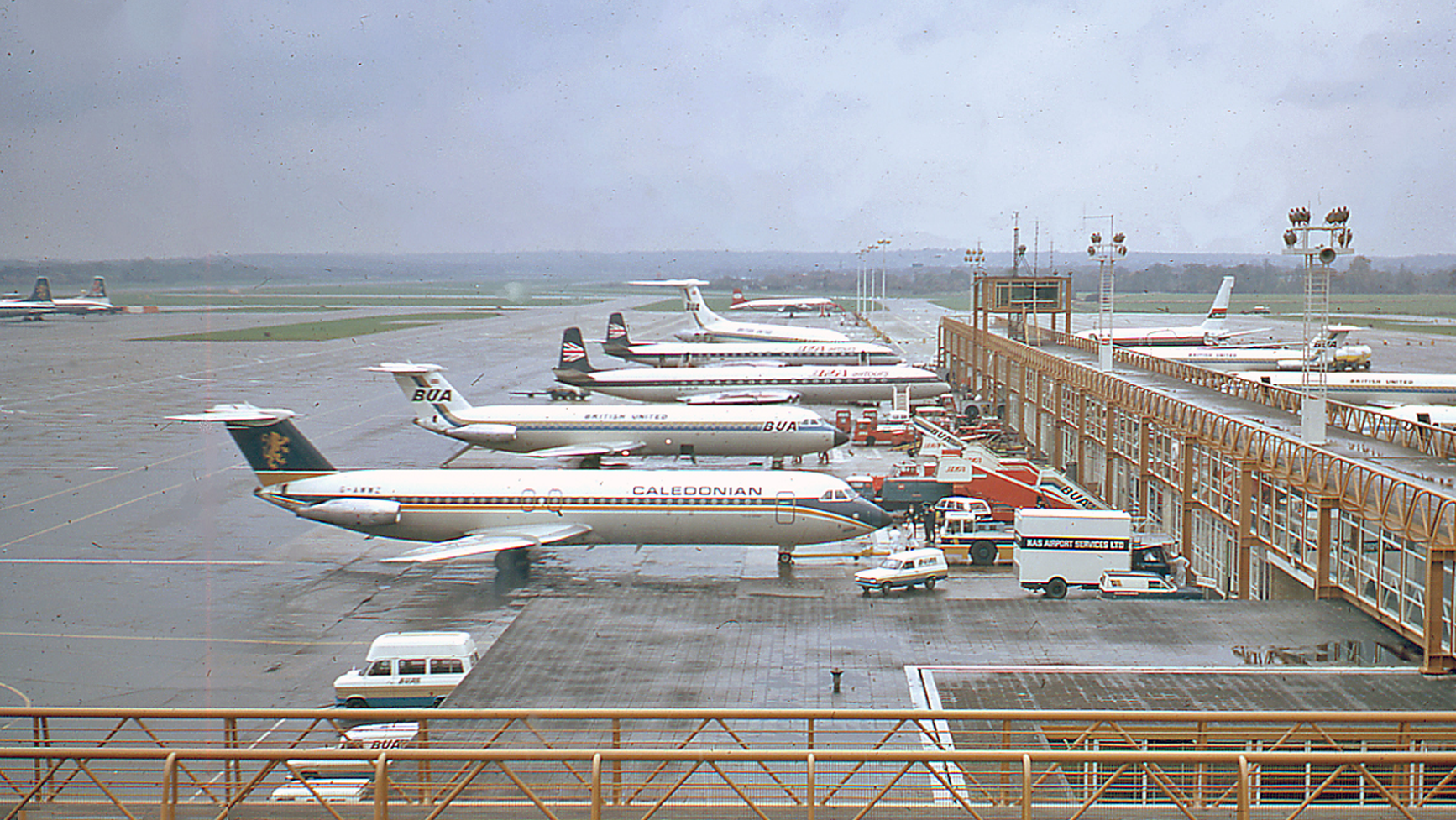
BUA & Dan-Air

In the 1960s, BUA and Dan-Air were two of the largest British independent airlines and both were based at Gatwick. Back then, BUA established itself as the dominant scheduled operator at the airport. It also provided a significant number of the airport’s non-scheduled services.
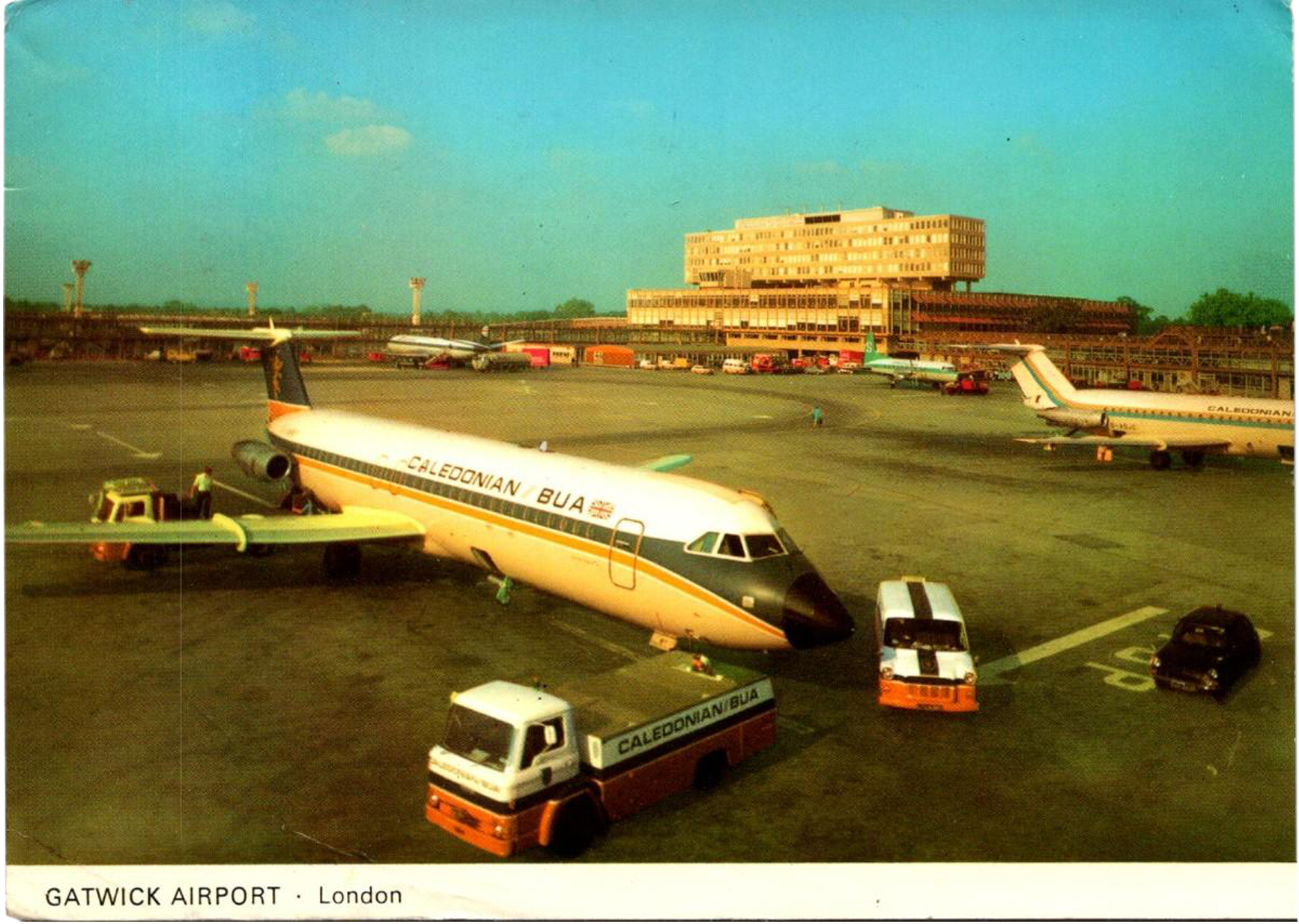
In 1961 BUA and Dan-Air were joined by Caledonian Airways, which went on to become a major operator of trans-Atlantic and Mediterranean charter flights from Gatwick.
Gatwick, circa 1963
1965
New inclusive-tour airlines such as BEA Airtours and Laker Airways set up bases at Gatwick. On 1st April 1966 the newly-formed British Airports Authority (BAA) took over responsibility for the operation of Gatwick and Heathrow airports.
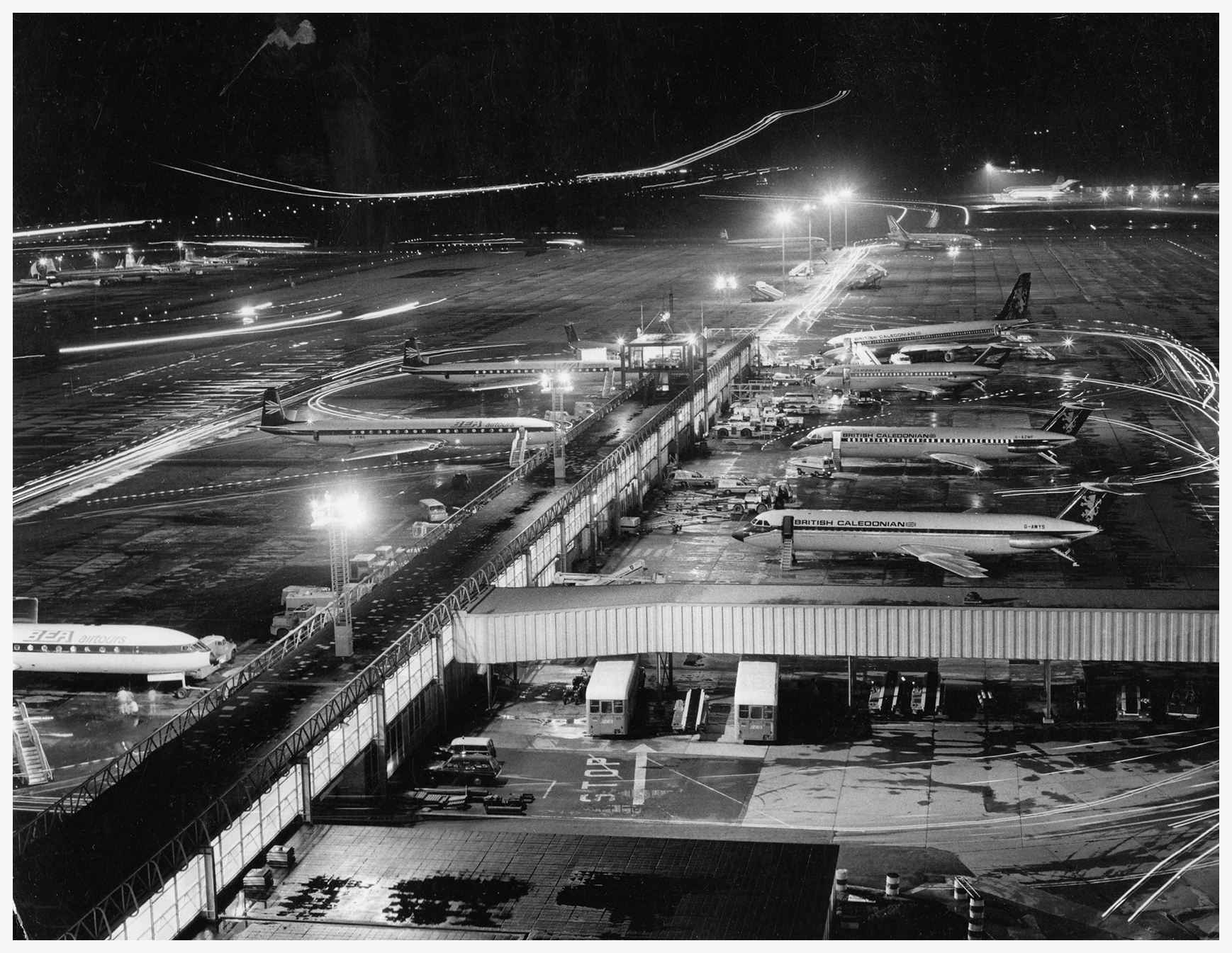
Jam packed aprons by 1966
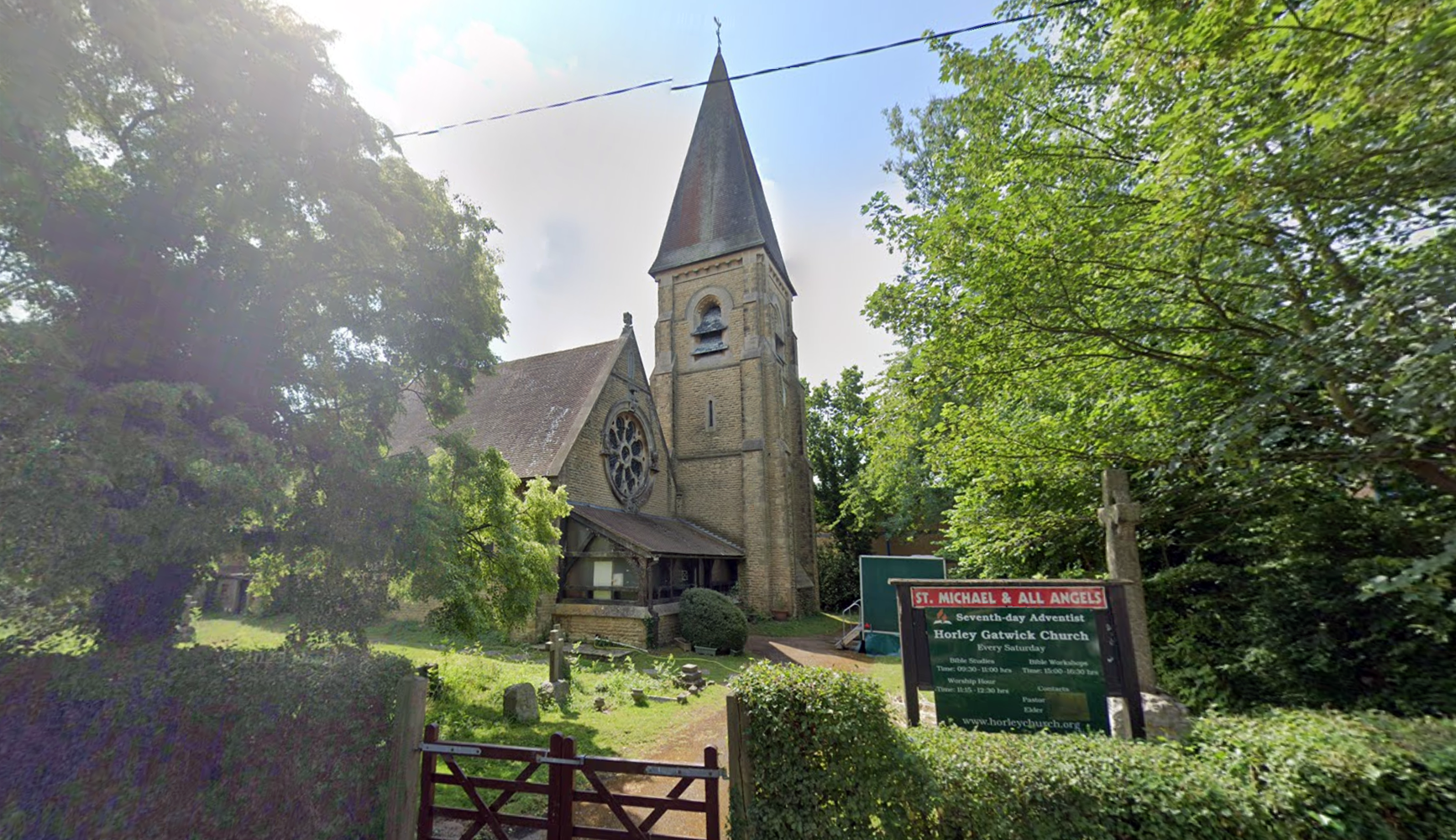
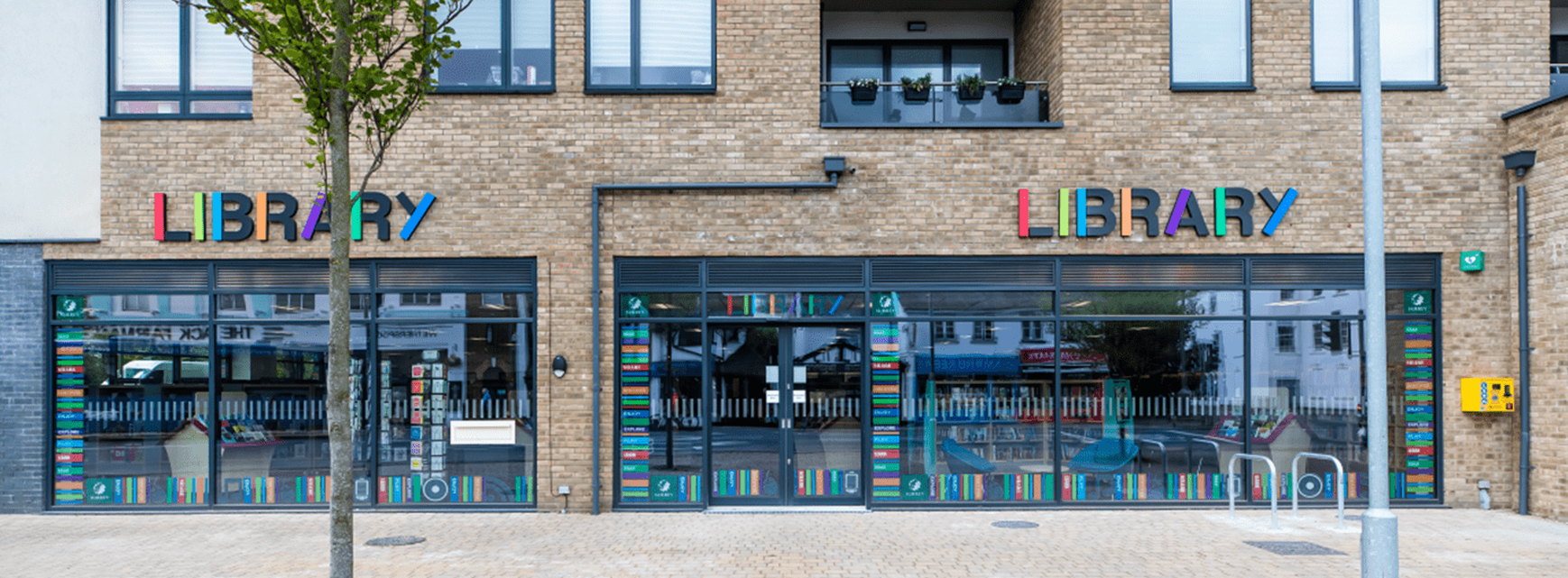
Dan-Air, for a time, became the leading provider of inclusive tour charter services (think for example, today’s ‘all inclusive’ EasyJet holiday). It had its offices and headquarters in Horley town centre (on the location where Horley’s new public library is).
Dan-Air
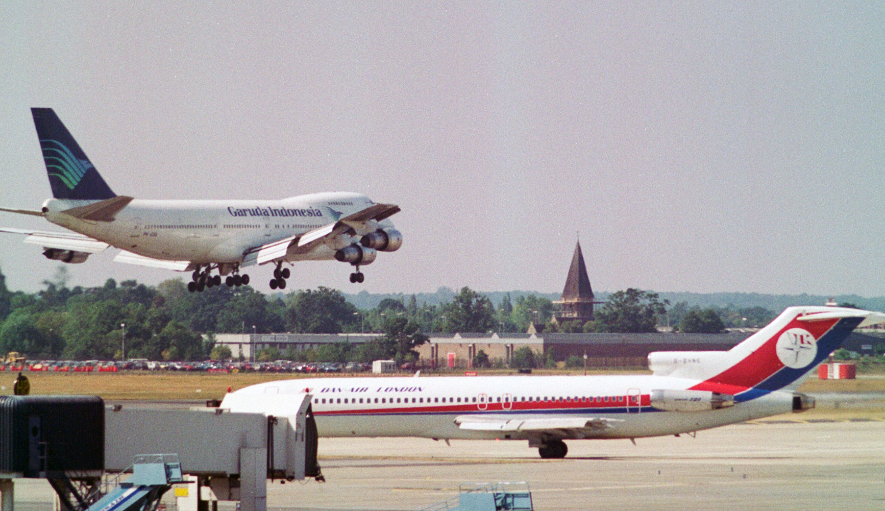
Lack of vertical integration with a tour operator, and an inefficient fleet mix dominated by ageing Boeing 727s and BAC One-Elevens made Dan-Air uncompetitive, resulting in increasing marginalisation and growing financial difficulties as well as a change in senior management and strategy by the early 1990s. Following unsuccessful merger attempts Dan-Air was sold to British Airways in 1992 for £1.
What once was, no longer is
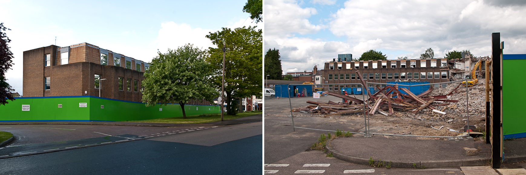
The Dan-Air site today:
Kodak quattro colour personalities
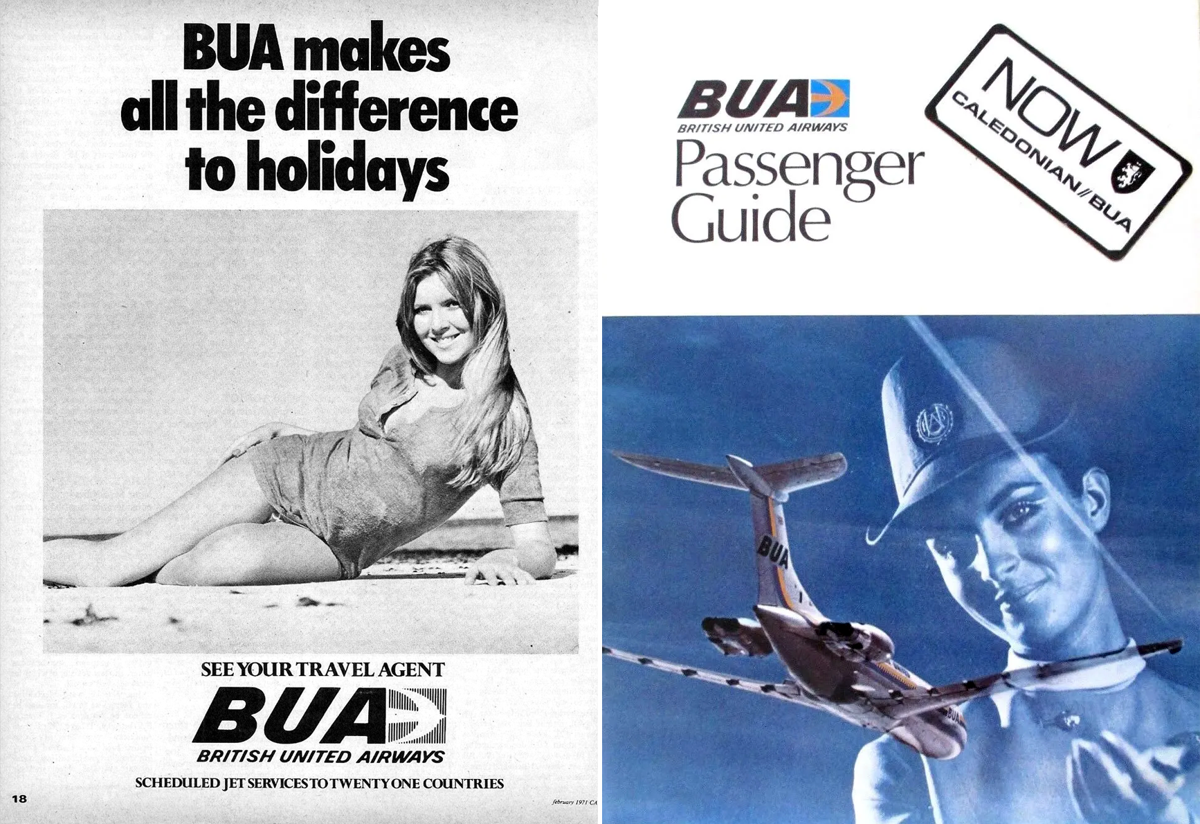
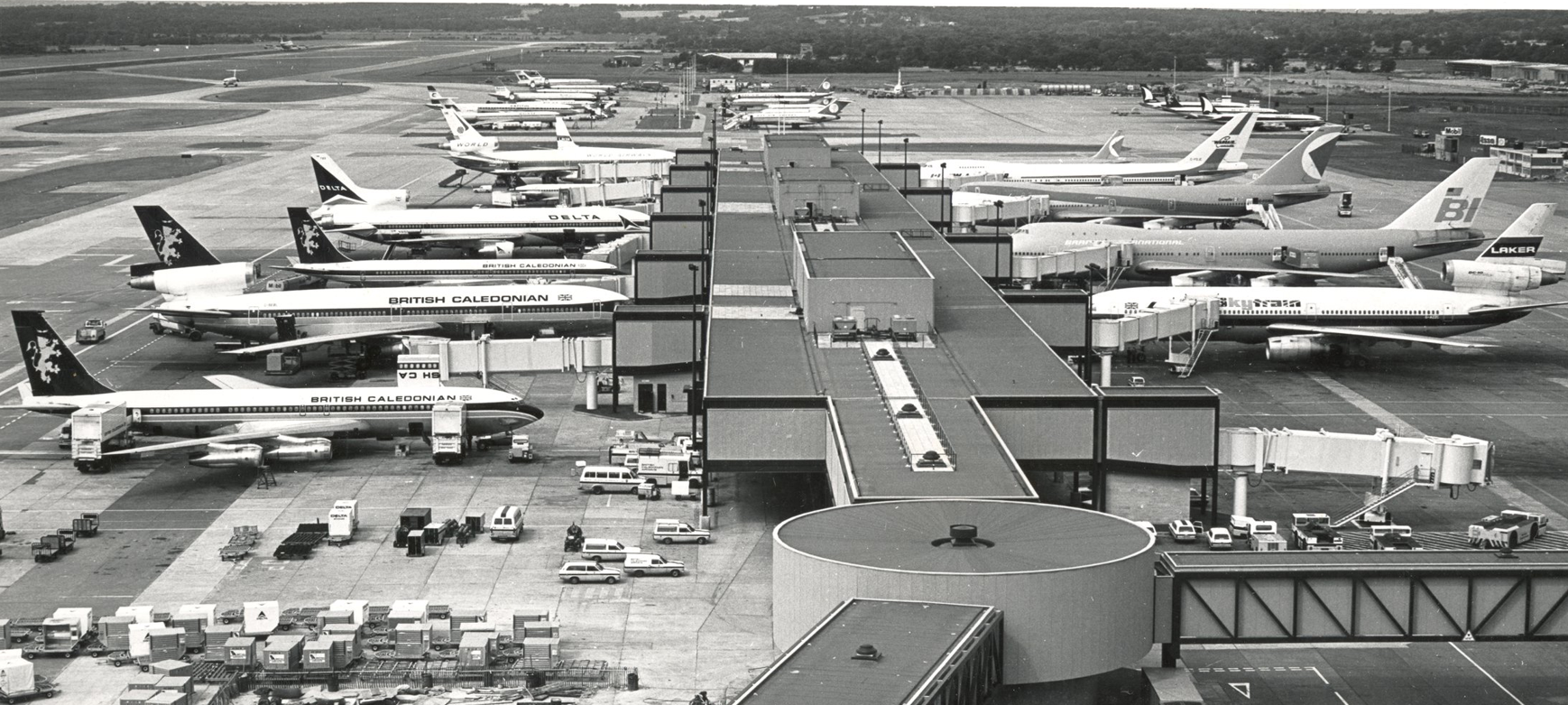
In November 1970 Caledonian Airways took over British United Airways, and, as British Caledonian Airways, went on to build up an extensive network of scheduled services from Gatwick to South America, West Africa, the Middle and Far East, and the USA.
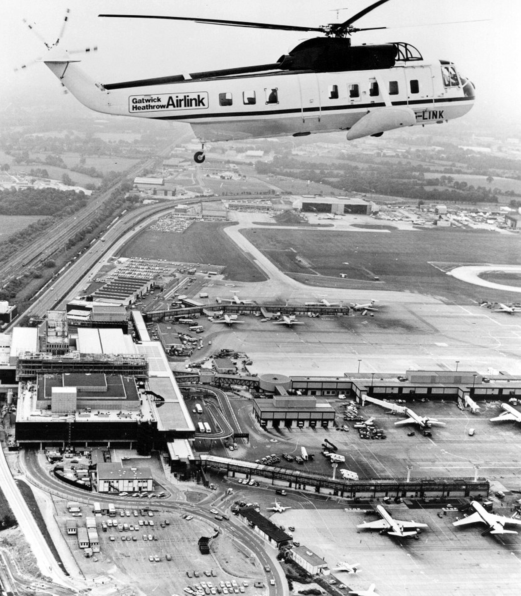
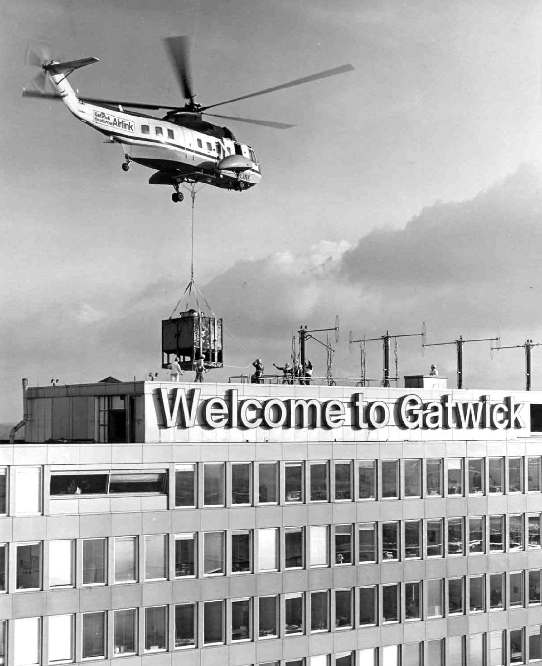
To provide speedy connections between Gatwick and Heathrow, a helicopter link was introduced in 1978. The 15-minute journey was inaugurated on 9th June by HRH the Prince of Wales, who had arrived that day to officially open the airport’s improved and enlarged terminal facilities.
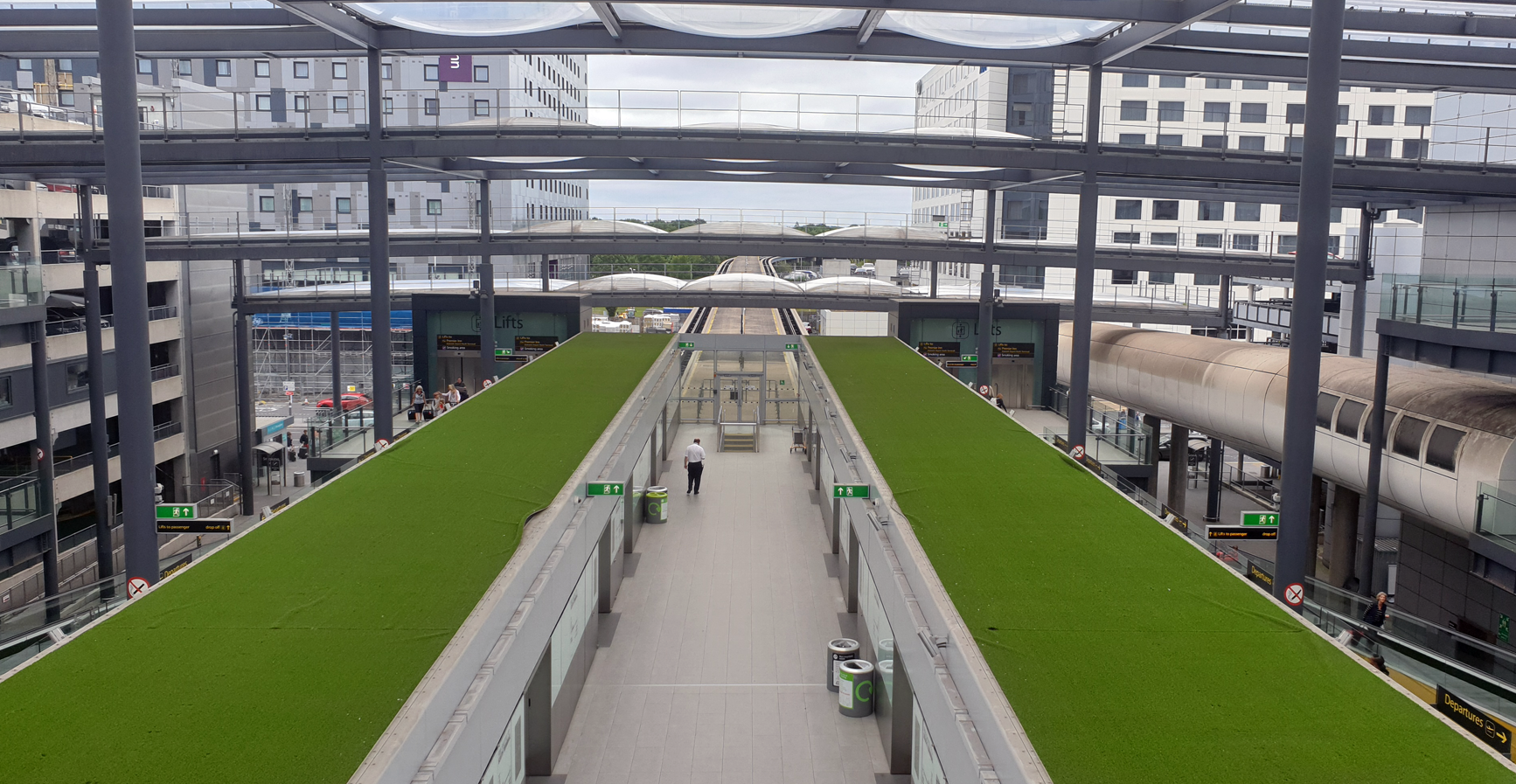
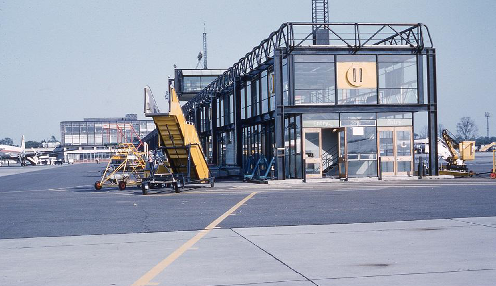
In August 1979 the British Airports Authority agreed not to build a second runway at Gatwick for at least 40 years, in return for being allowed to upgrade the taxiway for temporary use as an emergency landing strip. During the following month the BAA outlined its plans for the future of Gatwick. These included a second terminal building, linked to the existing one by a driverless tracked transit system.
BUA: British United Airways
British Caledonian & Laker, are now no more
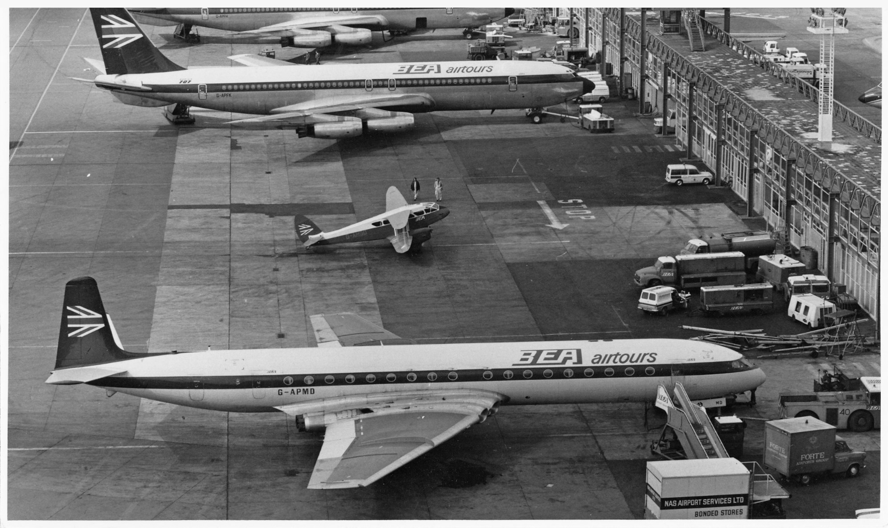
BEA airtours

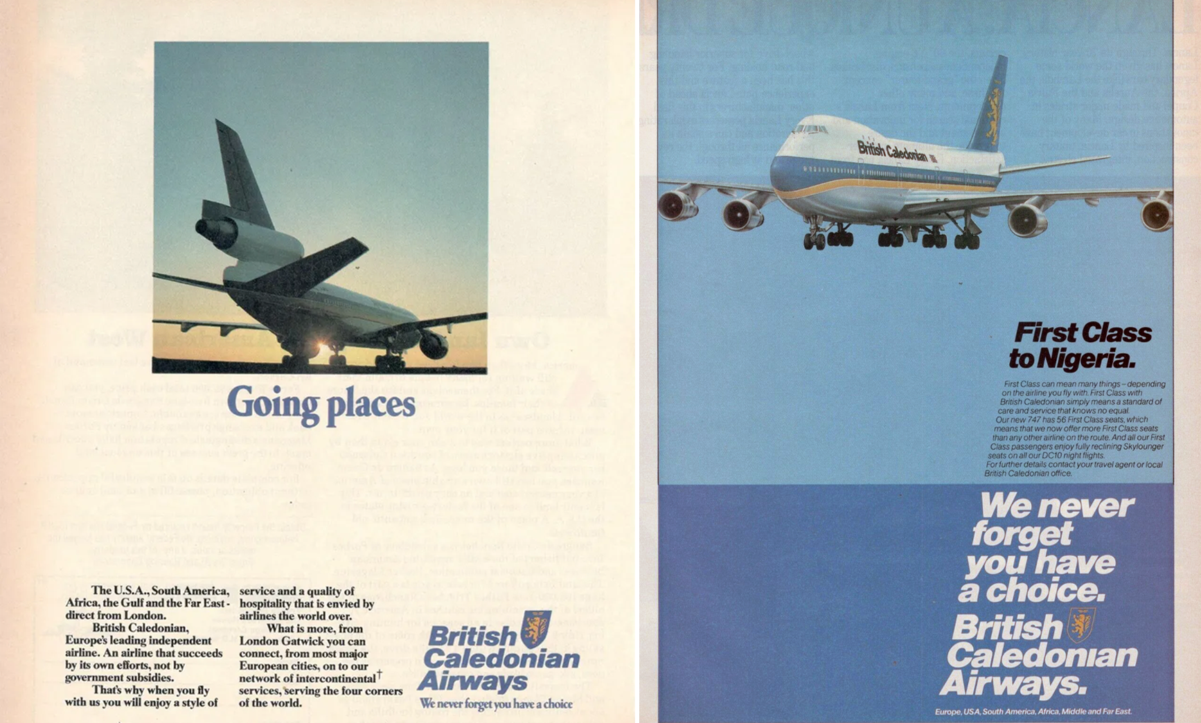
British Caledonian was a British independent airline operating out of Gatwick during the 1970s and 1980s. It was set up and billed as an alternative to the British government-controlled corporation airlines (basically British Airways) and was formed by the UK’s second-largest, independent charter airline Caledonian Airways taking over BUA.
The carrier slogan was ‘Let’s go British Caledonian’ in the 1970s and ‘We never forget you have a choice’ in the 1980s. For a time British Caledonian was the UK’s foremost independent, international scheduled airline.
Atmospheric Aerodynamic
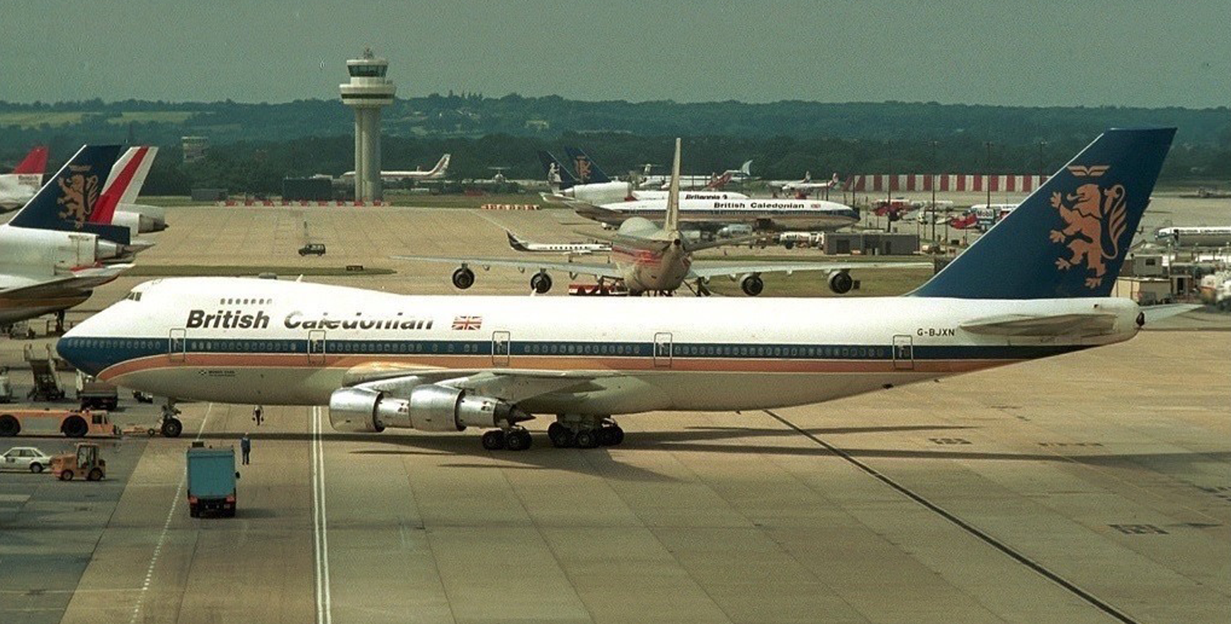
A series of major financial setbacks during the mid-1980s prompted British Caledonian to consider its options in terms of improving its competitive position. It is not without irony that it ended up being the newly privatised British Airways that bought British Caledonian outright in late 1987.9

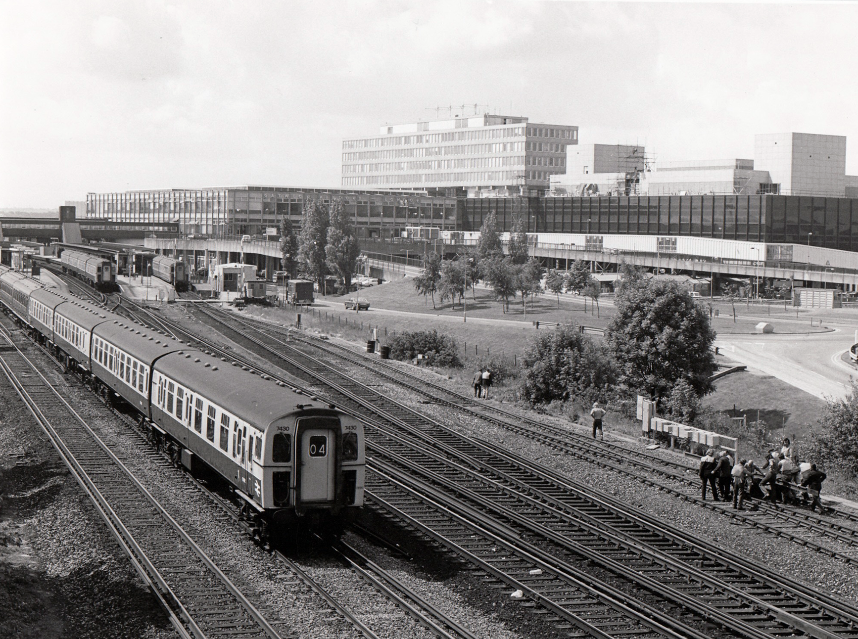
Gatwick Station, National Rail
Horley, on the airport’s periphery
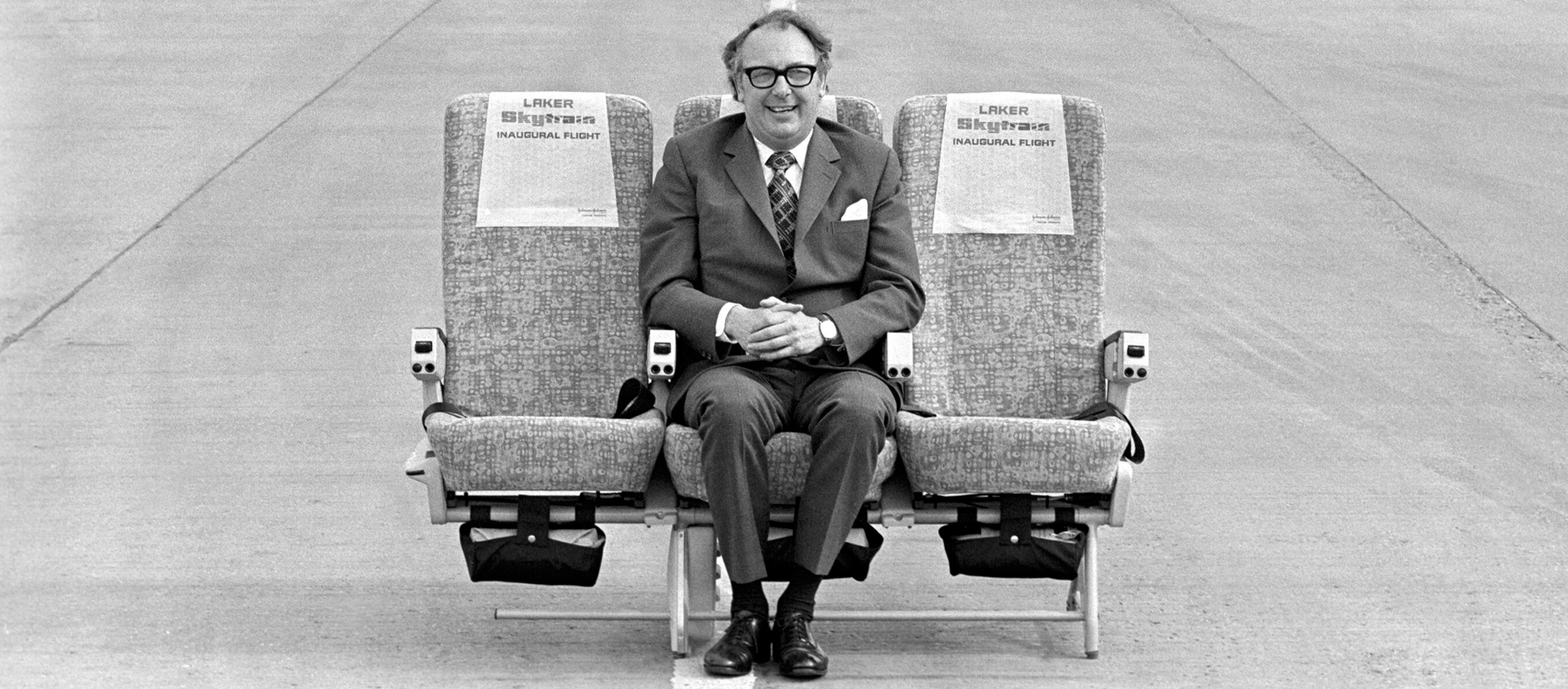
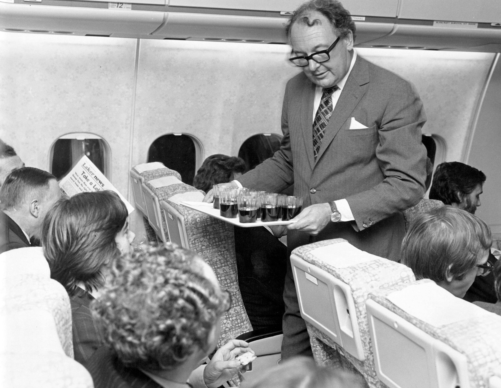
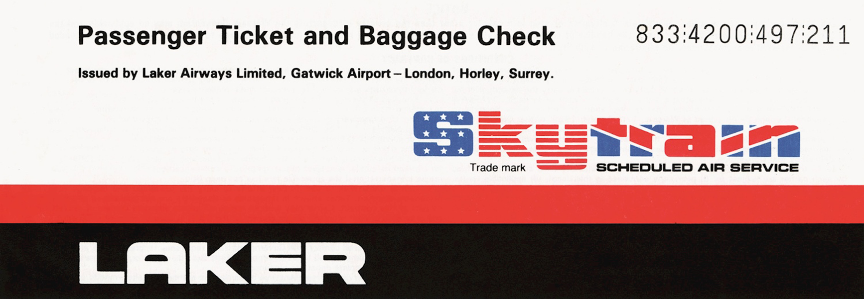
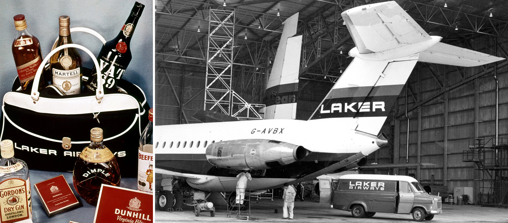
By 1974 Gatwick was linked to 57 destinations across the world by the scheduled services of 14 airlines. These were joined in September 1977 by the revolutionary Laker Airways ‘Skytrain’ low-fare service to New York.
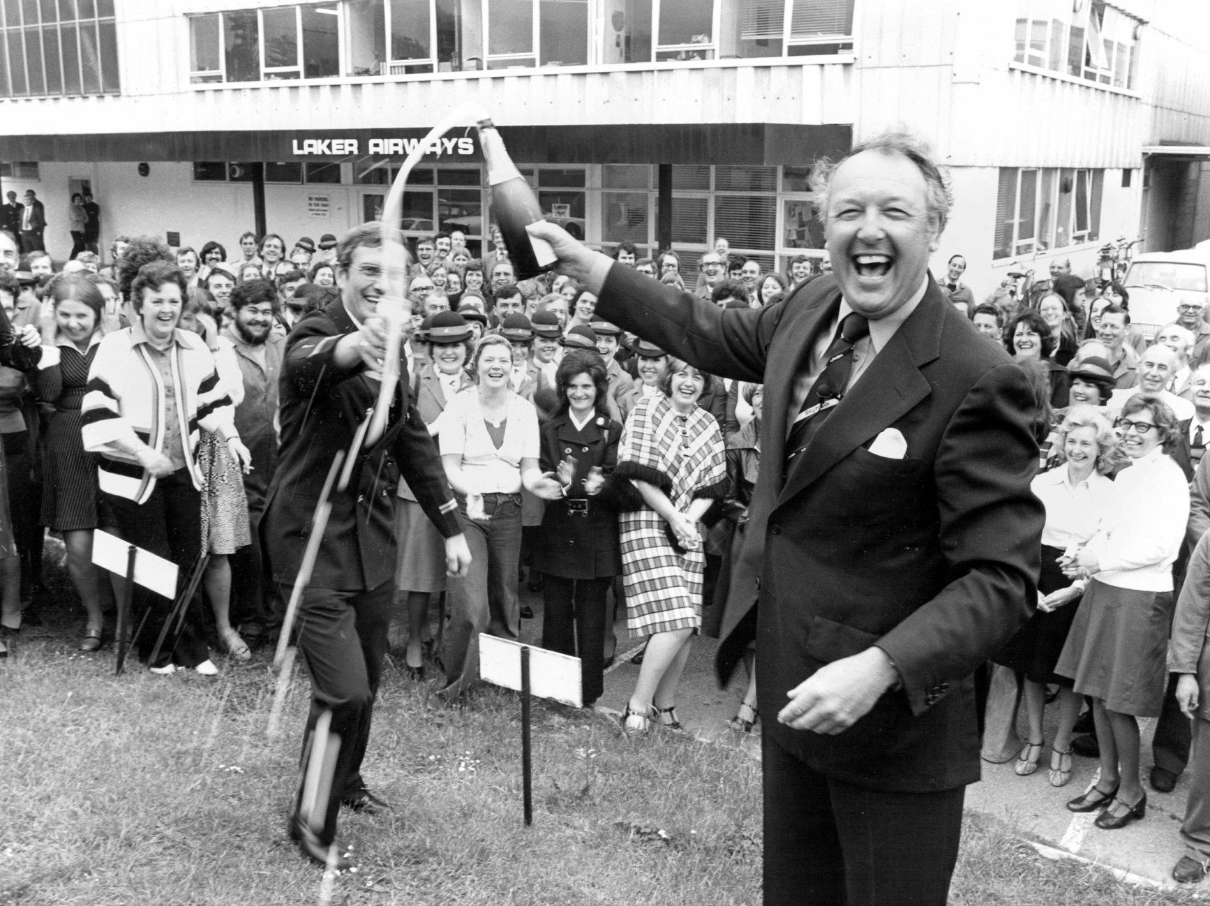
The legendary Freddie Laker
Freddie Laker was an English airline entrepreneur, best known for founding Laker Airways in 1966. He is famous for setting up one of the first “low cost / no-frills” airline business models that has since proven to be successful worldwide (think: easyJet).
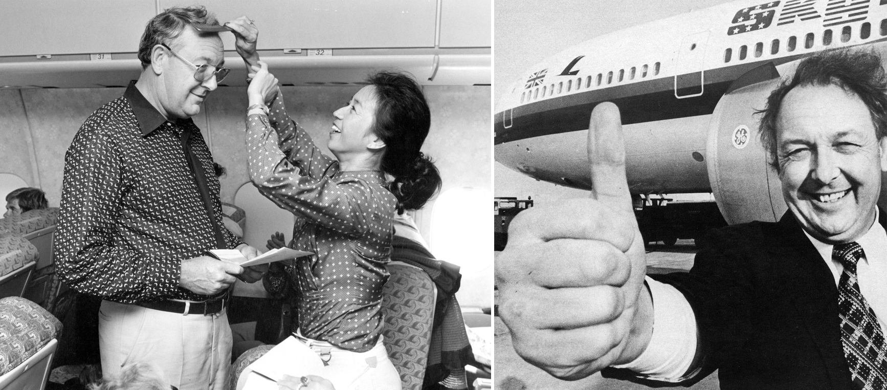
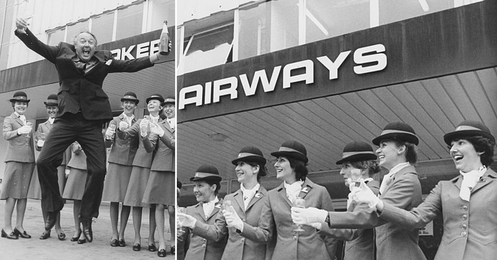
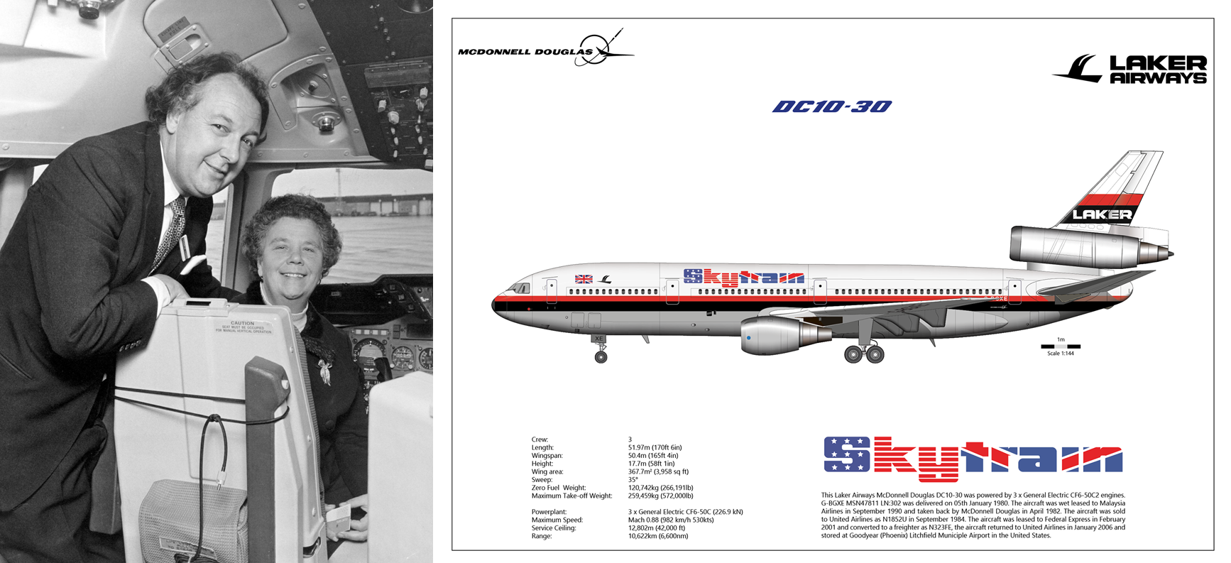
As a result, all the major airlines against which Laker was competing lowered their fares to the level he was charging. Although they were losing money, they agreed among themselves to maintain those low fares until they had driven Laker out of business. It was a deliberate effort by the cartel to drive out a brash interloper.
The economic recession that occurred during the late 1970s didn’t help Laker’s financial situation. In 1981 the final nail in his airline’s coffin was the revelation that the company was undercapitalized and overextended. Encumbered with debts of £270 million, Laker Airways went bankrupt on February 5, 1982.
Laker filed an antitrust lawsuit against a number of the carriers that had colluded to bring his airline down. In 1985 they agreed to settle, and Laker received payments amounting to £93 million, including £43 million from British Airways alone. That victory enabled him to pay off his creditors, but since his airline was defunct it was at best a pyrrhic victory.
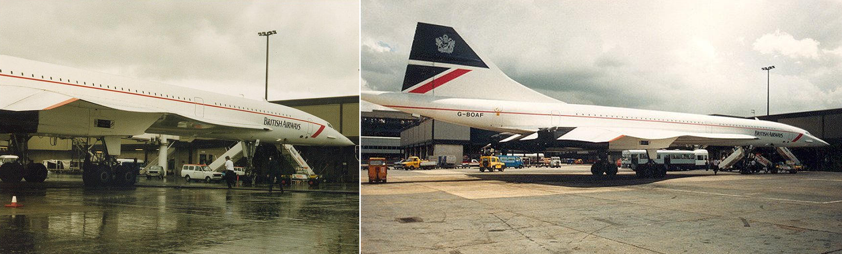
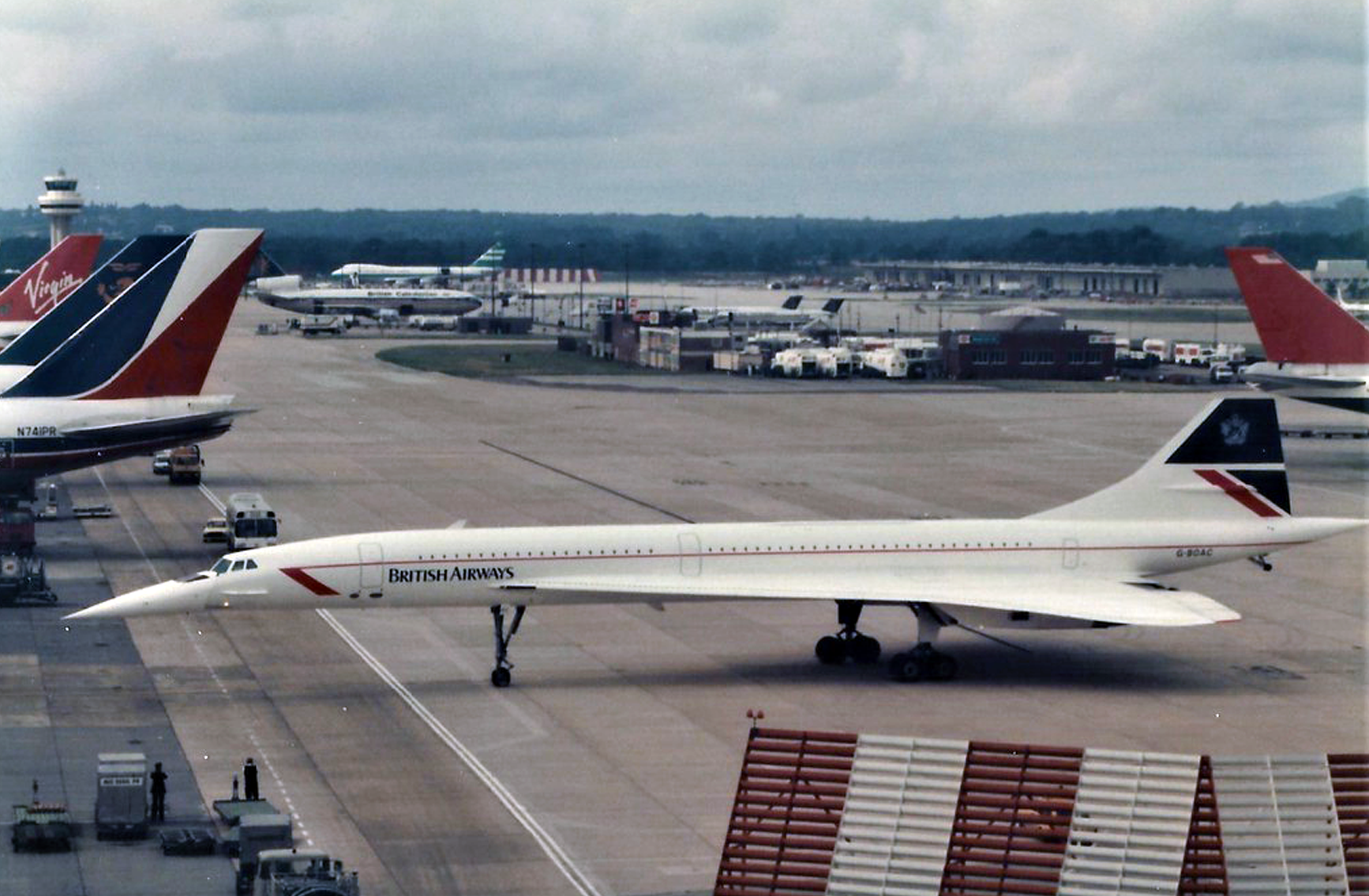
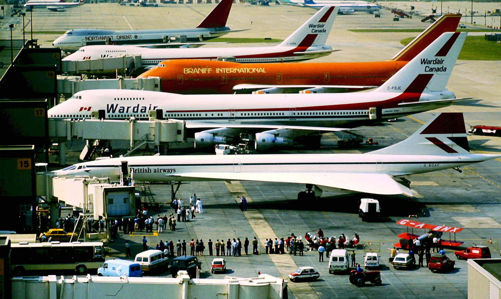
No more supersonic Concorde either
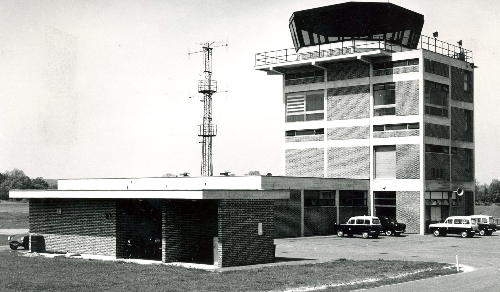
North Terminal, under construction
Gatwick, blessed
More followed Lakers suit
Following on from Lakers, Monarch was also the largest airline ever to have ceased trading in the UK until the collapse of Thomas Cook in 2019. Thomas Cook is not to be confused with Thomson (holidays) which itself was acquired by TUI. (TUI is an acronym for Touristik Union International—”Tourism Union International”—which itself was Preussag AG until 1997 when the company changed its activities from mining to tourism).
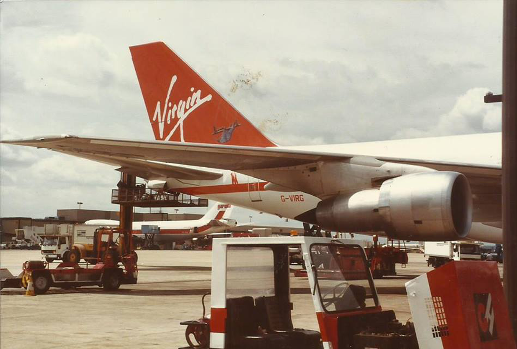
Virgin Atlantic, 1988
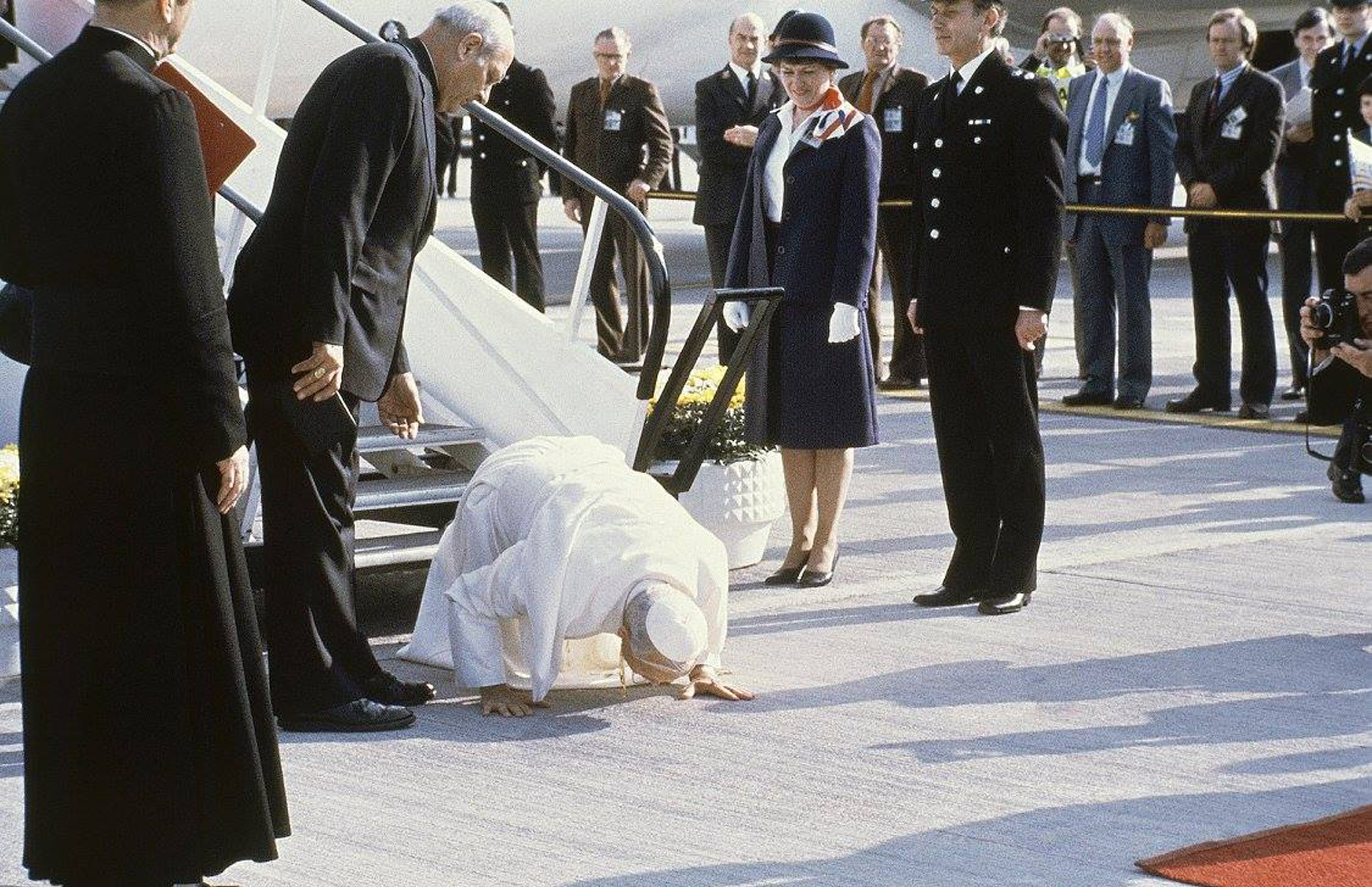
Queen Elizabeth visits again
North—South
South Terminal (map & guide) →
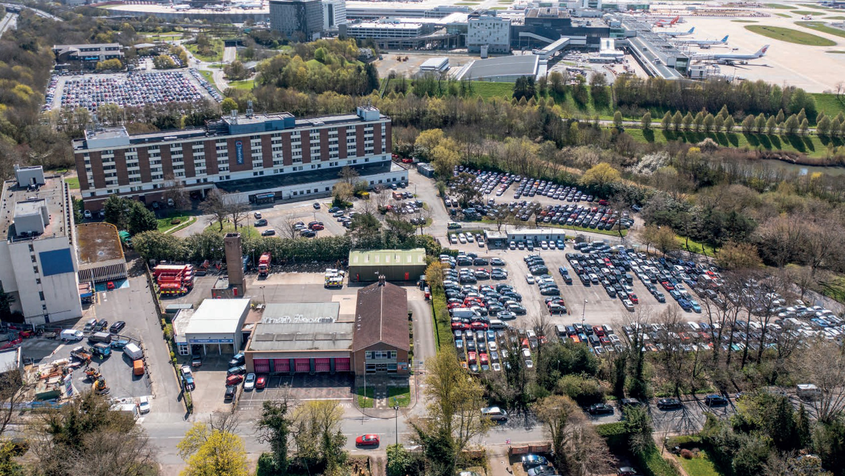
Aerial shots
Horley, Gatwick & Controversies
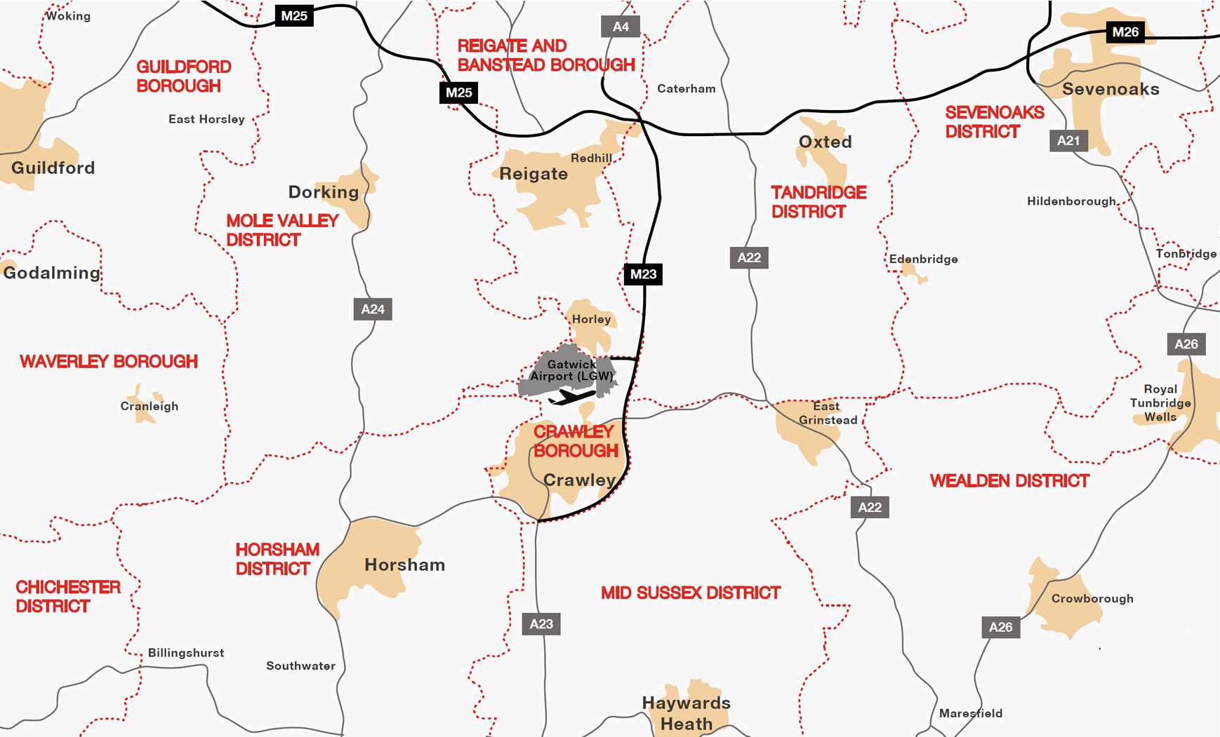
Considering Horley is right under Gatwick airport’s flightpath—with over 33 million passengers annually and the world’s second busiest runway, clocking up an average of 700 daily flights—it is a little grating to learn that the airport was once part of Horley town council’s parish but was arbitrarily taken and given to Crawley borough council by way of a 1972 Government decree.
Gatwick’s logo
Gatwick’s brand
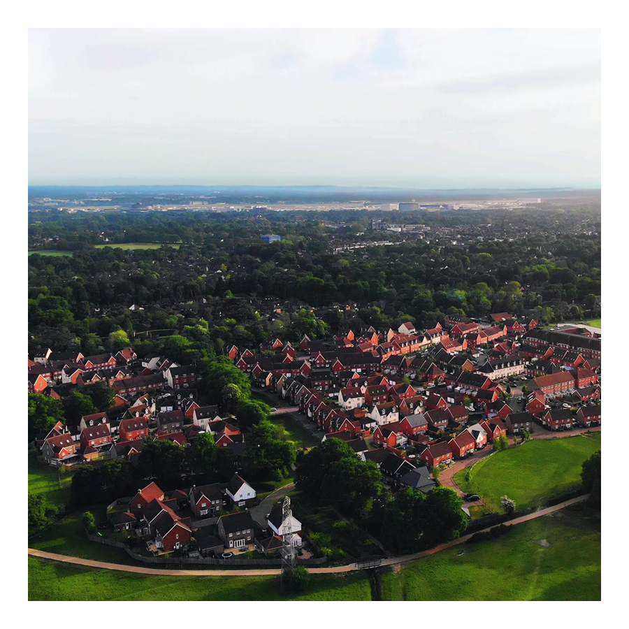
A bird’s-eye view, snapped in 2022
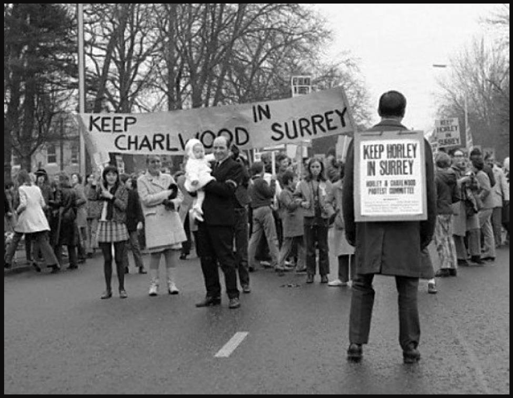
In the 1970s, Charlwood, Gatwick and Horley were ‘moved out’ of Surrey and into West Sussex as part of the Local Government Act of 1972. It should not come as much of a surprise but, most people in the Horley area were rather put out by this.
Protesting in the road, rightly so
Glorious Gatwick has long been close to the hearts of Horley residents. Gatwick was once a horse racing venue—one that hosted to the Grand National several times—and, it was Horley that catered to the crowds that came to party and flutter and, patronise the “flights for fun” services of the Surrey Aerodrome Club (housed at Gatwick Manor Farm) in the late 1920s and early 1930s.
Horse play, no more
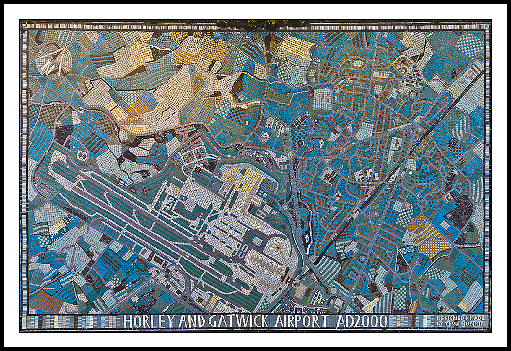
The Horley Millennium Mosaic (see below) was commissioned by Horley Town Council and was unveiled on the 2nd of December, 2000. It was designed and made by the Mosaic Workshop on Holloway Road, London, and paid for by local builders’ merchants, Mitchells of Horley, who were celebrating their centenary that year (they’ve now unfortunately closed down for good).
The mosaic, situated on the town’s partly pedestrianised High Street, is telling in that it prominently weaves the airport into Horley’s very fabric. As locals say: the bond between Horley and Gatwick is here set in stone.
Horley’s Y2K Mosaic
Ordinance Survey (OS) Grid Reference: TQ2843
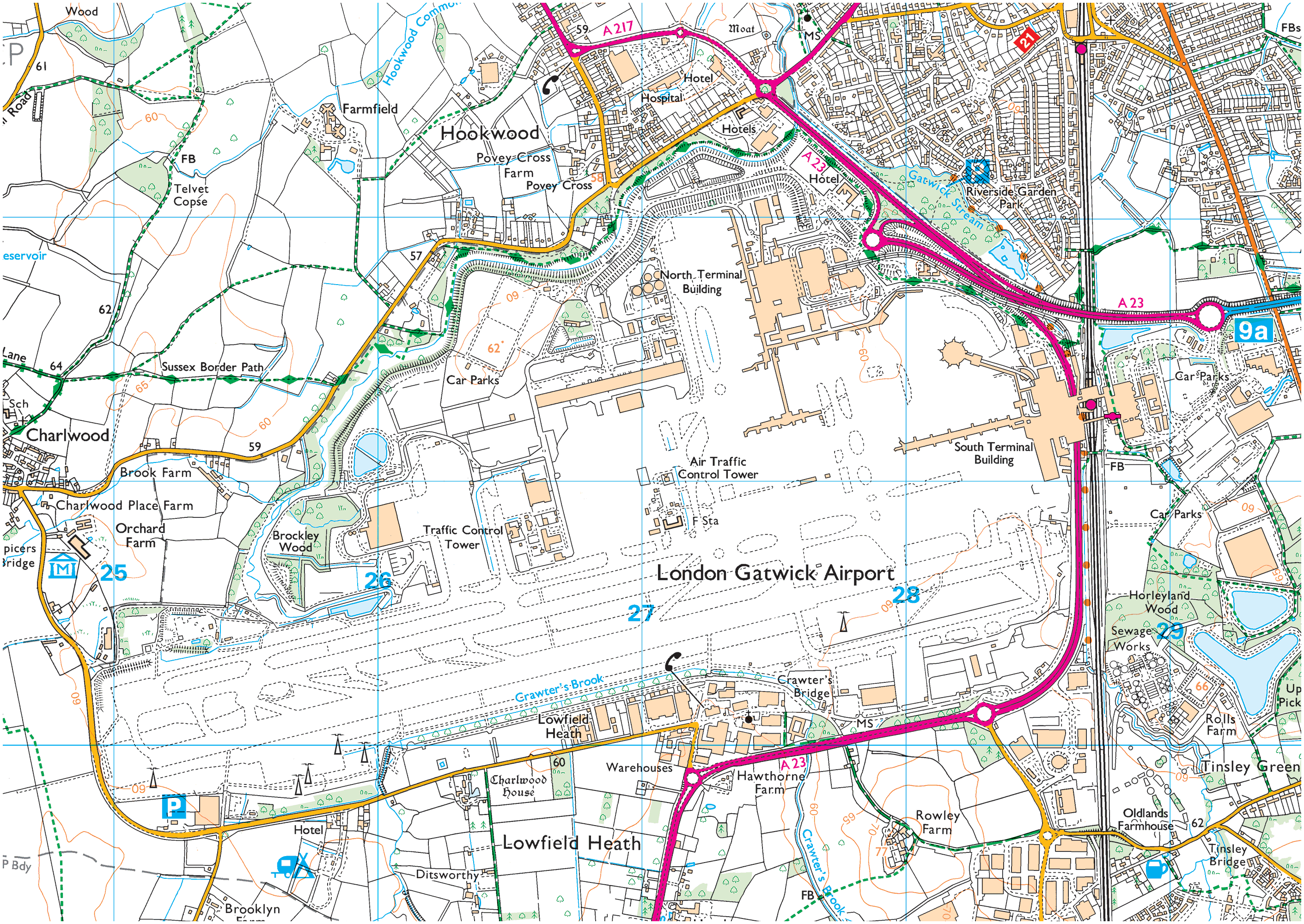
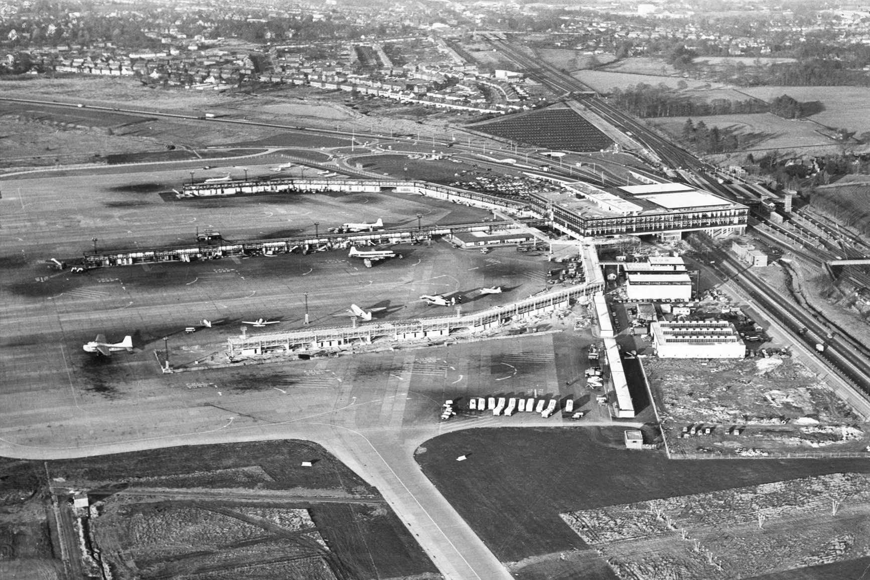
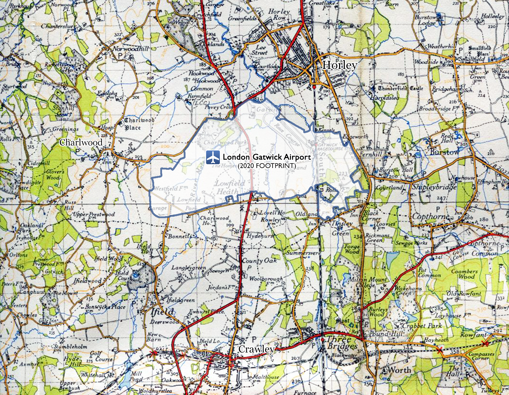
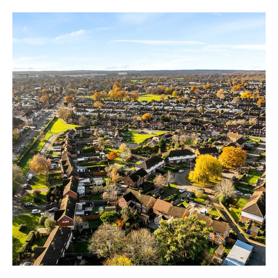
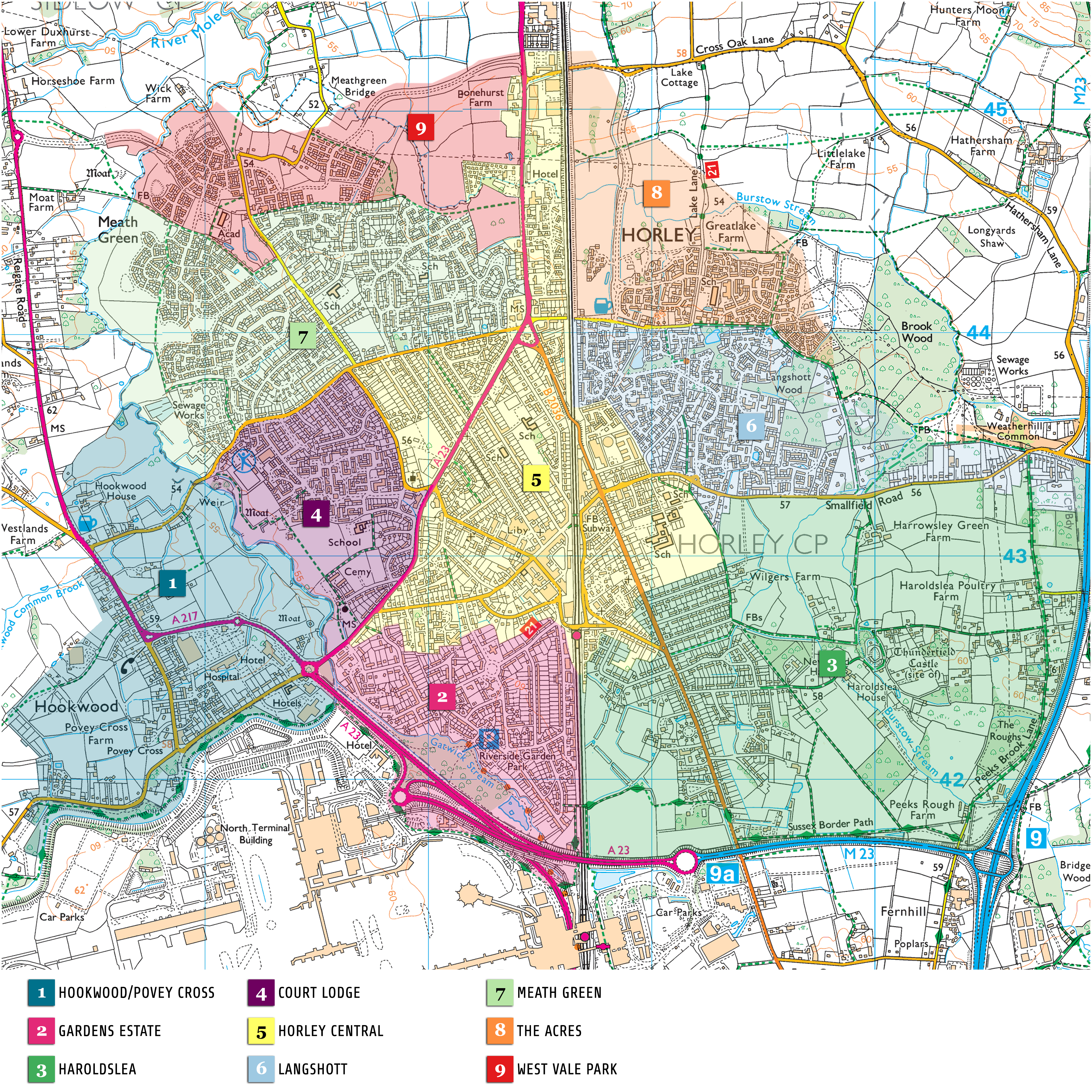
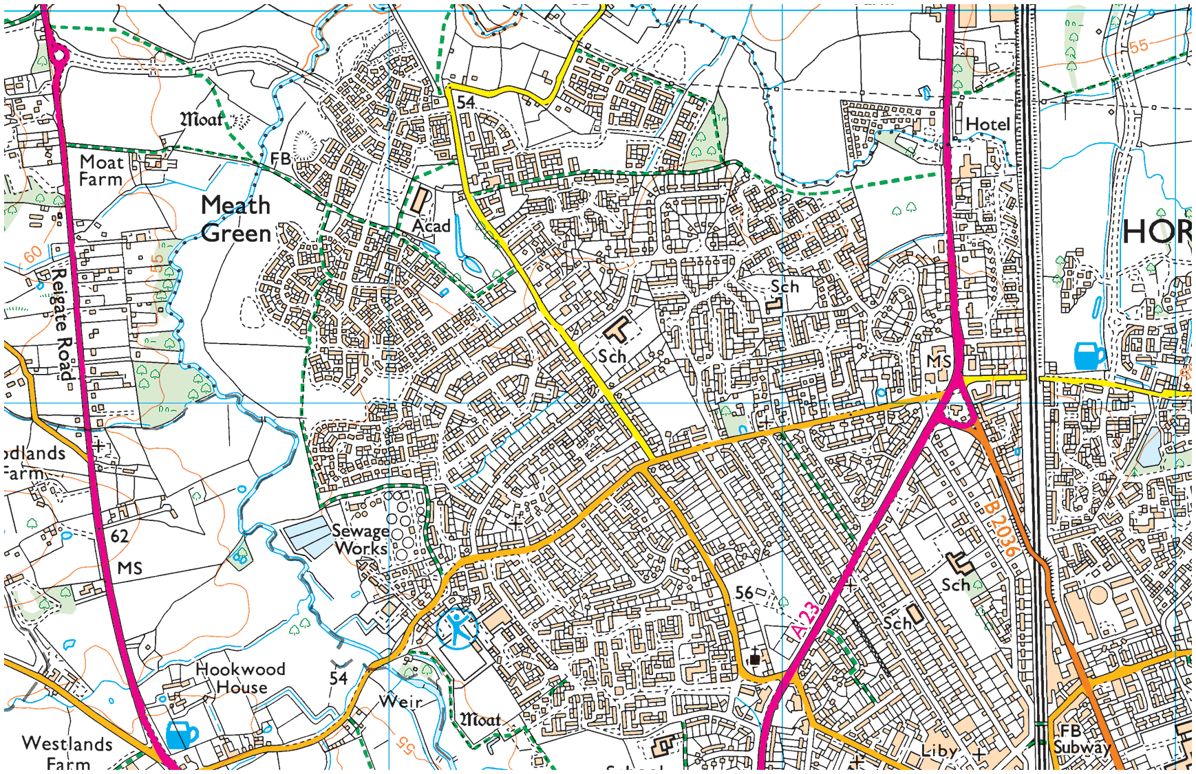
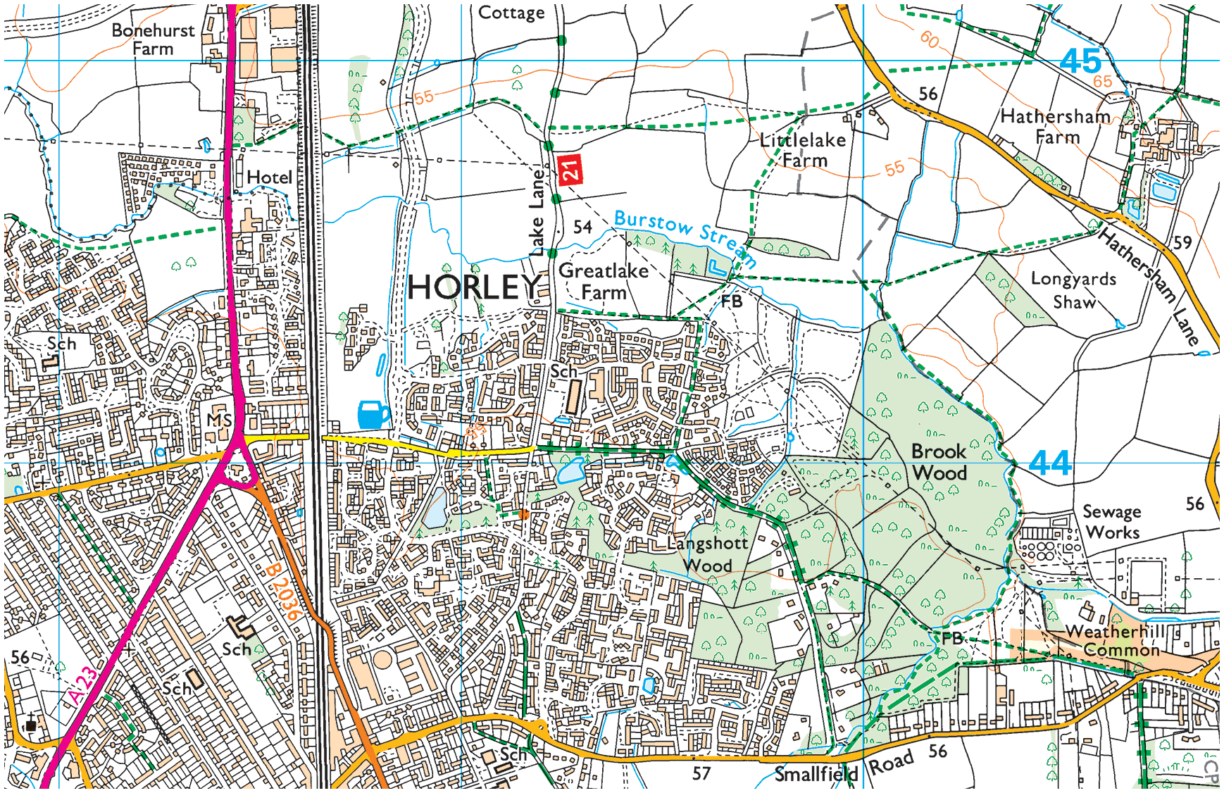
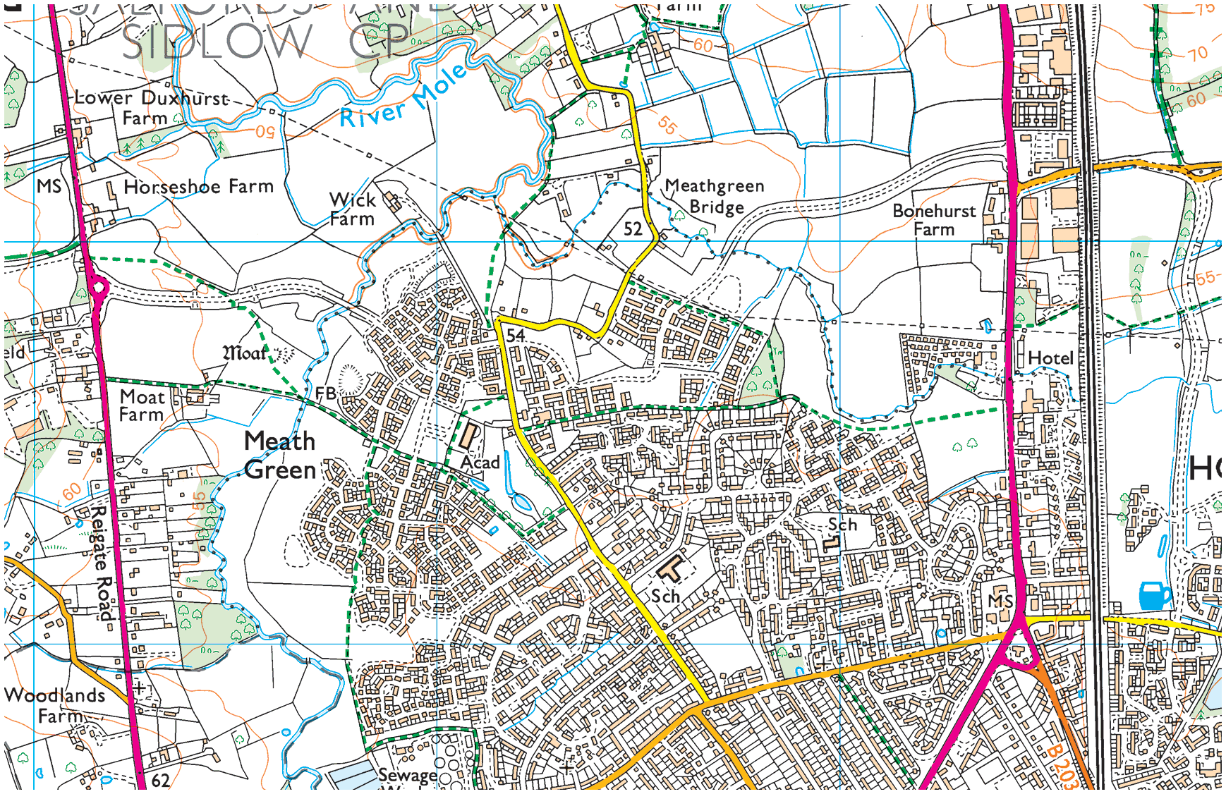
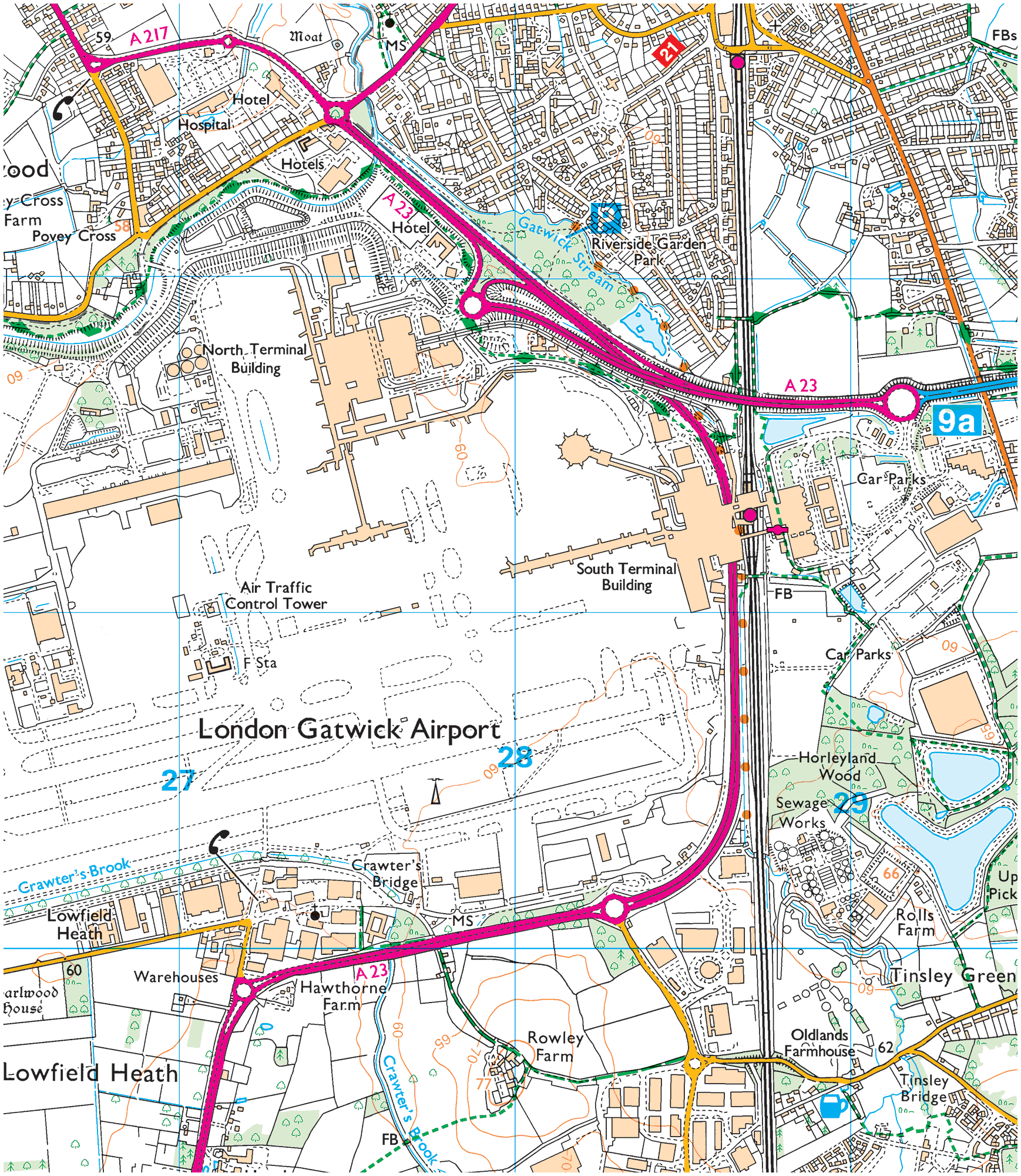
As the 1964 aerial snapshot below shows, Horley is immediately to the east and north of the airport. A number of Horley neighborhoods are depicted in this photograph: in the top-left are Court Lodge and Meath Green, at the top, in the centre, is Horley Central and below it, Gardens Estate, and Haroldslea is at the top, to the right of the London–Brighton main railway line.
Horley/Gatwick
Maps speak volumes too:
The airport’s on our doorstep:
The Charlwood & Horley Act, 1974
In an exception to the rule, residents of Horley and Charlwood were granted the right to have a one-time vote on that nationwide boundary redrawing exercise and, by a large majority, elected to once more be part of Surrey.
The Charlwood and Horley Act 1974 was an Act of the Parliament that amended the Local Government Act 1972 to move the village of Charlwood and the town of Horley back to Surrey.
On 17th October, 1973, it was announced that the Government would be holding negotiations about the Surrey/West Sussex boundary. The Charlwood and Horley Bill was introduced to Parliament on 31st October, 1973. It passed all stages on the last day of the parliamentary session and received royal assent on 8th February, 1974.10
However, the Government decided not to relinquish Gatwick back to Surrey. It follows that since then, and until today, some of the taxes LGW pays go to Crawley, not Horley town council.
Crawley creeps up on Horley
Gatwick’s clearly next to Horley:
It happened again in 1990
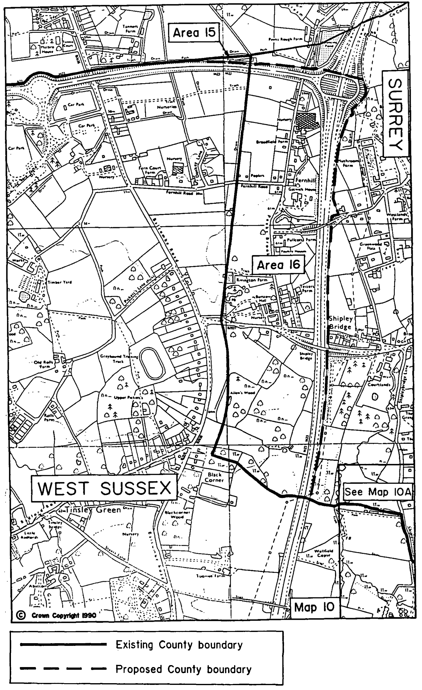
Again in 1990, as part of further county boundary realignment shenanigans, parts of Horley parish were reclassified as no longer being in Surrey but that day on being considered as hamlets of West Sussex.
Report No. 589, 1990
1990 boundary change map
It might not be Area 51, but nonetheless
Extract (01)
Extract (02)
Extract (03)
Extract (04)
Extract (05)
Council boundary map, 2023
* * *
There was/is further controversy—over and above the county lines, boundary changes of 1972 and 1990. This relates to the ever expanding airport itself.
In the aftermath of the war RAF Gatwick reverted back to civilian use, its mostly grass runways were often quag mires and its viability hung in the balance, both Redhill and Croydon were considered to host London’s principle hub airport, Gatwick wasn’t even a contender, in the event Heathrow, which was countryside, with hamlets, at the time was chosen. However Gatwick airport had backers and, in the early 1950s, residents of Charlwood and Horley, were given assurances that their homes wouldn’t be bulldozed by Gatwick seeking to become a rival to London’s newly opened and de facto hub airport, Heathrow. Back then, the backers of Gatwick airport only publicly sought a licence to accept flights intended for Heathrow if/when conditions there were too foggy.
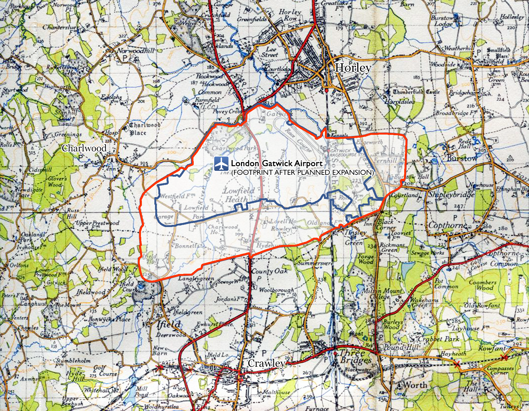
However, as soon as Gatwick was granted the right to act as an overflow airport, it then submitted plans (probably already well hatched in private) that would have made it bigger than Heathrow. The map below shows plans set out in 1952. Had those plans gone ahead in full, Charlwood would have been wiped from the map.
Grand ambitions back in 1952
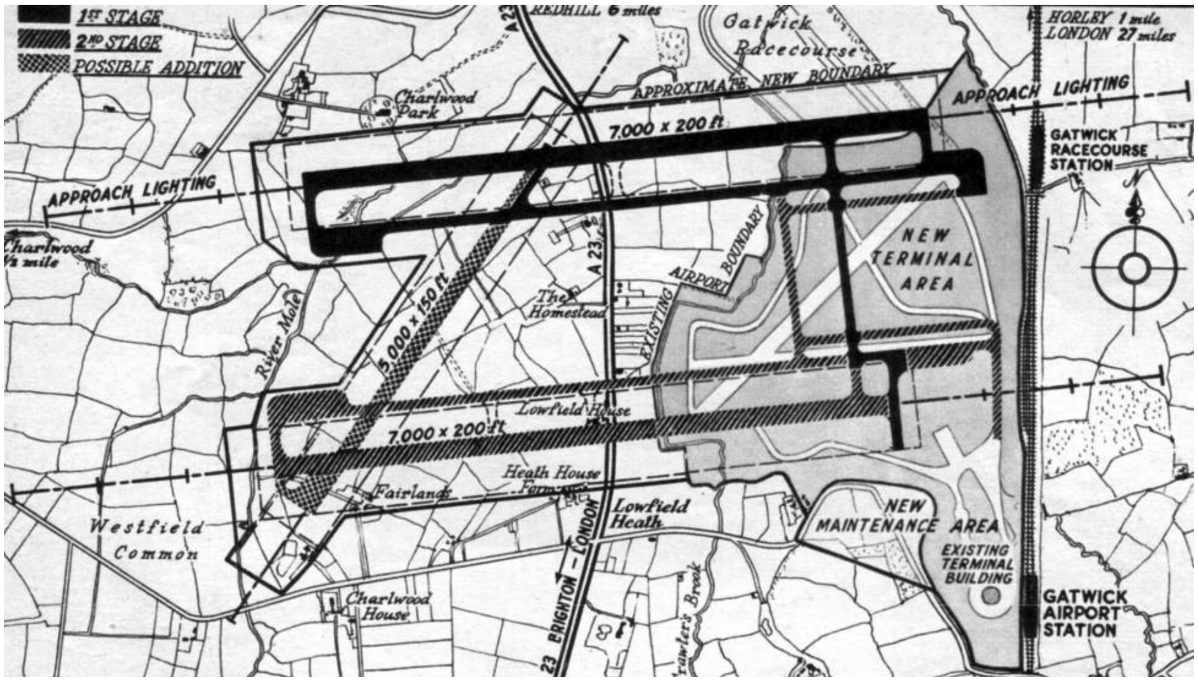
By the mid-1950s Gatwick had been granted the right to act as London’s second airport however, it was told it could not fulfil all of its ambitions immediately. In the event it completed the second stage (charted on the map above) and then decided to build North terminal on part of the area that had been penciled in for being the first stage. Charlwood was given a reprieve from the bulldozers but from the 1960s onwards the noise and congestion would grow and grow.
LGW’s Noise Insulation Scheme
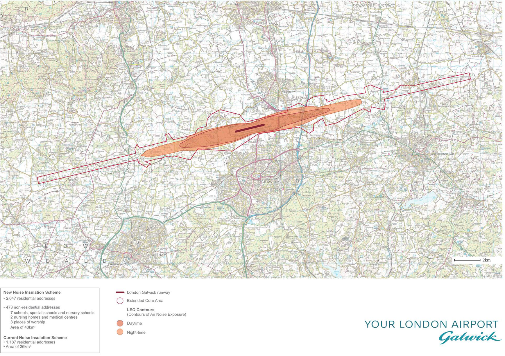
Gatwick’s Strategic Noise Maps (PDF) →
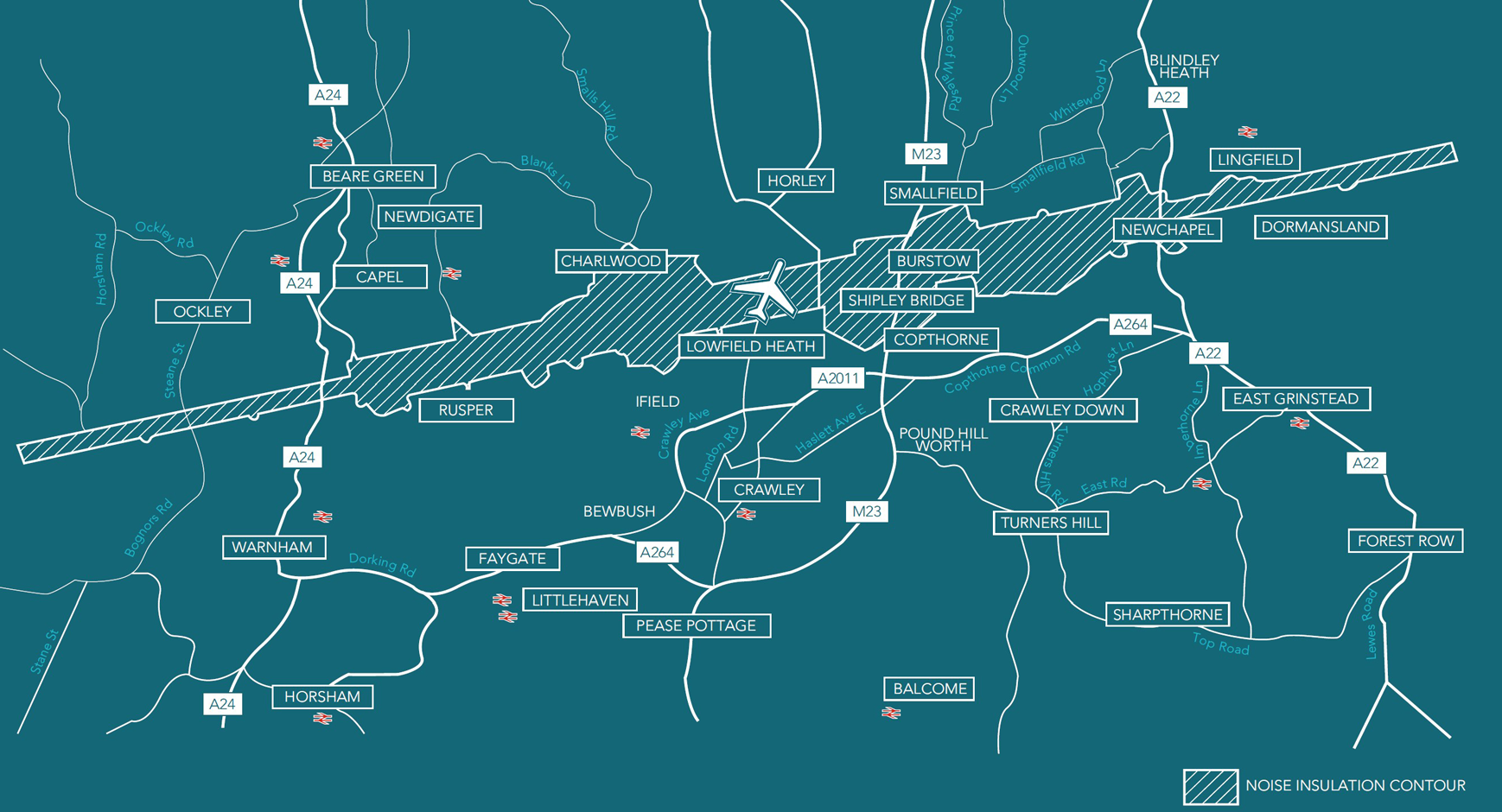
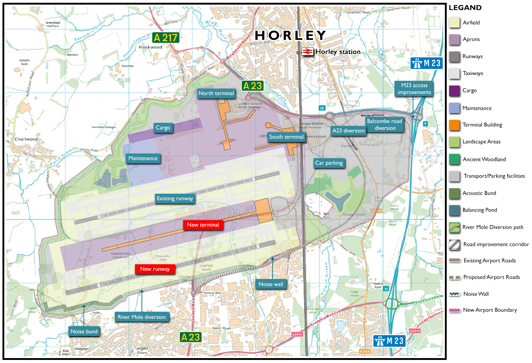
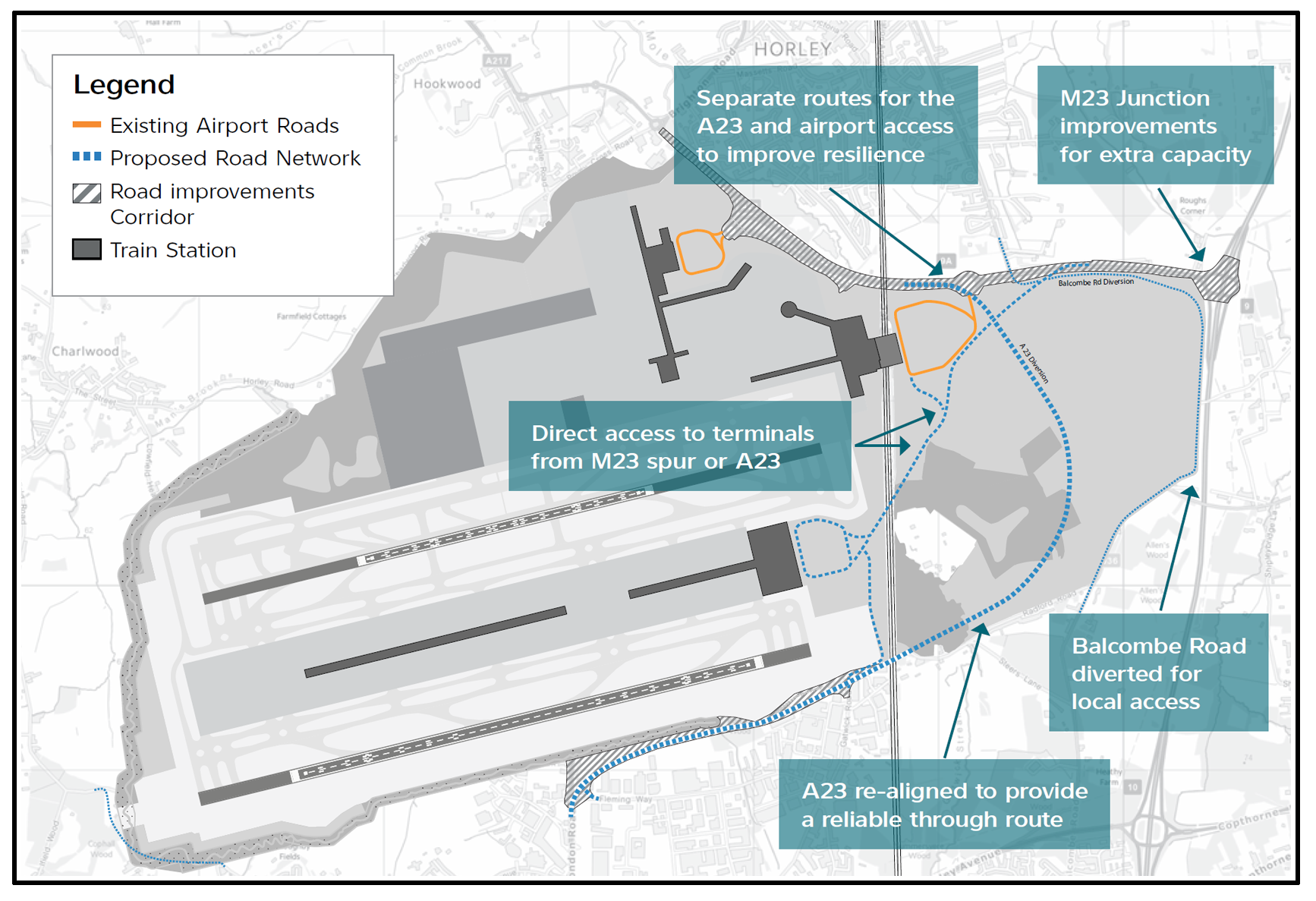
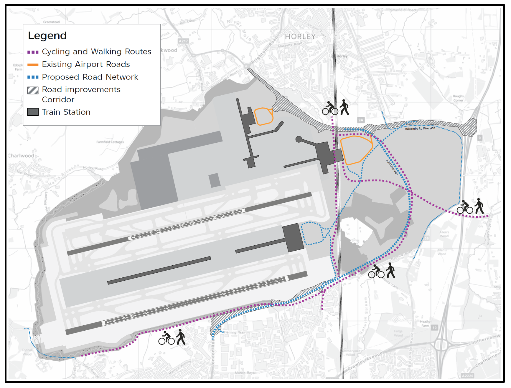
40 years have since passed and Gatwick now has an array of expansion plans on the table (and probably under it too). The moratorium on the idea of a second (or third) runway has expired. It is evident that a effort is underway to petition for a substantial increase in the capacity (and size) of London Gatwick.
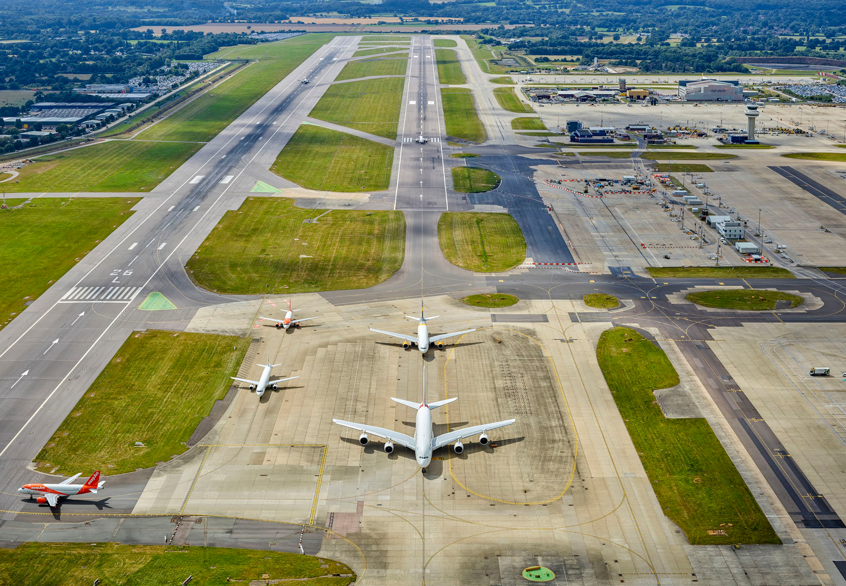
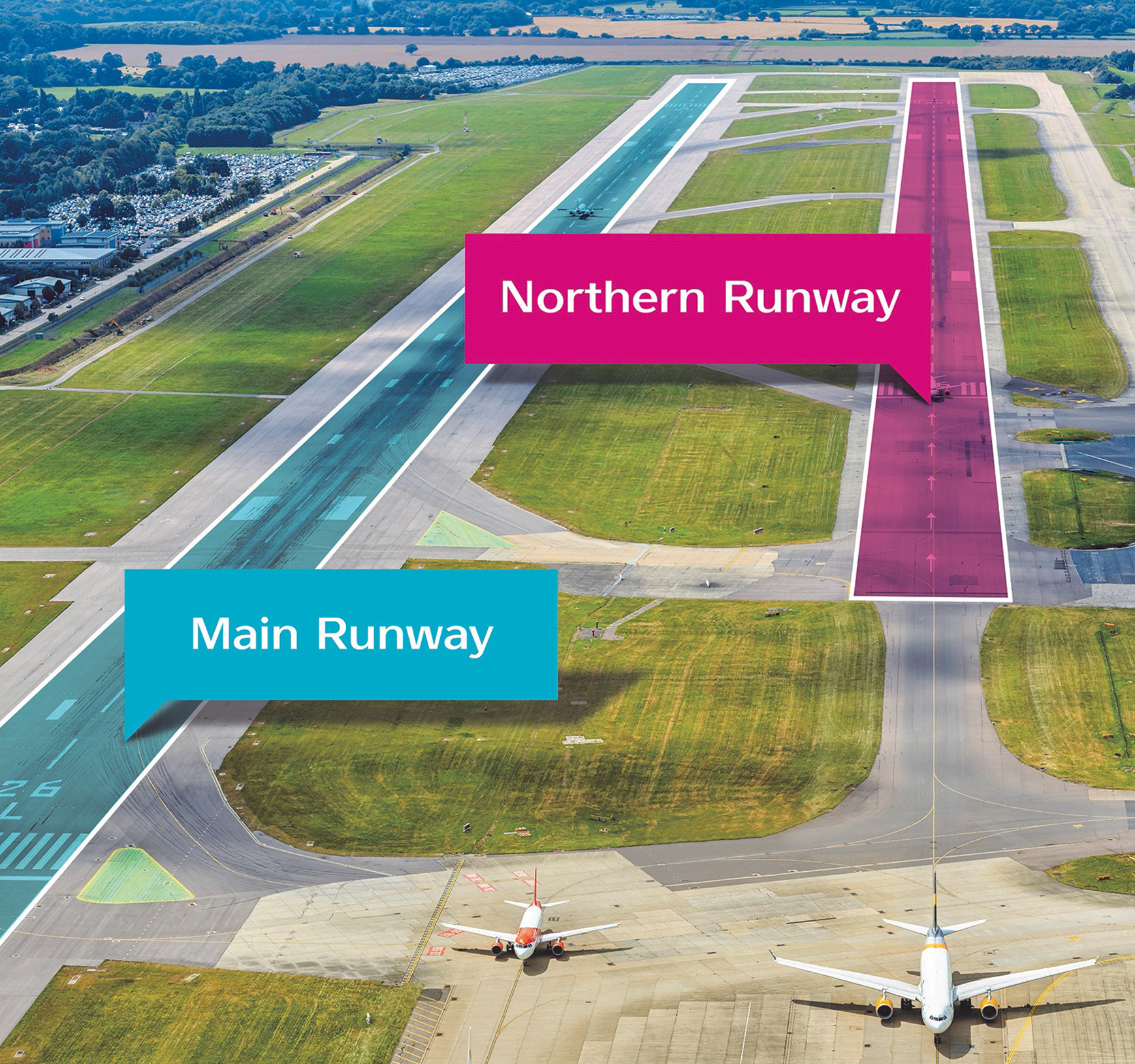
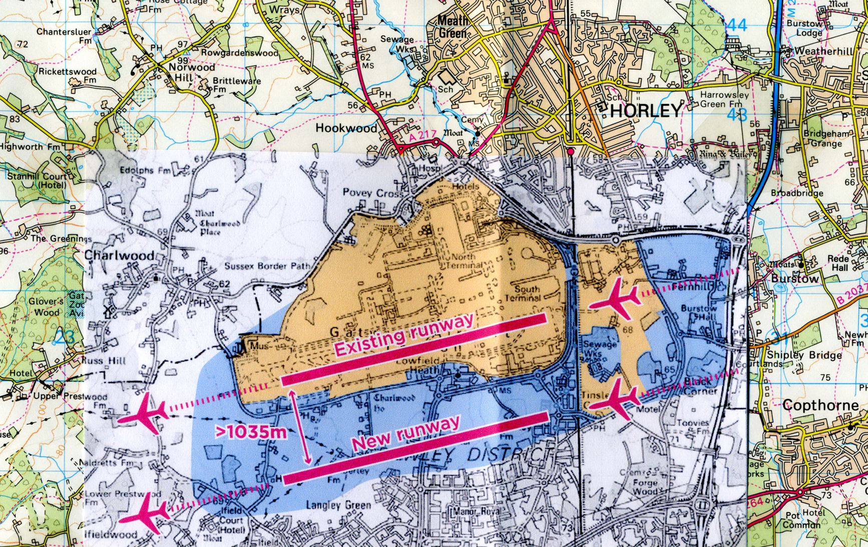
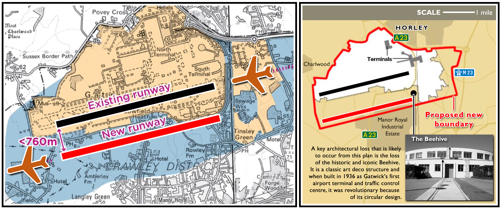
In the photograph below, a second runway is clearly seen. It can, under certain circumstances, be used but it’s too close to the main runway to be permitted for continuous commercial use at present. However, those regulations may change (1) and if not (2) plans are afoot to expand the airport to the east, west and south to accommodate a new ‘second’ runway and a third terminal.
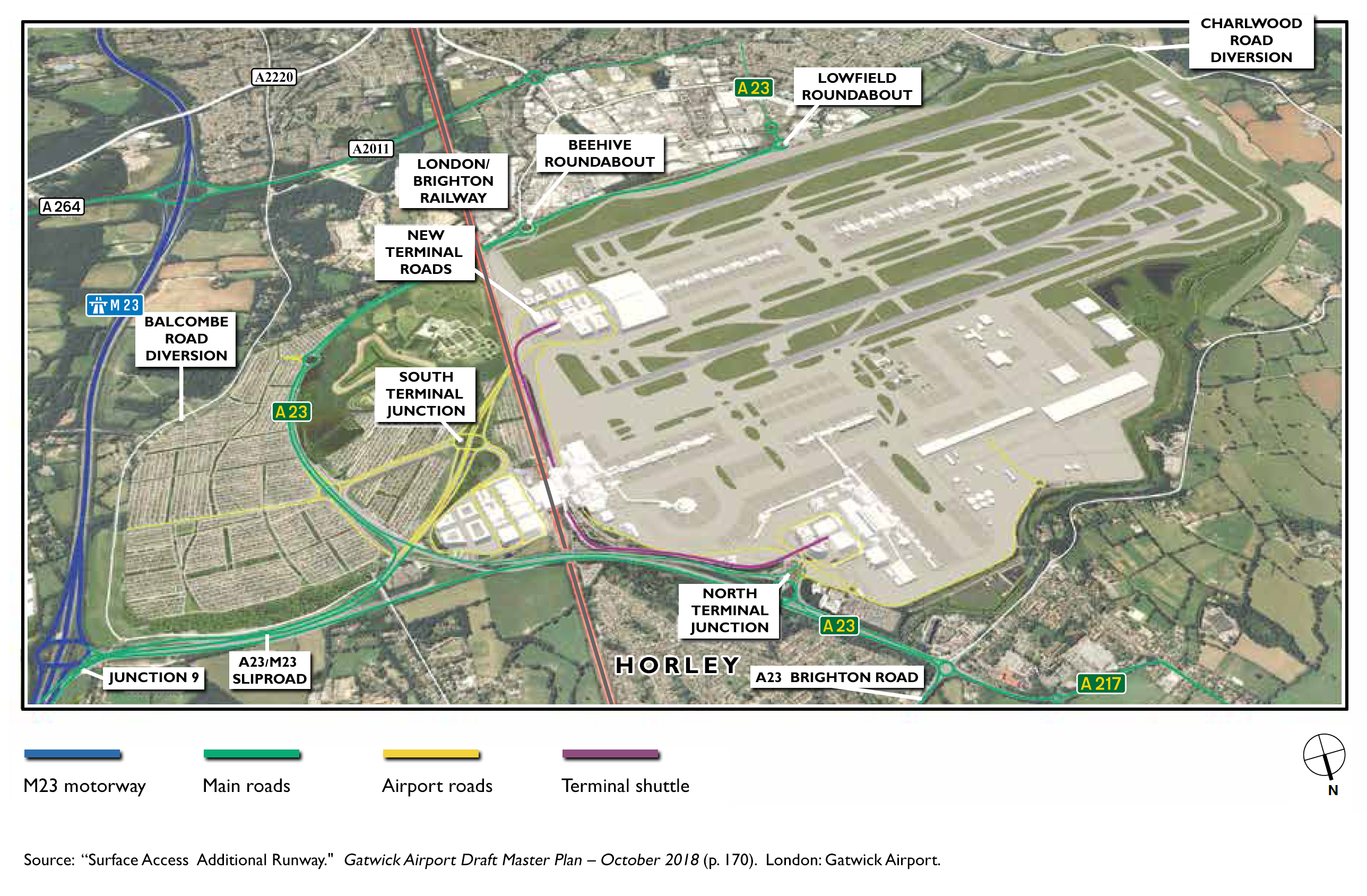
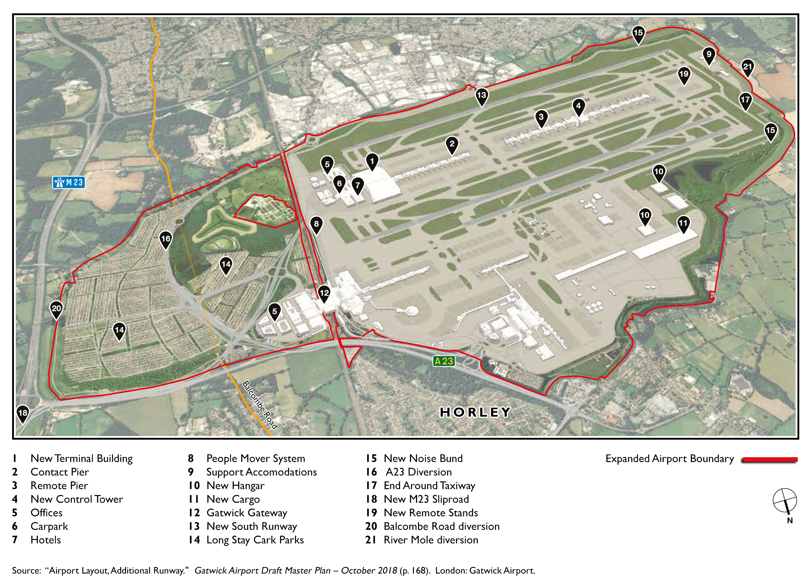
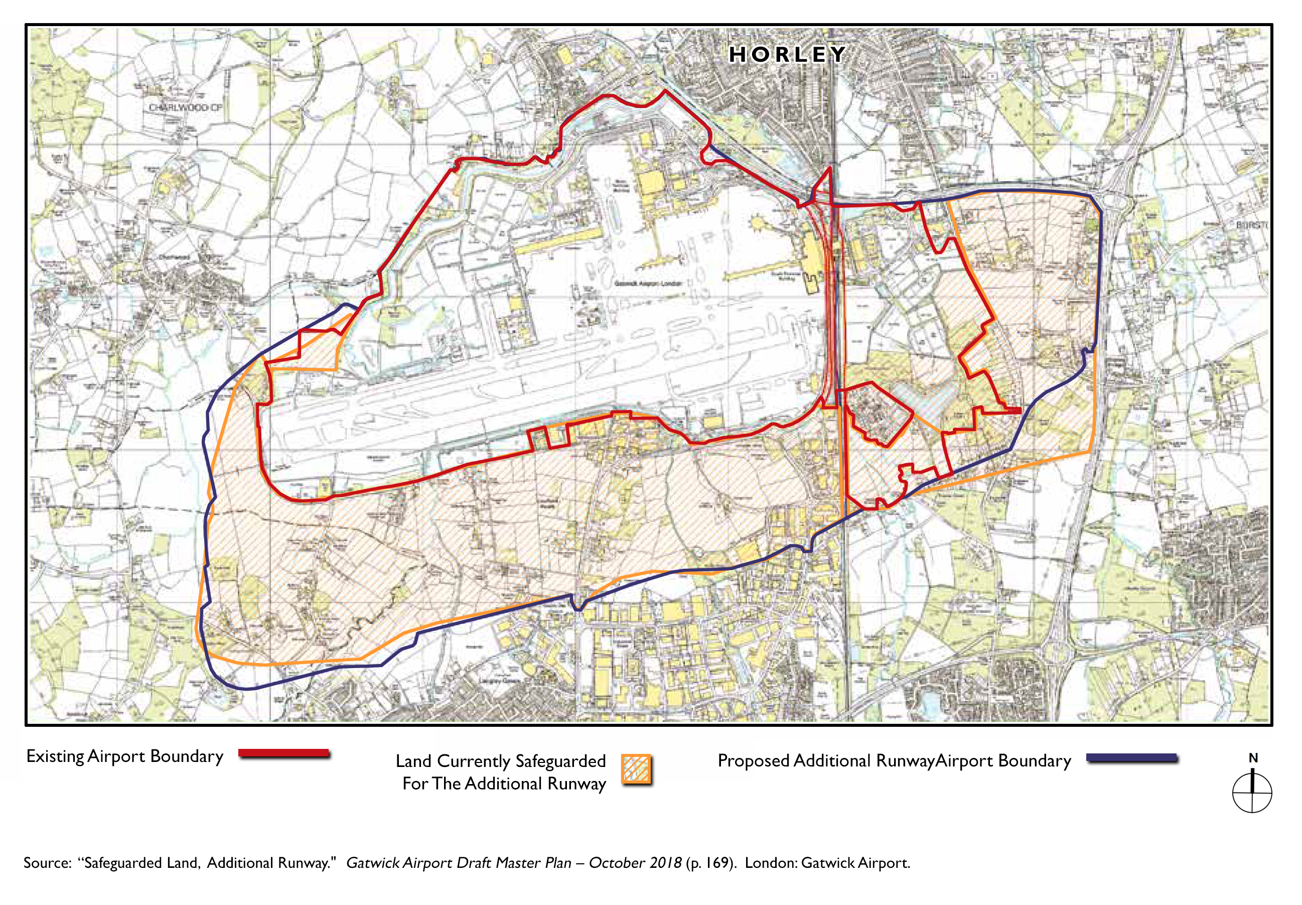
Horley, Gatwick and additional runways
Gatwick’s Plans
The consortium that own the airport are actively trying to get permission to expand. One plan is to widen somewhat the gap between the two runways. However, residents are concerned that this will require another land grab (e.g., between Hookwood/Povey Cross and Charlwood and, the areas to the south and to the west).
Grand designs…
…for doubling current capacity
An artist’s supposition
Further artists’ suppositions
Looking south
Again, looking south
Now we’re looking northward
Extract A, from a 2018 plan
Extract B, from a 2018 plan
Selected documentation
01. A Second Runway, April 2014
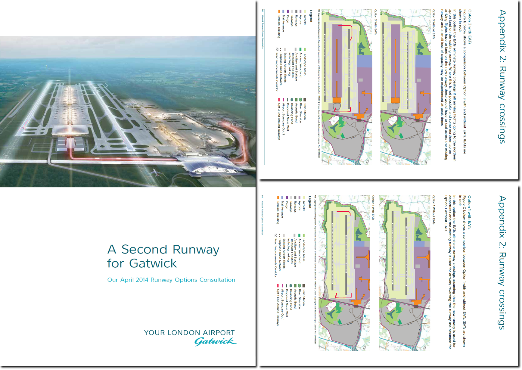
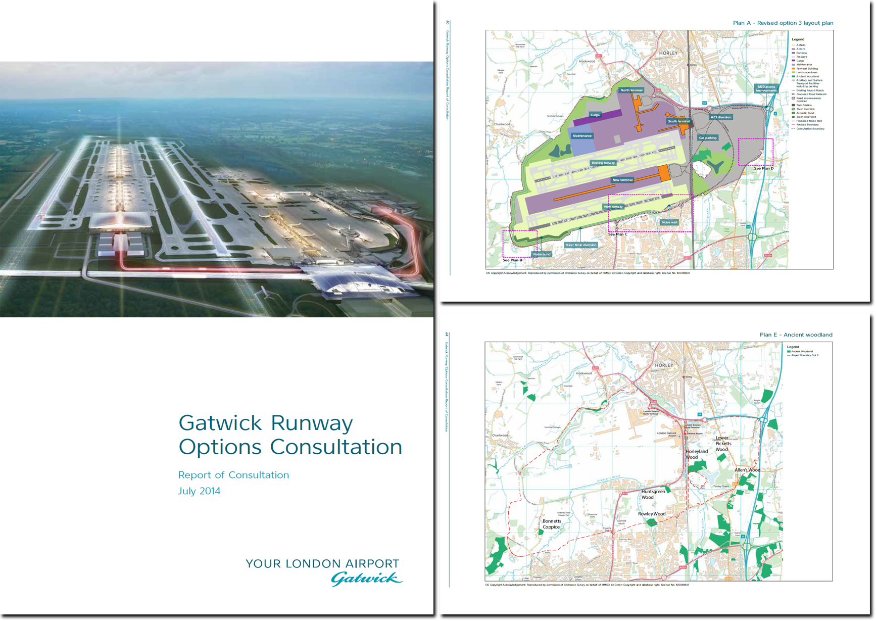
02. Runway Options, July 2014
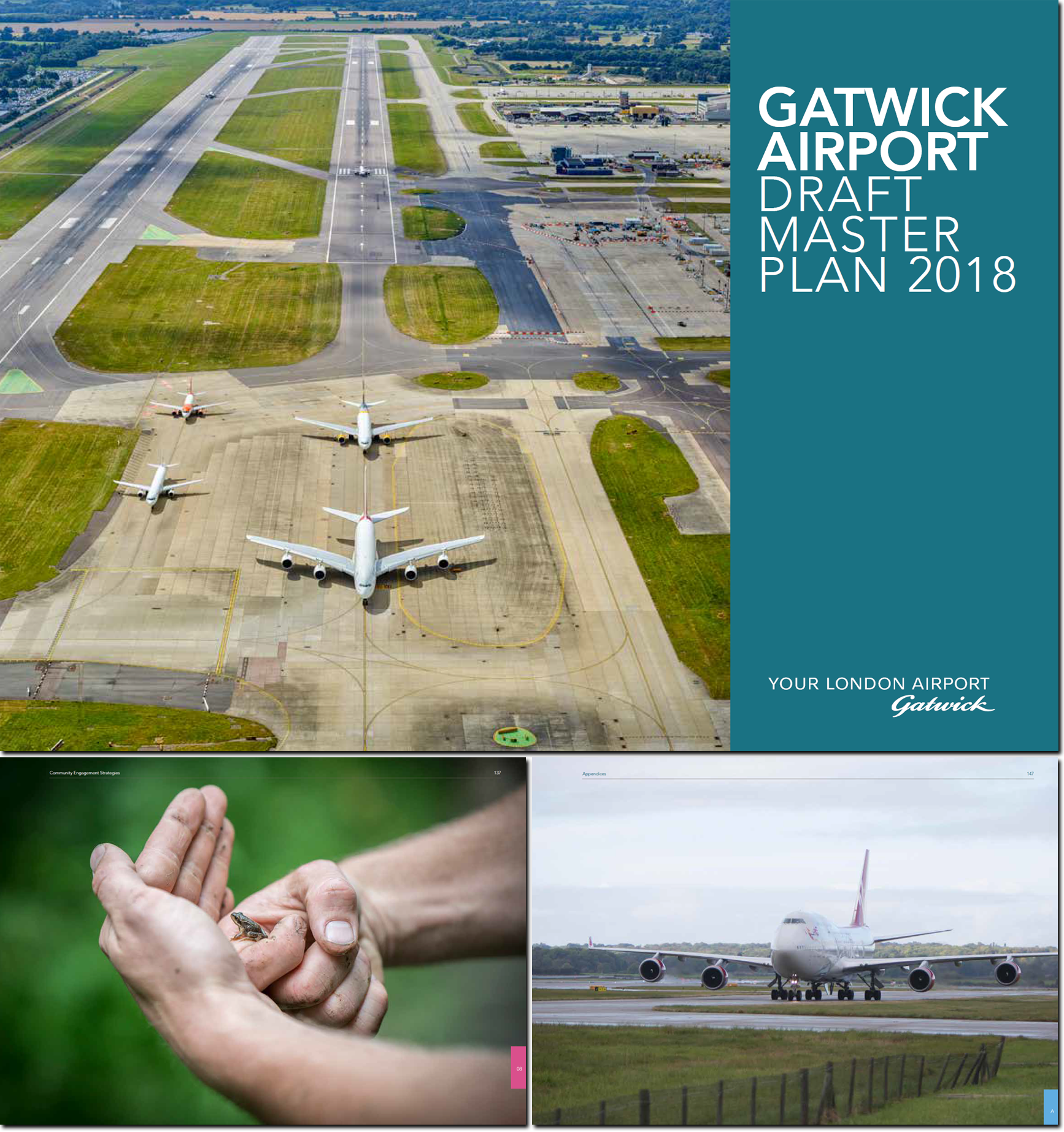
03. Draft Master Plan, 2018
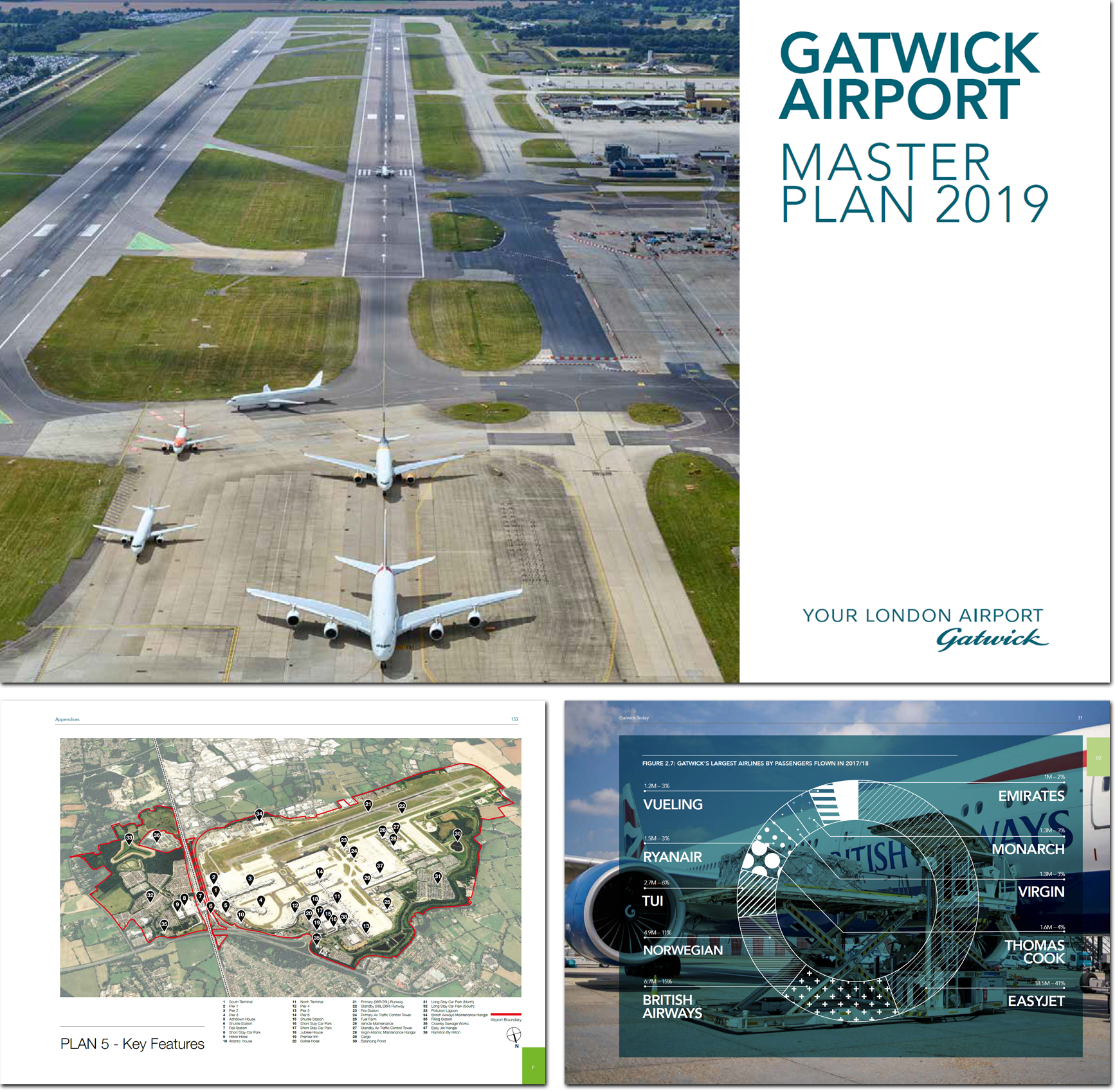
04. Master Plan, 2019
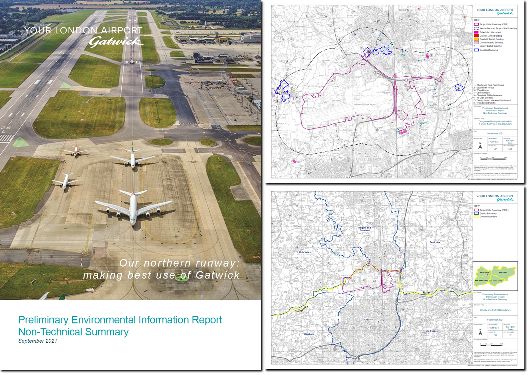
05. Environmental Report, 2021
06. Consultation, Summer 2022
Contact HH&M
HH&M’s services
- Assembling things →
- Building & Maintenance →
- Decorating & Painting →
- Gardening & Groundworks →
- Moving things →
Get a free quote
Horley by area
Although Horley does not have named-on-road-sign neighbourhoods—like Crawley does—the following areas are commonly referred to:
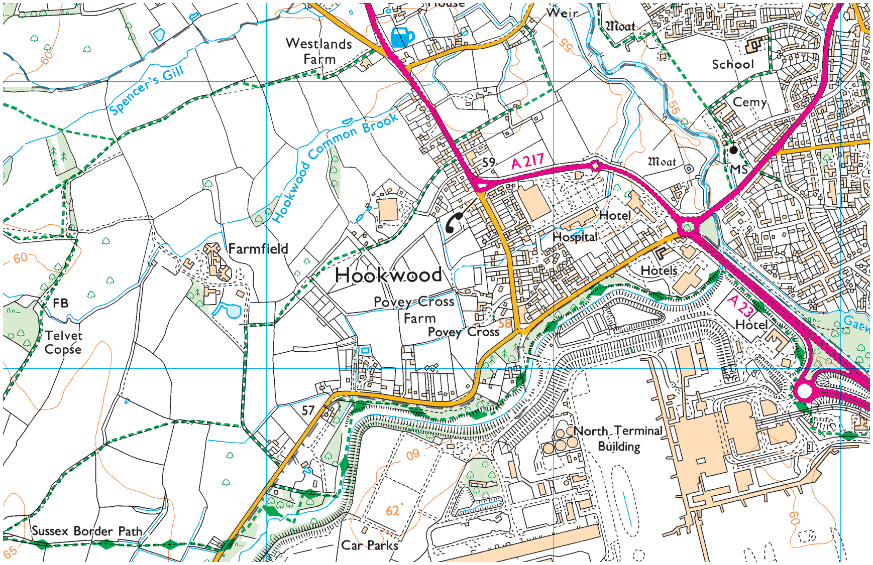
01. Hookwood/Povey Cross
Hookwood/Povey Cross →
Hookwood and Povey Cross are on the western outskirts of Horley. Many international hotels are situated here as is Tesco Hookwood. Several large housing developments are planned here. Hookwood and Povey Cross are directly beside the airport.
02. Gardens Estate
Gardens Estate →
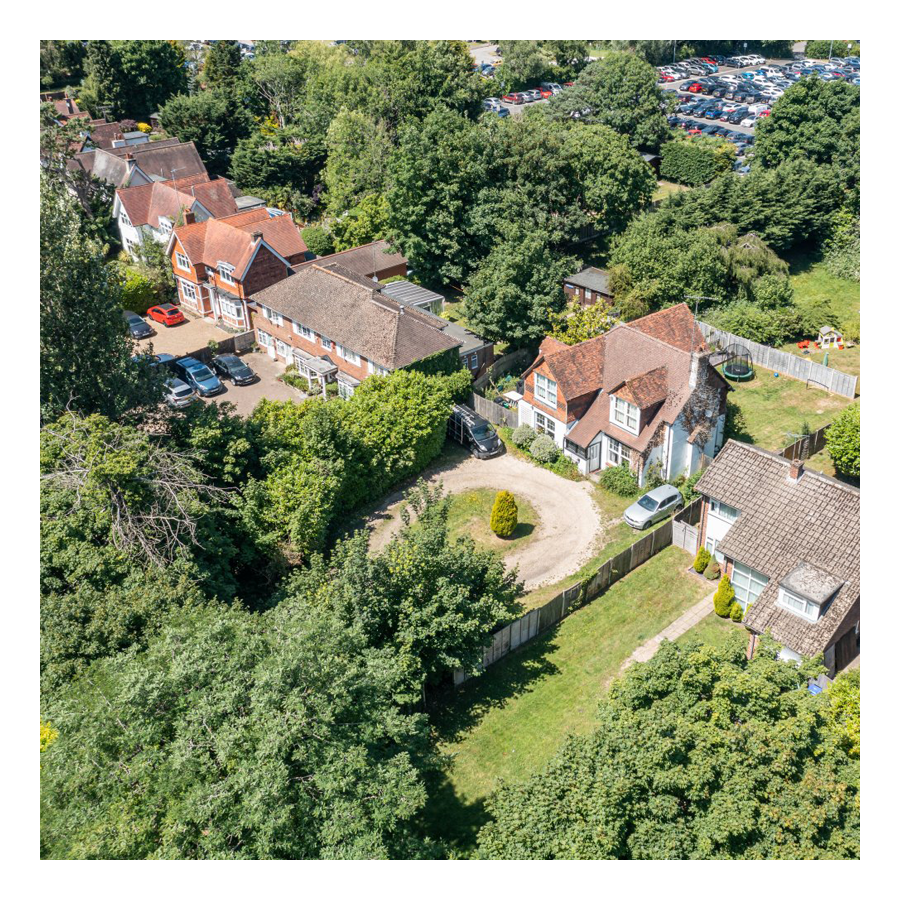
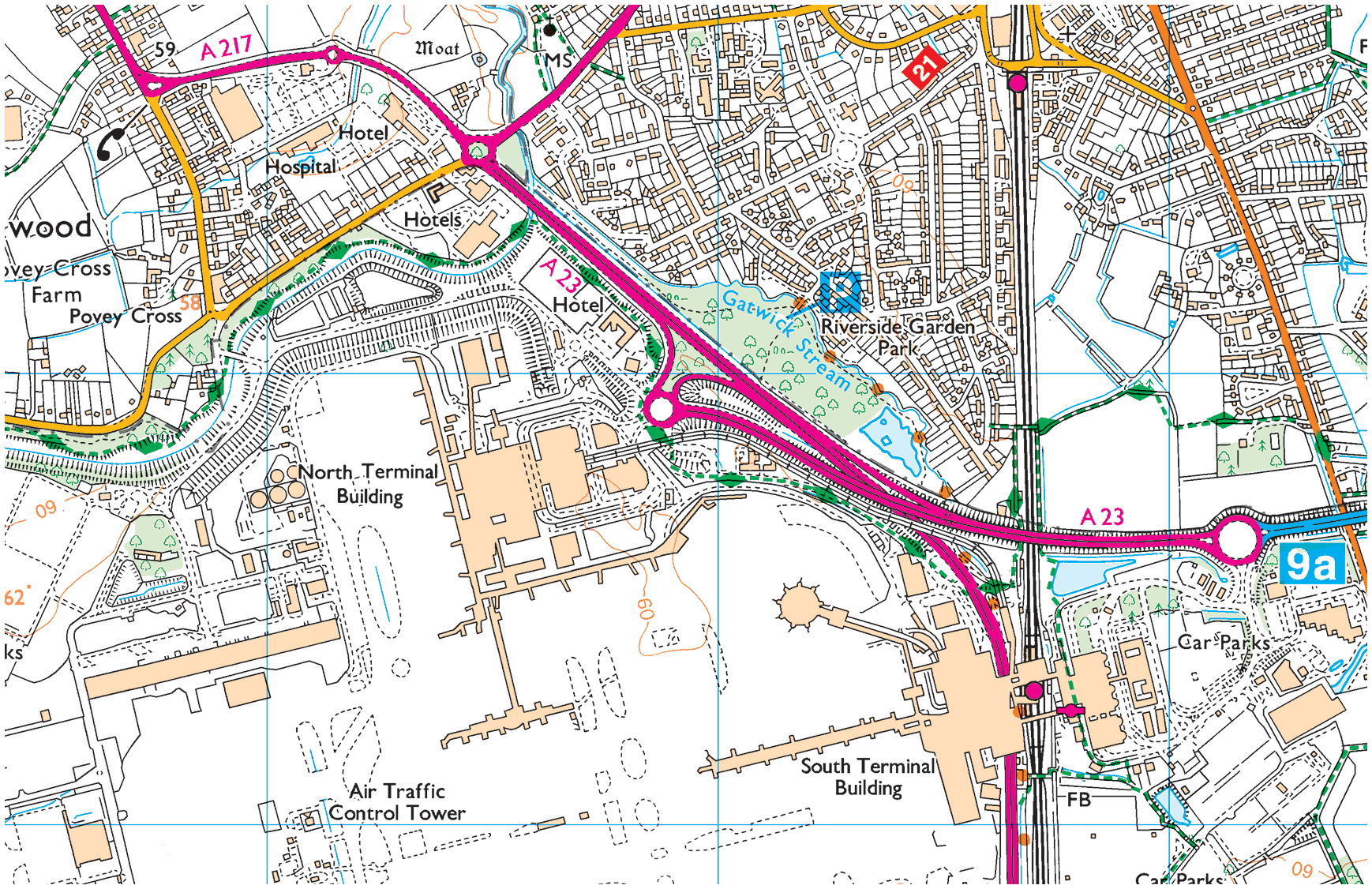
Gardens Estate is very close to Gatwick airport and those working at LGW can easily access the terminal building via footpaths from the recreational area, Riverside Garden Park via the underpass of Gatwick airport station.
03. Haroldslea
Haroldslea →
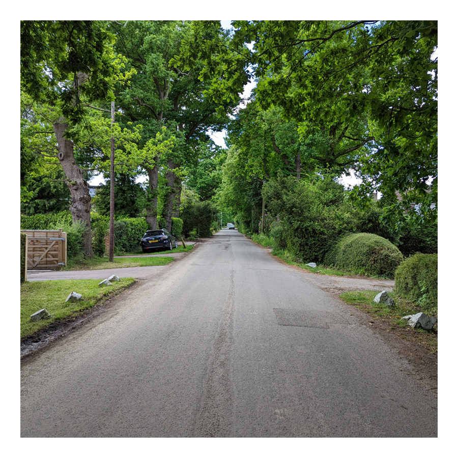
This area comprises: The Balcombe Road (B2036) and the roads leading from it between Oakwood School and the A23/M23 link road flyover. For example, Limes Avenue which was originally laid out in 1936 and still retains some of the Lime trees planted at that time.
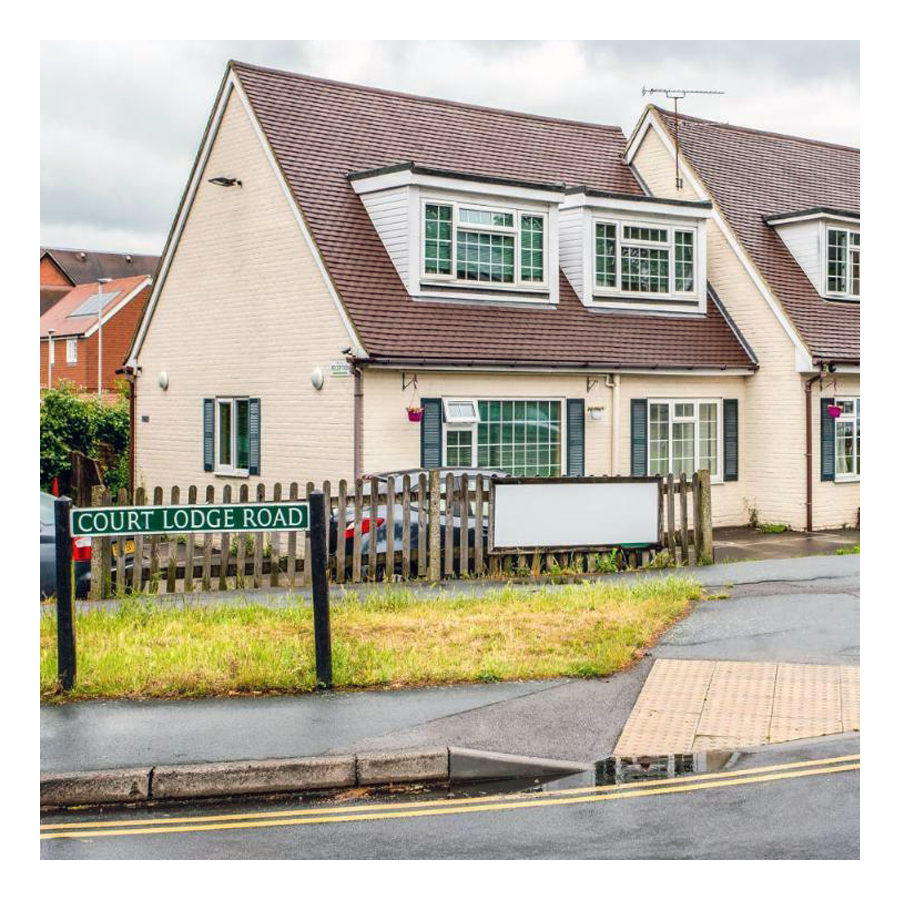
04. Court Lodge
Court Lodge →
This neighbourhood was set out in the 1950s and 1960s. It has a mixture of flats and houses. It is home to Horley leisure centre, several airport hotels and a couple of places of worship.
05. Horley Central
Horley Central →
This area includes the town centre which has quite a lot of purpose built residential flats and roads such as Church Road, Massetts Road, Pine Gardens, Ringley Avenue and, Russells Crescent.
06. Langshott
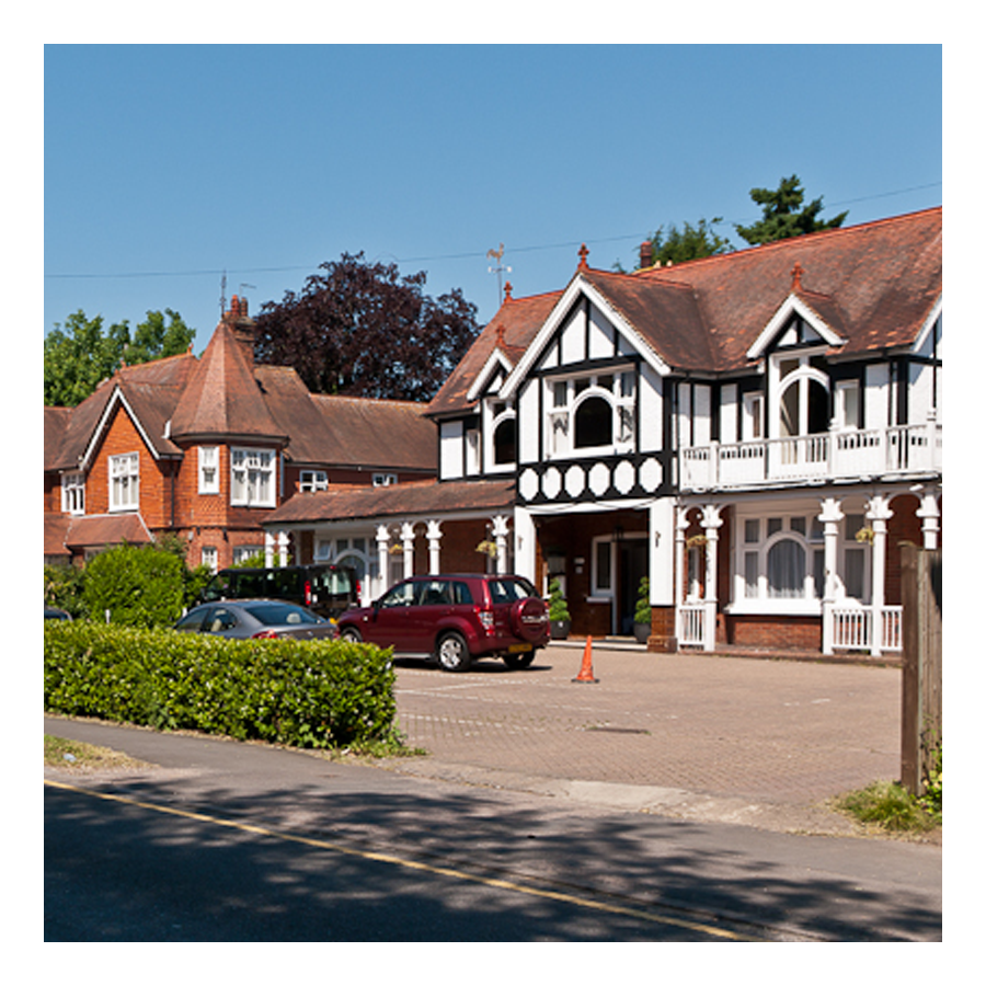
Langshott →
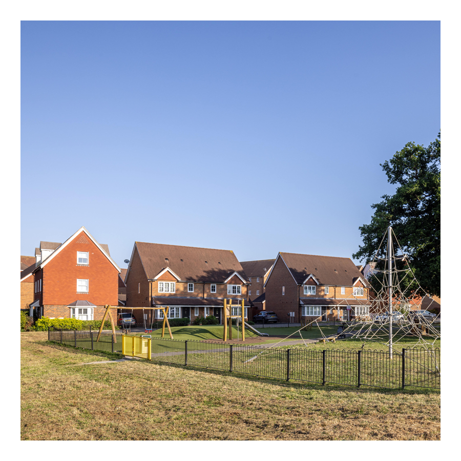
This area of Horley stretches eastward towards Smallfield. Immediately to its north is the new estate called The Acres. This area is home to Langshott Manor, which was built in 1580; it is now a luxury hotel.
07. Meath Green
Meath Green →
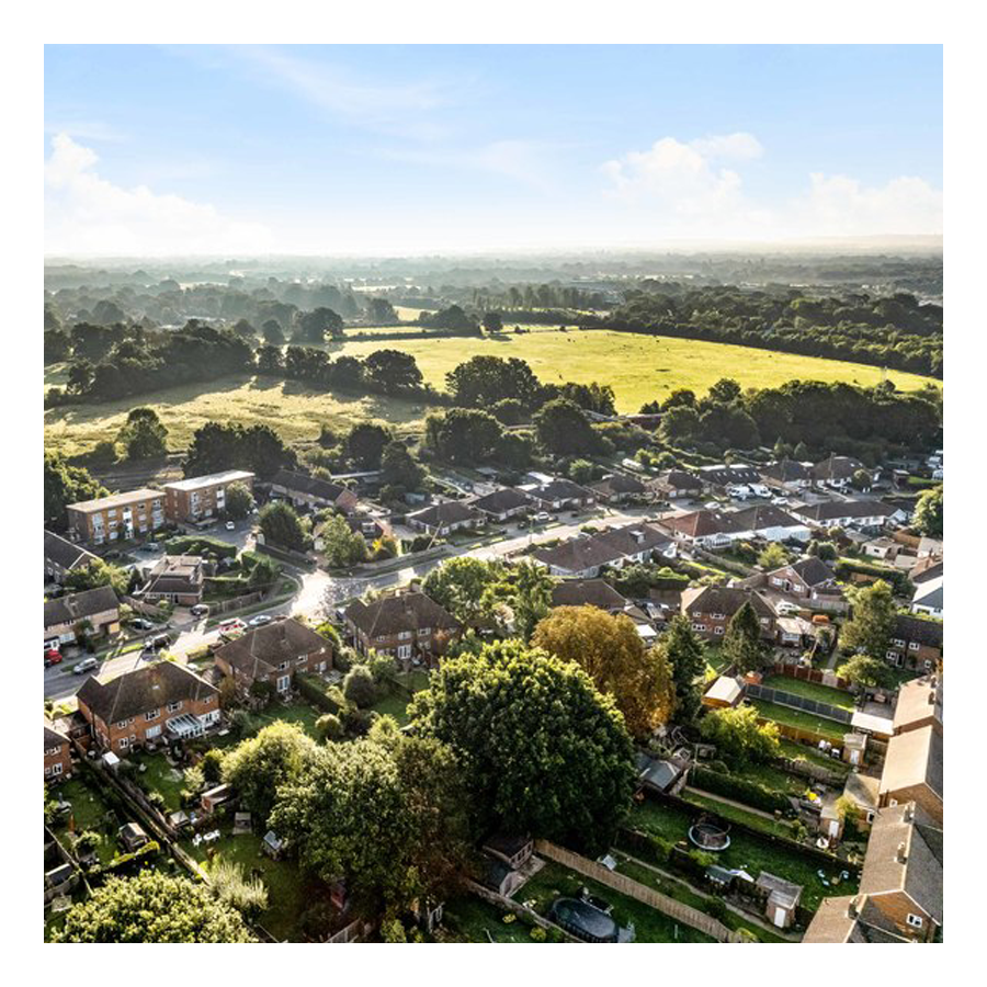
Once upon a time this area was called Moy Grene, and it has some of Horley’s oldest homes. Today, the vast majority of the homes in this area where built from the late 1950s onwards.
08. The Acres
The Acres →
This new neighbourhood of over 700 homes is in the north east of Horley and Langshott. The development was built mostly by Barratt and Bovis Homes between 2010 and 2016.
09. West Vale Park
West Vale Park →
This new neighbourhood is to the north west of Horley and joins onto Meath Green. To date, around 1,600 new homes have been constructed:
• Crest Nicholson brochure →
• Fabrica brochure →
• Taylor Wimpey brochure →
10. Gatwick
Explore Gatwick→
Gatwick airport is included as an area of Horley because historically it was part of Horley and, it remains adjacent to this day. Gatwick, before becoming a major international airport, was a famous horse racetrack which hosted the Grand National on several occasions.
Horley neighbourhoods
Horley Town
01. Hookwood/Povey Cross
02. Gardens Estate
03. Haroldslea
04. Court Lodge
05. Horley Central
06. Langshott
07. Meath Green
08. The Acres
09. West Vale Park
10. Gatwick

* * *
Footnotes
- Between 1916–1918, Aintree racecourse, the traditional home of The Grand National, was requisitioned by War Office. ↩︎
- Inter alia, The Waste Land was published in 1922, and, furthermore, so many hallowed words were seared into the hearts, souls and collective consciousnesses of the British public – Bent double, like old beggars under sacks / We lived, felt dawn, saw sunset glow, • Loved and were loved, and now we lie, / In that rich earth a richer dust concealed; • A dust whom England bore, shaped, made aware / As the stars that shall be bright when we are dust, • Moving in marches upon the heavenly plain; • As the stars that are starry in the time of our darkness, • To the end, to the end, they remain. // ↩︎
- A380s are very large wide-body airliners that were developed and produced by Airbus. They are the world’s largest passenger airliners and only full-length double-deck jet airliner. ↩︎
- In the 1920s, some of the land of Hunts Green Farm was converted into an airfield as flying grew in popularity became more popular and more landing grounds were sought. Earlier in the decade, London’s first airport had been established in Croydon. In August 1930, Ronald Walters, a pilot, bought the 260 acres of land at Hunts Green Farm and converted it into an aerodrome. In September 1933 Morris Jackaman, who owned several light aircraft, bought Gatwick Aerodrome for £13,500 (2023 equivalent £1.02 million). He planned a purpose-built terminal building; the previous aerodrome building was a converted farmhouse. He put great importance on the design process: he, and contemporaries, considered terminals at other aerodromes to be impractical and unsuitable for expansion. Jackaman developed the idea of a circular terminal building—reputedly in response to a throwaway comment by his father—and submitted a patent application for the concept on 8 October 1934. Advantages claimed for the design included efficient use of space and greater safety of aircraft movements. Telescopic “piers” or gangways would provide covered access from the building to the aircraft. A subway was recommended as the best method of bringing passengers into the building from outside. Jackaman raised money by floating his company, Airports Ltd, on the stock exchange. The Air Ministry also paid for the right to use Gatwick as a diversionary destination at times when Croydon Aerodrome was inaccessible; and in 1935, Hillman’s Airways—months before its merger to form the company now known as British Airways—made Gatwick its operational base, increasing its commercial viability and providing more finance. The aerodrome closed on 6 July 1935 to allow the terminal to be built. The contracted opening date of October 1935 was not met, partly because of ongoing drainage problems, but a new railway station was provided on time in September of that year. This was linked to the terminal when it did open. The terminal was completed in early 1936. Although the airport was officially reopened on 6 June 1936, flights to various destinations began in May. Jackaman’s proposed service to Paris was included: three flights were operated each day, connecting with fast trains from London Victoria station. Combined rail and air tickets were offered for £4.5s, and there was a very short transfer time at the terminal (on some flights, as little as 20 minutes was needed). Gatwick Airport, as it had become, was requisitioned for military use during the Second World War. Afterwards, it was eventually agreed upon as the site of London’s official second airport, behind Heathrow, after other contenders were ruled out. The government announced its decision in July 1952. Substantial redevelopment started in that year with the acquisition of more land (including the parts of the racecourse site which had not yet been developed) and the diversion of the A23 around the new boundary of the airport. A large new terminal was built between 1956 and 1958, the 1935 railway station closed and a new station was built within the terminal complex, on the site of the old racecourse station. The Beehive was thus cut off from transport connections and the airport at large, although it was still within its boundaries and was used for helicopter traffic for several more years. ↩︎
- Established originally as “Gibraltar Airways” in 1931, the airline was in business up until 2008 when it was purchased by easyJet. ↩︎
- British European Airways (BEA), was a British airline which existed from 1946 until 1974. BEA operated to Europe, North Africa and the Middle East. The airline was also the largest UK domestic operator, serving major British cities, including London, Manchester, Glasgow, Edinburgh and Belfast, as well as areas of the British Isles such as the Highlands and Islands of Scotland, the Channel Islands and the Isle of Man. BEA also operated a network of internal German routes between West Berlin and West Germany as part of the Cold War agreements regulating air travel within Germany. Its catchphrase was “Number One in Europe.” Formed as the British European Airways division of British Overseas Airways Corporation, on 1st January, 1946, BEA became a crown corporation in its own right on 1st August, 1946. ↩︎
- On 1st April, 1940, Imperial Airways Ltd and British Airways Ltd were officially combined into a new company, British Overseas Airways Corporation (BOAC)—BOAC had already been formed on 24th November, 1939 with retrospective financial arrangements. ↩︎
- Dan ↩︎
- On 11th February, 1987, the world witnessed one of the most historic moments brought about by privatisation, British Airways, the UKs flag carrier, was completely sold to private (the first major state-owned airline to have been sold off). This was after all, the Thatcher era; it was also the year of “Big Bang” when the City of London was deregulated (restrictive practices in the City and rules on foreign ownership of stock brokers were abolished) 1987 was also that year the film “Wall Street” was released, in which, Gordon Gekko made that now in/famous speech: “Greed, for lack of a better word, is good. Greed, in all of its forms; greed for life, for money, for love, knowledge has marked the upward surge of mankind.” ↩︎
- The term “Madison Avenue” is often used metonymically to stand for the American advertising industry—made that much more famous by the the AMC television drama Mad Men. Madison Avenue became identified with advertising after that sector’s explosive growth in this area in the 1920s. ↩︎