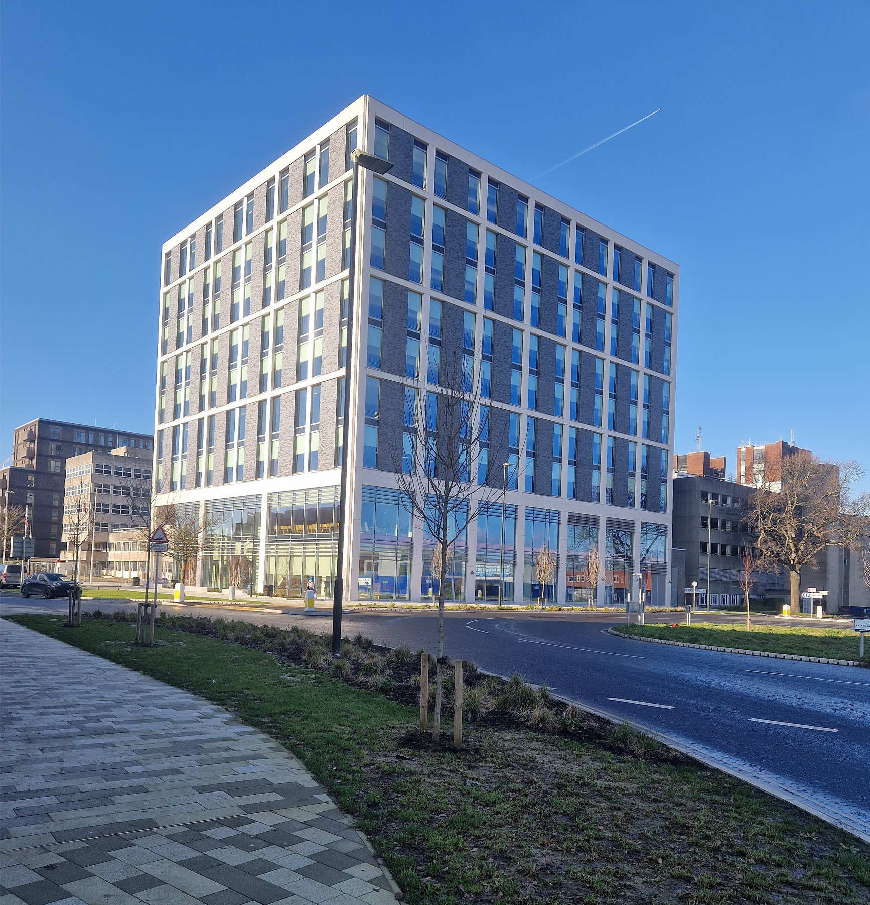
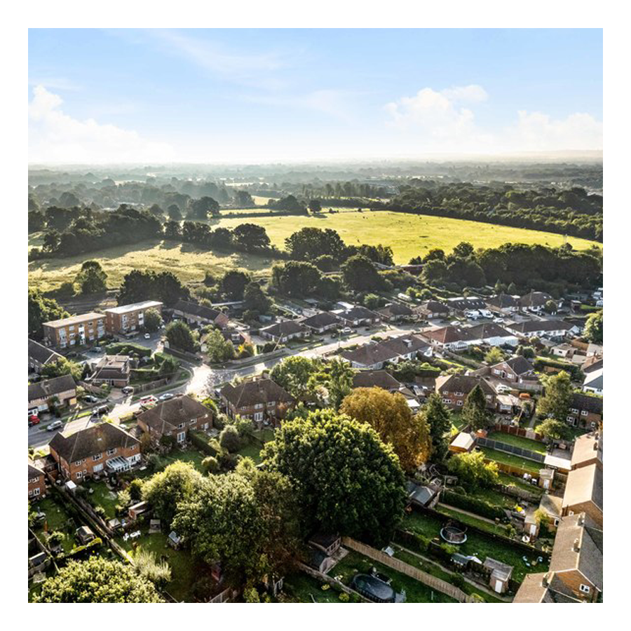
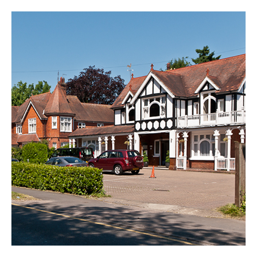
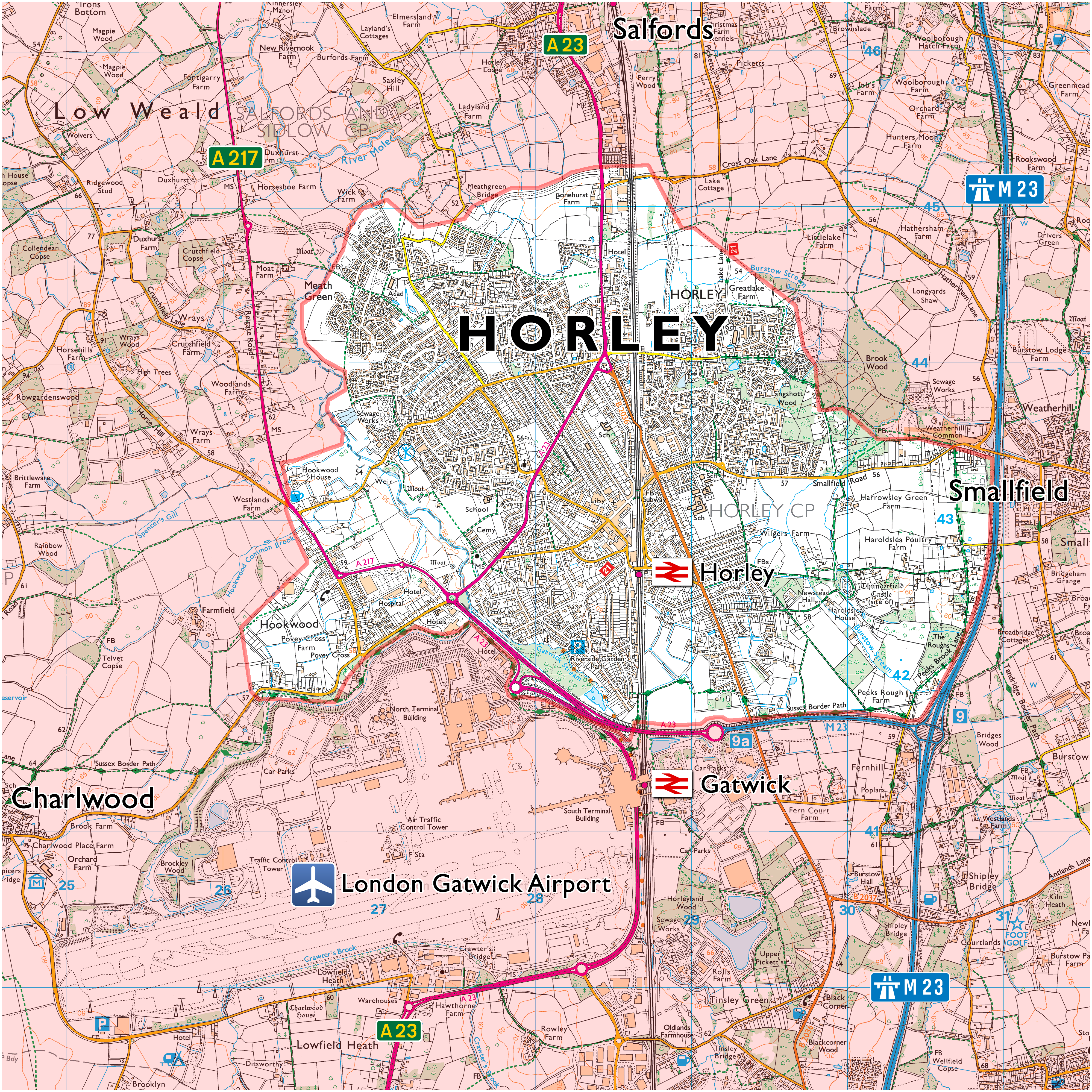
Crawley is a town in West Sussex with a population of about 110,000. Horley, by comparison, has a population of around 22,000 and is located in Surrey.
Archetypal scenes


Contents:
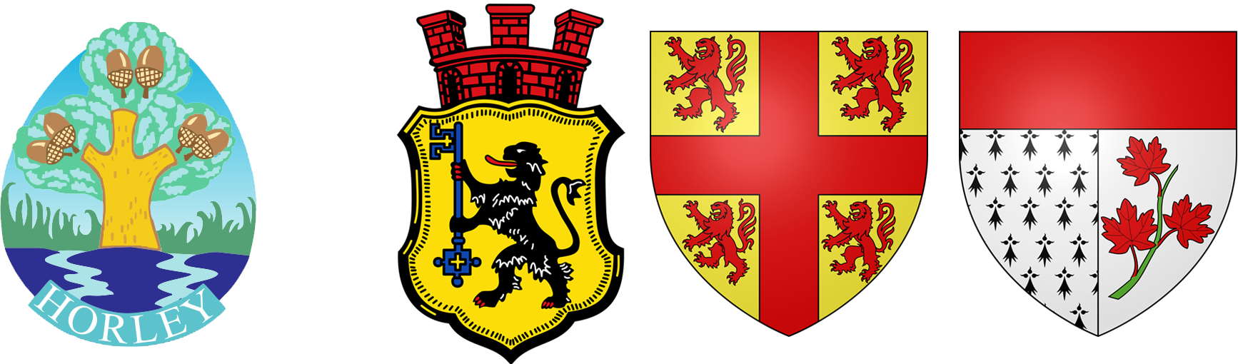
- Horley
- Gatwick airport
- Crawley, a history ↓
- Crawley, pictures and maps ↓
- Academic article: “Crawley New Town”
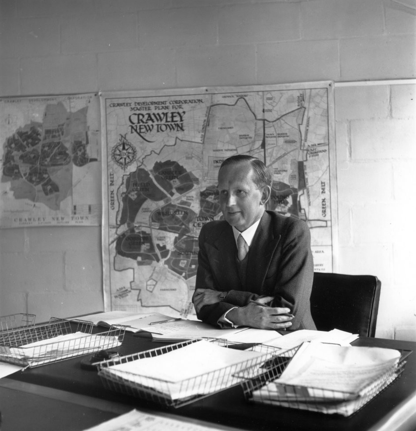
Thomas Bennett…
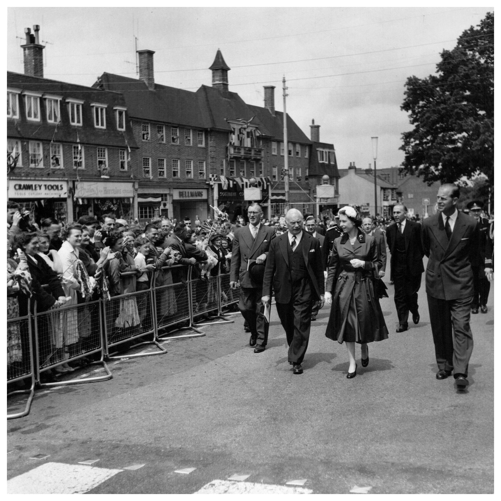
…helped build Crawley town

Image: 33 MB (4,751 by 3,557 pixels)
History of Crawley
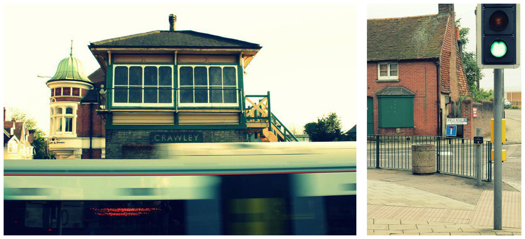
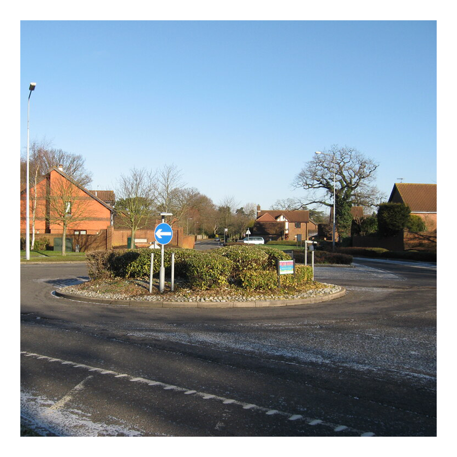
Crawley is a post-war planed town, 30 miles south of London, 20 miles north of Brighton. Crawley’s train station is not on the London-Brighton main line but connected to it by a one stop branch line.
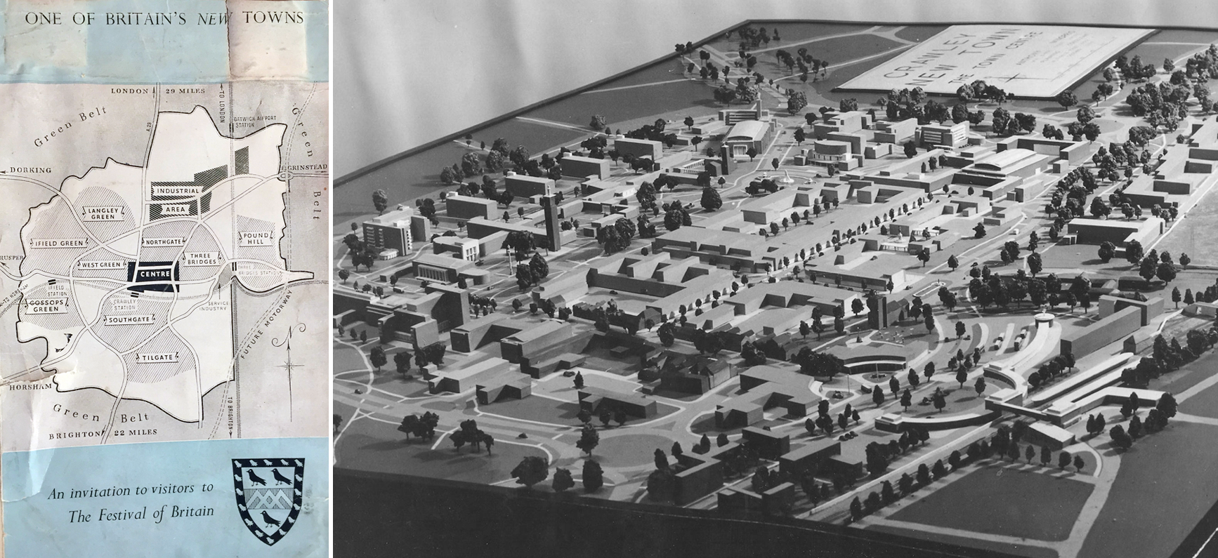
One of Britain’s New Towns
London–Brighton main line

Direct trains also depart from Horley travelling to London St Pancras International, home of the Eurostar and thus, high speed connections to Paris, Brussels, Amsterdam and Disneyland.
In the 5th century, the Saxons named the area that now comprises Horley historic High Street, “Crow’s Leah”—meaning a crow-infested clearing. Crawley, like its older neighbour to the north, Horley, was not mentioned in the Domesday Book of 1086. However the nearby settlements of Ifield and Worth—both now suburbs of Crawley—were all recorded in that book.
The first written record of Crawley dates from 1202, when a licence was issued by King John for a weekly market on Wednesdays. Crawley still has a well patronised and versatile market.
Crawley – Spitfire — “Rubber Rosie”


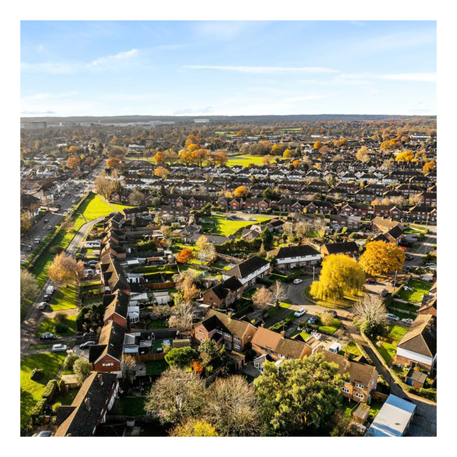
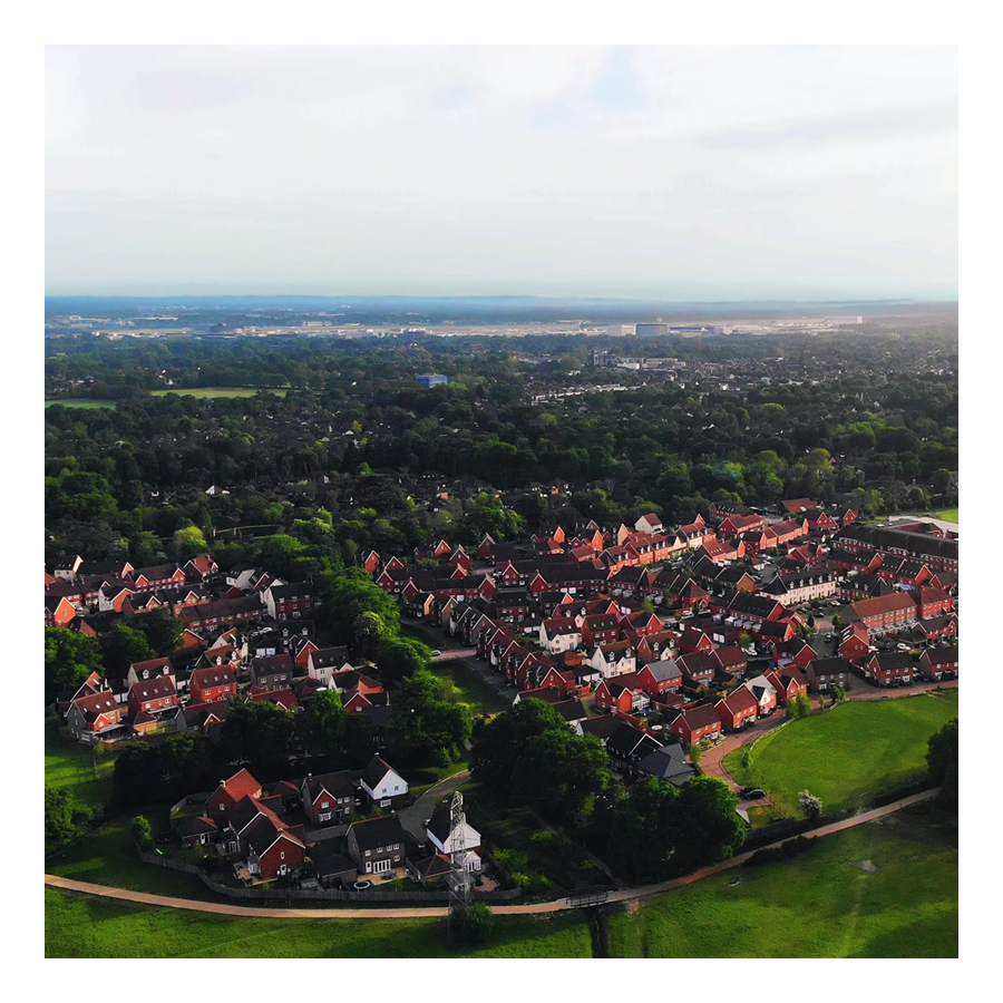
Today, Crawley has 14 neighbourhoods (15 if you prefer to include Kilnwood, which is, after all, joined to Bewbush), all with their own different character. The bulk of the new town was built between the 1950s and 1980s. Maidenbower, which was built on previously designated Greenbelt, was only completed in the mid-1990s. Forge Wood (north, towards Horley) and Kilnwood (west, towards Horsham) are still being constructed. Ifield, Worth and Three Bridges retain some of their characteristics from before 1948.
Kilnwood Vale
In 1947 Crawley was designated as the site for a New Town to take the overspill population from London following the destruction caused by the second world war.
Crawley Development Corporation was set up in February 1947 by the UK government to establish, administer and control the development of the New Town of Crawley in accordance with the New Towns Act 1946. The Corporation had the task of growing the village of Crawley into a fully fledged town by the early 1960s.
Crawley Development Corporation appointed Minoprio as consultant planner in place of Thomas Wilfred Sharp after the latter’s sudden decision to resign soon after submitting his master plan—”an extraordinary decision which was never completely explained”. By June 1947 Minoprio had prepared a new draft plan, and this was approved and published in December 1947. Minoprio’s vision of a carefully planned and balanced community (which proposed nine neighbourhoods ringing an expanded town centre) was seen through to its conclusion by the Development Corporation under the leadership of its “dogmatic and highly successful” chairman Thomas Bennett.
The Corporation was based at Broadfield House, a 19th c. villa which lay south of the then village of Crawley.
The Grade II Broadfield House
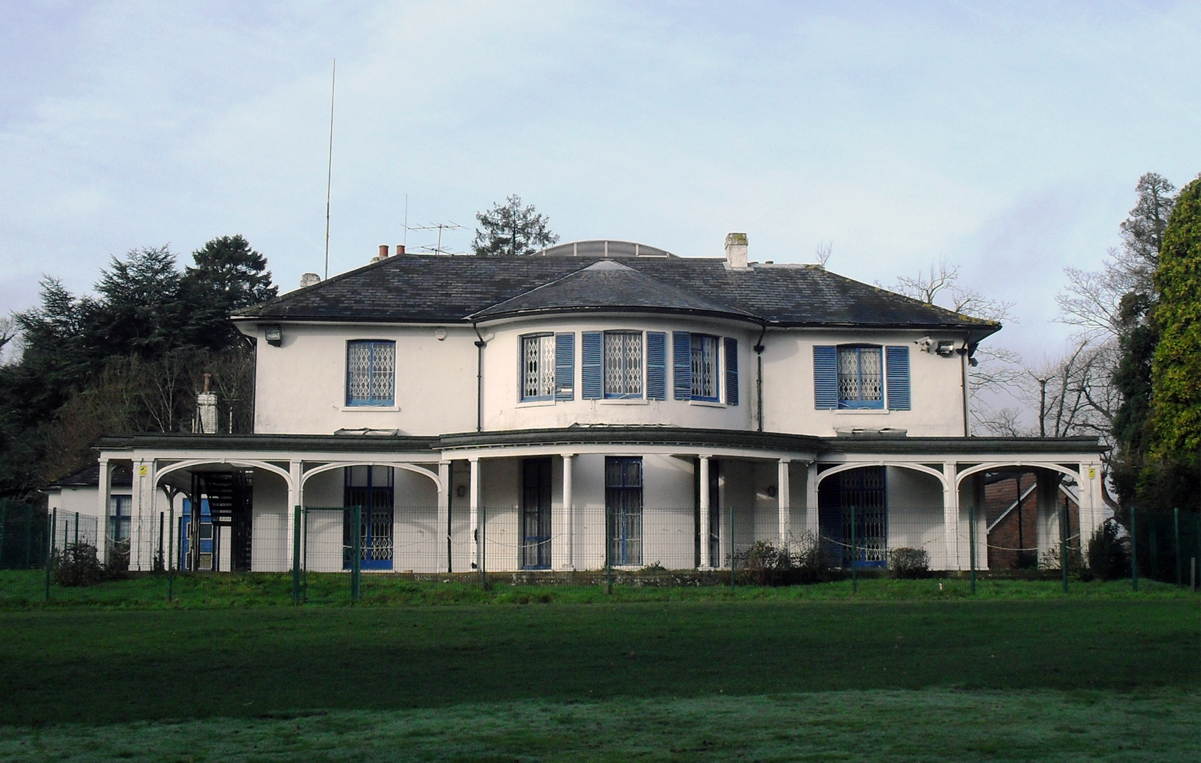
Location

Professionals, including architects, engineers, designers, legal and financial experts, were all involved during the Corporation’s 15-year existence. A committee headed by Bennett took overall charge. Wide-ranging powers were granted—from physically preparing the land to examining financial contracts—and in return the Corporation was expected to transform the 5,920-acre (2,400 ha) “designated area” into a viable regional centre and community.
Problems faced by the Development Corporation included labour and materials shortages, a lengthy legal battle against the designation order, the resignation of the original master plan designer, complaints from residents about its far-reaching powers (including some high-profile challenges), and the position of the designated area across the boundaries of several local authorities, making negotiations more complex. Nevertheless, the Corporation was able to drive the New Town’s rapid postwar growth and transformation; population targets were regularly revised upwards because of Crawley’s success in attracting people and jobs, and the town now houses 100,000 people.
Crawley is now much larger than originally anticipated: the plan’s target population of 50,000 was exceeded within 13 years of work beginning, and there are now more than 105,000 residents. Nevertheless, the town’s design and layout remain substantially similar to Minoprio’s plan.
Anthony Minoprio
Anthony Minoprio was born Liverpool, England on 6 January 1900. He entered the University of Liverpool School of Architecture in 1920 and then gained work experience in the office of Thomas Hastings in New York City in 1924. He graduated with a B. Arch. in 1925 and that year was awarded a Henry Jarvis Scholarship to attend the British School in Rome to study architecture. In the 1950s and 1960s, Minoprio worked on master plans for several cities abroad including Kuwait City (1951), Baghdad (1956) and the Bangladeshi cities of Dhaka (1959) and Chittagong (1961).
Thomas Bennett
Thomas Penberthy Bennett KBE1 FRIBA2 (14 August 1887 – 29 January 1980) was an English architect. It is said that his “energy and enthusiasm” whilst Chair of the Crawley Development Corporation helped it meet many of its targets early, and it was formally dissolved in 1962 (its assets are have since been sold off or under Crawley Borough Council ownership).
Thomas Bennett was born in 1887 in Paddington, London. He trained as an architect at Regent Street Polytechnic while employed in the drawing office of the London and North Western Railway. He went on to study at the Royal Academy Schools. He joined the Office of Works (later Ministry of Works) in 1911. A career in both education and government followed, until setting up his own practice known as TP Bennett in 1921. In 1922, he became a Fellow of the Royal Institute of British Architects. In 1940, he became Director of Bricks at the Ministry of Works, where he was awarded the CBE in 1942, but returned to private practice immediately after the Second World War. He was knighted in 1946. His practice was responsible for many landmark buildings such as the Saville Theatre, Esso House, John Barnes Department store, Hampstead (since 1986, a branch of Waitrose), Westminster Hospital, a BOAC air terminal and the London Mormon Temple in Surrey. In 1947, he was appointed as the Chairman of the Development Corporation of Crawley New Town, in West Sussex, a post he held until 1960. In his early days at the Development Corporation, he was responsible for the scrapping of the existing plans for the New Town, and the appointment of Sir Anthony Minoprio to create a new master plan. When the town was built, a new comprehensive school was named for him, opening in 1958.
Crawley Corp. & Gatwick Airport
In the 1940s and early 1950s, Crawley Development Corporation expected no development to take place at the modest aerodrome, and even stated in September 1949 that it expected it to be decommissioned as an airport. In 1950, though, the government announced that it would be redeveloped as London’s second airport; the Corporation retreated on its initial opposition—based principally on the effect the airport would have on local industry—and acquiesced. Gatwick airport was closed between 1956 and 1958, and was extended and rebuilt as an international airport. By 1964, soon after the Corporation’s dissolution, the industrial estate about supported about 16,000 jobs: the master plan had anticipated half that number. Labour shortages were frequent. For a period in the 1960s, Crawley industrial estate labour shortages were exacerbated by competition from the reopened and greatly enlarged Gatwick Airport, which was located to the north of the industrial state, next to Horley. Gatwick airport offered high wages for semi-skilled and unskilled jobs (a threat anticipated by Thomas Bennett in the 1950s). However, Crawley town council elected to build additional suburbs (Bewbush, Broadfield and Furnace Green), greatly increasing its population and the area’s labour supply (for the industrial estate and the airport).
The Town Planers
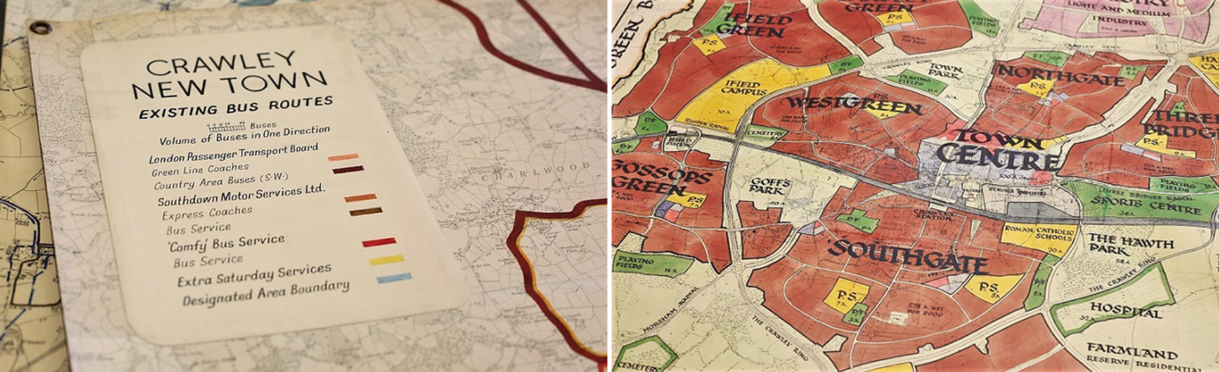
Crawley Development Corp. Map

Plans mapped out
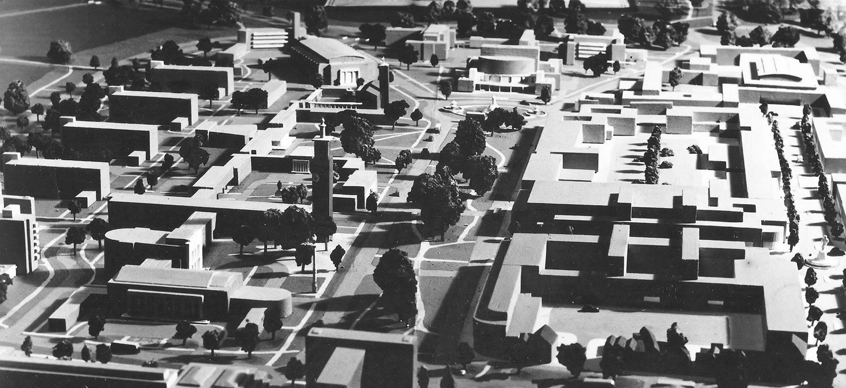
Modelled

The first nine neighbourhoods were mostly complete by 1961 when a new development plan was adopted. The second plan set out further areas of expansion including three neighbourhoods—Furnace Green, Broadfield and Bewbush which were constructed during the late 1960s to 1980s.
Crawley keeps growing
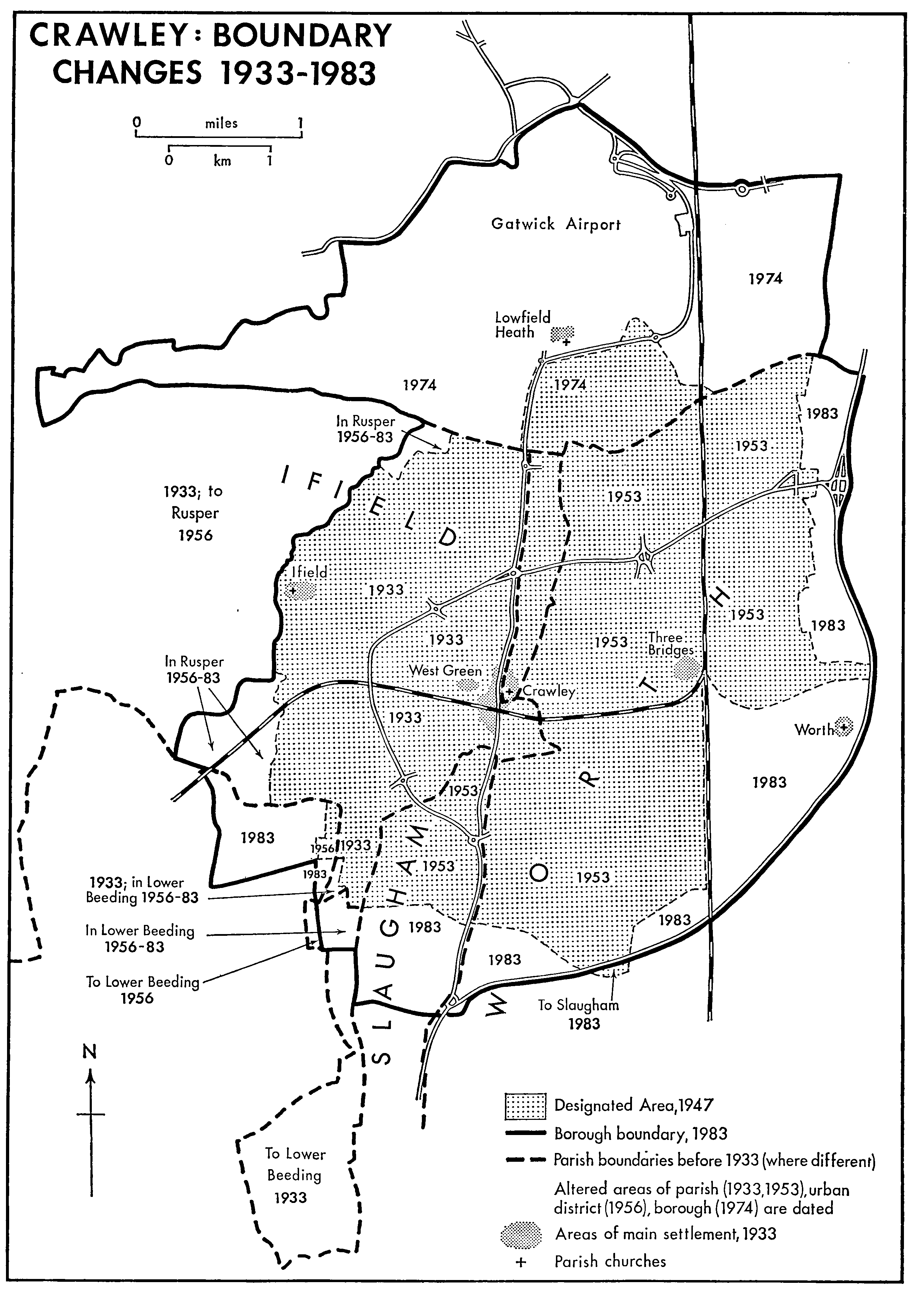
Currently, Crawley has 15 residential neighbourhoods radiating out from the core of the old market town, and separated by main roads and railway lines. The extant hamlets of of Ifield, Pound Hill and Three Bridges were absorbed into the new town.
Crawley neighbourhoods, c. 1982

One of the most recent neighbourhood is Maidenbower. It was designated in 1986 and building took place between 1988 and 1997.
Strategic character areas
Crawley urban area has been classified into eight strategic character areas based on urban and landscape character, predominant land use and development age. Each character type contains a number of distinct geographic areas spread across the borough that share similar characteristics.
The strategic character areas are as follows:
Town Centre
Including the sub-areas of historic Crawley High Street, New Town centre and expansion, and the outer ring of commercial and community uses. These areas are grouped together due to their proximity to the town centre and/or focus on non-residential uses.
Historic Settlements
Historic residential villages, streets and hamlets with geographic sub-areas covering the historic hearts of Ifield and Worth. These areas retain a pre-Victorian character.
Pre New Town Expansion
Including geographic sub-areas covering Ifield, West Green, Southgate, Northgate, Three Bridges and Pound Hill / Worth where expansion in the Victorian and early part of the twentieth century occurred prior to the development of Crawley New Town.
New Town Phase 1a
This group of neighbourhoods (Langley Green, Ifield, West Green, Northgate, Southgate, and Three Bridges) were developed during the first five years of the New Town growth in line with the 1948 Minoprio masterplan. Sub-areas in this group are defined by the dominant land use and residential typologies.
New Town Phase 1b
The second phase development of the original nine neighbourhoods identified in the Minoprio masterplan (Tilgate, Gossops Green) plus Furnace Green which was designed as a possible expansion area in the masterplan and designated for housing in 1956. Sub-areas in this group are defined by the dominant land use and residential typologies.
New Town Phase 2
Extensions to phase 1 neighbourhoods (Pound Hill North, Furnace Green and Southgate West) share a similar character with two new neighbourhoods identified for development in 1961—Bewbush and Broadfield. Sub-areas in this group are defined by the dominant land use and residential typologies.
New Town Phase 3
Covering Maidenbower, built out during the 1980s and the last of Crawley’s current thirteen neighbourhoods. In addition this group includes recent infill and redevelopment on small sites around the town over the last two decades. Sub-areas in this group are defined by the dominant land use and residential typologies.
Crawley neighbourhoods
There are 14 currently (15 if you choose to include Kilnwood Vale). They are, alphabetically, as follow
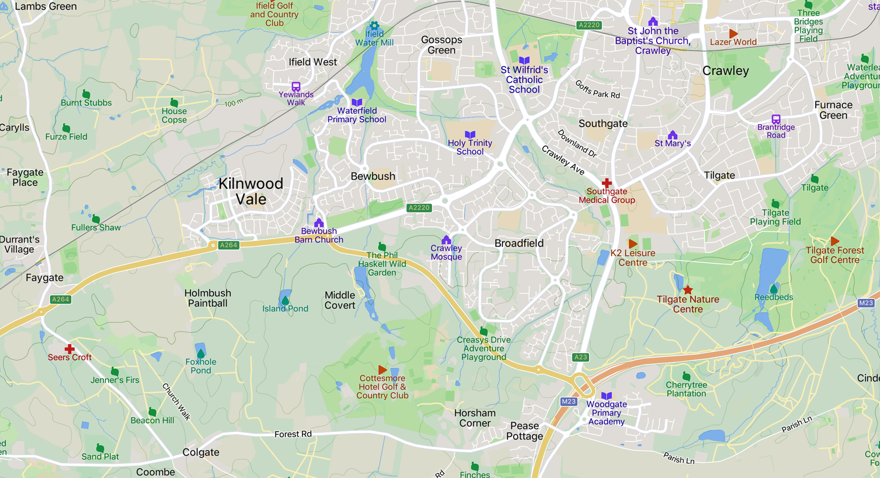
Bewbush
Bewbush is in the south west of Crawley. It was mainly built during the 1970s and 80s with links to Crawley town centre, Manor Royal Industrial Estate and Gatwick Airport by the Fastway bus service. As of the Census 2011 there were 3,234 households in Bewbush with a total of 8,865 people.
Broadfield
Broadfield is in the south west of Crawley. It was built starting in the 1970s and is now one of the largest neighbourhoods. Broadfield has transport links to the surrounding area with the Fastway bus service taking passengers to the town centre, Manor Royal Industrial Estate, Gatwick Airport and Three Bridges. As of the Census 2011, there are 5,129 households in Broadfield. According to the Office of National Statistics (ONS) there were 14,138 people living in Broadfield in 2017.
Forge Wood
Forge Wood is in the north east of Crawley and is the newest neighbourhood (currently…). According to Crawley council, when complete, Forge Wood will have 1,900 homes built around a central community space. This will include a primary school, community centre, office and industrial space, retail space and parkland. House buliders Persimmon and Taylor Wimpey are constructing Forge Wood in four phases. The first residents moved in during 2015. By January 2020, there were 787 households occupied in Forge Wood. The roads have not been adopted by West Sussex County Council (WSCC), however once the development is complete, the main road will become the responsibility of WSCC. Side and access roads and parking forecourts/drives will remain the responsibility of the management company.
Furnace Green
Furnace Green is to the south east of Crawley. Its name comes from Roman times when iron smelting was reputed to have taken place in the area. House building started in Furnace Green in 1960 and carried on into the 1980s. The neighbourhood backs onto Tilgate Forest and Golf Course. As of the Census 2011 there are 2,309 households in Furnace Green and, according to the ONS, there were 5,837 people living in Furnace Green in 2017.
Gossops Green
Gossops Green is located in the west of Crawley. The neighbourhood was mainly built between 1958 and 1961. Open space in Gossops Green includes Woldhurstlea Wood and Bewbush Water Gardens. As of the Census 2011 there are: 2,128 households and 5,252 people living in Gossops Green.
Ifield
Ifield is located in the west of Crawley. It is one of the most historic areas of the town and is mentioned in the Domesday Book of 1086. With the development of the new town in 1947, the village of Ifield was merged with the market village of Crawley and the village of Three Bridges to become Crawley new town. Ifield and Ifield Green have a mix of modern and traditional housing, with three neighbourhood shopping areas. A notable feature is the Mill and surrounding pond. Built in the early 19th Century, the building still has a working waterwheel and is now used to house a local history display. The impressive mill pond is one of Crawley’s most important wetland sites. As of the Census 2011 there are: 3,613 households in Ifield and 8,882 people living in Ifield
Langley Green
Langley Green is located towards the northwest of the town. Building began in the early 1950s and many of the early residents of Langley Green were builders who mostly came from London. As of the Census 2011 there are, 2,942 households in Langley Green with a total of 8,255 residents.
Maidenbower
Maidenbower is located in the south east of Crawley, with good transport links being within easy reach of the M23 motorway and Three Bridges rail station. The neighbourhood also has bus links to Manor Royal and Gatwick. As of the Census 2011 there are: 3,722 households in Maidenbower and 9,369 people living there.
Northgate
Northgate is located directly to the north of Crawley town centre. The area gets its name from the North Toll Gate from the London to Brighton road. The neighbourhood is well located within walking distance of both the town centre and the Manor Royal Business District. As of the Census 2011 there are: 2,259 households and 5,298 people living in Northgate.
Pound Hill
Pound Hill is in the east of Crawley and is the largest of the 14 (or 15) neighbourhoods. This area was originally a hamlet in the parish of Worth but with the development of the new town, work began on building homes in the area in 1953. A bus service links Pound Hill to the Manor Royal Industrial Estate and to Gatwick. Due to its size, Pound Hill is split into two electoral wards: Pound Hill North & Pound Hill South. Pound Hill’s most famous resident was Robert Smith, lead singer of The Cure. As of the 2011 Census there were 6,064 households and 14,977 people living in Pound Hill.
Southgate
Southgate is located in the south of Crawley within walking distance of the town centre. Most of the area was built between the 1950s and 1970s. The popular Goffs Park is located in Southgate and features a boating pond and lake, pitch and putt and a model railway. As of the Census 2011 there are 3,554 households and 8,533 people living in Southgate.
Three Bridges
Three Bridges was originally a small village which merged with other villages in Crawley and Ifield to become Crawley new town. Three Bridges rail station is a mainline station on the London to Brighton line and the village grew with the development of the railway line. Three Bridges is on the route of the Fastway bus service which links the area with Gatwick and Horley. As of the Census 2011 there are: 3,101 households and 7,253 people living in Three Bridges.
See: Three Bridges Landscape Heritage trail map
Tilgate
Tilgate is in the south of Crawley and backs onto Tilgate Forest and Golf Course. It was built in the 1950s and 1960s. As of the Census 2011 there are 2,454 households in Tilgate. As of the ONS mid-year estimates for 2017, there are 6,108 people living in Tilgate.
West Green
West Green is located to the west of Crawley town centre. It was built in the 1950s as part of the new town and includes part of the original town of Crawley. It is home to Crawley Hospital.At the Census 2011 there were 2,218 households and 5,120 people living in West Green.
Pictures & Maps
Old Crawley
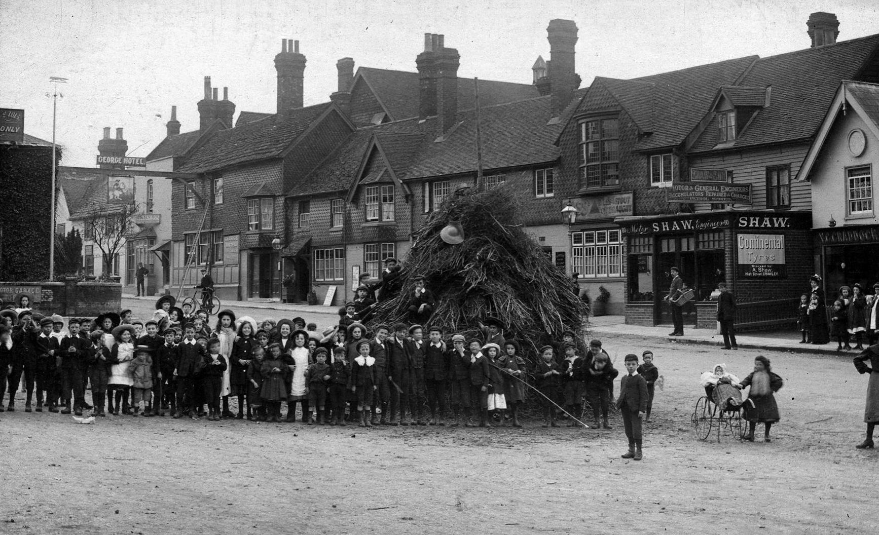
High Street, 1900

High Street, 1903
Queen’s Square, 1967

Queen’s Square, 1971
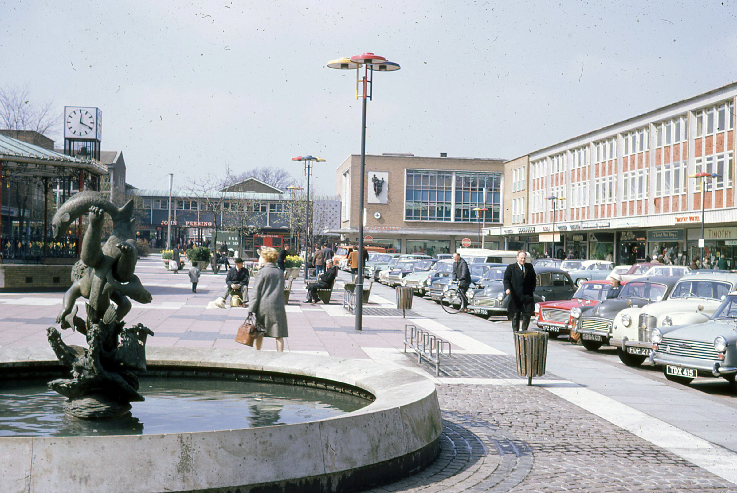
Retro Crawley

The RIBA Collection 3
Pound Hill, 1958

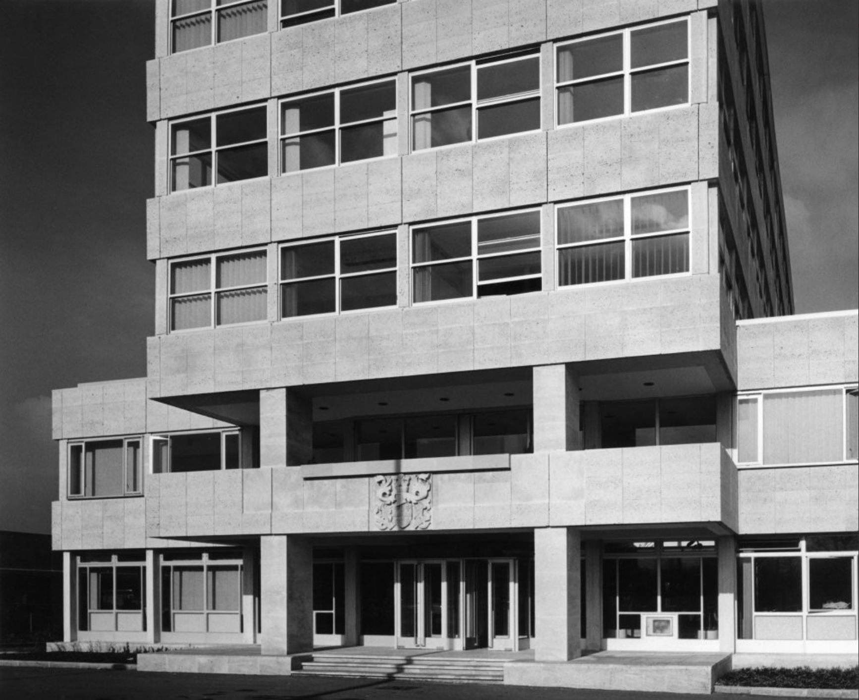
Crawley Town Hall, 1968 (and 2022)

* * *
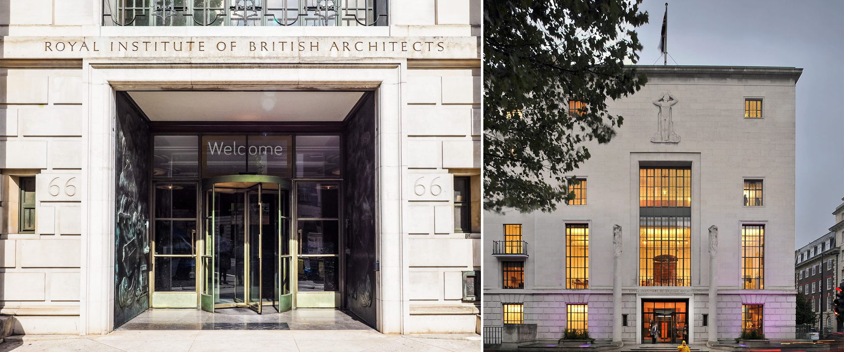
RIBA, an aside
Designed by George Grey Wornum, 66 Portland Place, the headquarters of the Royal Institute of British Architects, was officially opened on 8th November, 1934 by King George V.
RIBA HQ…

…welcomes in the public
The design of the institute’s Mycenaean lions medal and the Latin motto is attributed to Thomas Leverton Donaldson, who had been RIBA’s honorary secretary until 1839. The logo was refined in 1931 by Eric Gill and again in 1960 by Joan Hassall. RIBA’s motto (Latin: usui civium decori urbium) translates as, “for the use of the people, for the glory of the city.”
A Roof With a View
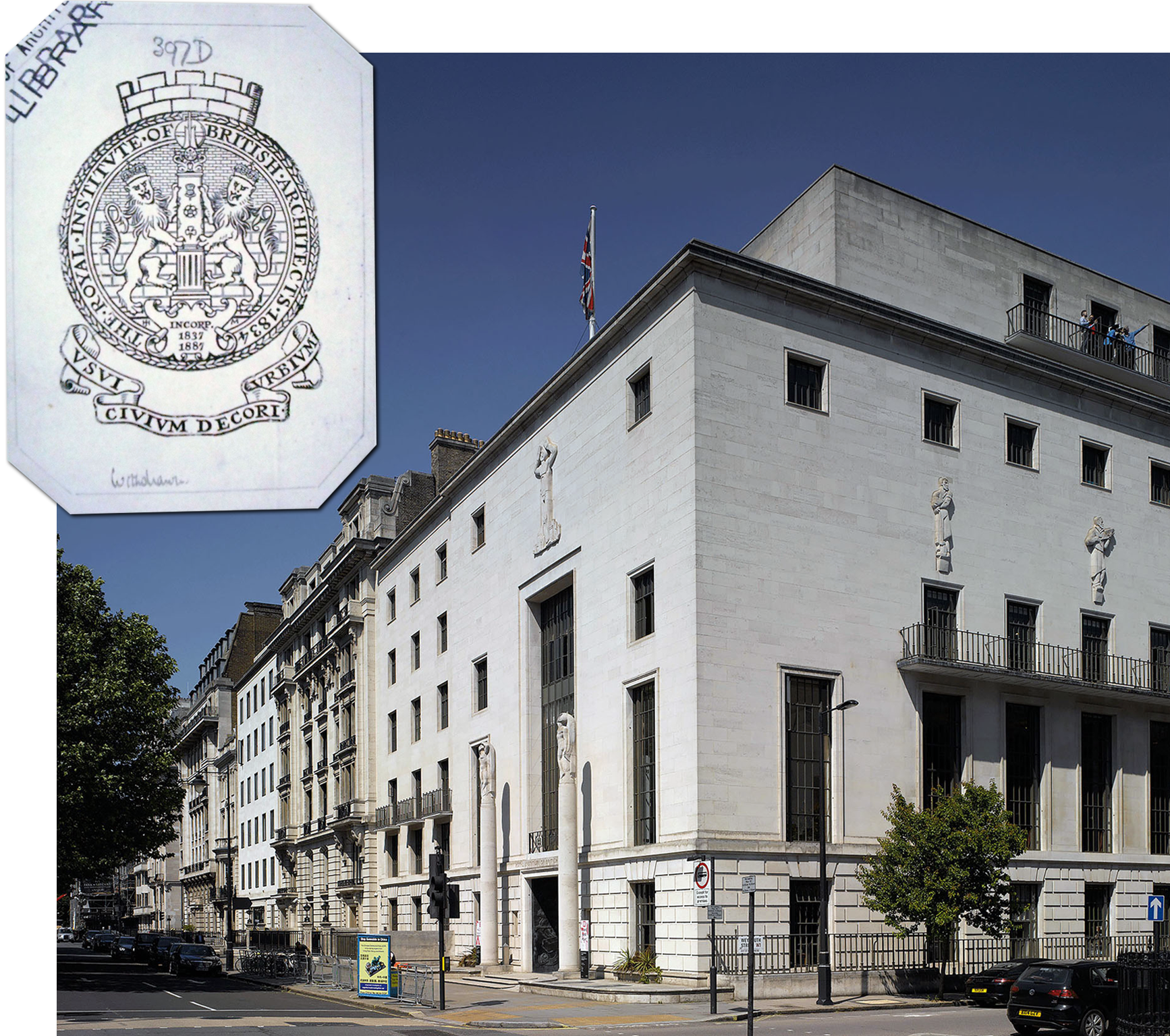
Grade II Listed
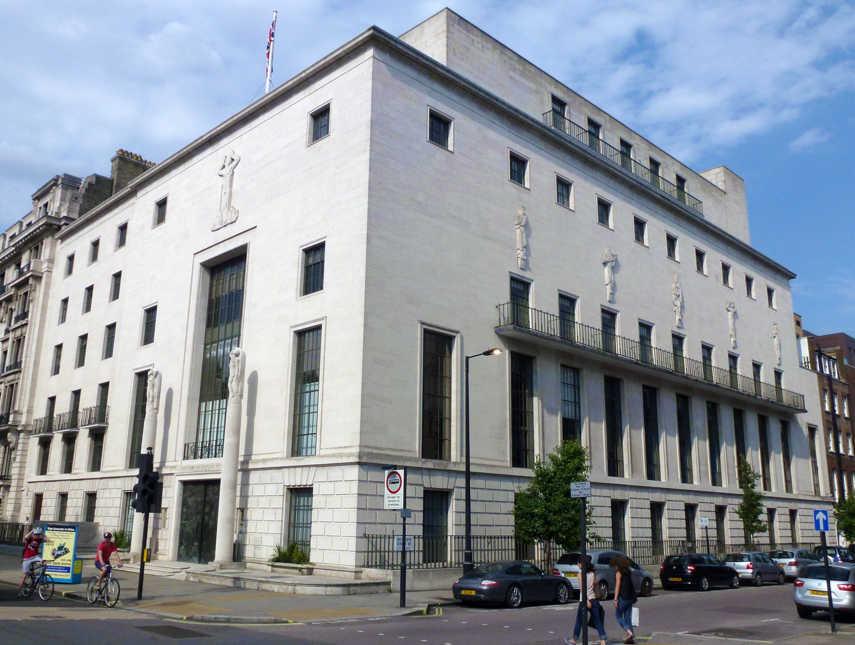
A haven for Art Decco

* * *
Pictorial carrousel
Lowfield Heath & Marbles


Maps
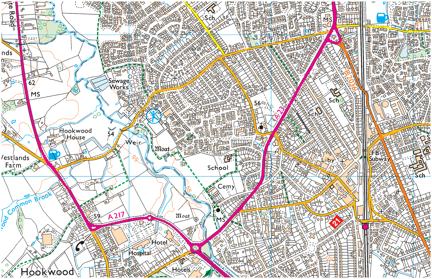
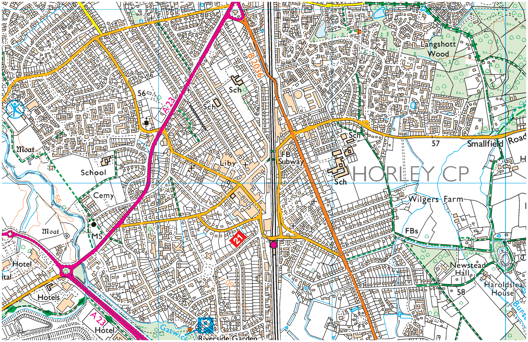
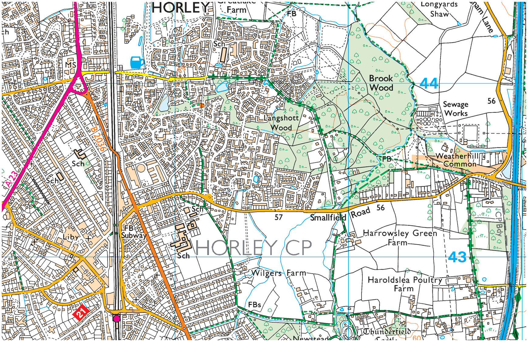
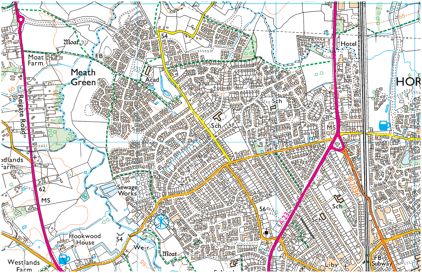
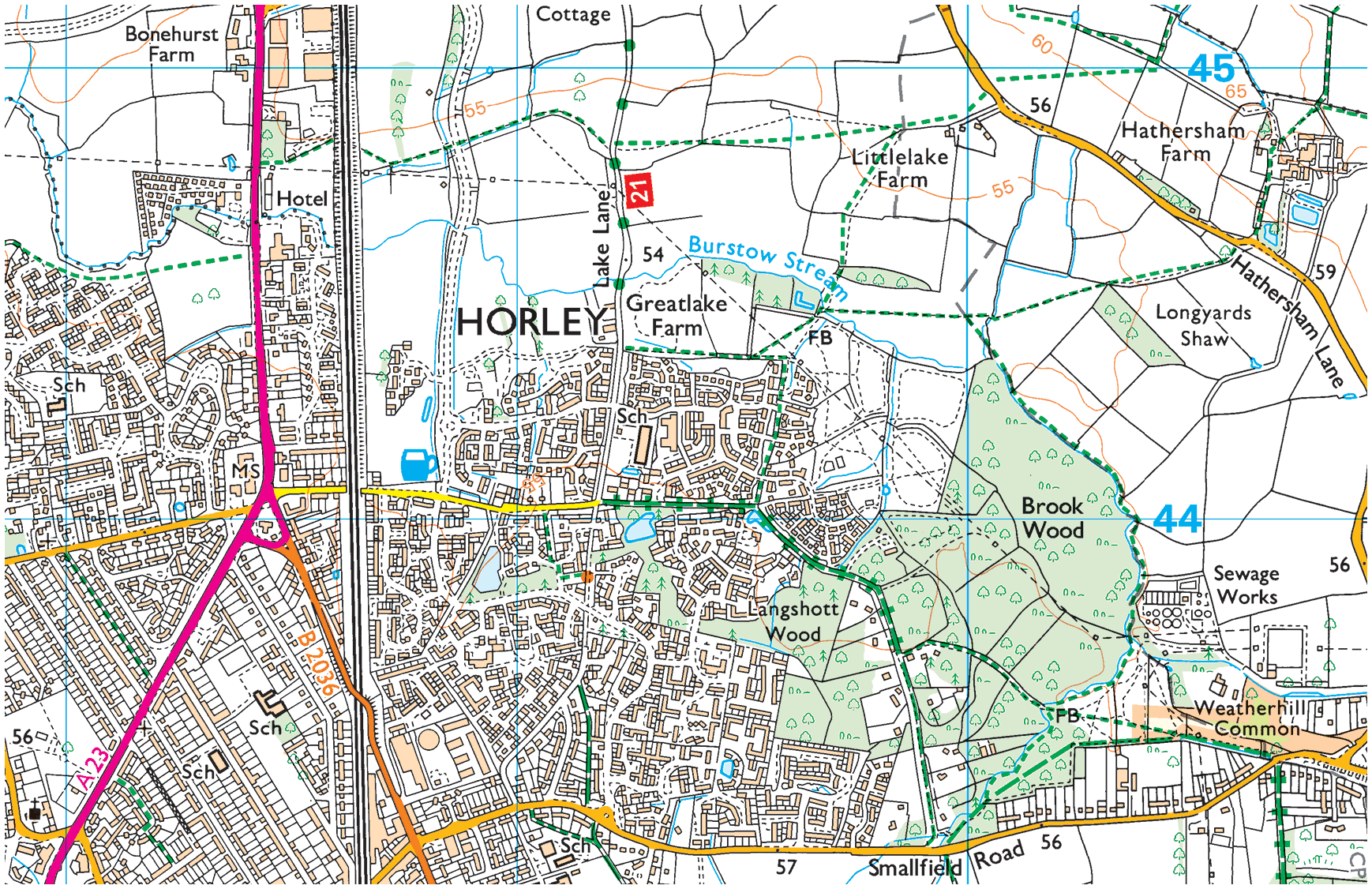
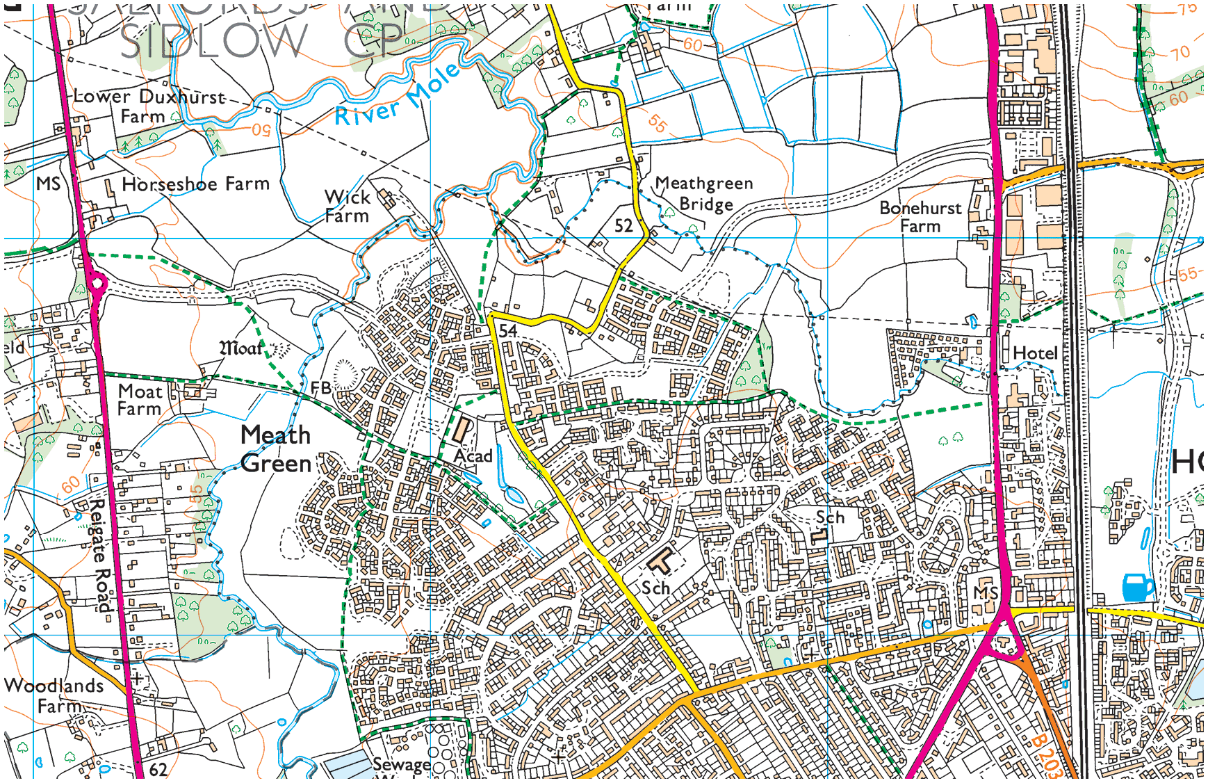
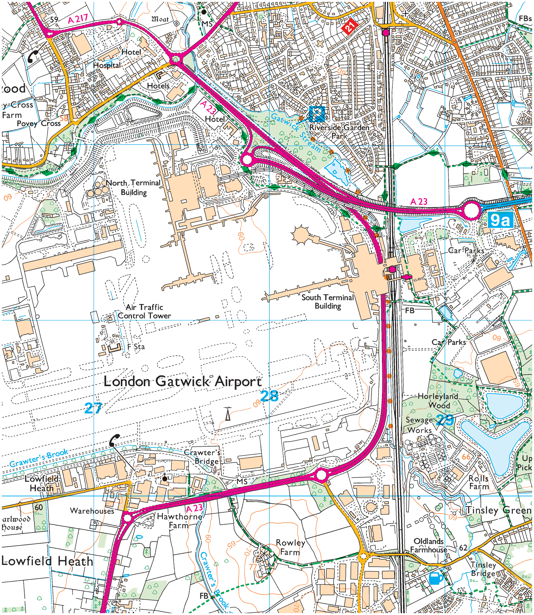
Crawley, OS Explorer (scale: 1:50,000)
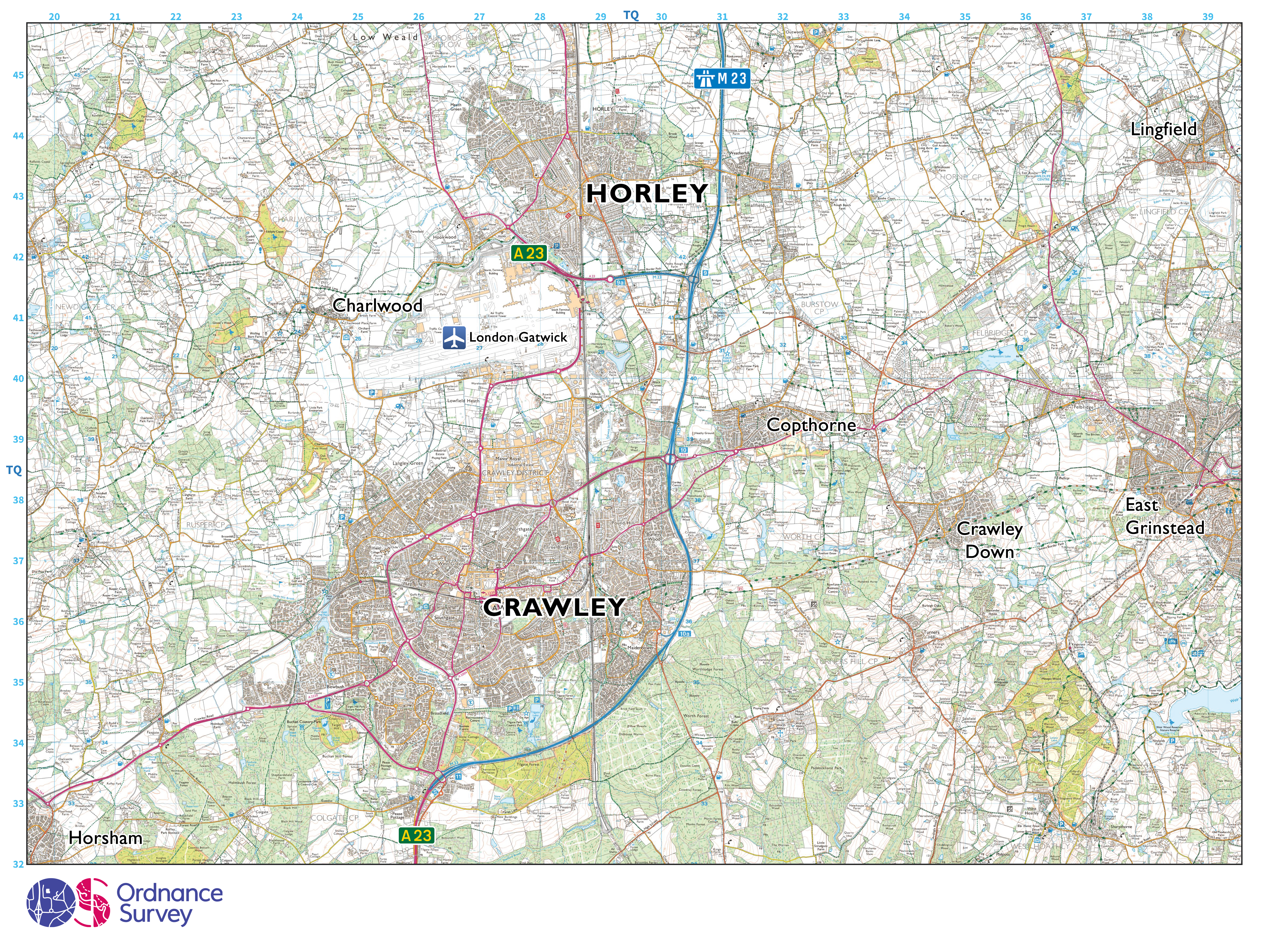
Image: 33 MB (4,751 by 3,557 pixels)
Crawley, OS Landranger (scale: 1:50,000)
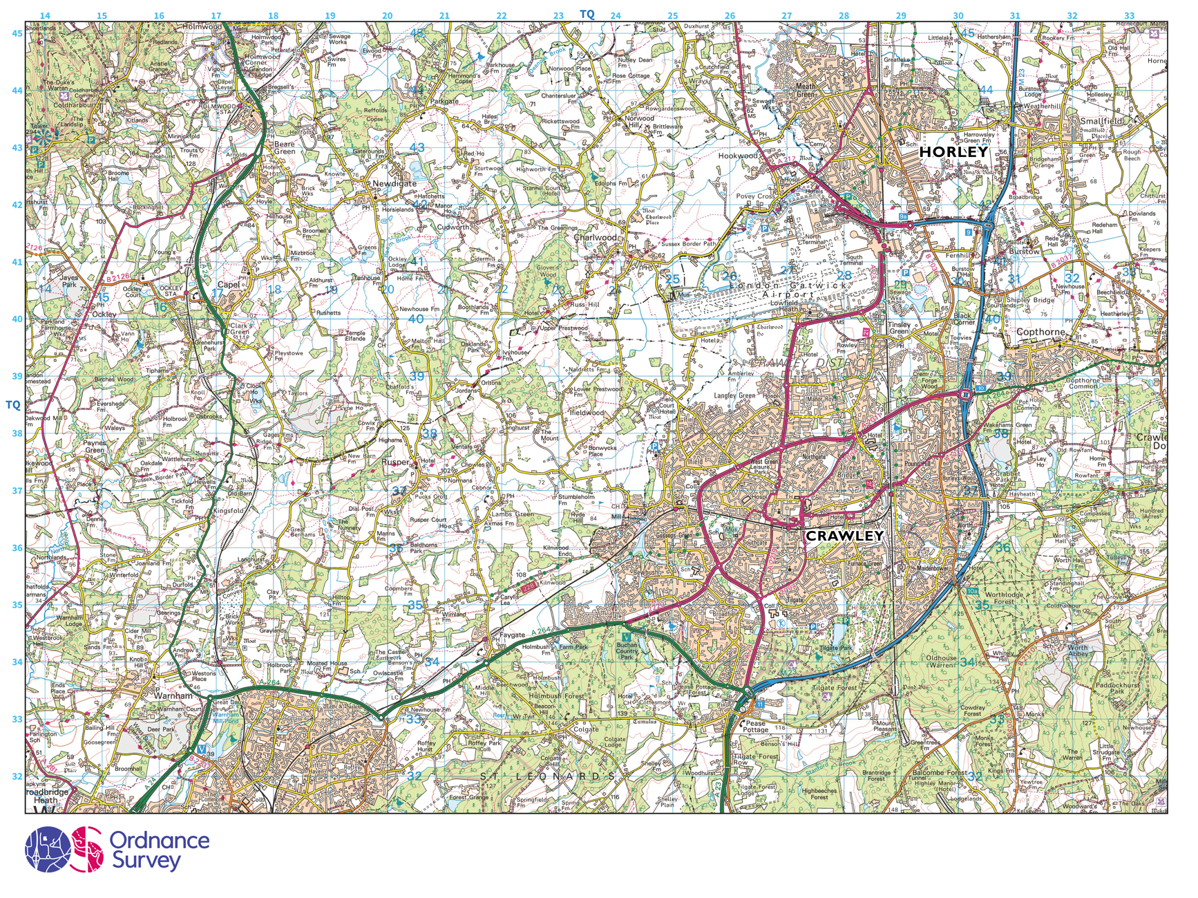
Image: 29 MB (4,751 by 3,557 pixels)
Crawley, OS Explorer (scale: 1:40,000)
Image: 33 MB (4,751 by 3,557 pixels)
Crawley, OS Landranger (scale: 1:40,000)

Image: 29 MB (4,751 by 3,557 pixels)
Crawley, OS Explorer (scale: 1:25,000)

Image: 31 MB (4,751 by 3,557 pixels)
Crawley, OS Landranger (scale: 1:25,000)

Image: 27 MB (4,751 by 3,557 pixels)
Crawley, OS Explorer (scale: 1:12,500)
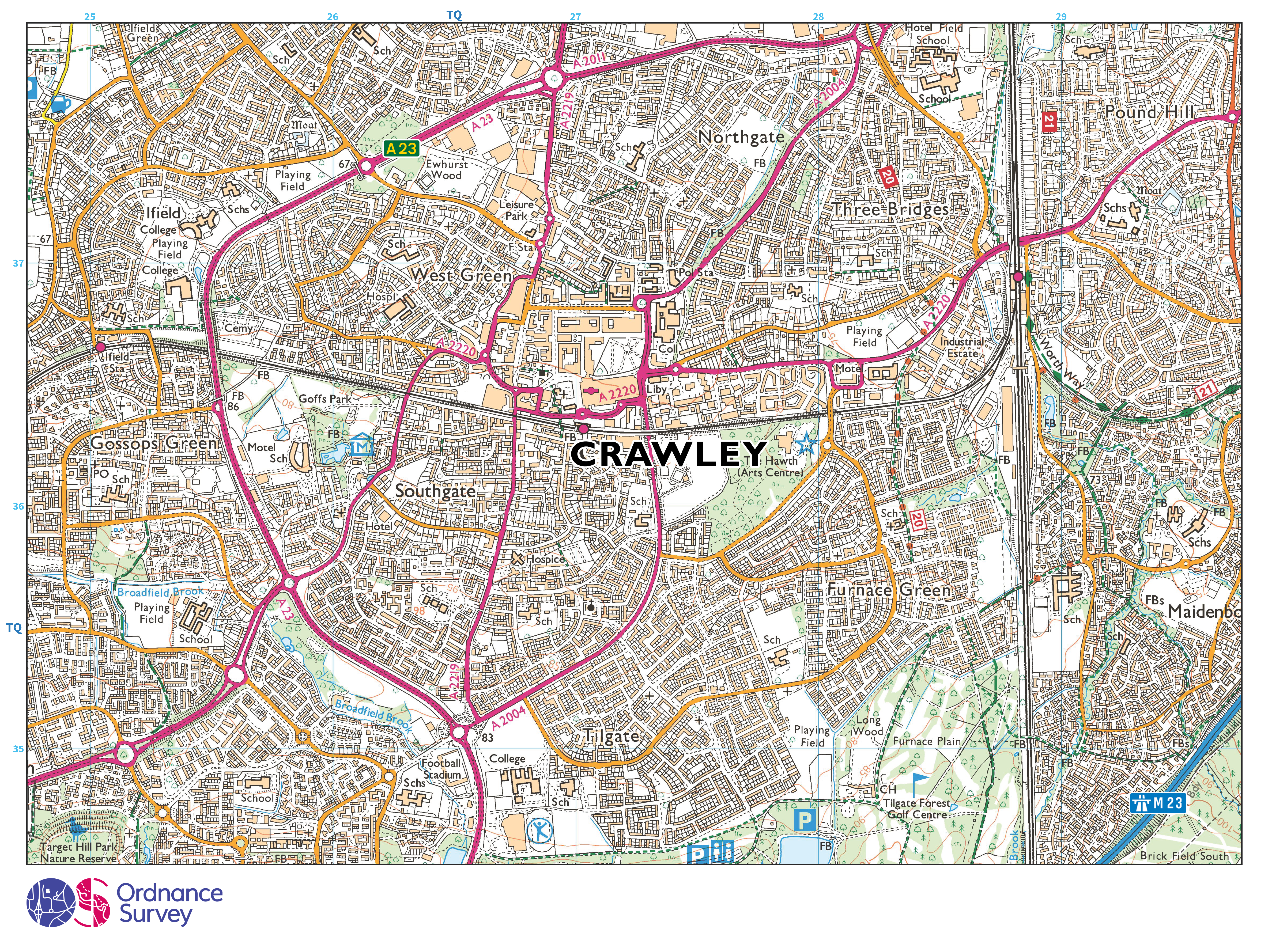
Image: 29 MB (4,751 by 3,557 pixels)
Crawley, OS Explorer (scale: 1:10,000)
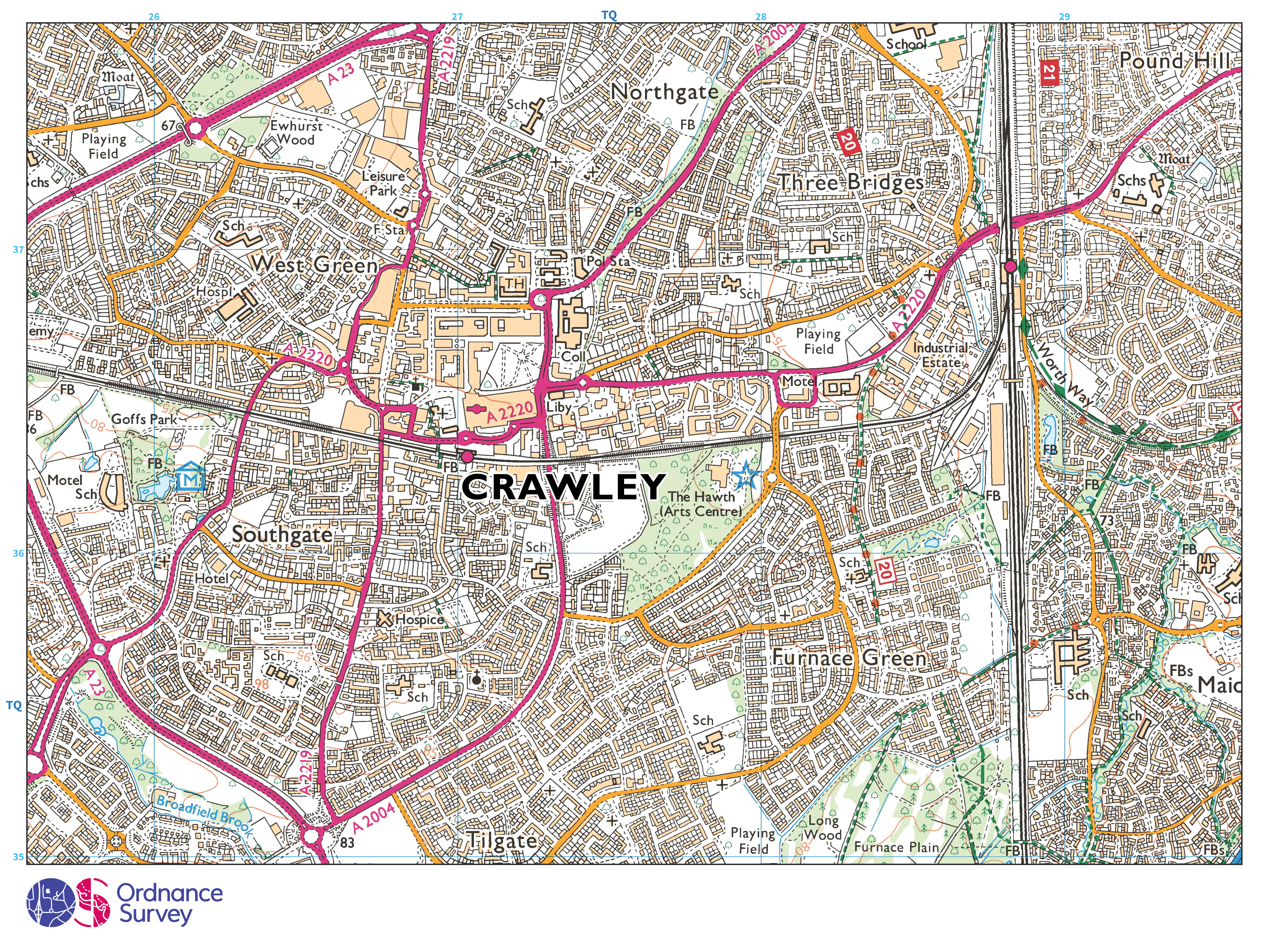
Image: 27 MB (4,751 by 3,557 pixels)
Contact HH&M
HH&M’s services
- Assembling things →
- Building & Maintenance →
- Decorating & Painting →
- Gardening & Groundworks →
- Moving things →
Get a free quote
Horley by area
Although Horley does not have named-on-road-sign neighbourhoods—like Crawley does—the following areas are commonly referred to:
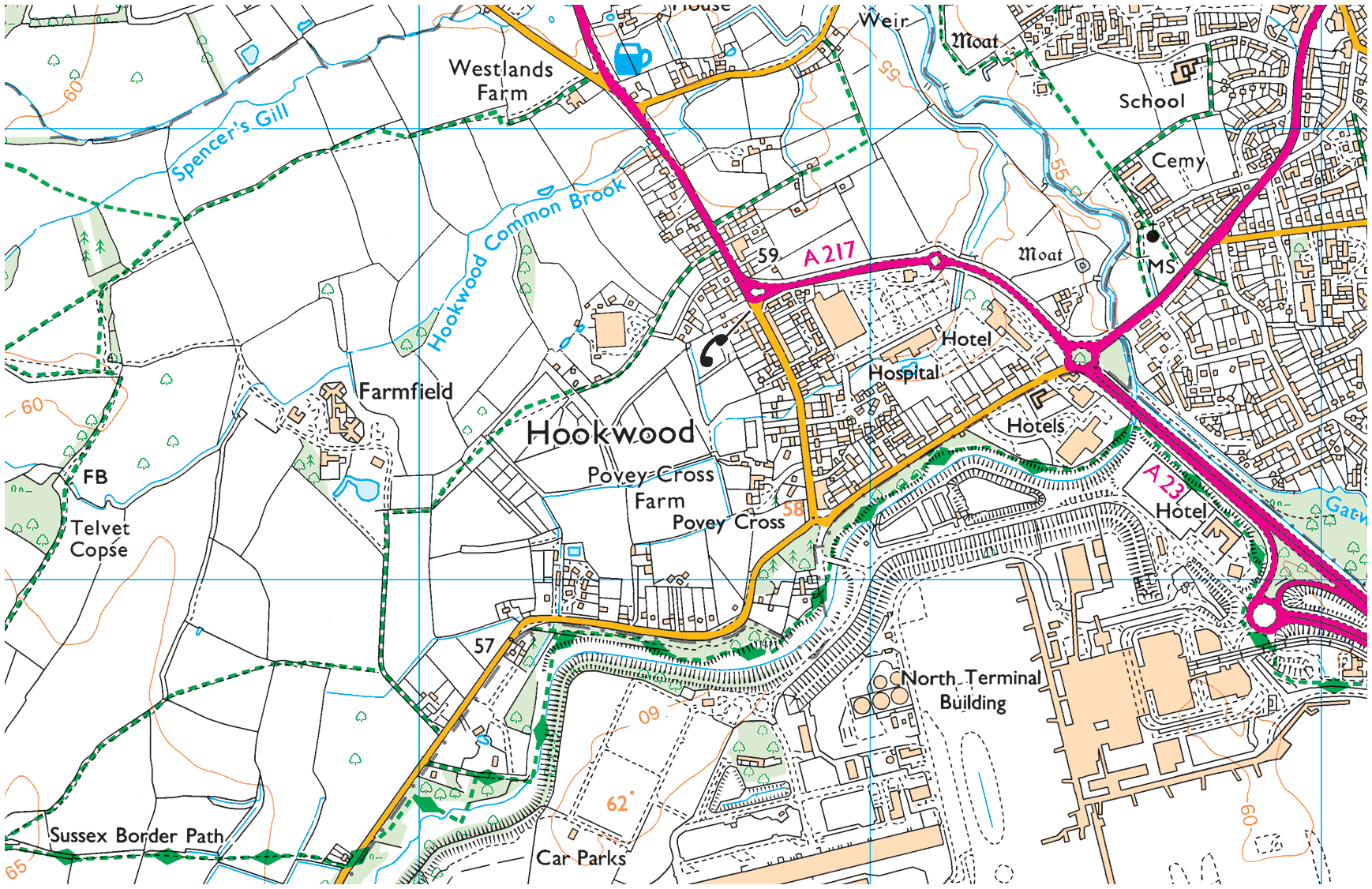
01. Hookwood/Povey Cross
Hookwood/Povey Cross →
Hookwood and Povey Cross are on the western outskirts of Horley. Many international hotels are situated here as is Tesco Hookwood. Several large housing developments are planned here. Hookwood and Povey Cross are directly beside the airport.
02. Gardens Estate
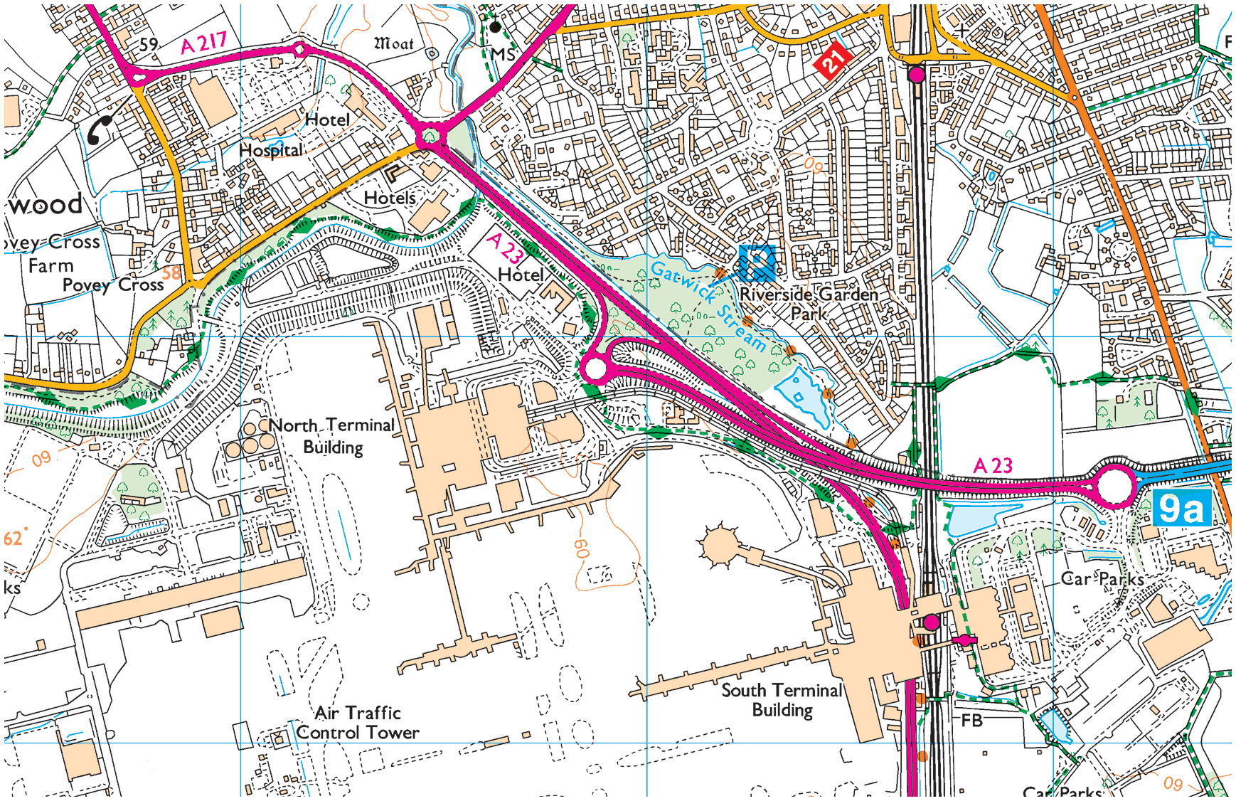
Gardens Estate →
Gardens Estate is very close to Gatwick airport and those working at LGW can easily access the terminal building via footpaths from the recreational area, Riverside Garden Park via the underpass of Gatwick airport station.
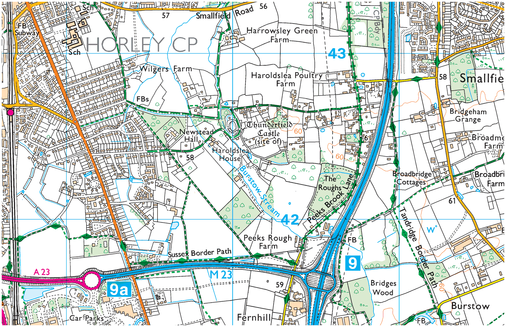
03. Haroldslea
Haroldslea →
This area comprises: The Balcombe Road (B2036) and the roads leading from it between Oakwood School and the A23/M23 link road flyover. For example, Limes Avenue which was originally laid out in 1936 and still retains some of the Lime trees planted at that time.
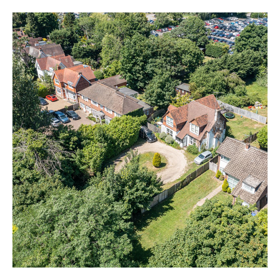
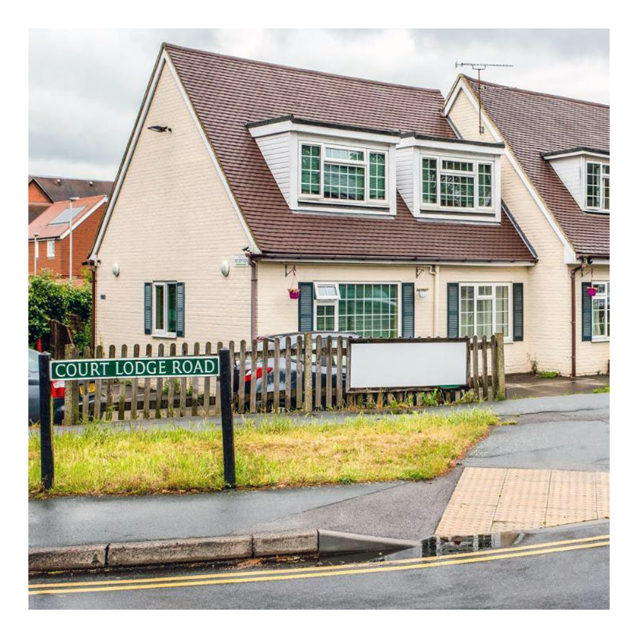
04. Court Lodge
Court Lodge →
This neighbourhood was set out in the 1950s and 1960s. It has a mixture of flats and houses. It is home to Horley leisure centre, several airport hotels and a couple of places of worship.
05. Horley Central
Horley Central →
This area includes the town centre which has quite a lot of purpose built residential flats and roads such as Church Road, Massetts Road, Pine Gardens, Ringley Avenue and, Russells Crescent.
06. Langshott
Langshott →
This area of Horley stretches eastward towards Smallfield. Immediately to its north is the new estate called The Acres. This area is home to Langshott Manor, which was built in 1580; it is now a luxury hotel.
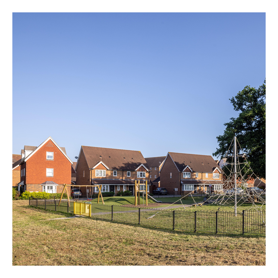
07. Meath Green
Meath Green →
Once upon a time this area was called Moy Grene, and it has some of Horley’s oldest homes. Today, the vast majority of the homes in this area where built from the late 1950s onwards.
08. The Acres
The Acres →
This new neighbourhood of over 700 homes is in the north east of Horley and Langshott. The development was built mostly by Barratt and Bovis Homes between 2010 and 2016.
09. West Vale Park
West Vale Park →
This new neighbourhood is to the north west of Horley and joins onto Meath Green. To date, around 1,600 new homes have been constructed:
• Crest Nicholson brochure →
• Fabrica brochure →
• Taylor Wimpey brochure →
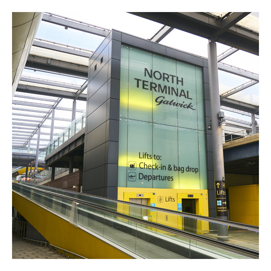
10. Gatwick
Explore Gatwick→
Gatwick airport is included as an area of Horley because historically it was part of Horley and, it remains adjacent to this day. Gatwick, before becoming a major international airport, was a famous horse racetrack which hosted the Grand National on several occasions.
Horley neighbourhoods
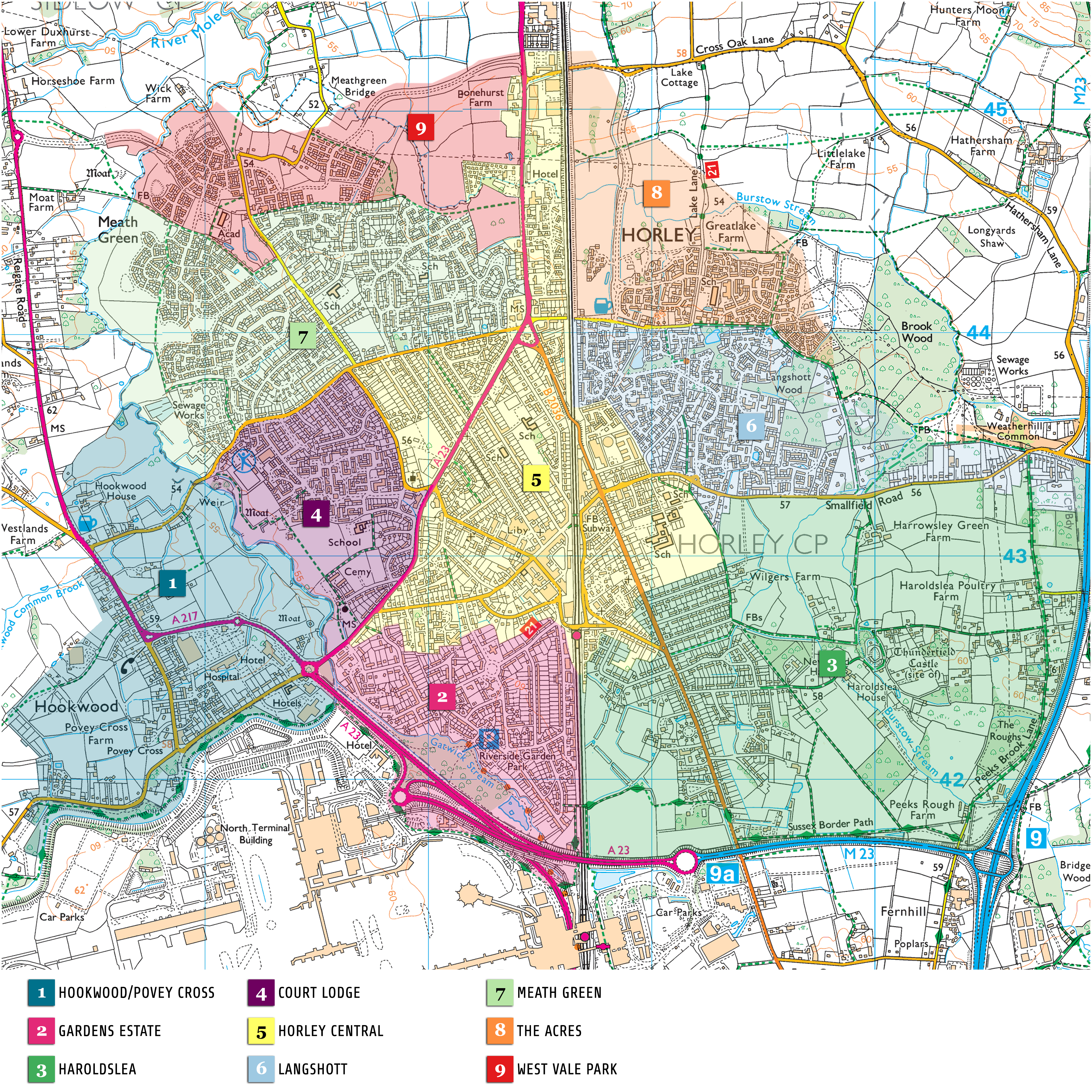
Horley Town
01. Hookwood/Povey Cross
02. Gardens Estate
03. Haroldslea
04. Court Lodge
05. Horley Central
06. Langshott
07. Meath Green
08. The Acres
09. West Vale Park
10. Gatwick

* * *
Footnotes
- K.B.E. – The Most Excellent Order of the British Empire. This British order of chivalry, rewarding contributions to the arts and sciences, work with charitable and welfare organisations, and public service. It was established on 4th June, 1917 by King George V and comprises five classes, the most senior two of which make the recipient either a knight or dame. ↩︎
- F.R.I.B.A. – Fellow of the Royal Institute of British Architects. ↩︎
- R.I.B.A. – Royal Institute of British Architects. Among other things (inter alia), they provide the following architectural styles guides: (1) Art Deco [→] a decorative style of bold geometric shapes and bright colours, it encompassed furniture, textiles, ceramics, sculpture and architecture; it became a favourite for building types associated with the modern age, airports, cinemas, swimming pools, office buildings, department stores, power stations and factories (2) Arts and Crafts [→] a style that urged for a return to craftsmanship and which rebelled against industrialisation; very influential in the late 19th century and sought to re-establish the skills of craft-ship threatened by mass production and industrialisation; its main protagonist was the designer-cum-poet, William Morris who was inspired by the writings of the art critic John Ruskin (3), Brutalism [→] a style with an emphasis on materials, textures and construction, producing highly expressive forms (4), High Tech [→] a development in British Modernist architecture from the late 1960s; Norman Foster and Richard Rogers were the key architects who brought about these changes and implemented them from the 1970s (5), Modernism [→] a style that rejecting ornament and embraced minimalism, Modernism became the single most important new style or philosophy of architecture and design of the 20th century; it’s associated with an analytical approach to the function of buildings and a strictly rational use of modern materials (6), Palladianism [→] a classical style, named after the Italian Renaissance architect Andrea Palladio; he re-interpreted Roman architecture for contemporary use and published his ideas in I Quattro Libri dell’Architettura (The Four Books of Architecture, 1570), which was translated and re-published across Europe (7), Postmodernism [→] a style or styles of architecture and the decorative arts that were a reaction to Modernism and the Modern Movement (8), Gothic [→] widespread throughout western Europe during the Middle Ages (12th to early 17th c.), it encompasses the pointed arch, the rib vault, the flying buttress, window tracery, pinnacles, and spires; Gothic is mostly dominated by church architecture during this period, but is also seen in collegiate architecture, notably at Oxford and Cambridge (9) Gothic revival [→] a conscious movement that began in England to revive medieval Gothic forms (second half of the 18th and throughout 19th c.), it incidentally led to an increasing interest in preserving and restoring older buildings and (10), Neoclassical [→] a revival style that looks back to the Classical past and the architecture of ancient Greece and Rome, but unlike the re-interpretation of classical forms seen in the Renaissance, was much more academic in approach; it began in France from the mid-18th c., with architects theorising over the supremacy of ancient Greece versus ancient Rome, following the rediscovery of the Parthenon and the excavations at Herculaneum and Pompeii. It is safe to say that Crawley is almost all Modernist. ↩︎