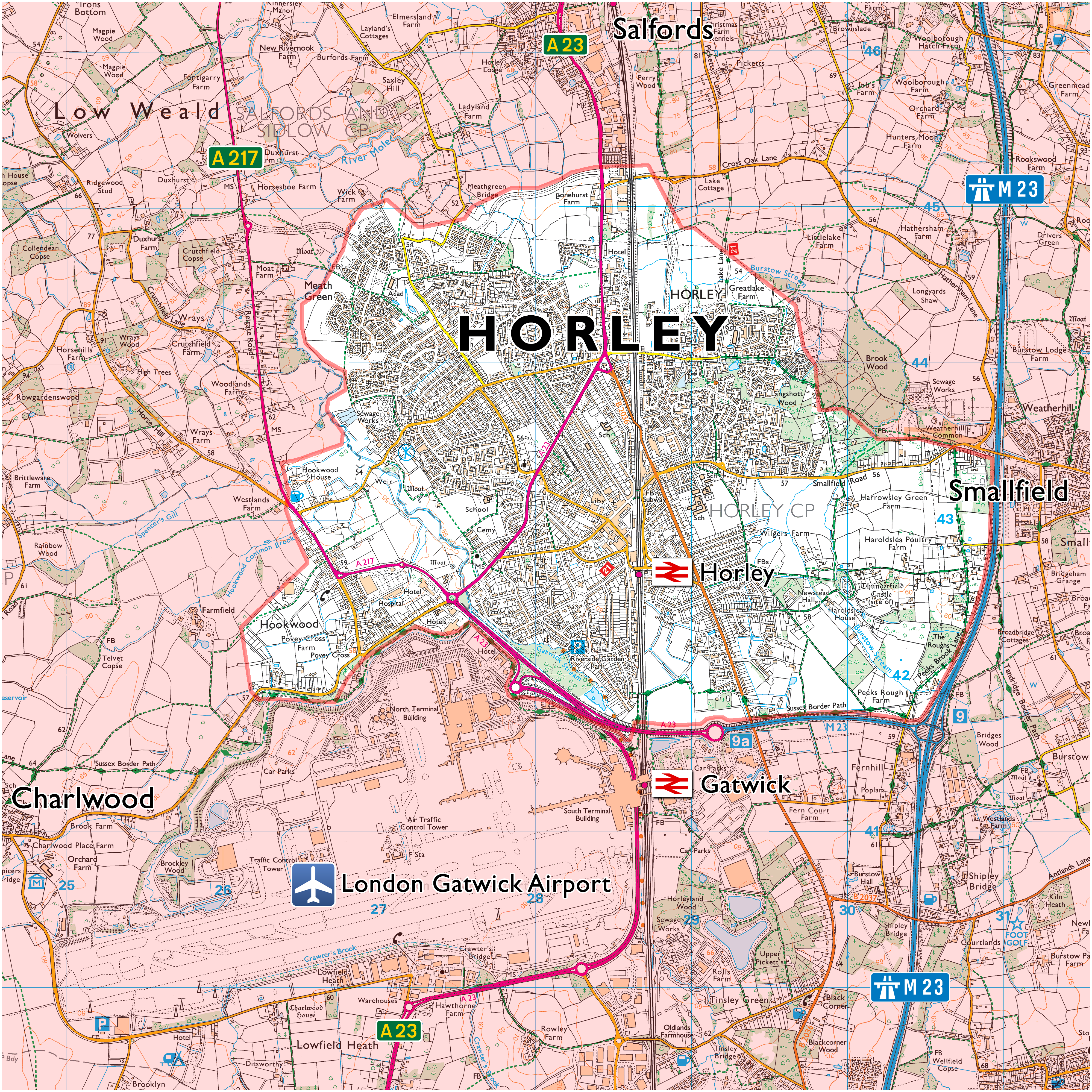
Sometimes known as the “Brighton Main Line” (and, the “South Central Main Line”), the London–Brighton line is one of the major U.K. railway lines. It links a number of central London’s major stations with Brighton, on the south coast of England.
In London, the line has two branches, one to Victoria (where it terminates) and another to London Bridge, Blackfriars, City Thameslink, Farringdon and London St Pancras International. None of the latter set of stations are now terminal ones because, you can get on a train at Horley and travel all the way through London—via St Pancras—and go as far north as Market Harborough (on the Midland Main Line) and Peterborough (on the East Coast Main Line) without needing to change trains.
Contents
The London–Brighton Line

Lions & Seagulls
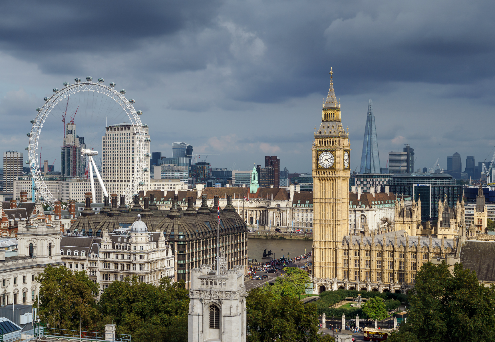
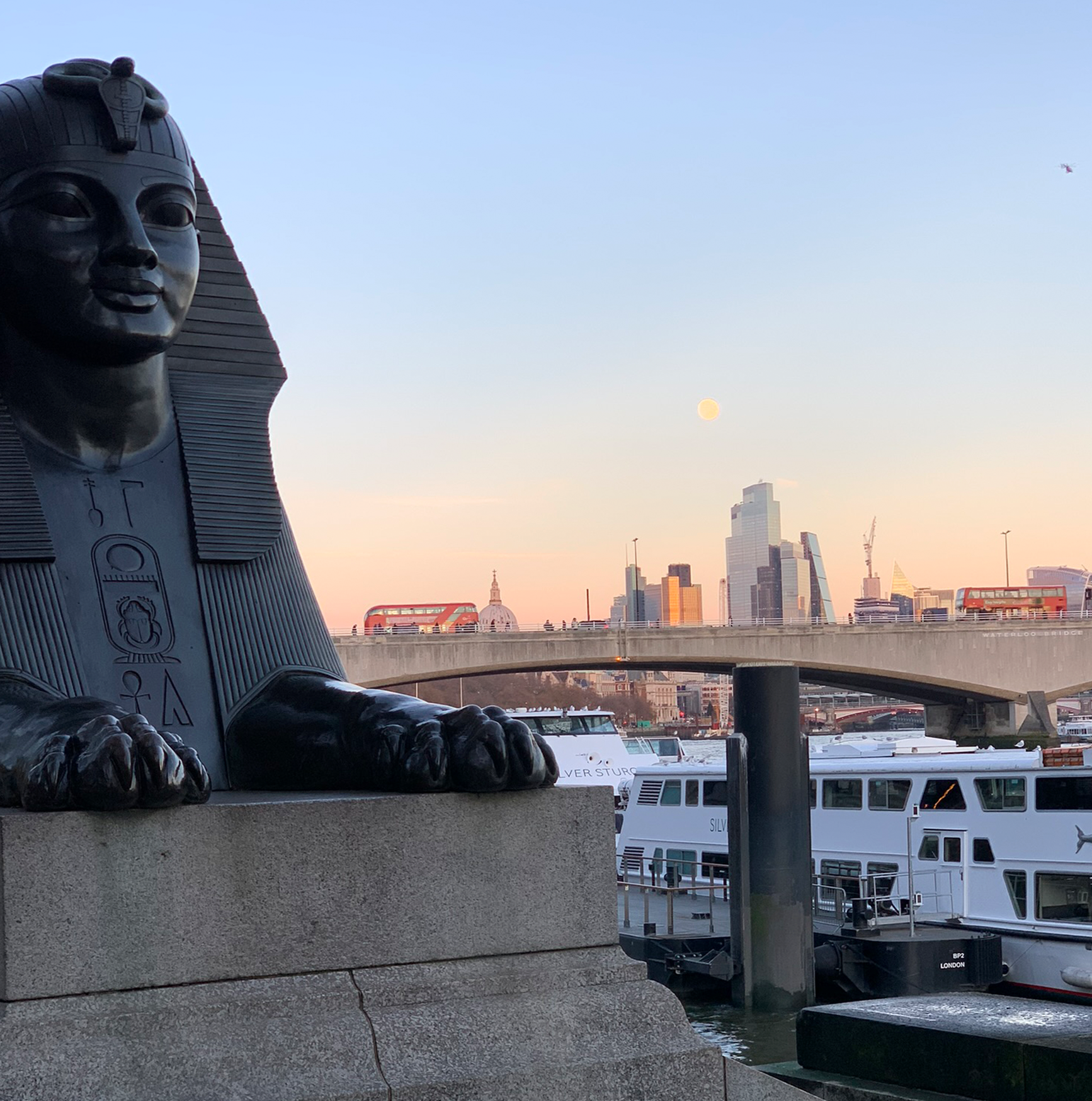
London
London, … . What is one to say? Heave on – to Euston. “London Calling,” that’ll be The Millwall.
London at dawn
London at dusk
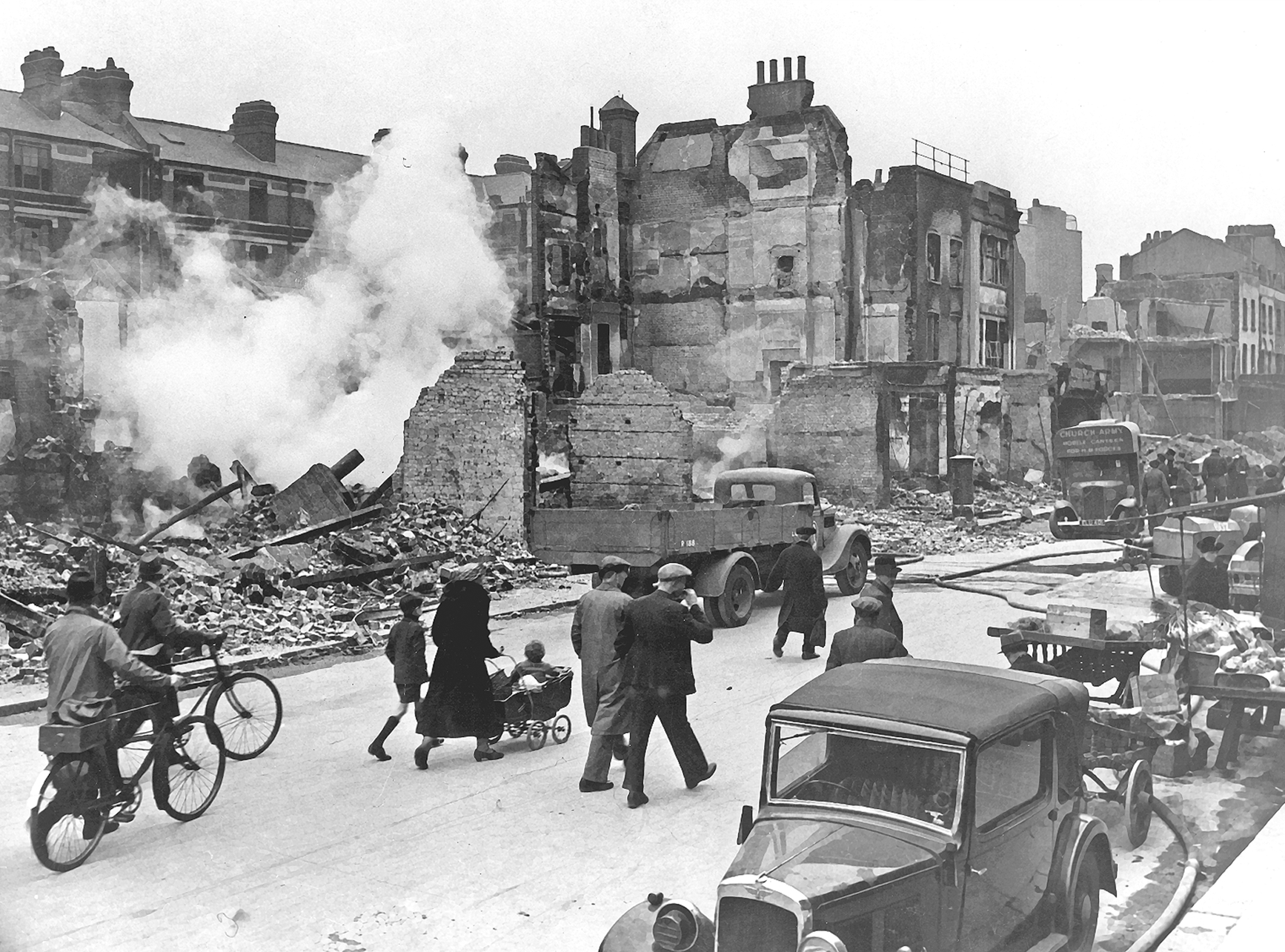
London during The Blitz
The Stations
From north to south; all of the following London stations have direct trains to Horley. The maps and station infographics, etc. are adapted from those located at the following sources:

A great deal of invaluable information, some of which is referenced here, is to be found at the following advertisement free, online encyclopedic resource:

(A.) Victoria
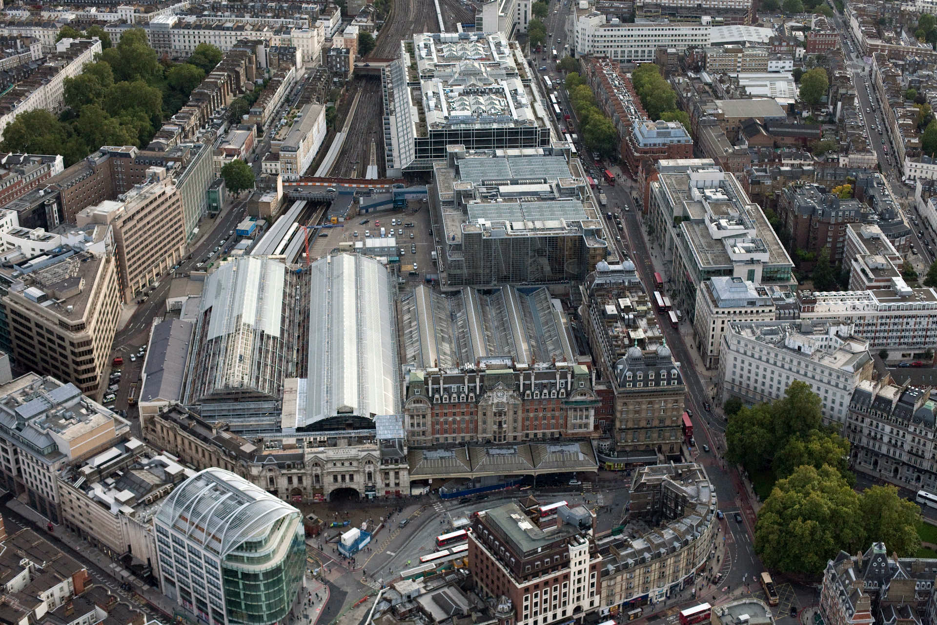
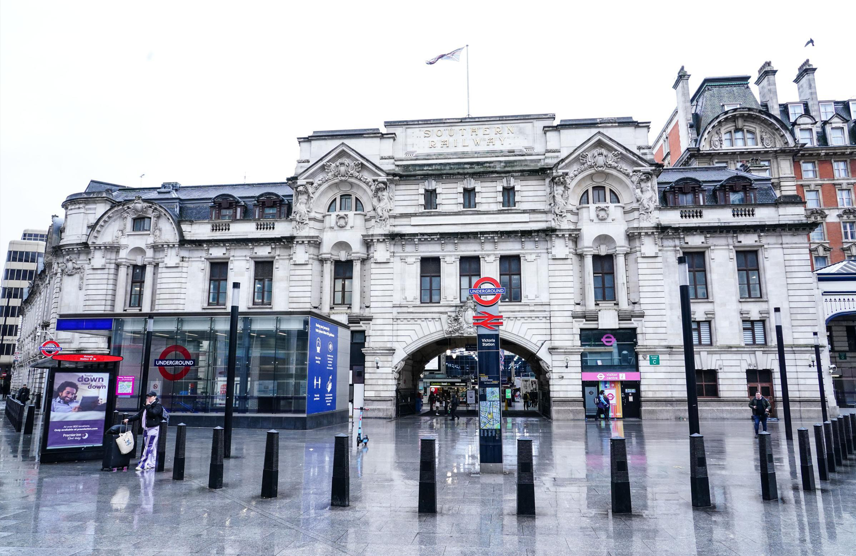
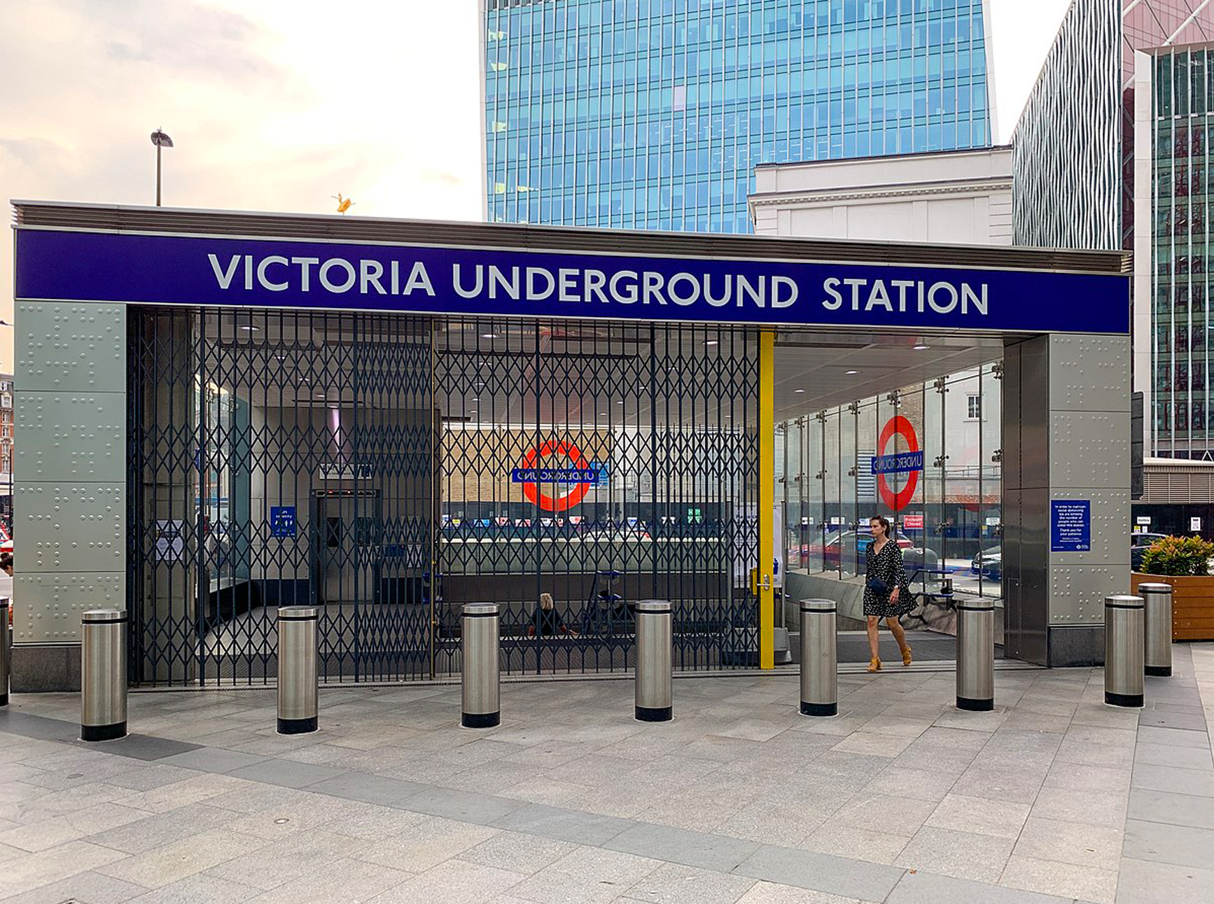
Victoria is a central London railway terminus with an Underground station of the same name in the City of Westminster. It is a terminus for the London–Brighton line and also, the Chatham Main Line that goes to Ramsgate and Dover in the county of Kent.
Station map
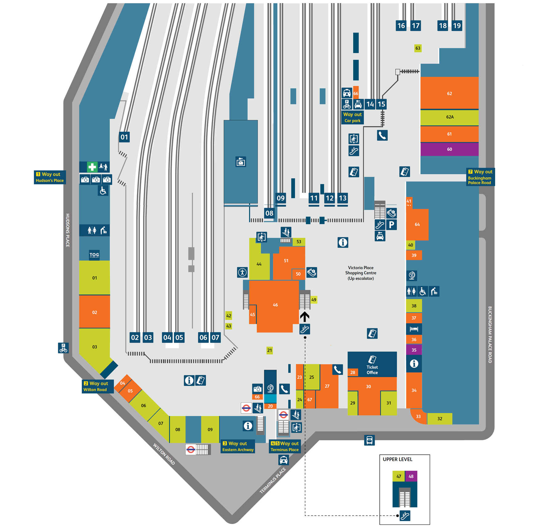

Victoria, Station Map [National Rail →]
Victoria station from above
Entrance to Victoria station
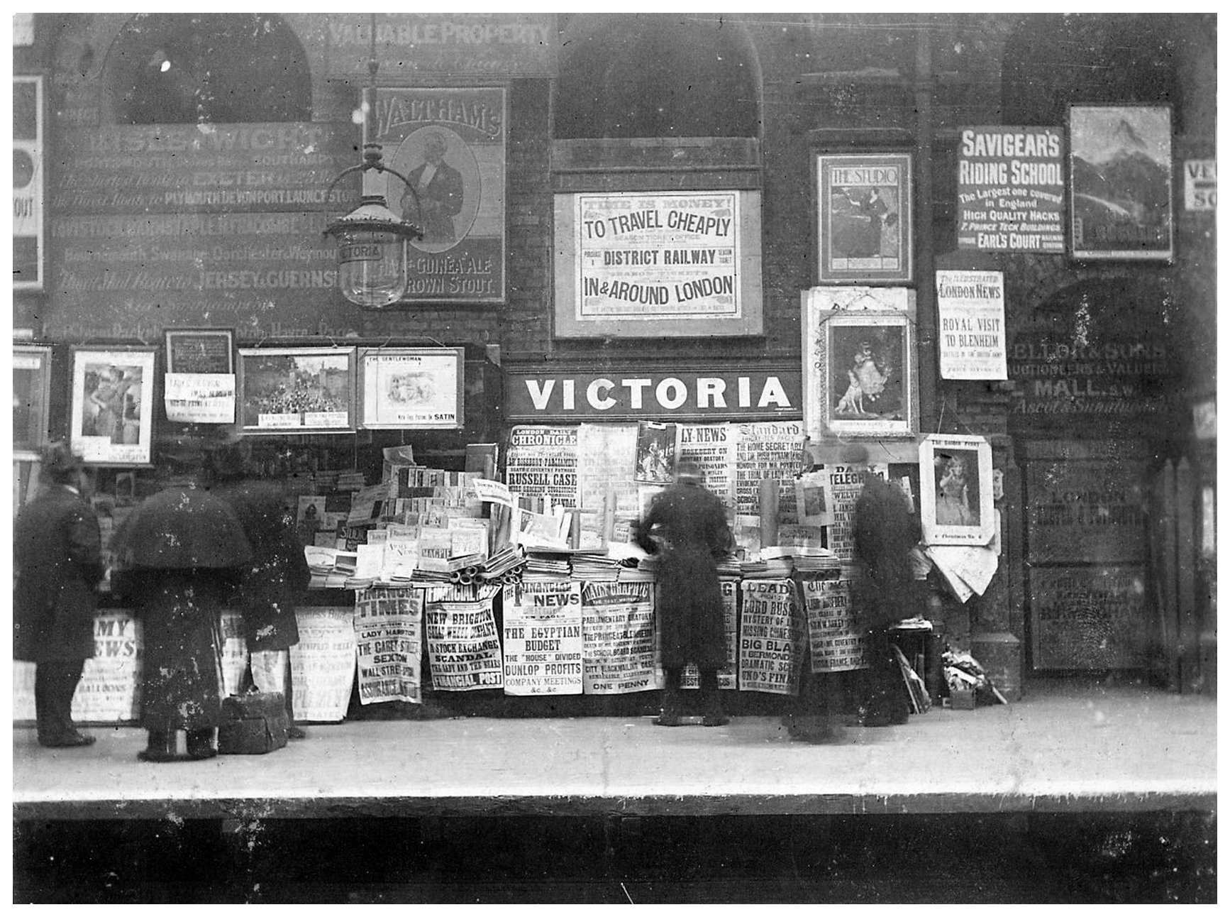
Victoria underground station, 1896
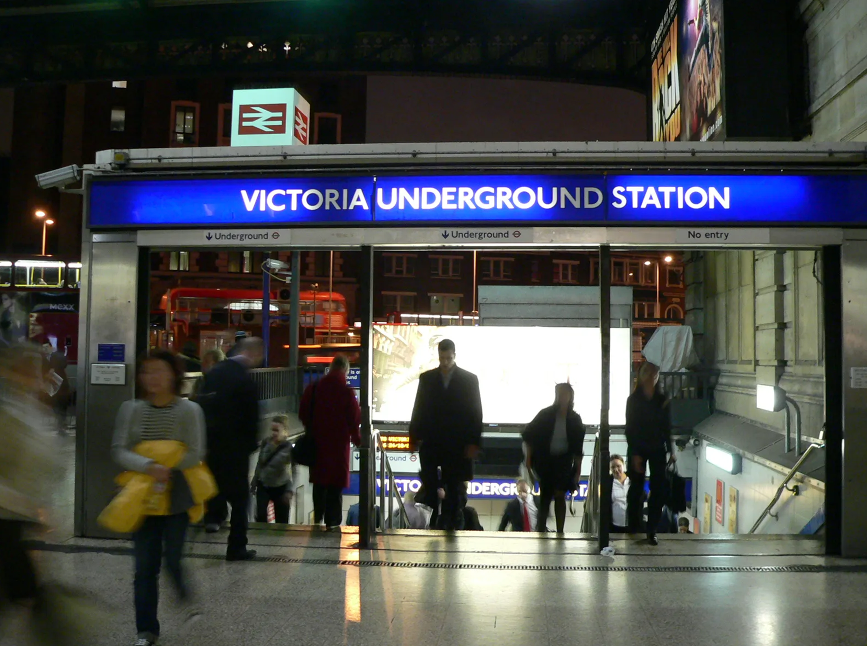
Victoria underground, during daylight
Victoria underground, at nighttime
1914: a harrowing time

See this moving photograph at full resolution →
* * *
Dover, Ramsgate (& Margate)
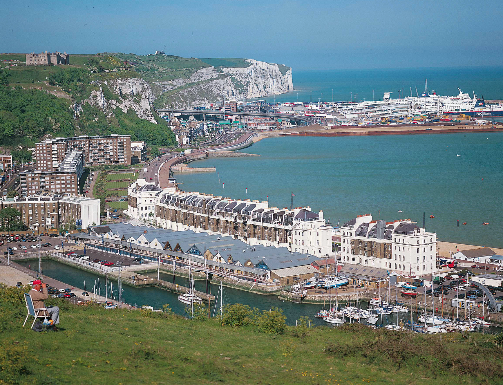
Dover and Ramsgate are destinations on the other of the main lines that terminate at London Victoria. Margate is quite separate and is famed for being the seaside town of choice for East Enders. Margate can also be reached directly from Victoria—being as it is one of the stops along the Chatham Main Line toward Ramsgate—and also from stops in east London such as Peckham.
Dover port

Observing the port
Queuing to get to the port
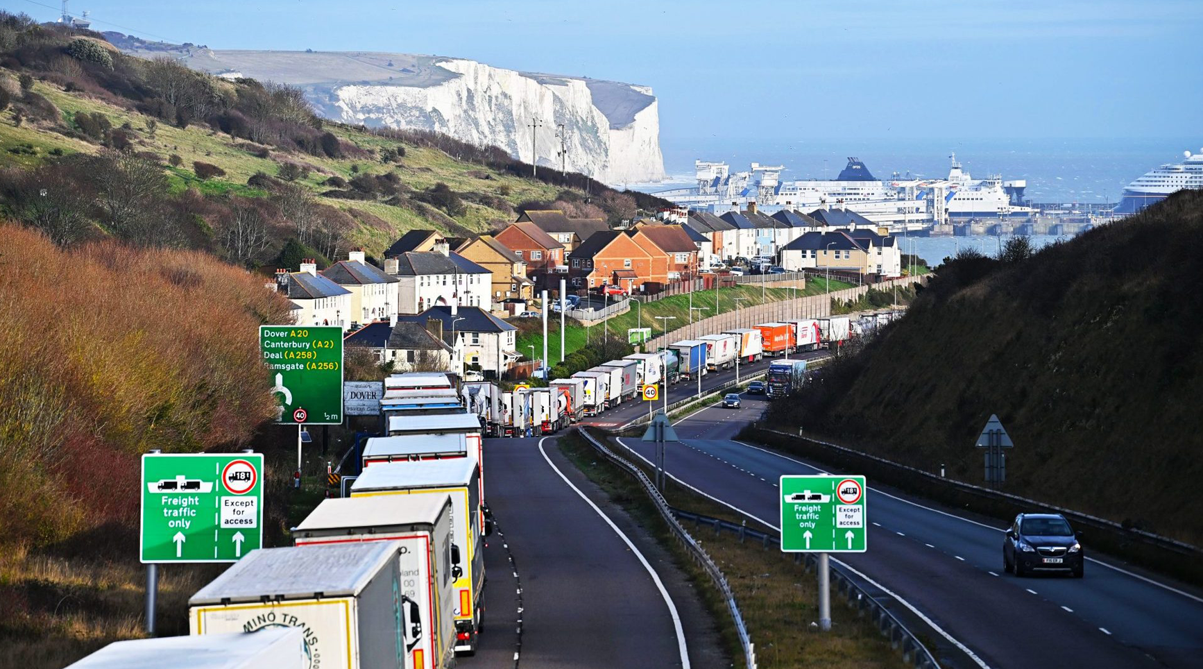
The “White Cliffs” (of Dover)

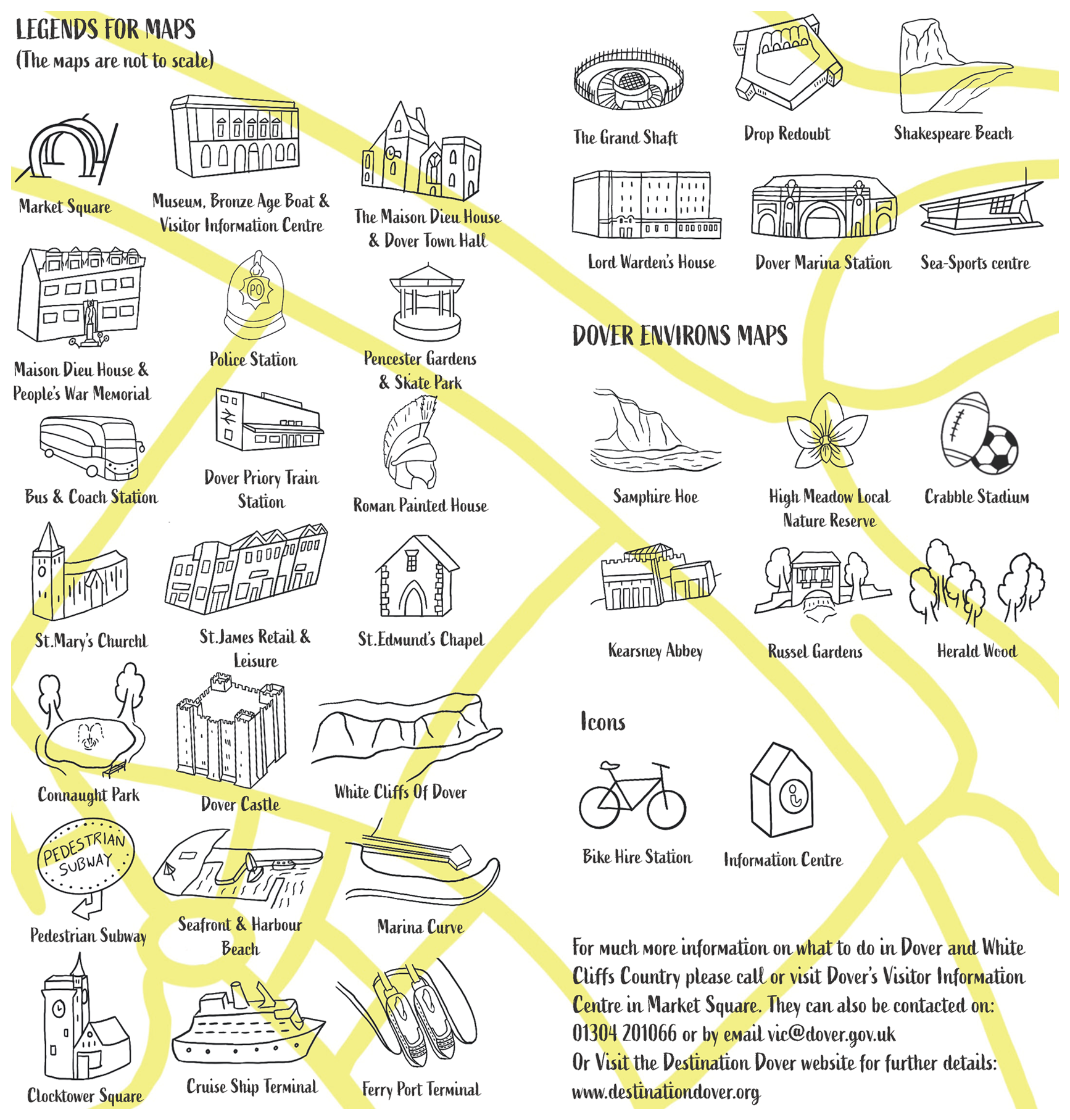
Map of Dover


Ramsgate, an aerial view (i)

Ramsgate, an aerial view (ii)
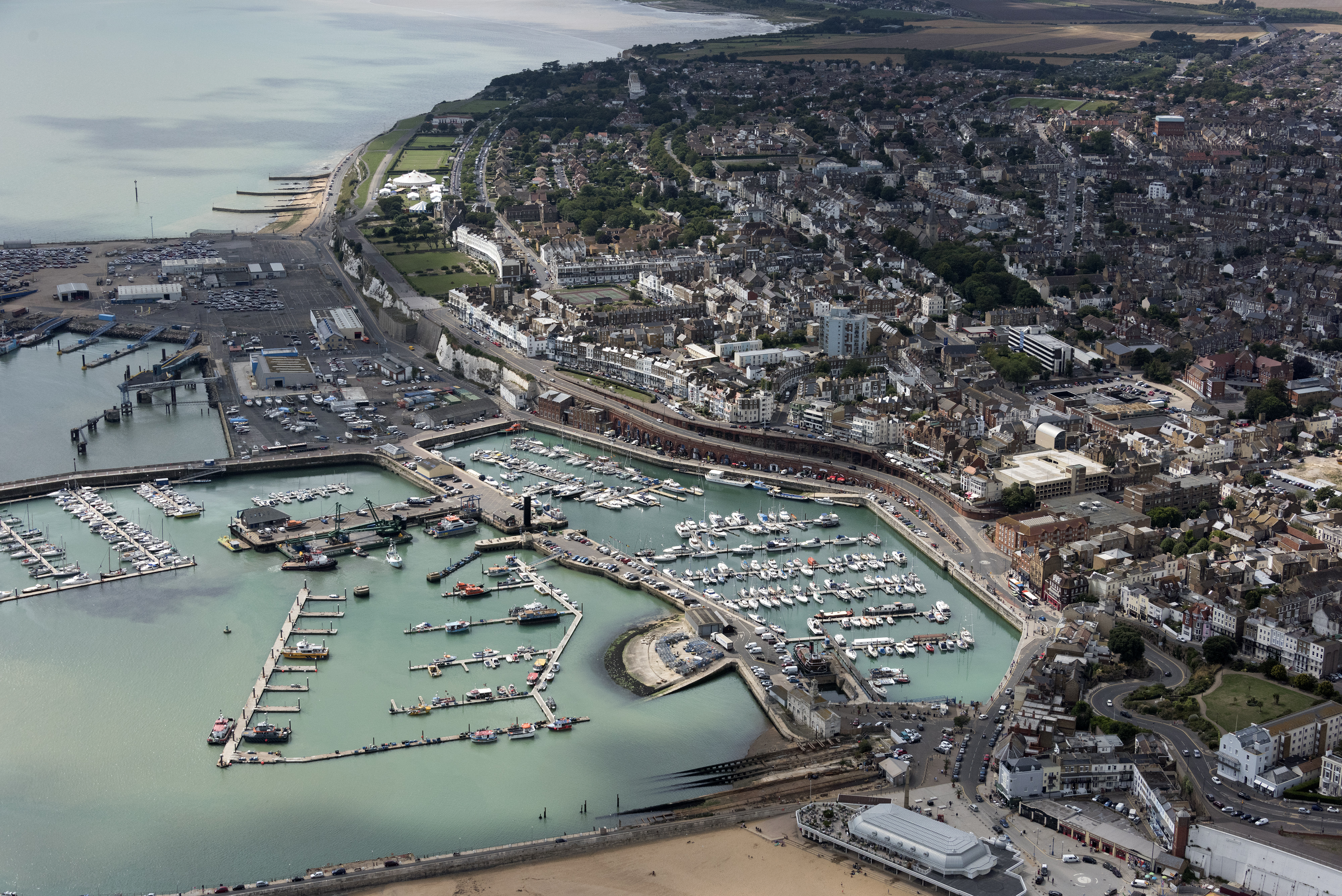
Image: 19 MB (4,000 by 2,670 pixels)
Margate snaps
Margate’s Dreamland
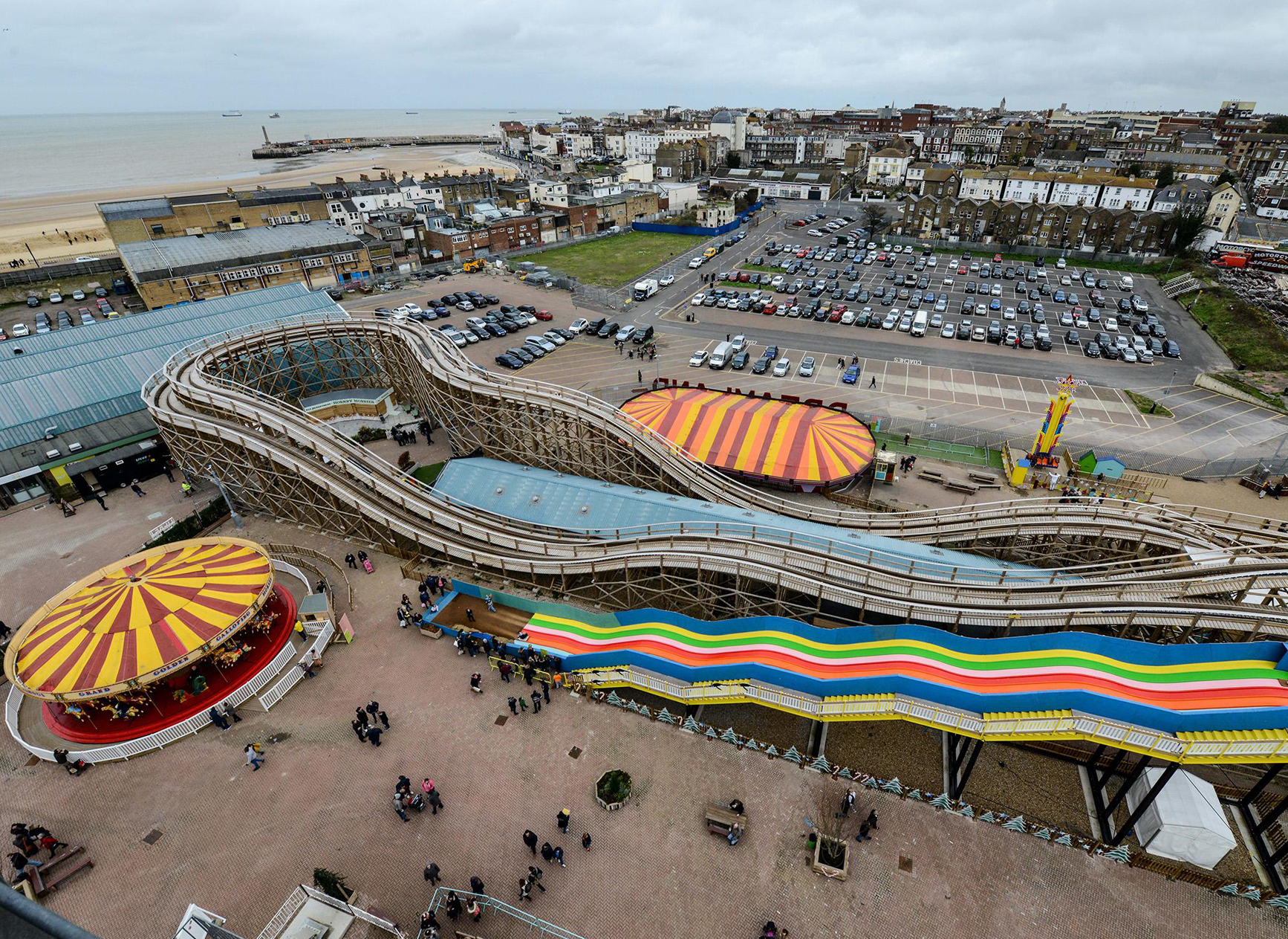
Margate, an aerial view

Image: 17 MB (3,992 by 2,992 pixels)
* * *
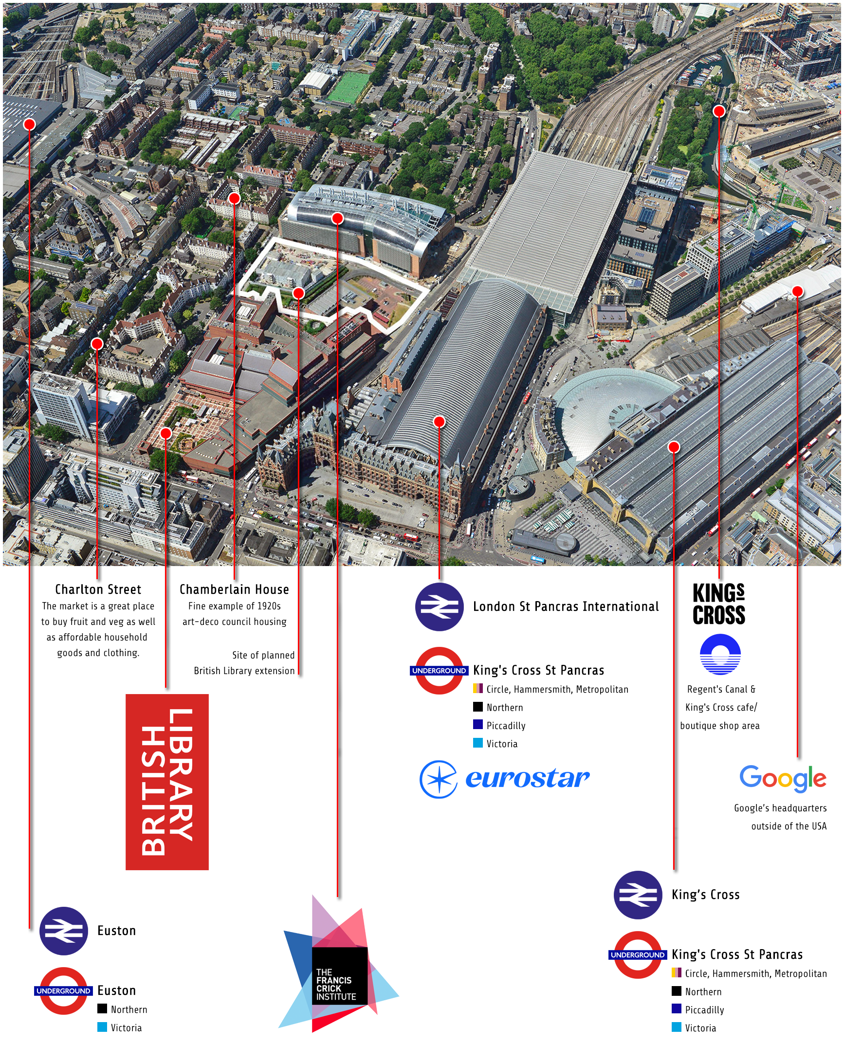
(B.) St Pancras International
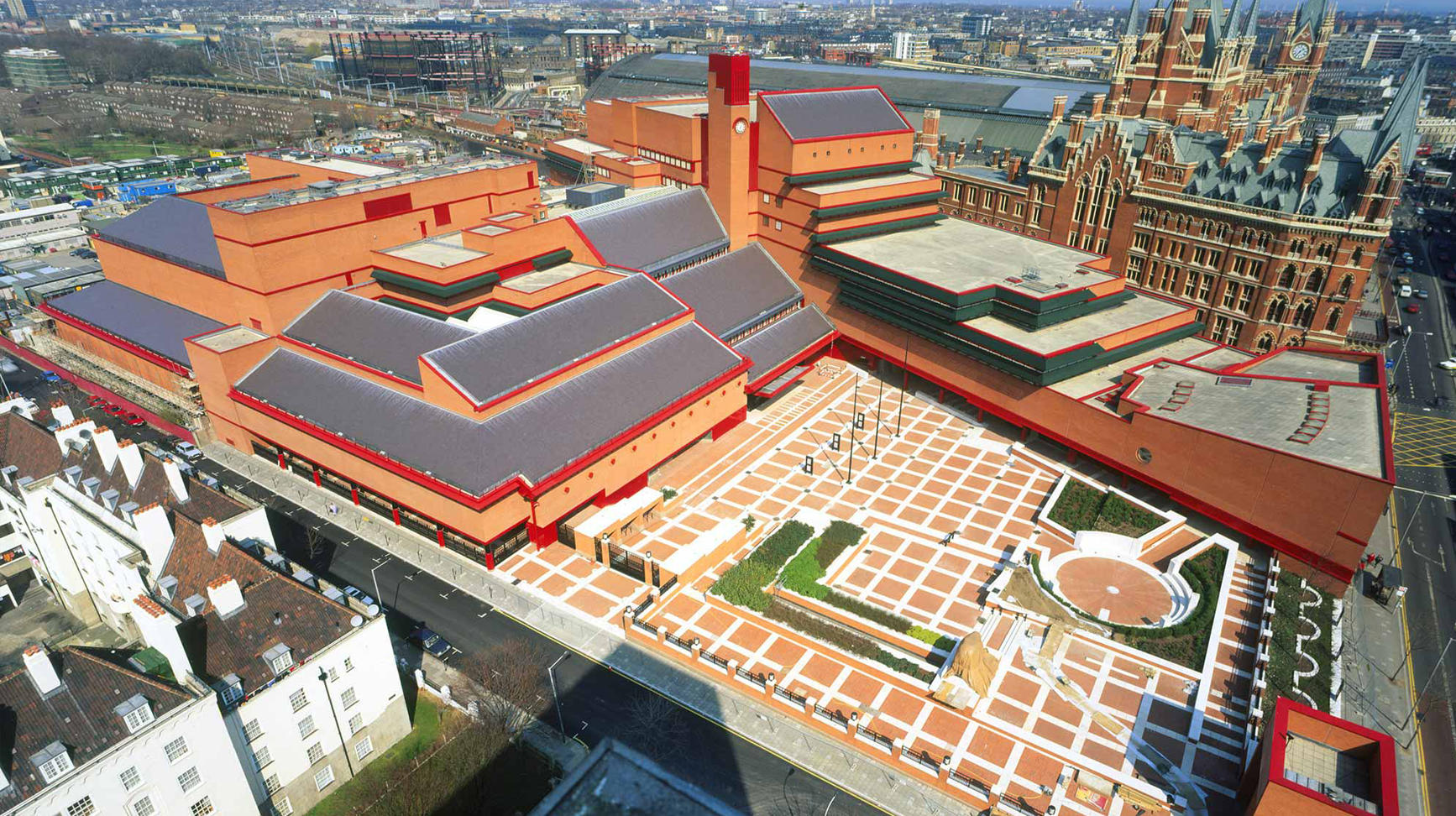
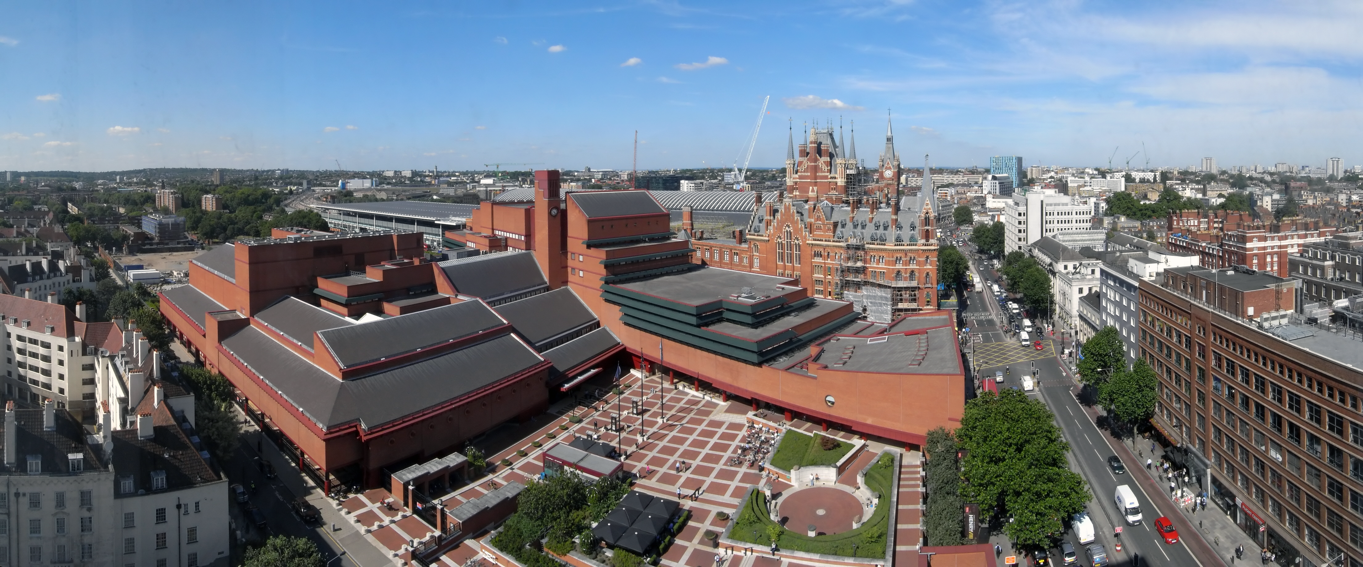
St Pancras railway station (since 2007, officially called: “London St Pancras International”) is a central London railway terminus on Euston Road in the London Borough of Camden. It is the London terminus for Eurostar services from Belgium, France and the Netherlands. It is located between the British Library, the Regent’s Canal and London King’s Cross railway station, with which it shares a London Underground station, King’s Cross St Pancras (see infographic below).
St Pancras & its surrounds
St Pancras in the 1990s
St Pancras, a bird’s-eye view
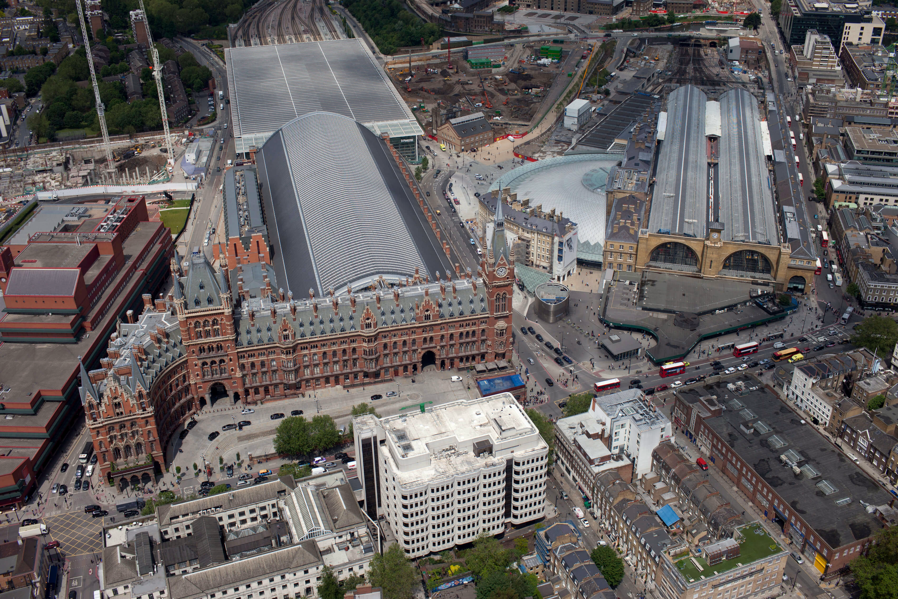
Image: 14 MB (3,780 by 2,520 pixels)
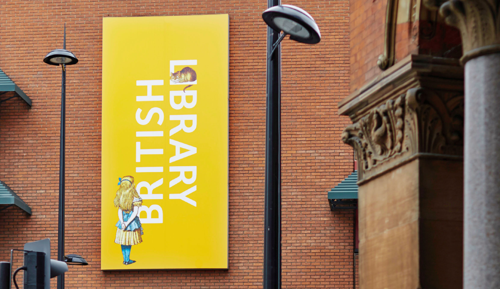
The British Library (in doctored red)
The British Library, in wide-angle
The British Library (with red, less audacious)

The British Library’s iconic entrance gates

The British Library (home of reason)
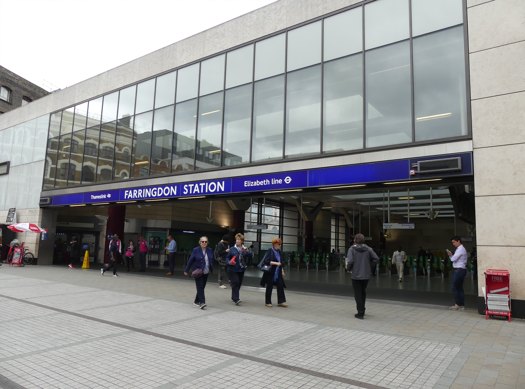
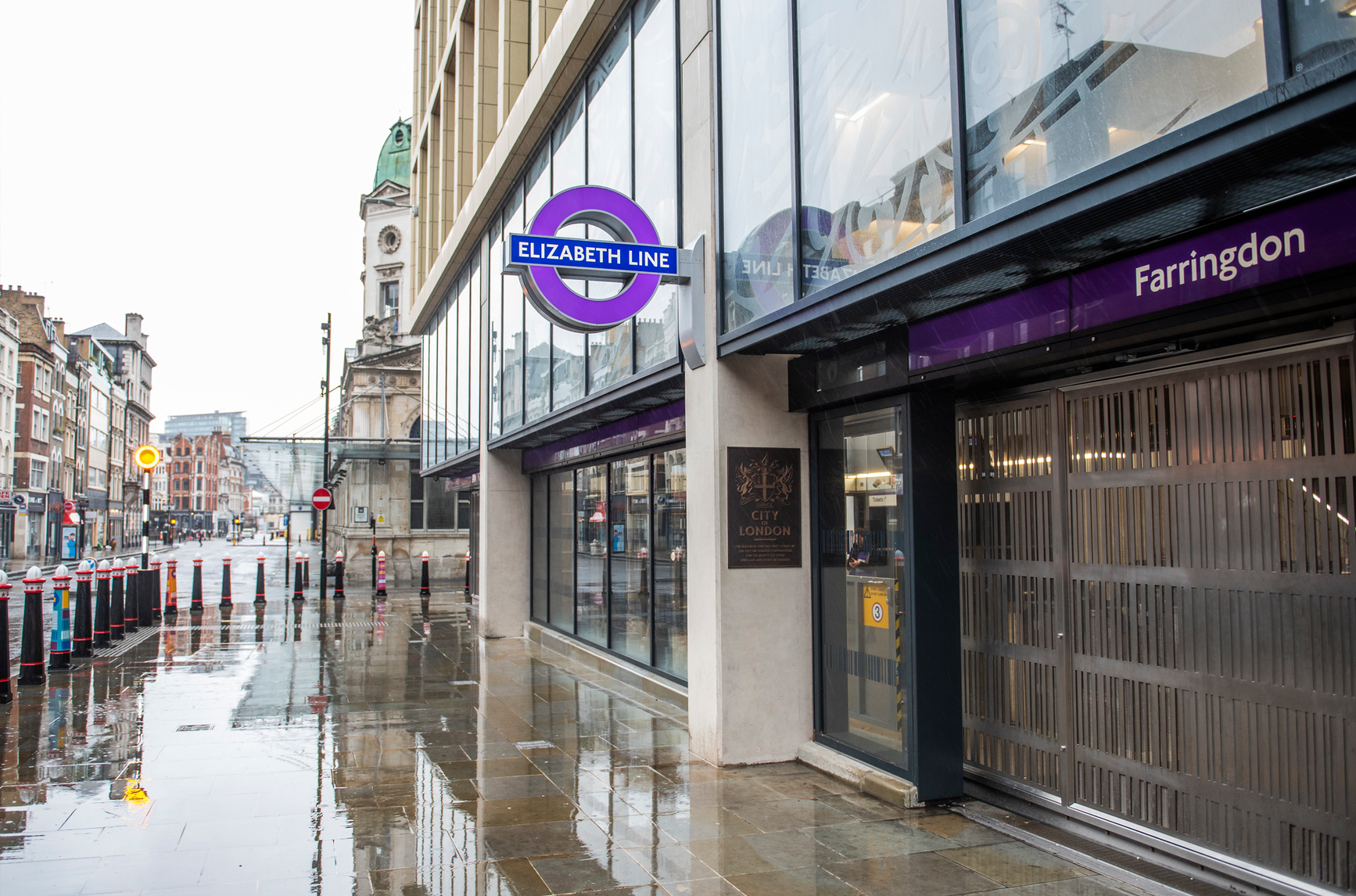
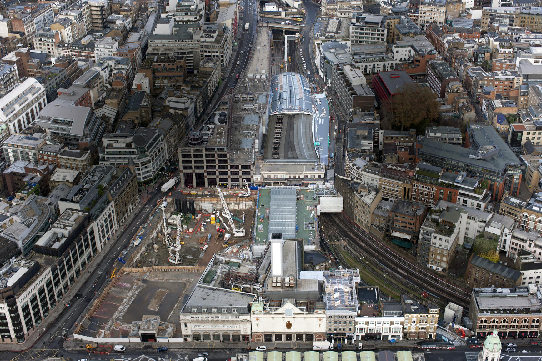
(B.1.) Farringdon
Farringdon is a London Underground and connected main line National Rail station in Clerkenwell, in the London Borough of Islington, just outside the boundary of the City of London. Opened in 1863 as the terminus of the Metropolitan Railway, the world’s first underground passenger railway, Farringdon is one of the oldest surviving underground railway stations in the world.
Farringdon station (01)
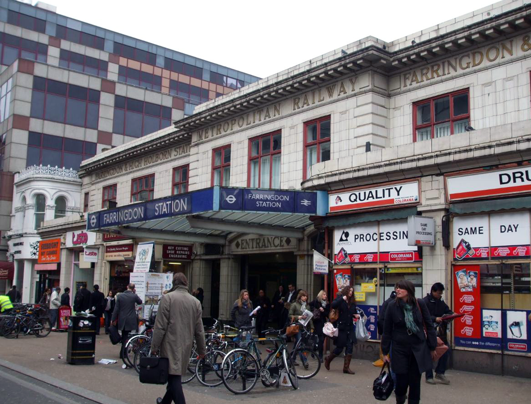
Farringdon station (02)

Farringdon station (03)
Farringdon station (04)

Farringdon station (05)
Farringdon station from above
Farringdon tube station

Farringdon links to The Barbican

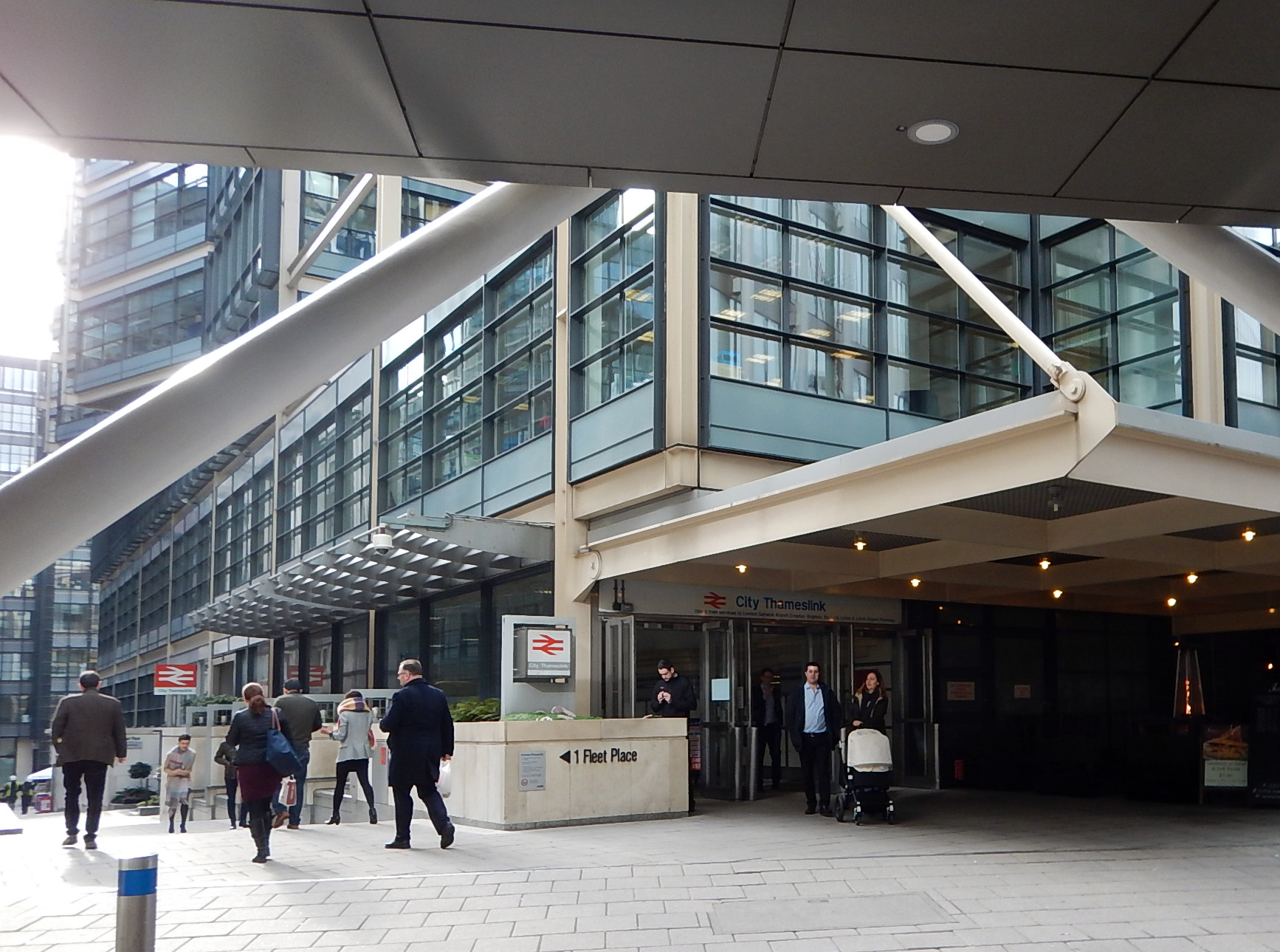
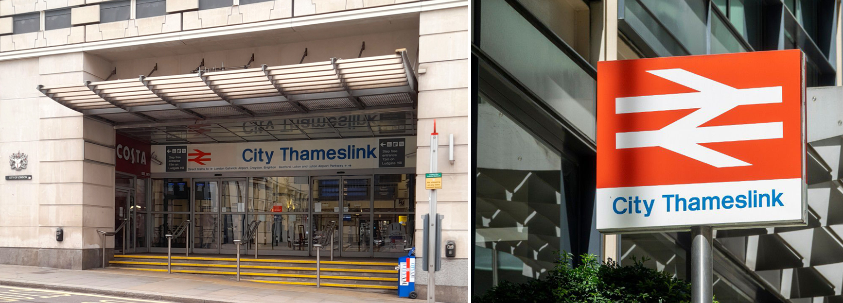
(B.2.) City Thameslink
City Thameslink is a central London railway station within the City of London, (a.k.a.—also known as—”The Square Mile”) with entrances on Ludgate Hill and Holborn Viaduct. The City, contains London’s ancient centre and today, constitutes (alongside Canary Wharf) the primary central business district of London and one of the leading financial centres of the world.
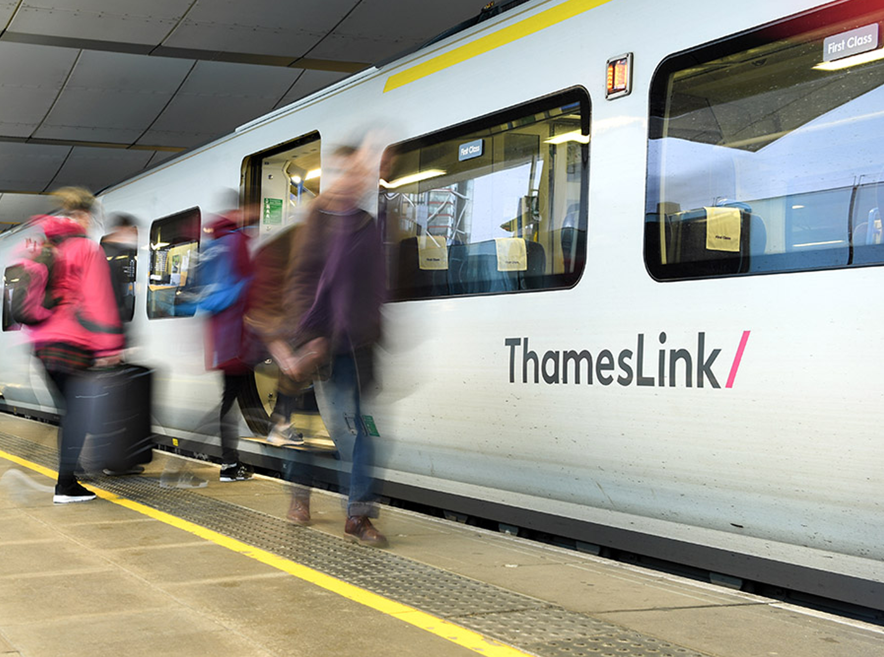
Thameslink train (01)

City Thameslink station (01)
The Bank of England

* * *
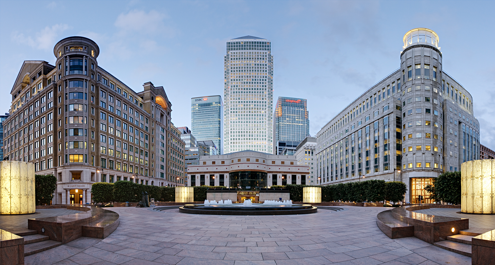
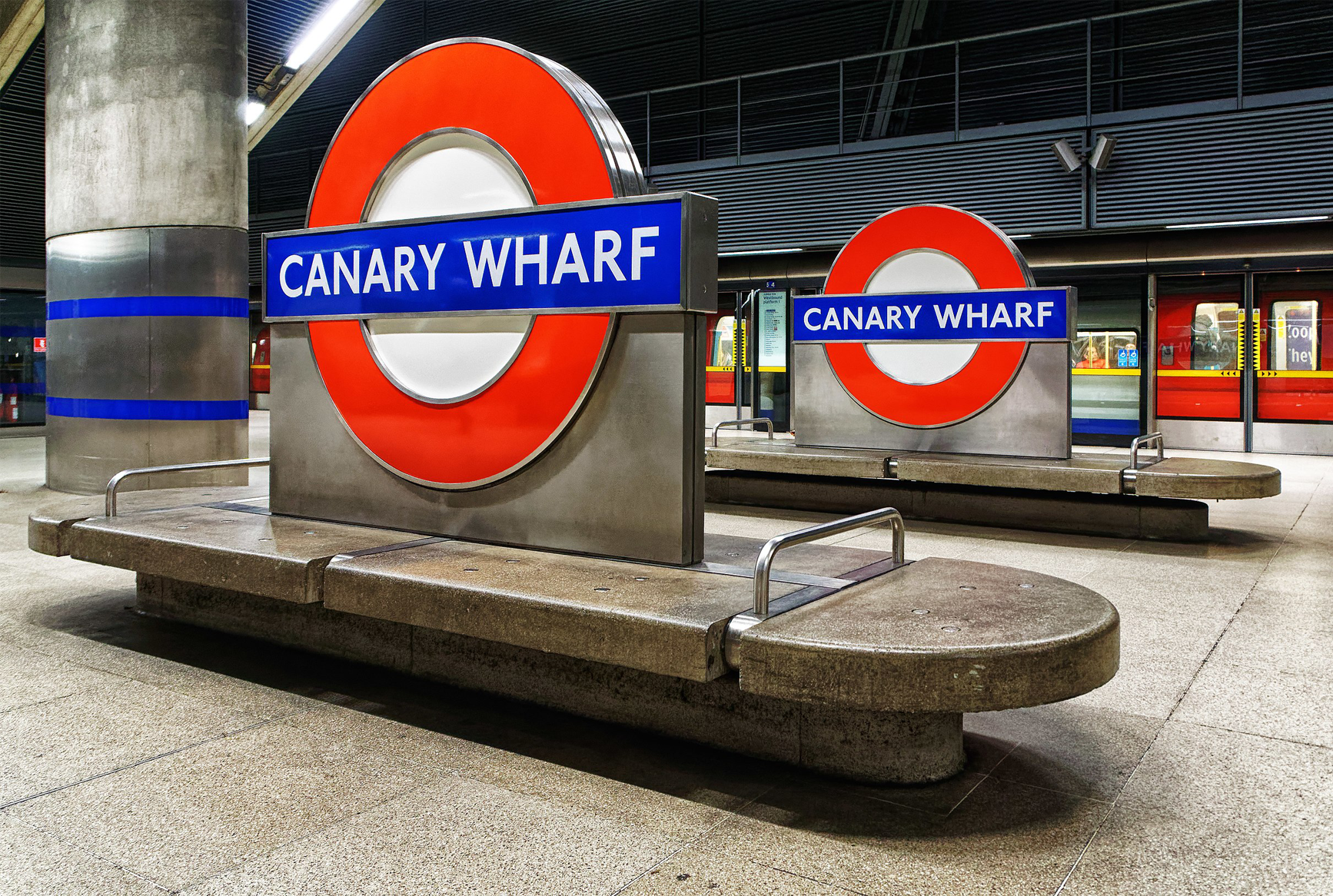
Canary Wharf
Canary Wharf is located near the Isle of Dogs on the site of the former West India Docks. Canary Wharf is today—alongside the City of London—constitutes one of the main financial centres in the UK and indeed, the world. It contains over a dozen iconic skyscrapers. It was developed on the site of the former West India Docks and, including its public open spaces is around 97 acres in area2.
Some of the iconic buildings
* * *
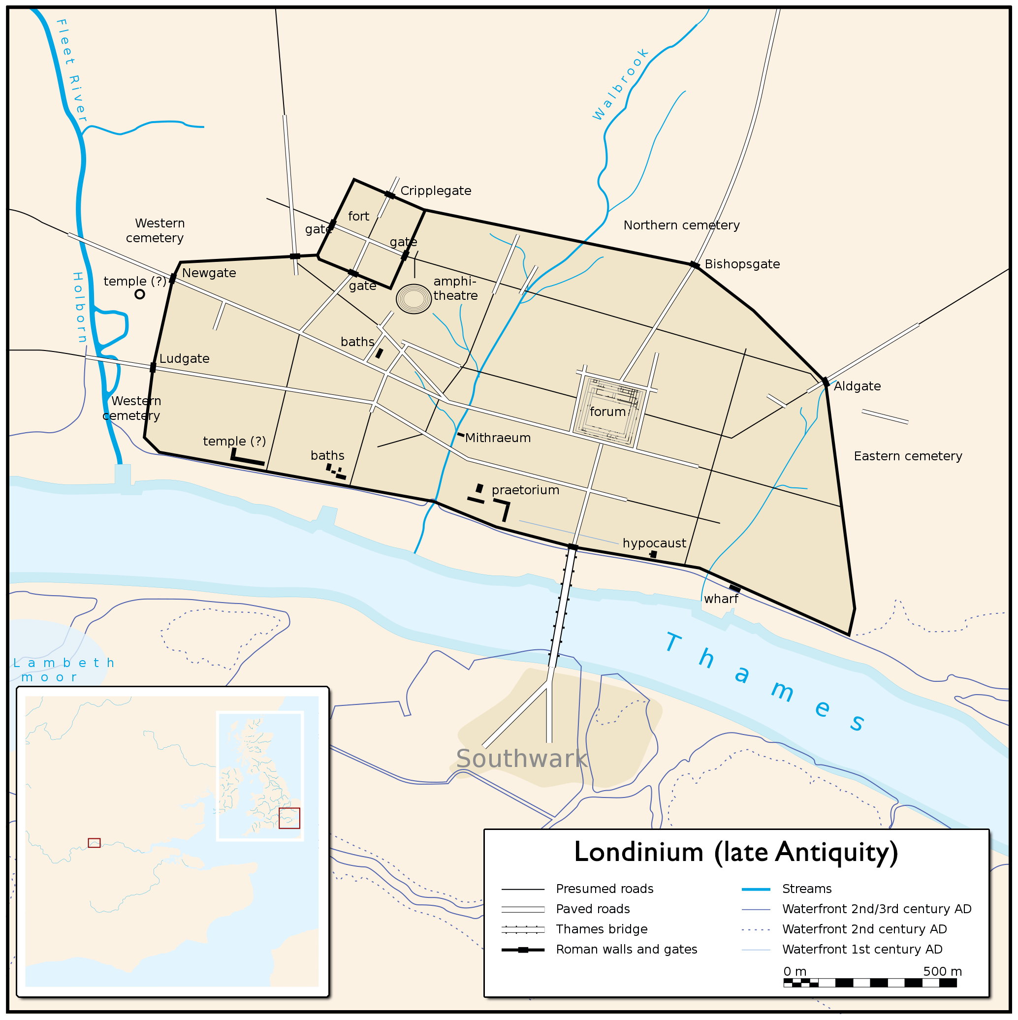
The City is where the Romans basically started it all when founding their main British Isles logistics base in what was but a tidal hamlet. They named it Londinium. And, it is here, at this juncture upon the River Thames, listlessly, the tale of the journey into The Heart of Darkness was told: “And this also,” began Marlow as if suddenly jolted from the depths of troubled musing, “has been one of the dark places of the earth” (Conrad conjure’s in our mind’s eye a Roman Centurion sailing quietly up the Thames and, in his eyes seeing little other than savagery).
Londinium
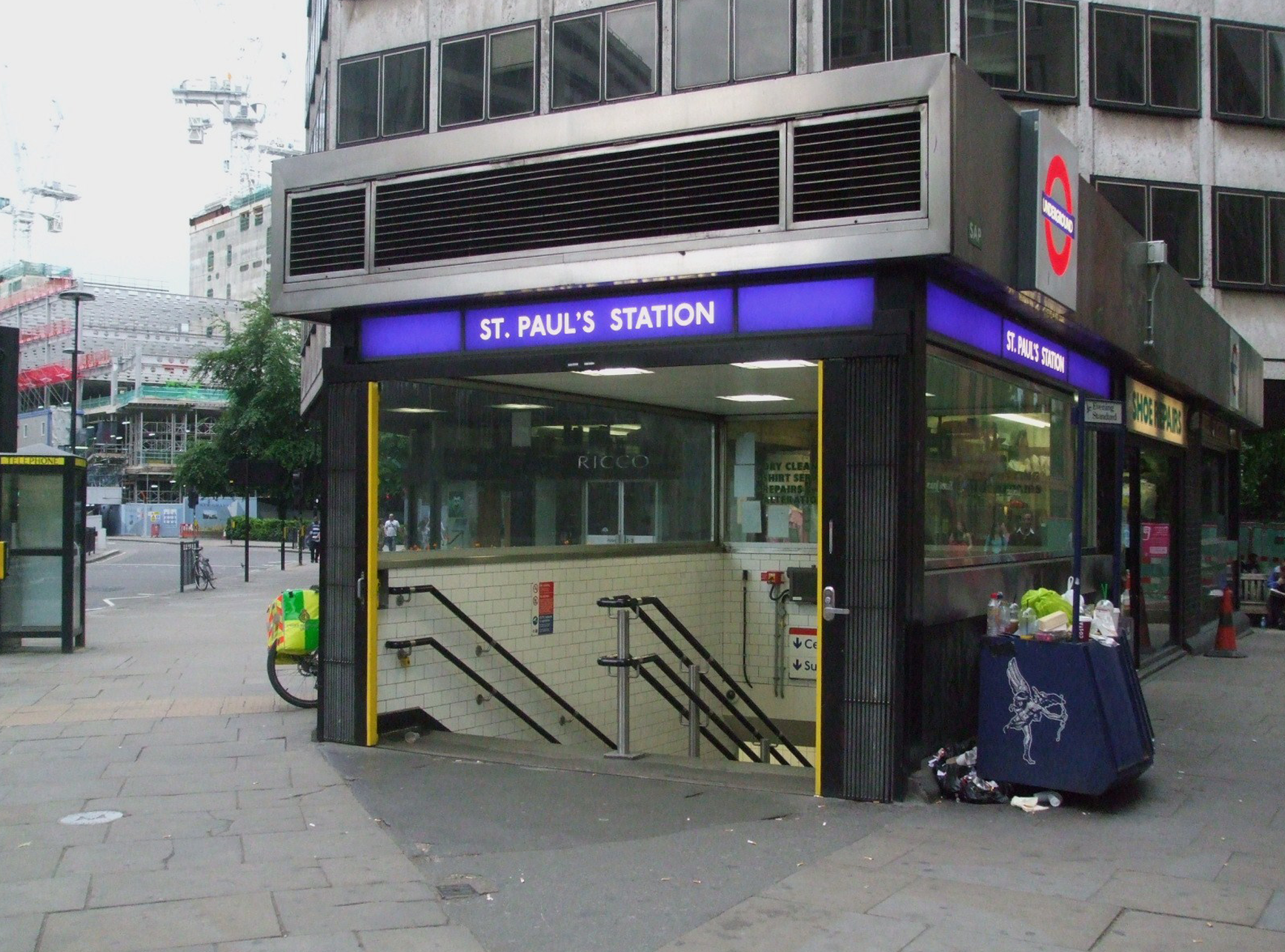
City Thameslink station is on the Thameslink route between Blackfriars to the south and Farringdon to the north. The station opened in 1990 to replace Holborn Viaduct railway station. It was part of the Thameslink project that re-opened the Snow Hill Tunnel to provide a continuous north–south route across London (enabling Horley residents to board a train and remain on it, traversing London below ground and over river, until reaching Market Harborough and Peterborough; junction stations well to the north of the capital).
Originally named “St. Paul’s Thameslink,” it was renamed City Thameslink the following year to avoid confusion with the nearby St Paul’s tube station on the Central line.
St. Paul’s tube station
City Thameslink was refurbished in 2010–2011 to increase capacity. A major overhaul of the timetable occurred in 2018 following the introduction of automatic signalling.
Thameslink train (02)
City Thameslink station (02)
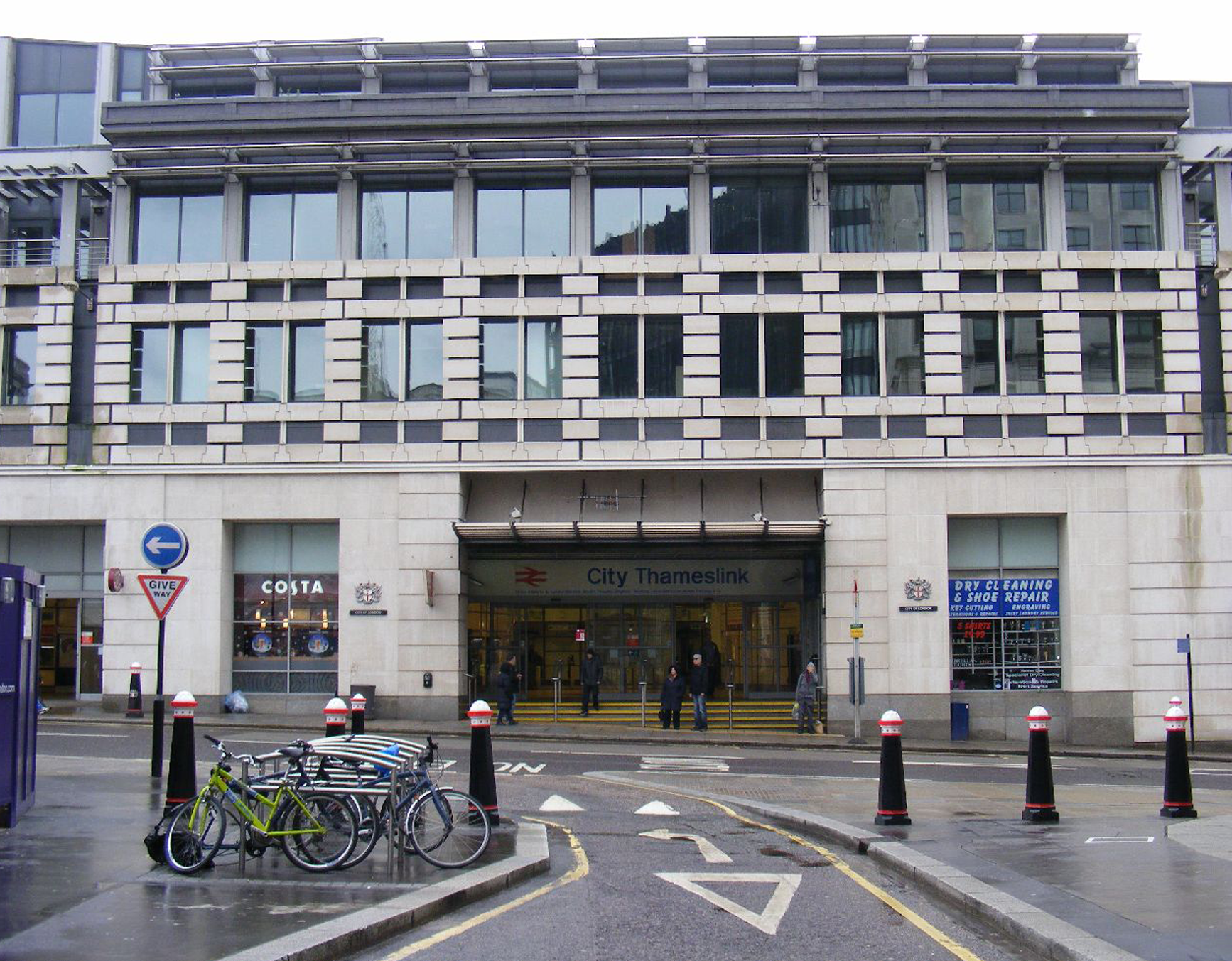
City Thameslink station (03)
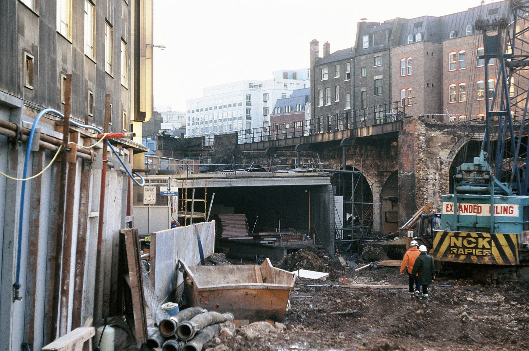
Building City Thameslink (c. 1990)
A former City Thameslink station entrance

City Thameslink route map
All Pride; No Prejudice
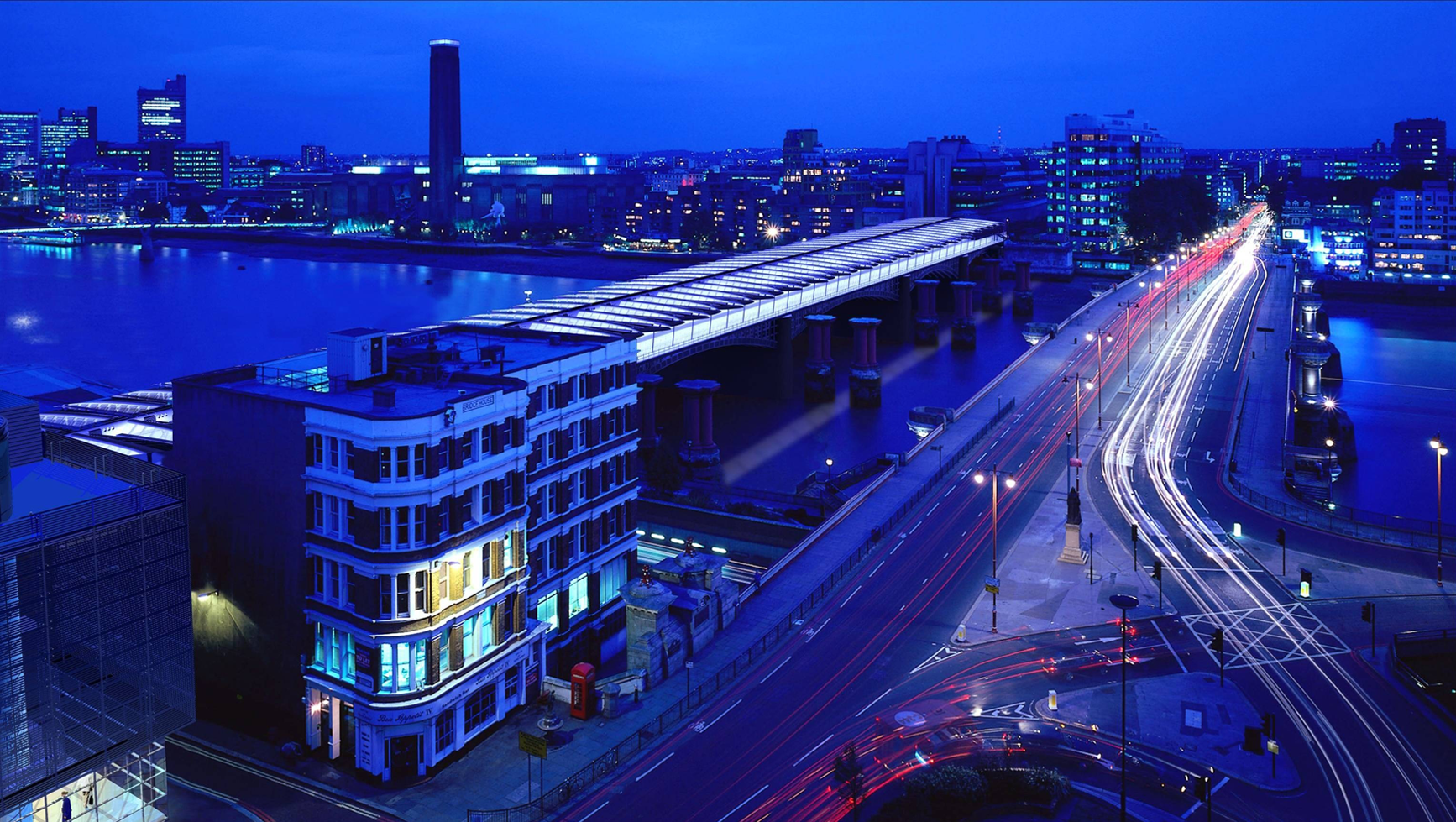
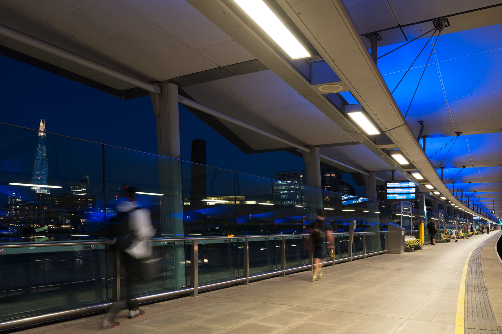
(B.3.) Blackfriars
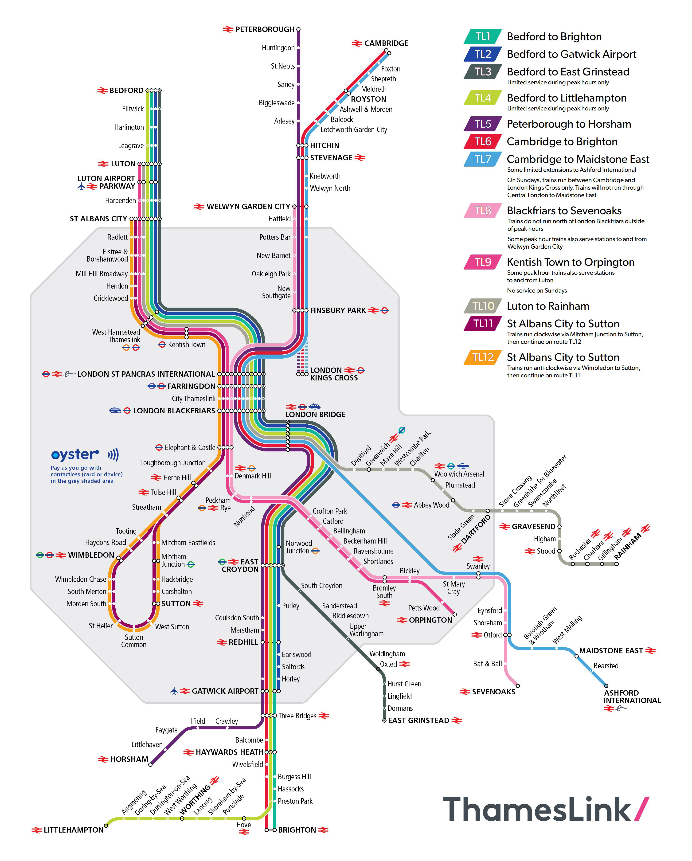
Blackfriars (a.k.a.—also known as—”London Blackfriars”) is connected to the London Underground and the City of London. It provides Thameslink train services to stations in London and ones as far north as Cambridge and as far south as Brighton.
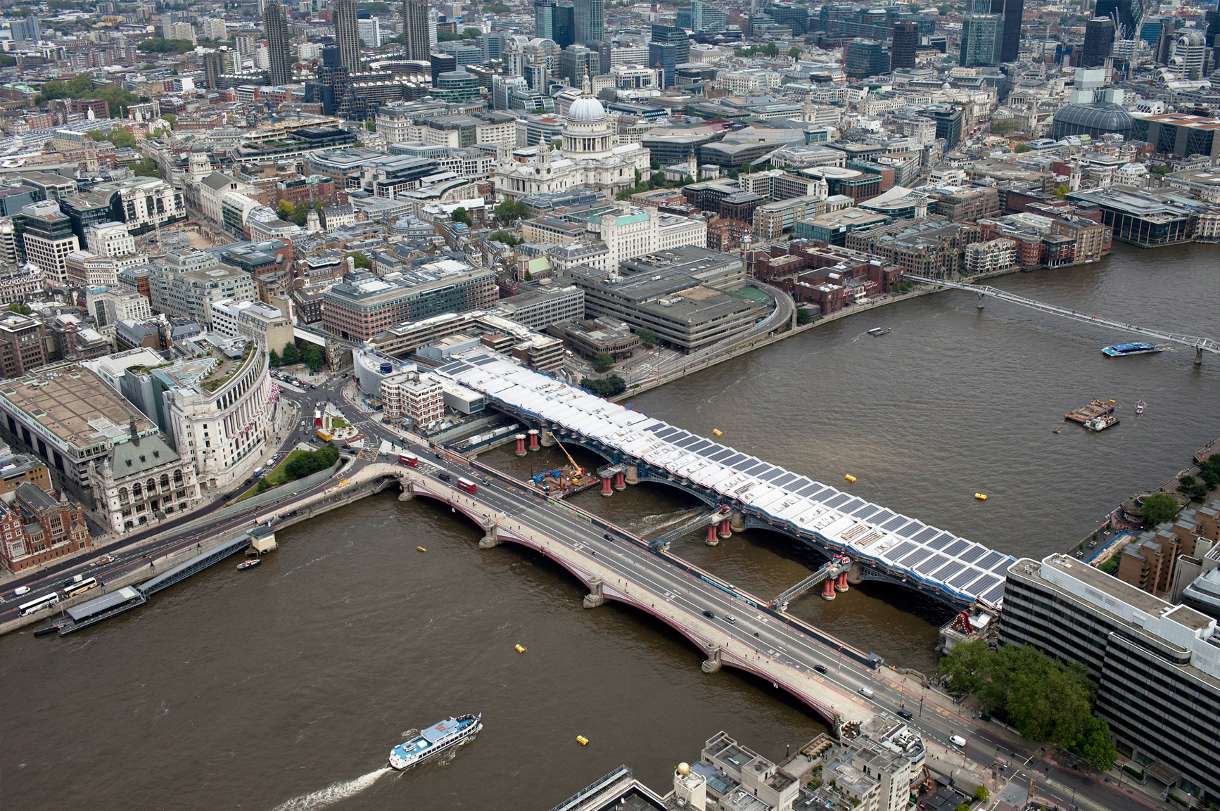
Blackfriars: a station with The Thames below it
Blackfriars station, infographic
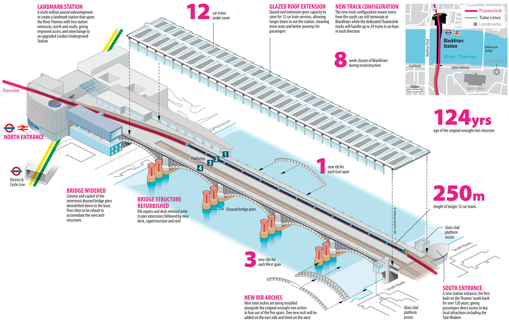
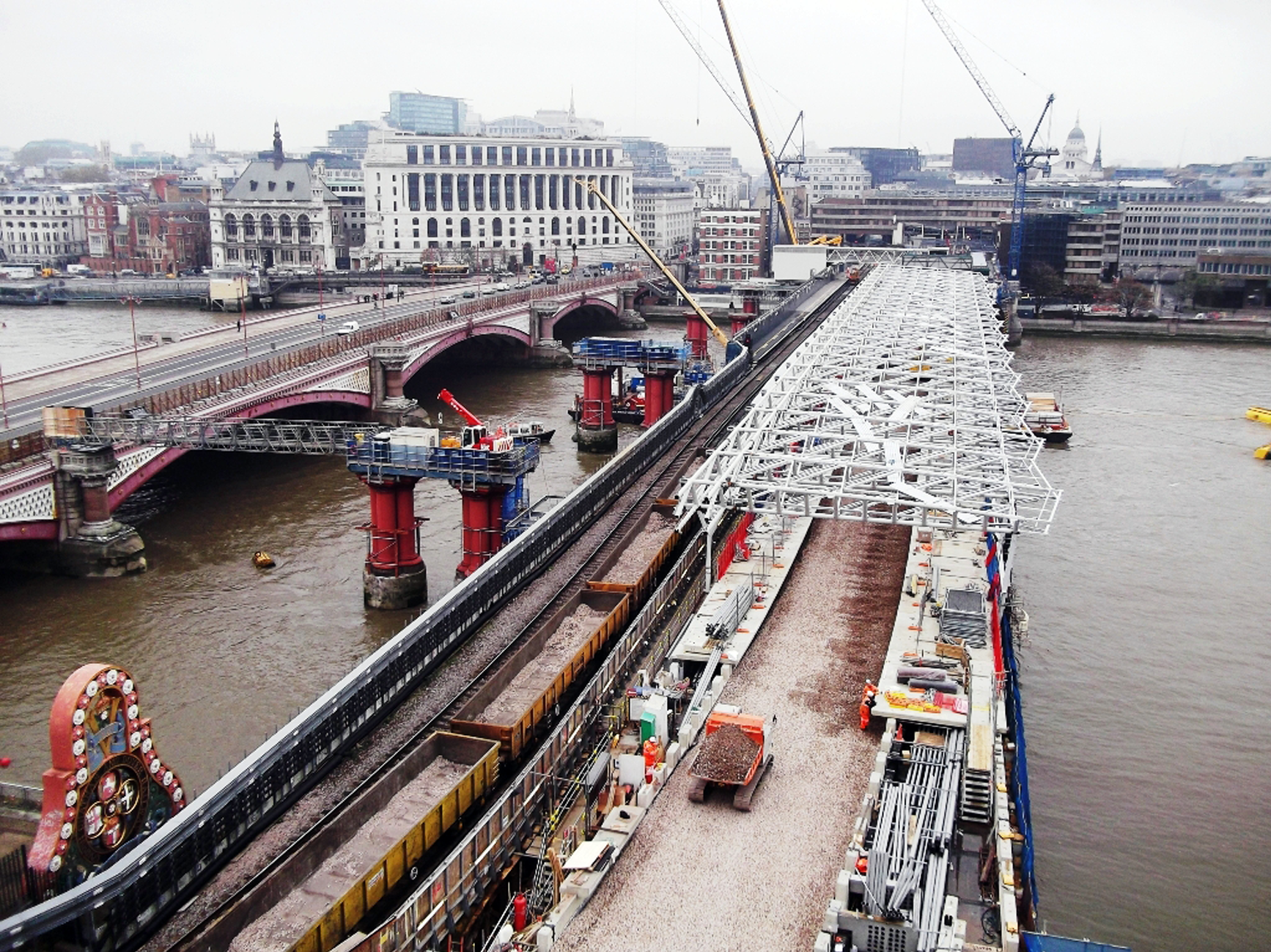
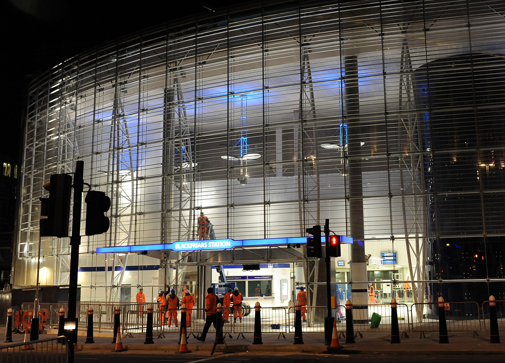
Blackfriars station, under renovation
A station beside and above The Thames

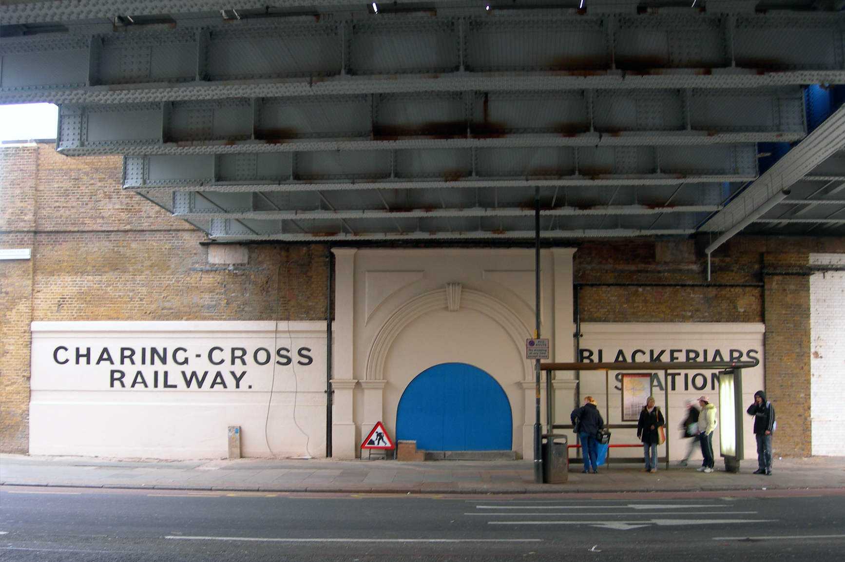
Blackfriars: under the arches
Blackfriars station (revamp)
Blackfriars

Northern entrance to Blackfriars station
Blackfriars station; an artist’s impression
Platforms above The Thames
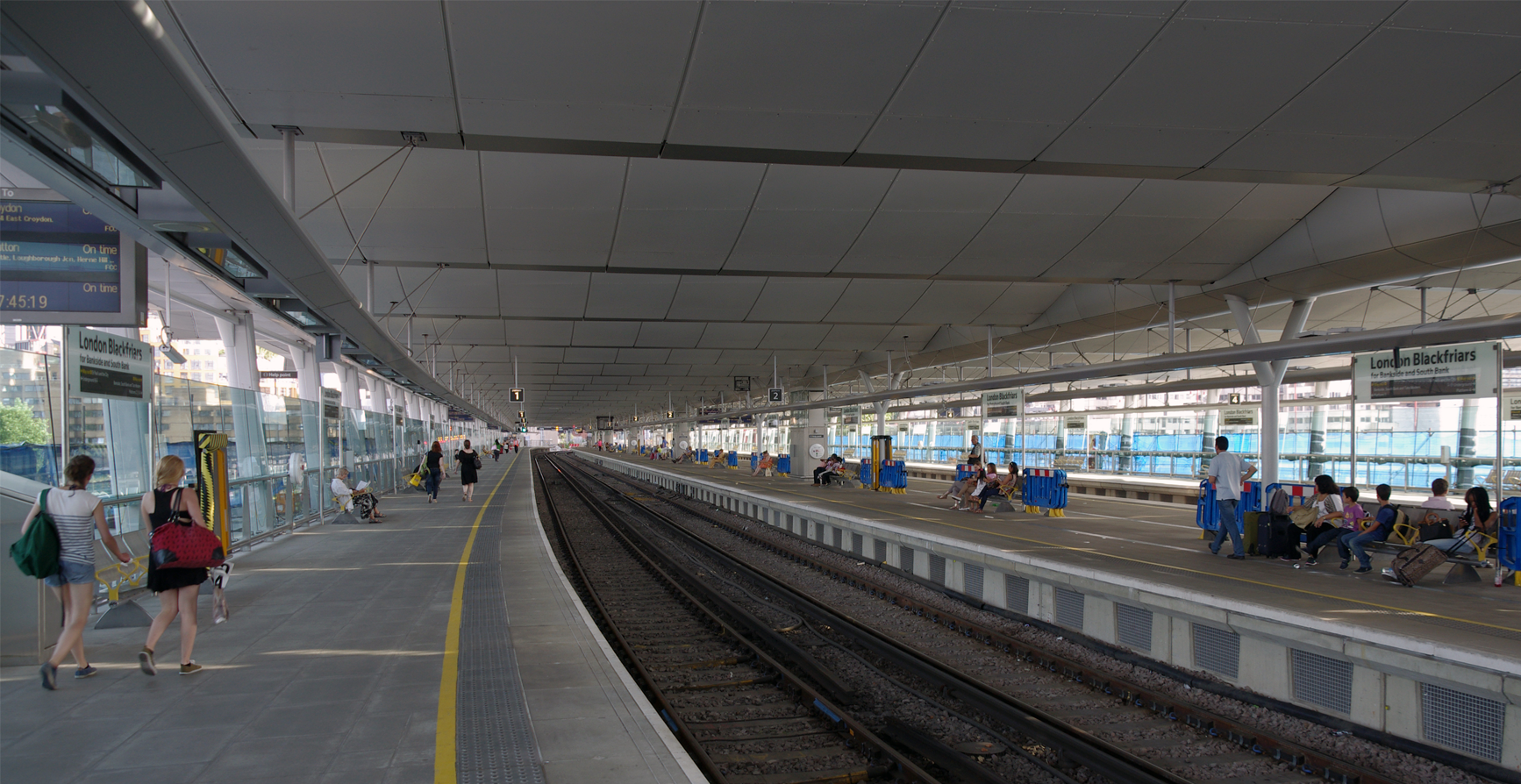
A station with The Thames below it
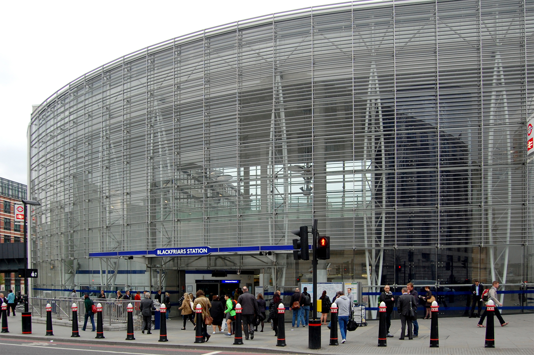
Blackfriars revamped . . .

Blackfriars underground station

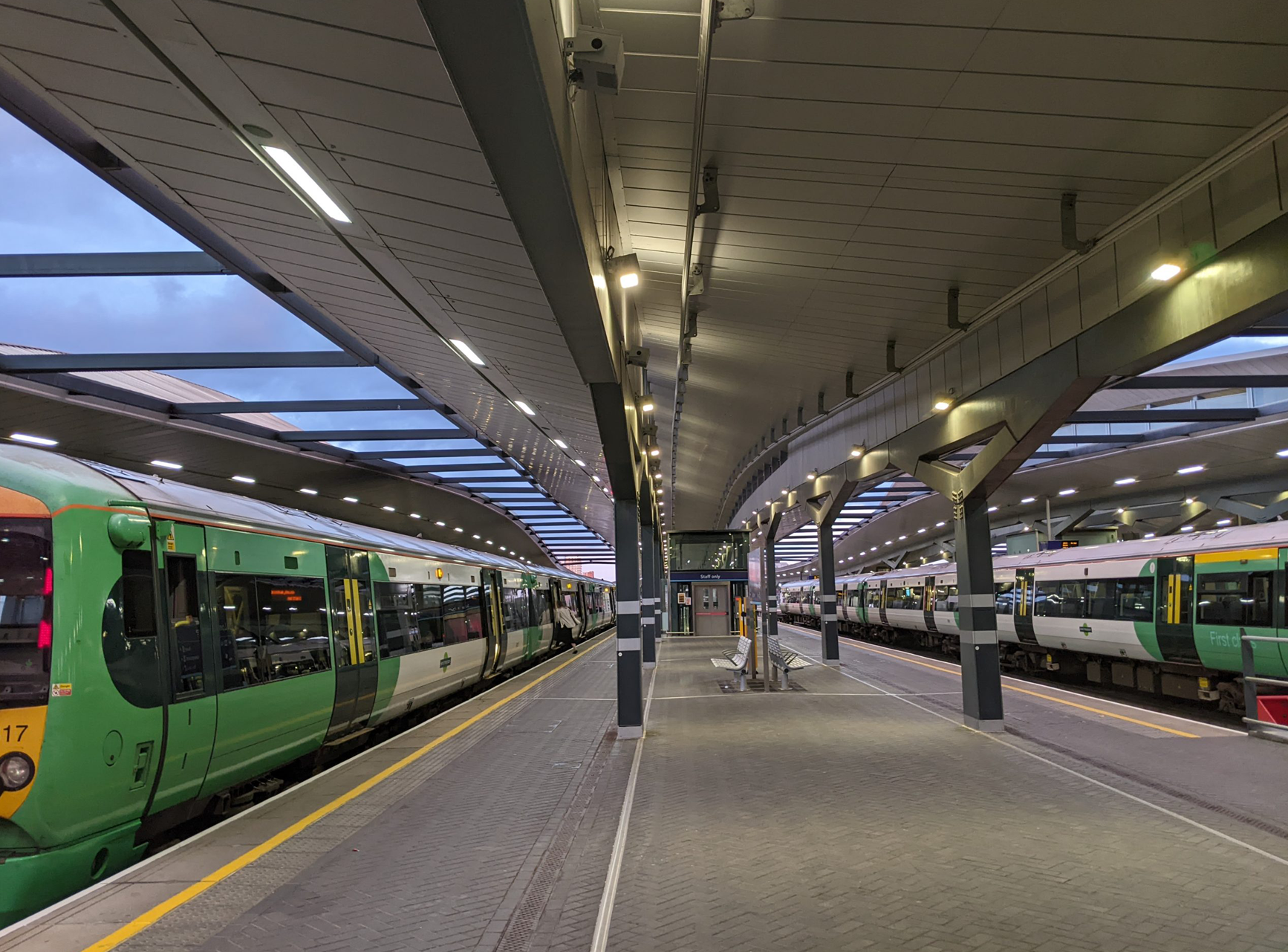
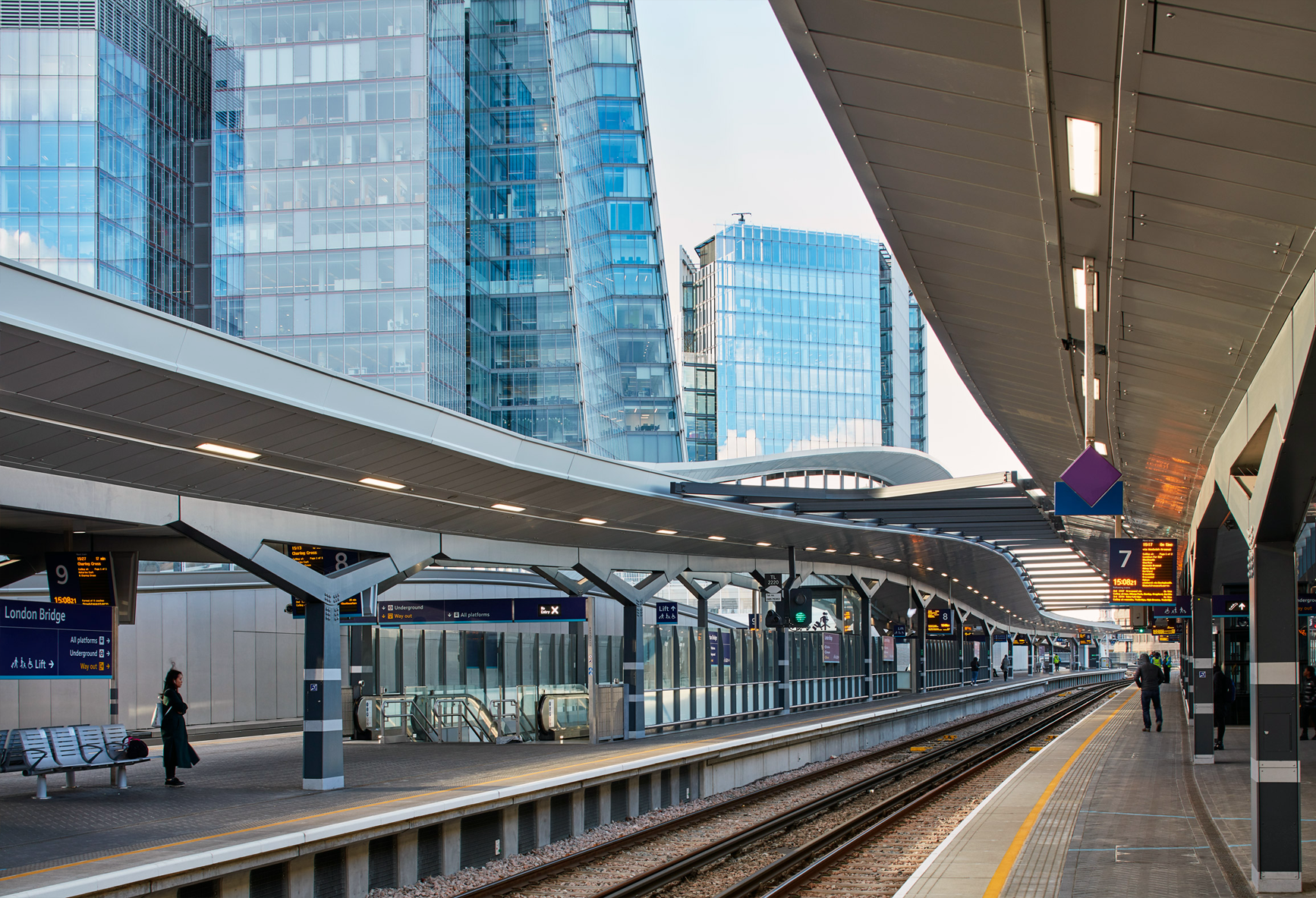
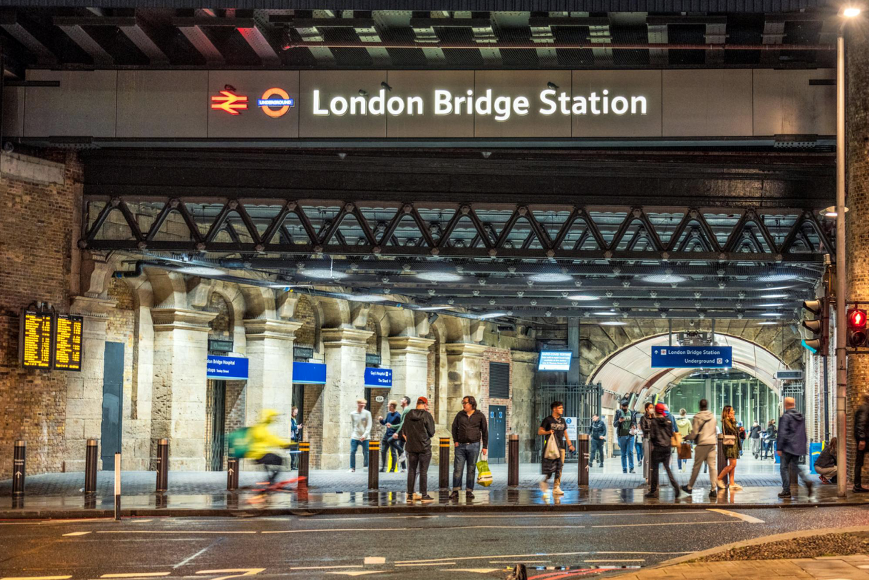
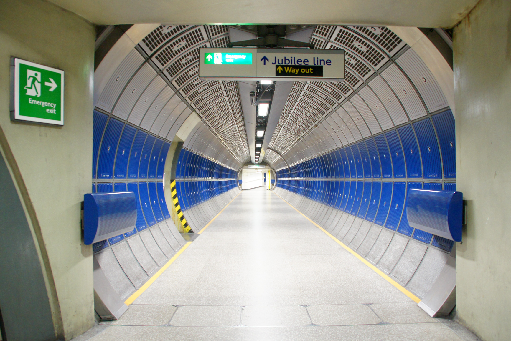
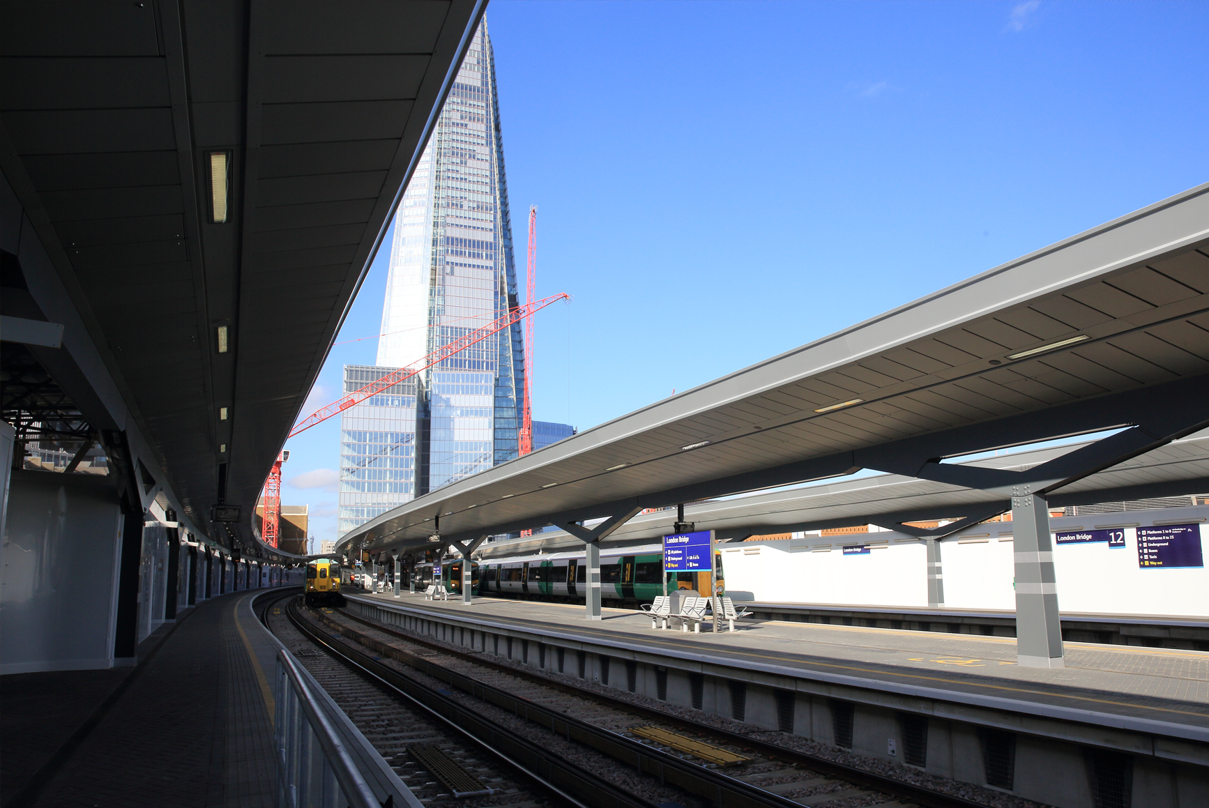
(B.4.) London Bridge
London Bridge is a central London railway terminus and connected London Underground station in Southwark, south-east London. It occupies a large area on three levels immediately south-east of London Bridge, from which it takes its name. The main line station is the oldest railway station in London fare zone 1 and one of the oldest in the world (it opened in 1836).
London Bridge station

London Bridge, platform view (01)
London Bridge, platform view (02)
Map of tracks

London Bridge train station (01)

London Bridge train station (02)
Inside London Bridge train station

London Bridge underground station (01)
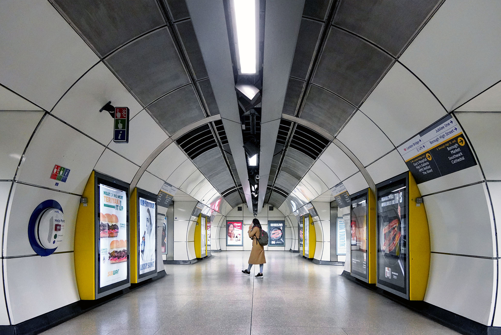
London Bridge underground station (02)

London Bridge from above
London Bridge, from the platforms, looking up
London Bridge from above

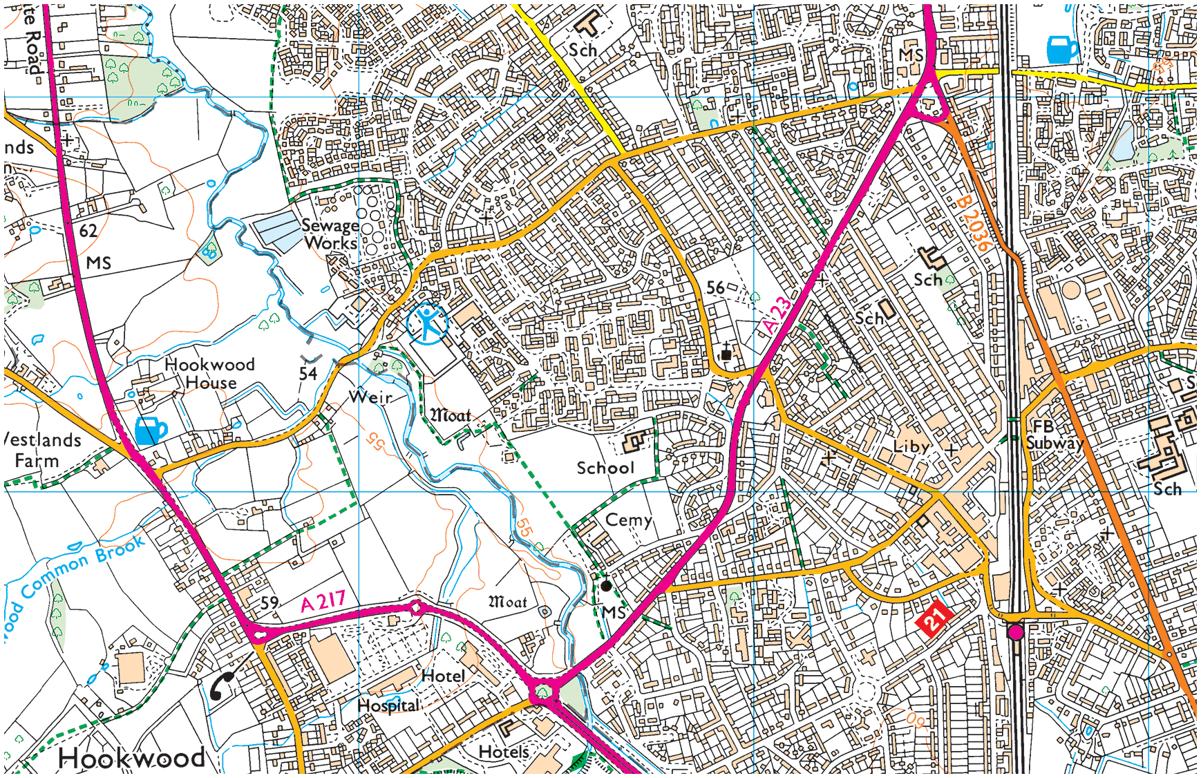
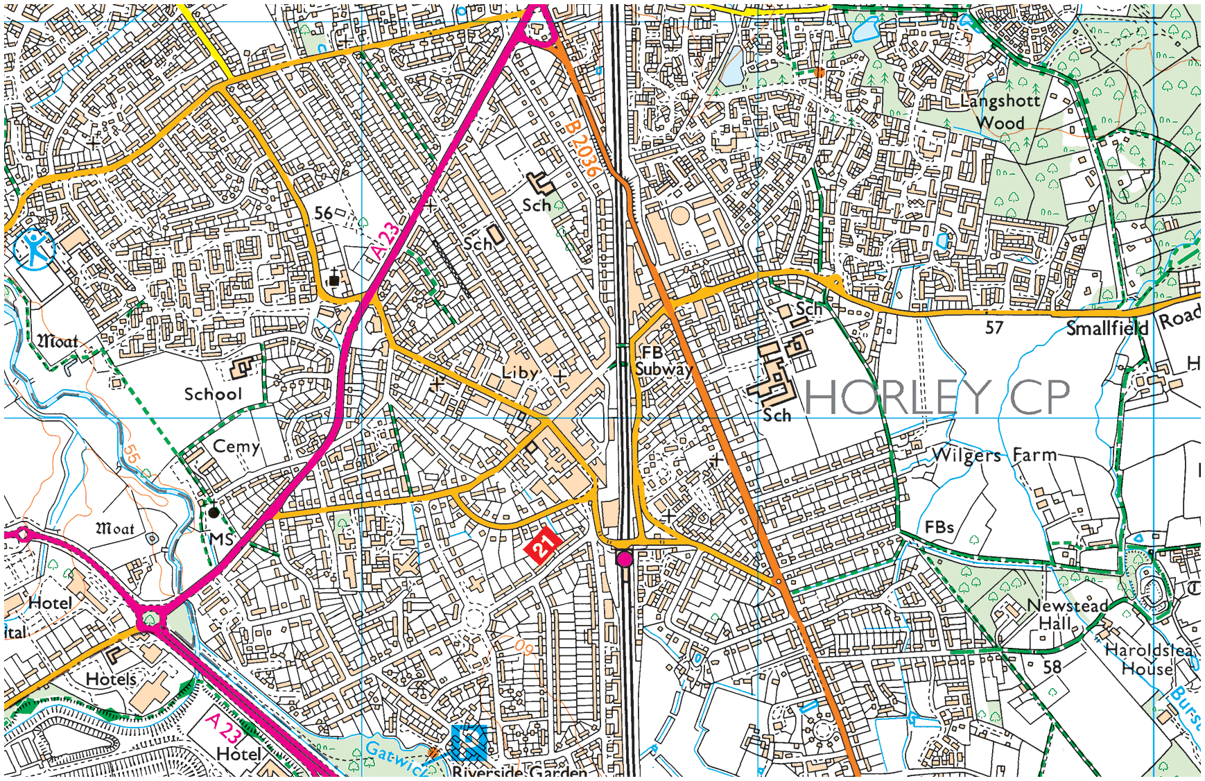
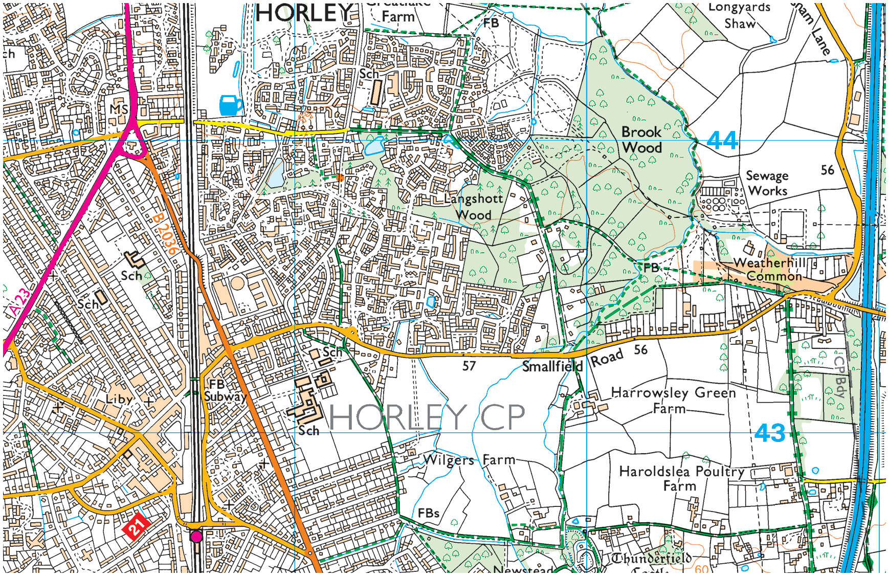
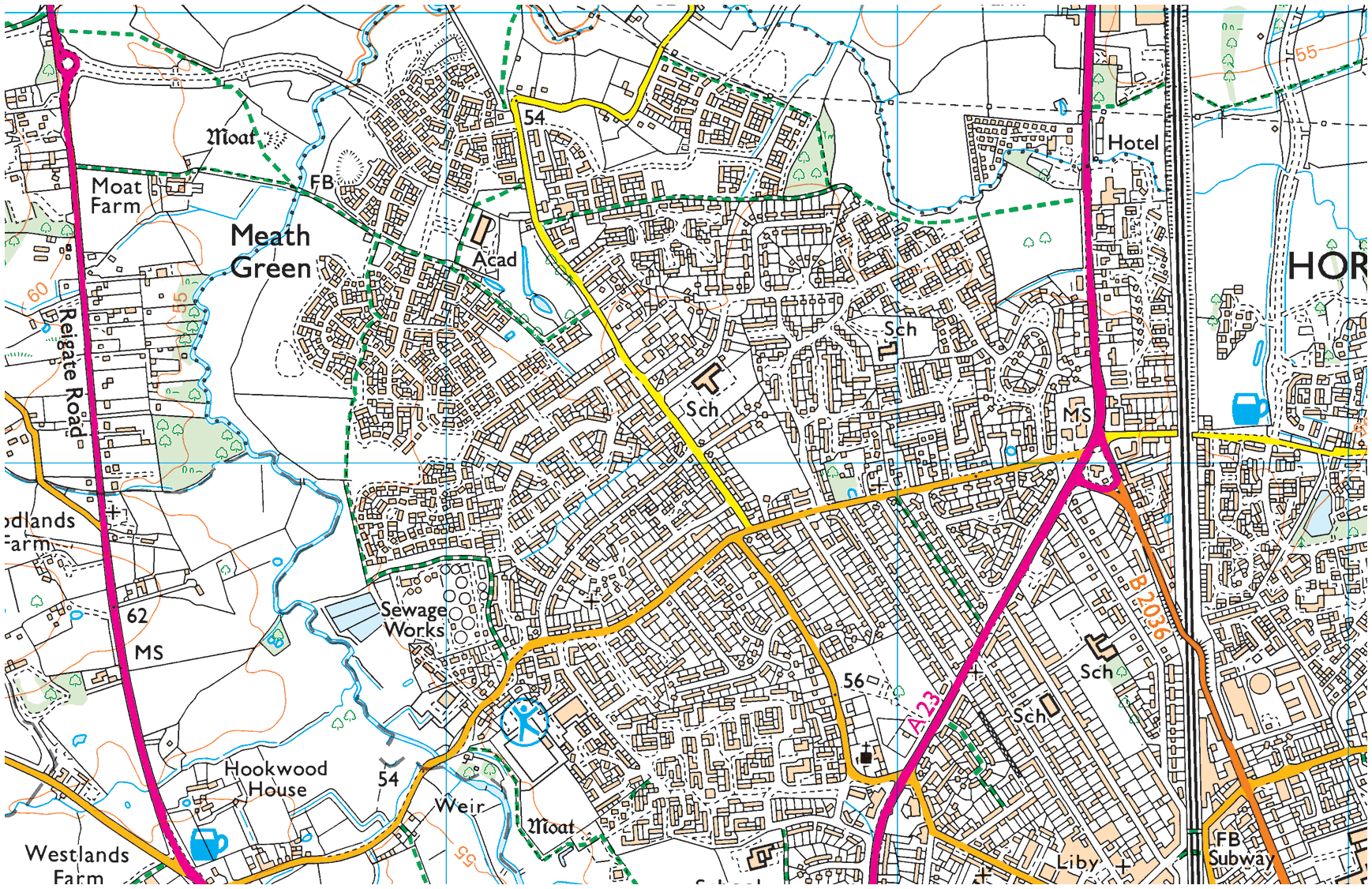
Maps of London
OS Landranger (scale: 1:50,000)
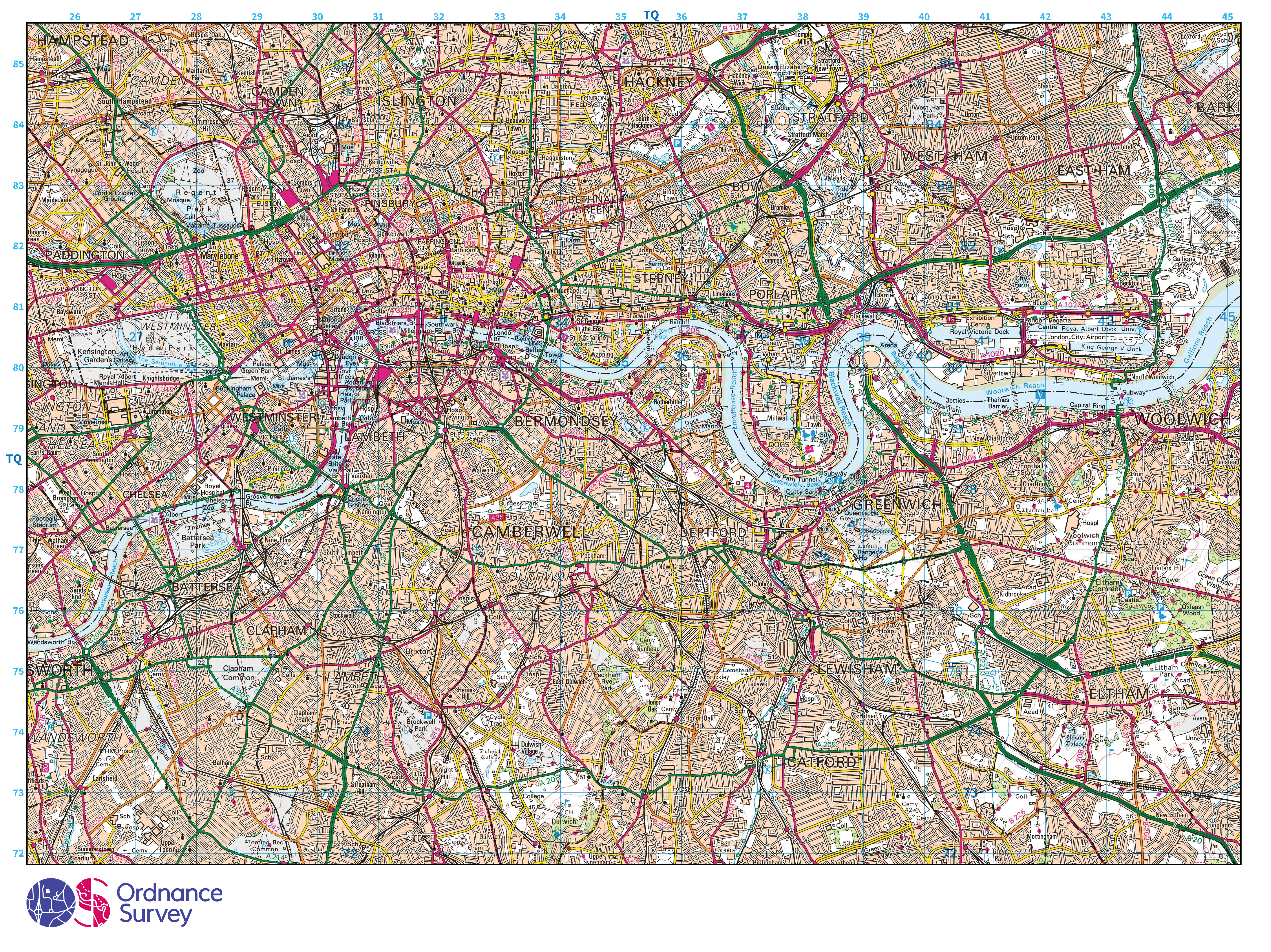
Image: 37 MB (4,751 by 3,557 pixels)
OS Landranger (scale: 1:40,000)

Image: 35 MB (4,751 by 3,557 pixels)
OS Landranger (scale: 1:25,000)
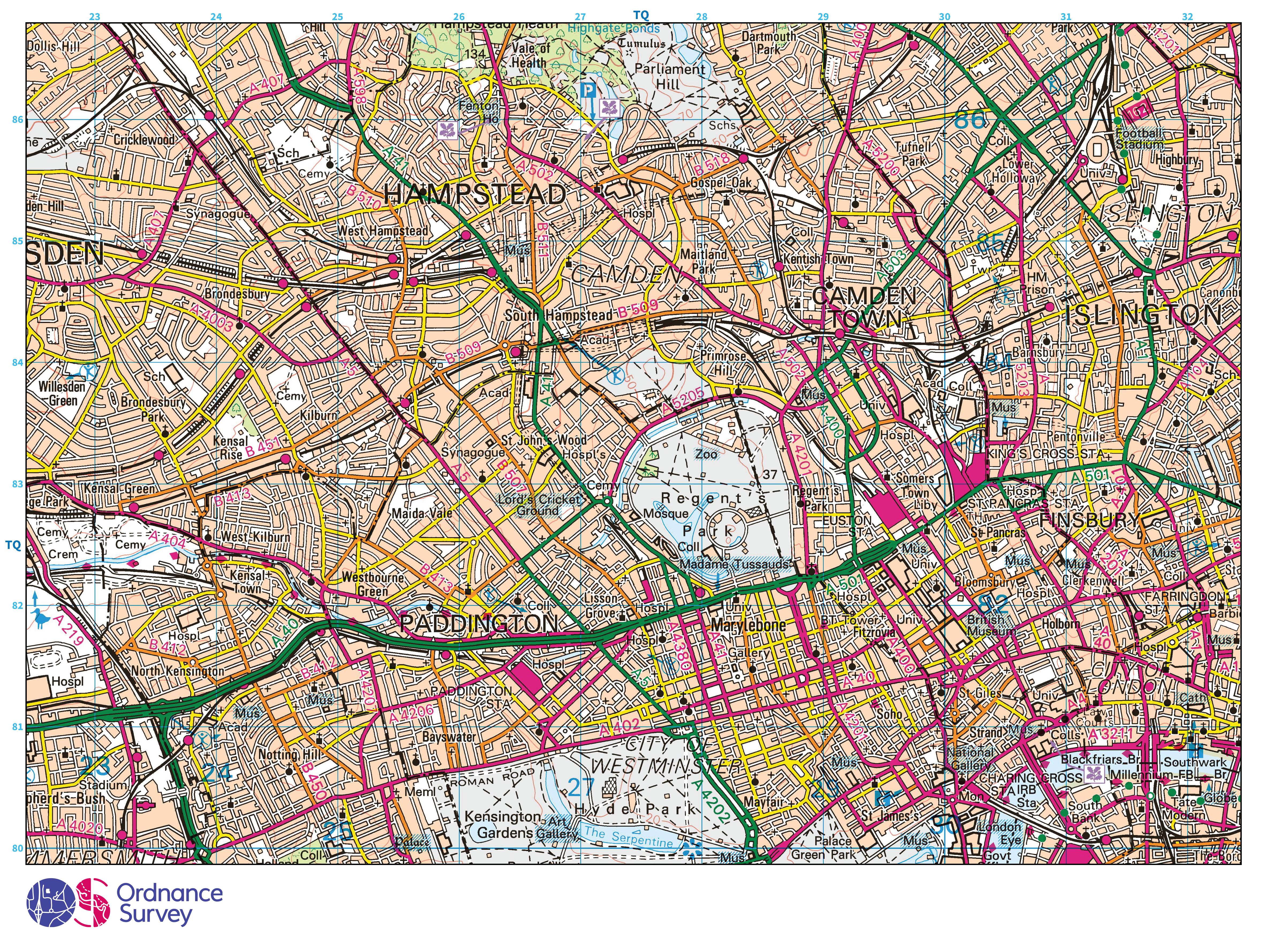
Image: 30 MB (4,751 by 3,557 pixels)
OS Explorer (scale: 1:50,000)

Image: 41 MB (4,751 by 3,557 pixels)
OS Explorer (scale: 1:40,000)

Image: 41 MB (4,751 by 3,557 pixels)
OS Explorer (scale: 1:25,000)

Image: 37 MB (4,751 by 3,557 pixels)
OS Explorer (scale: 1:12,500)

Image: 29 MB (4,751 by 3,557 pixels)
OS Explorer (scale: 1:10,000)

Image: 26 MB (4,751 by 3,557 pixels)
in between
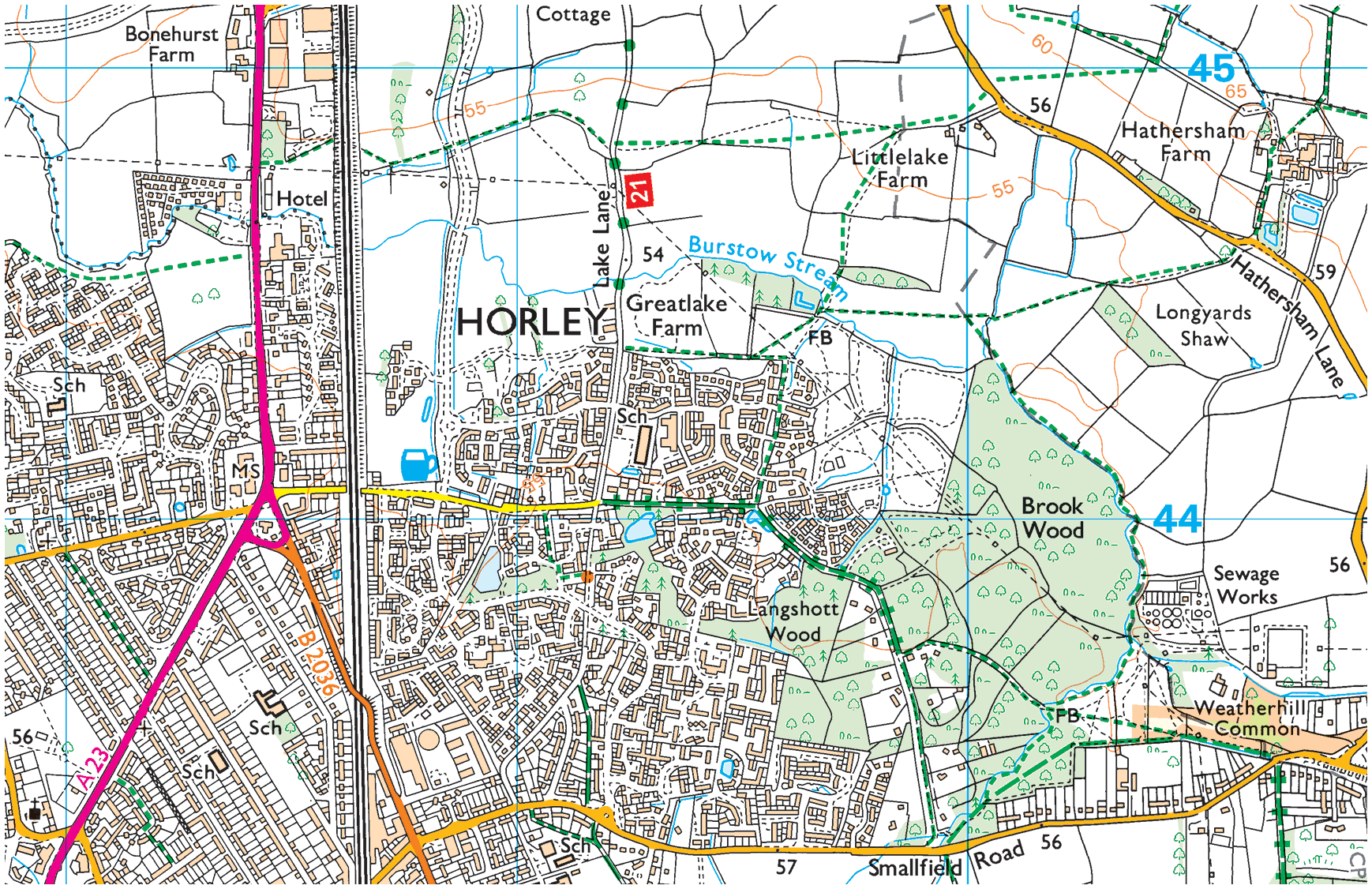
Along the line, stations include Redhill and Horley.
Ouse Valley viaduct
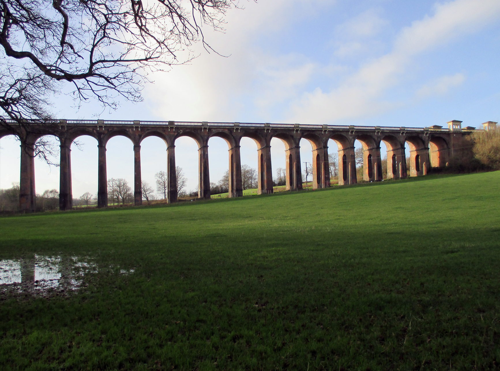
Selected stations on the London–Brighton line, from north to south.
Clapham Junction (CLJ)
Clapham Junction station, St John’s Hill, Clapham, London, SW11 2QP
East Croydon (ECR)
East Croydon station, Station Approach, Croydon, Greater London, CR0 1L
Purley (PUR)
Purley station, Station Approach, Whytecliffe Road, Purley, London, CR2 2AP
Coulsdon South (CDS)
Coulsdon South station, Brighton Road, Coulsdon, London, CR5 3EA
Merstham (MHM)
Merstham station, Station Road, Merstham, Surrey, RH1 3ED
Redhill (RDH)
Redhill station, Redstone Hill, Redhill, Surrey, RH1 1RB
Earlswood (Surrey) (ELD)
Earlswood station, Station Approach West, Earlswood, Surrey, RH1 6HP
Salfords (Surrey) (SAF)
Salfords station, Southern Avenue, Salfords, Surrey, RH1 5DE
Horley (HOR)
Horley station, Victoria Road, Horley, Surrey, RH6 7NL
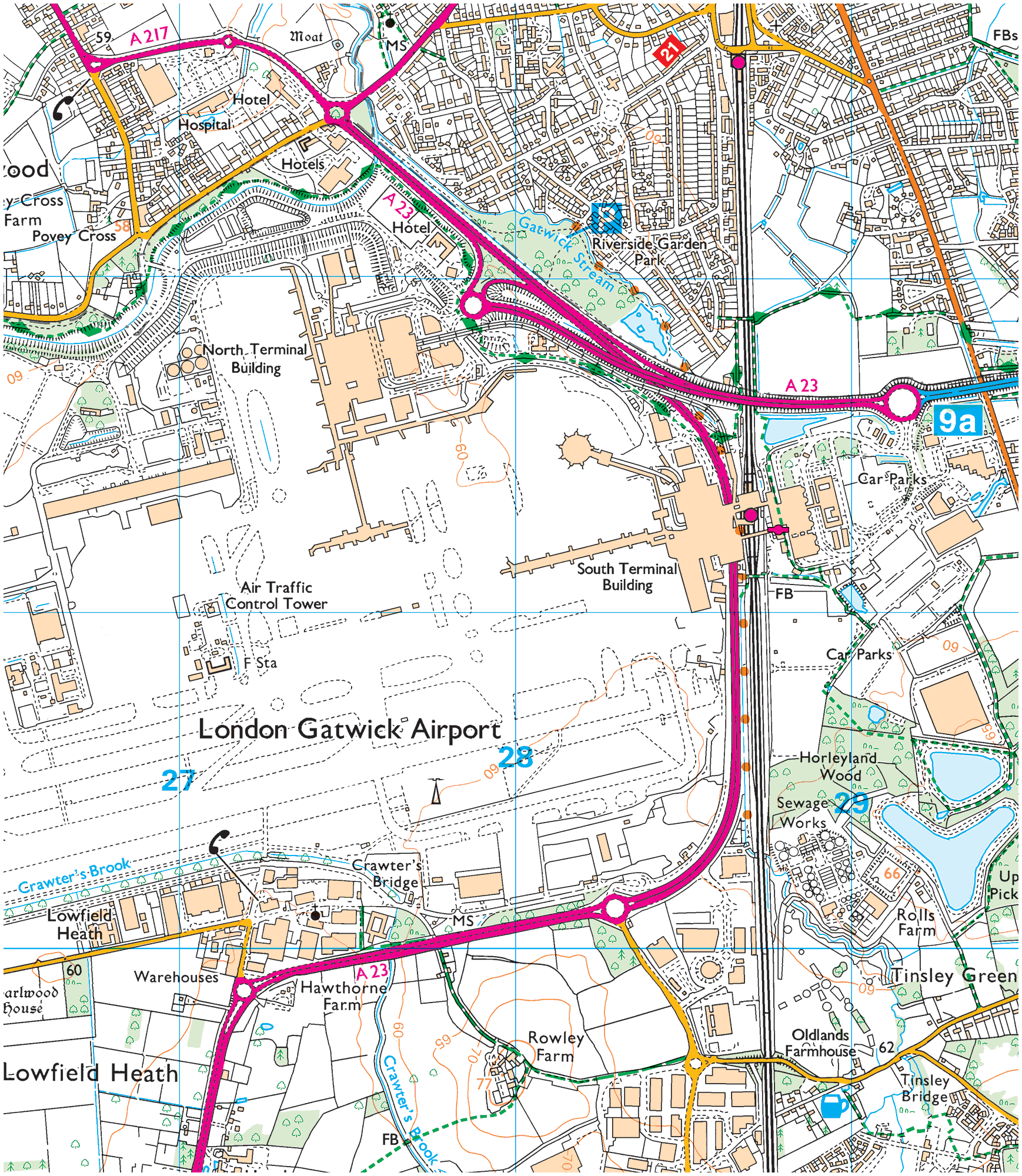
Gatwick Airport (GTW)
Gatwick Airport station, South Terminal, Surrey, RH6 0RD
Three Bridges (TBD)
Three Bridges station, Haslett Avenue, Crawley, West Sussex, RH10 1LY
Balcombe (BAB)
Balcombe station, London Road, Balcombe, West Sussex, RH17 6JQ
Haywards Heath (HHE)
Haywards Heath station, Commercial Square, Haywards Heath, West Sussex, RH16 1DJ
Wivelsfield (WVF)
Wivelsfield station, Leylands Road, Burgess Hill, West Sussex, RH15 0QF
Burgess Hill (BUG)
Burgess Hill station, Station Road, Burgess Hill, West Sussex, RH15 9DG
Hassocks (HSK)
Hassocks station, Station Approach West, Hassocks, West Sussex, BN6 8JD
Preston Park (PRP)
Preston Park station, Clermont Road, Preston Park, Brighton, East Sussex, BN1 6S
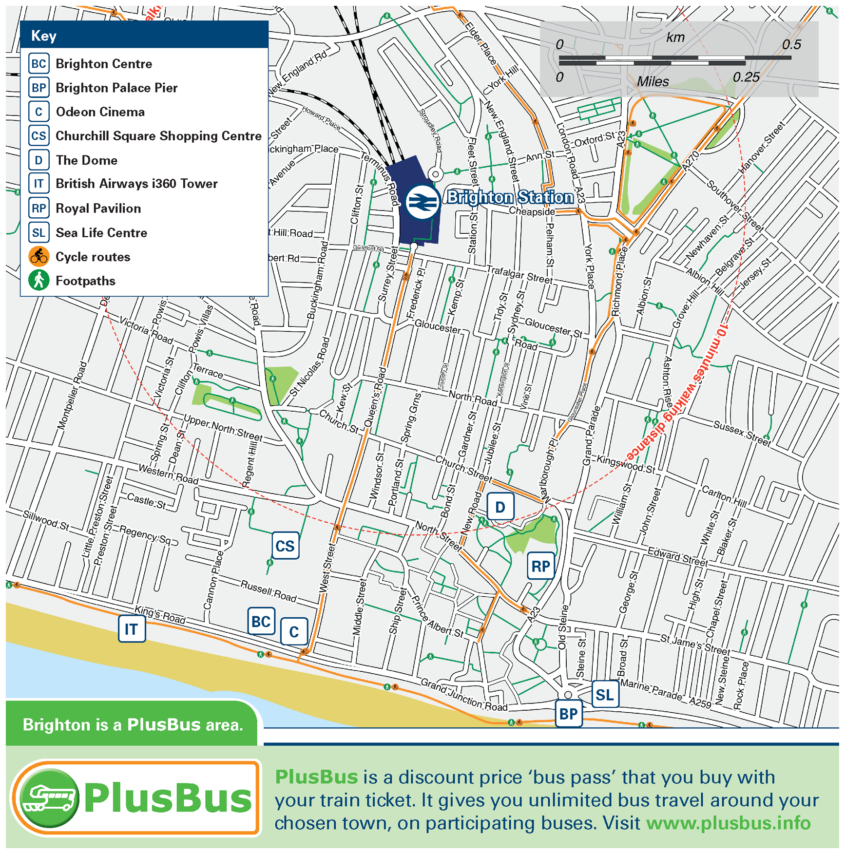
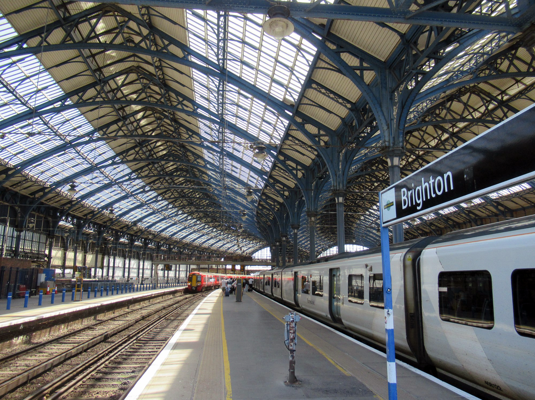
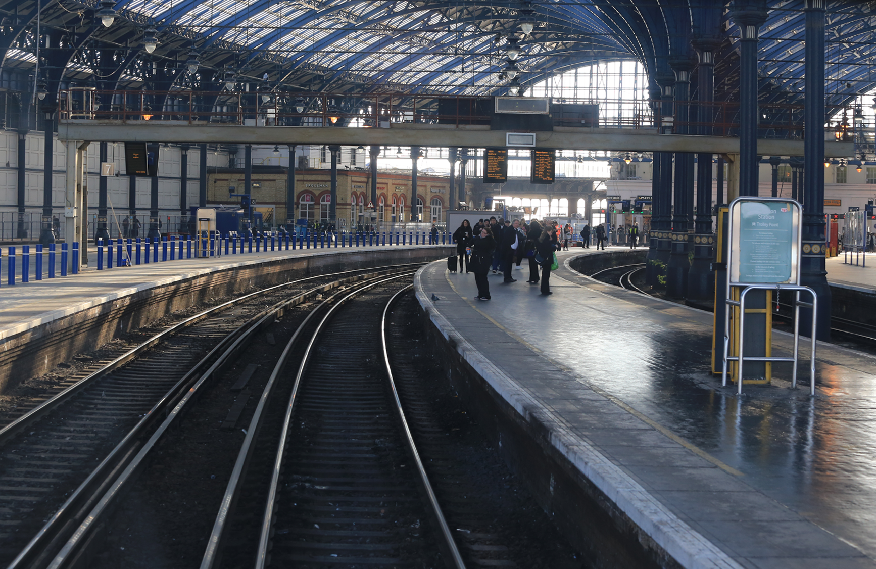
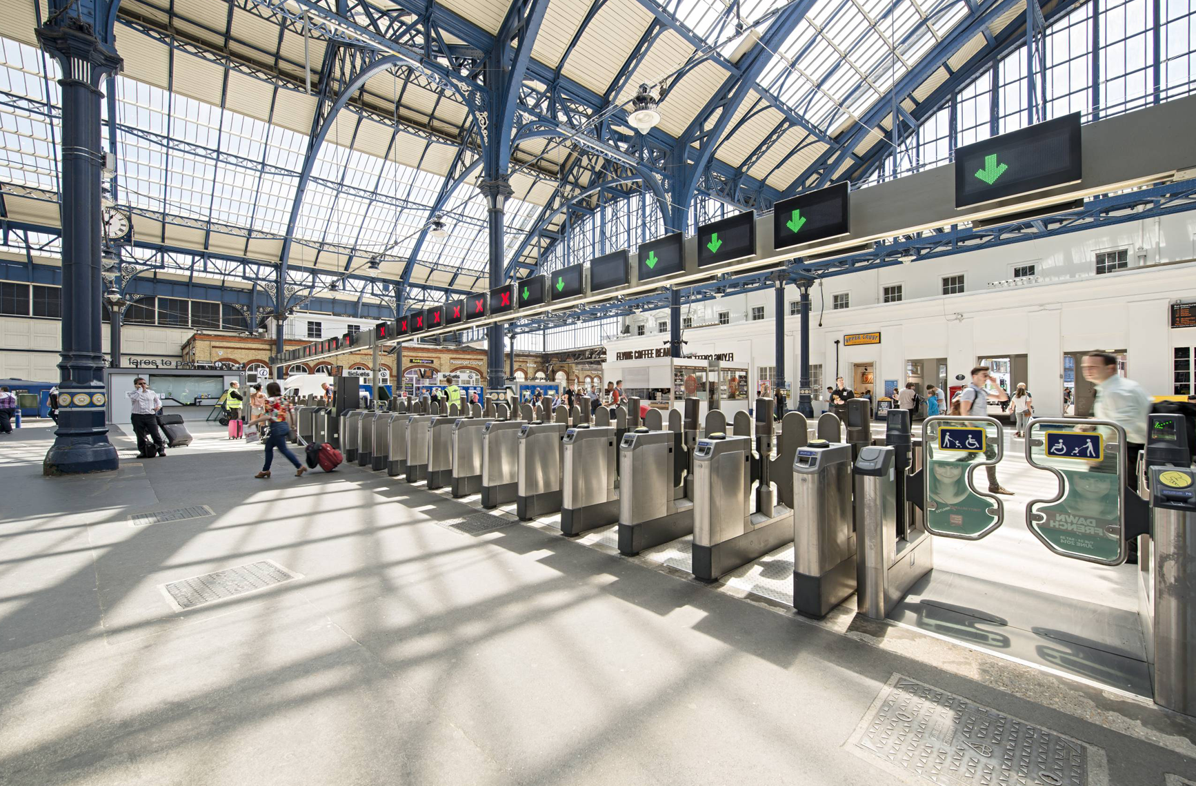
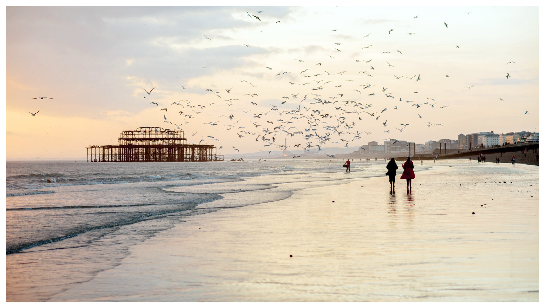
Brighton
Brighton is a seaside resort 47 miles south of London. A settlement in the same location named “Brighthelmstone” is documented in Domesday (1086). Brighton has a large and vibrant cultural, music and arts scene, and its large LGBT population, leading to its recognition as the “unofficial gay capital of the UK.” In the 2021 census, 10.7 per cent of the population of Brighton and Hove over the age of 18 identify as gay, lesbian or bisexual, the highest percentage in the entire UK. Brighton is often considered “the happiest place to live in the UK” because of its openness and lack of judgmentalism.
The Station
Brighton railway station (BTN) is the southern terminus of the London-Brighton main line, the western terminus of the East Coastway Line and the eastern terminus of the West Coastway Line. The station is just over 50 miles from London Bridge via Horley (50.61 miles; 81.45km or, in old money, 50 miles & 49 chains3).
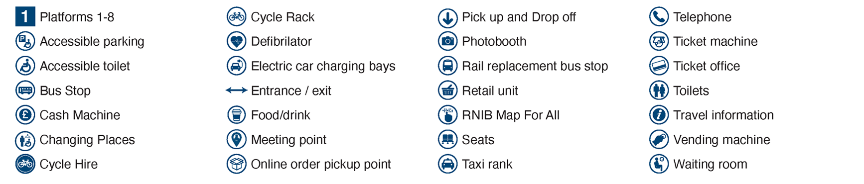
Station plan

Key to plan
Bike hire & Buses
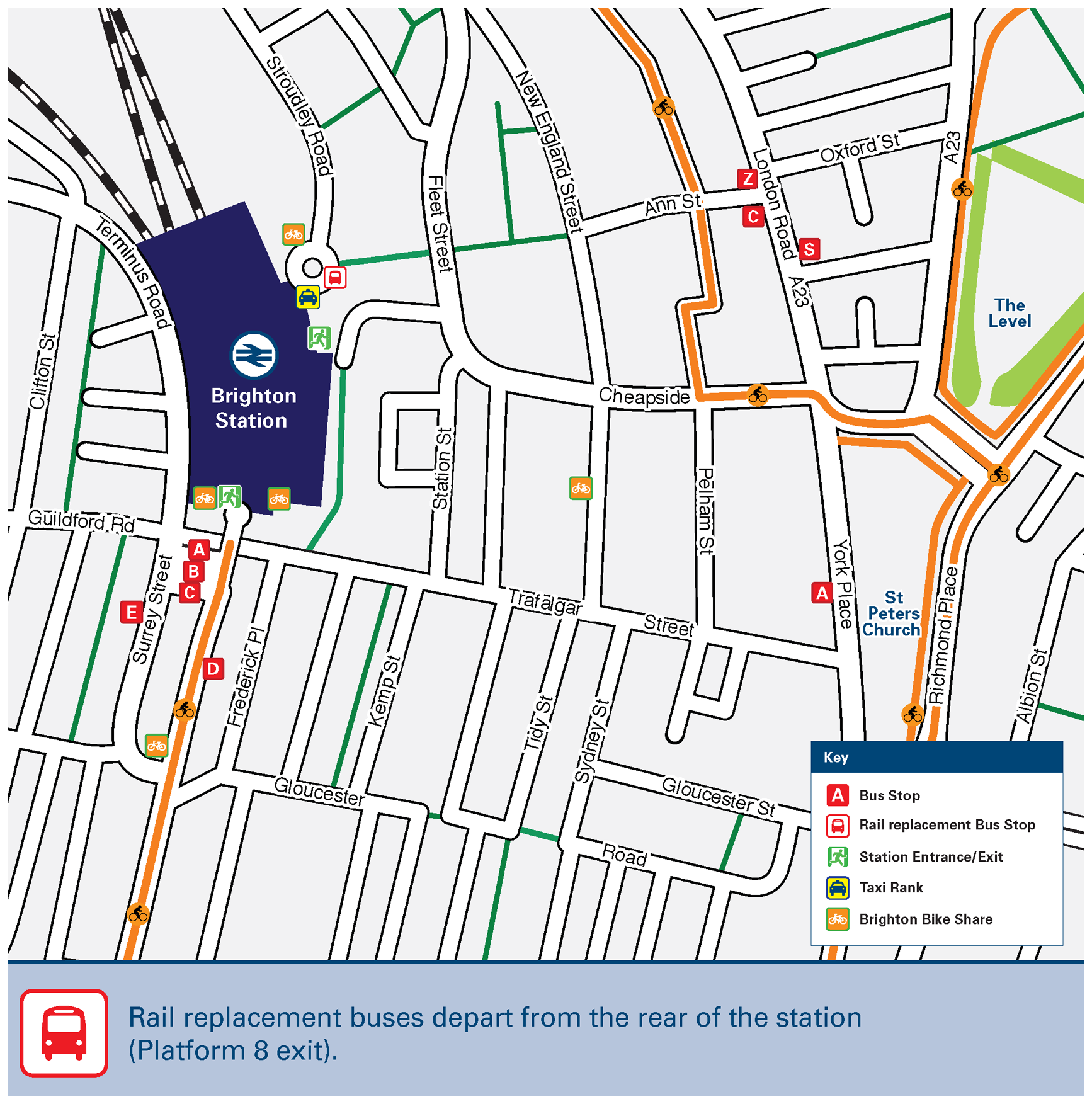
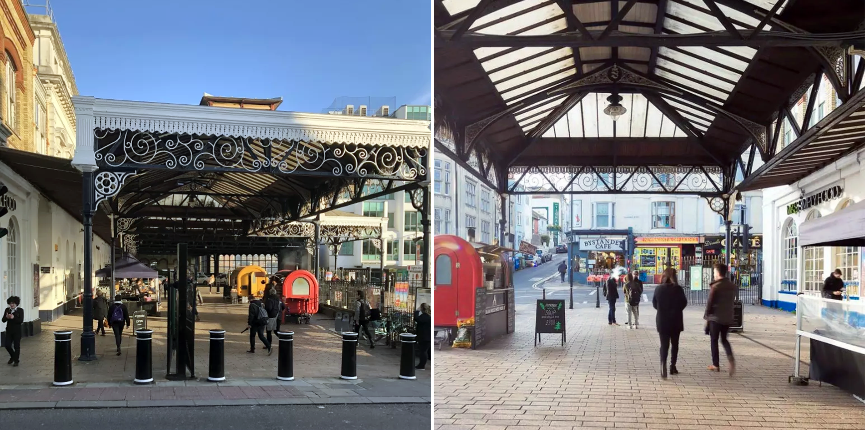
Station surrounds
Pictures
Station from above

Brighton from above

Brighton Pier (Pleasure-dome)

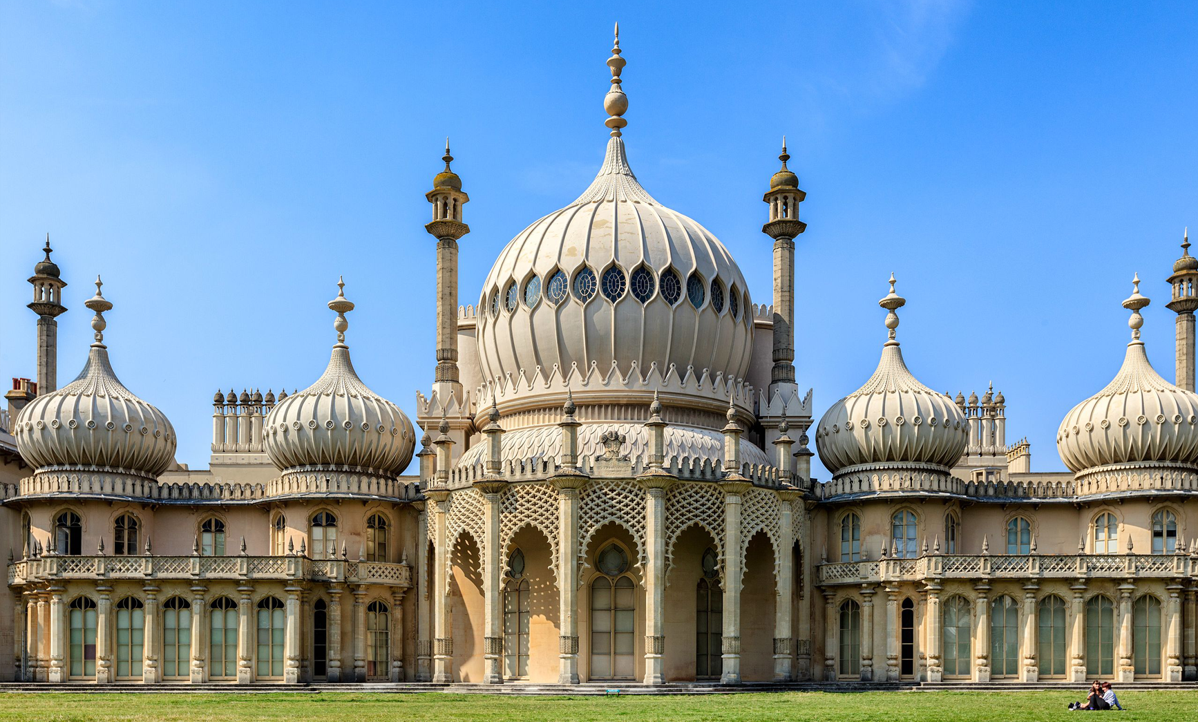
King George IV’s Royal Pavilion
The station in 1972
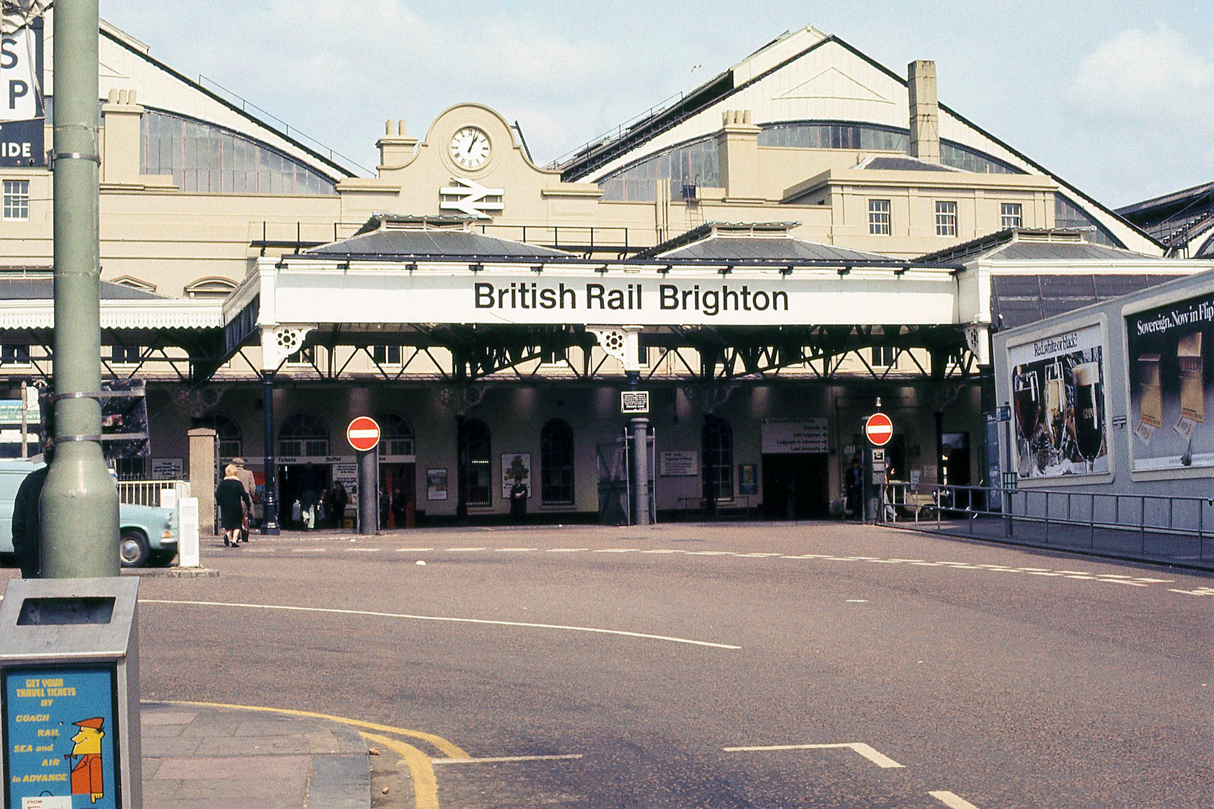
The station in 1975
The station in 1979
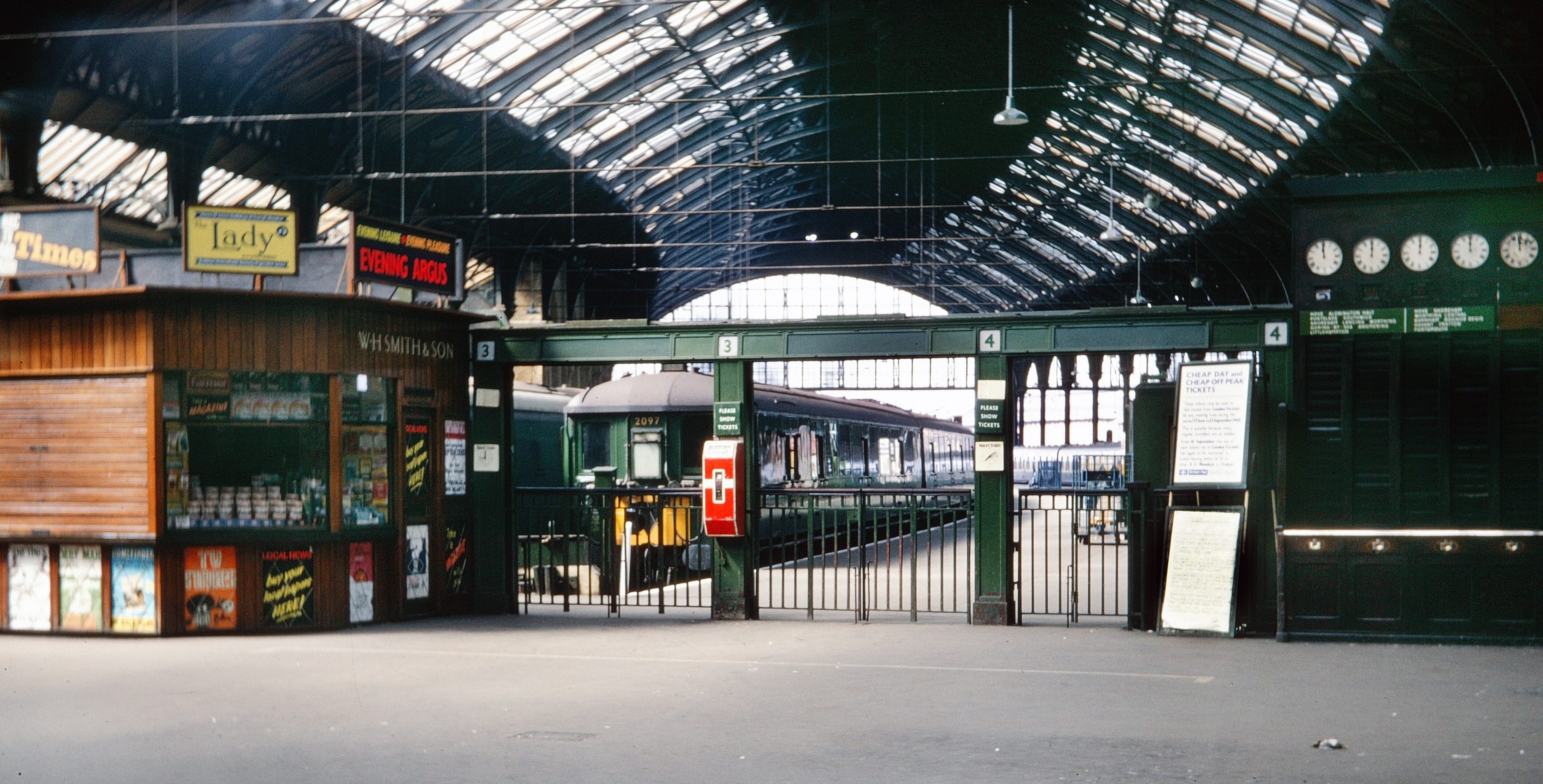
Image: 12 MB (3,660 by 1,860 pixels)
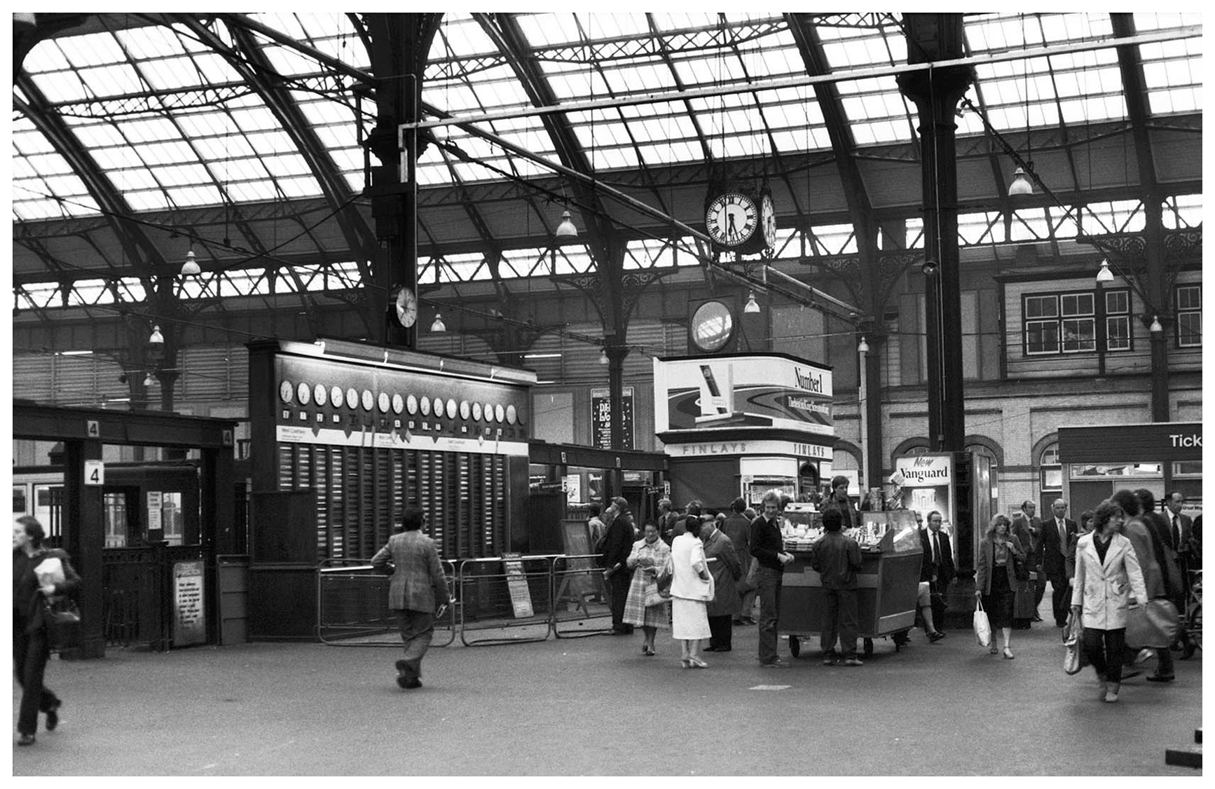
1986

During the nineteen nineties

Early two thousands

Outside station’s main entrance
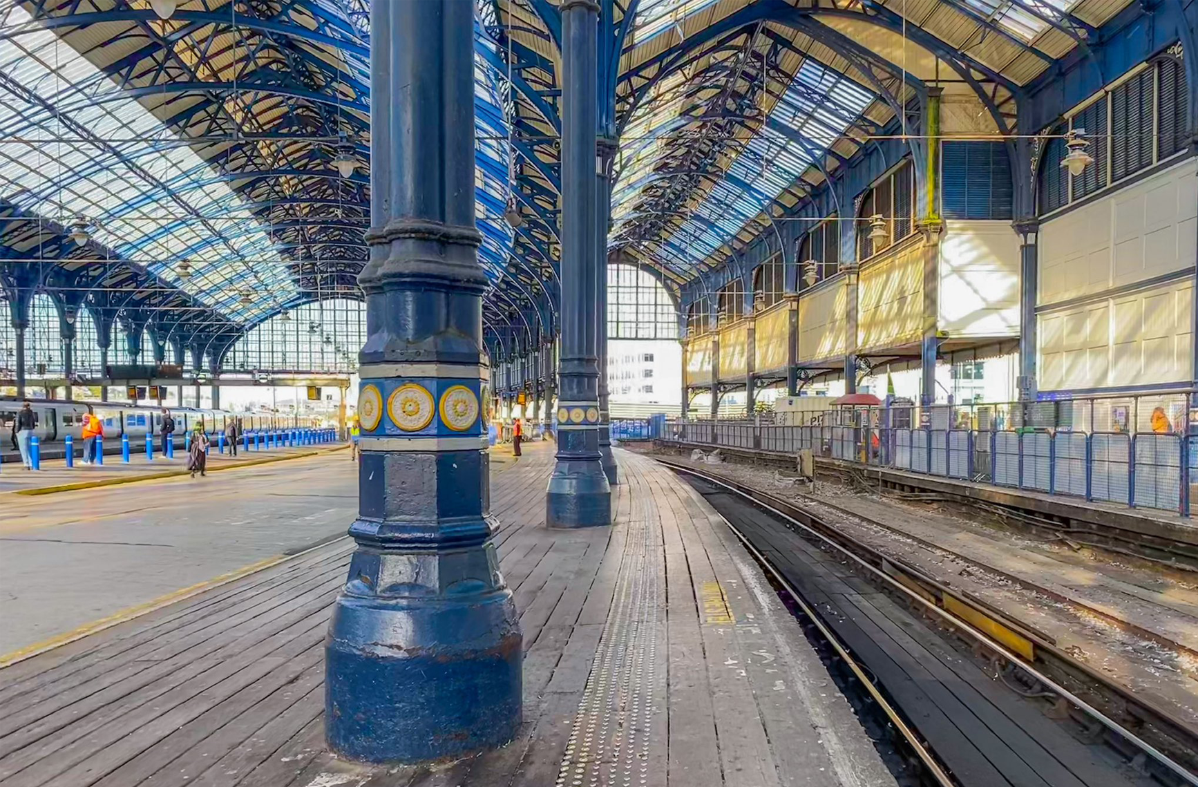
Victorian engineering
In detail
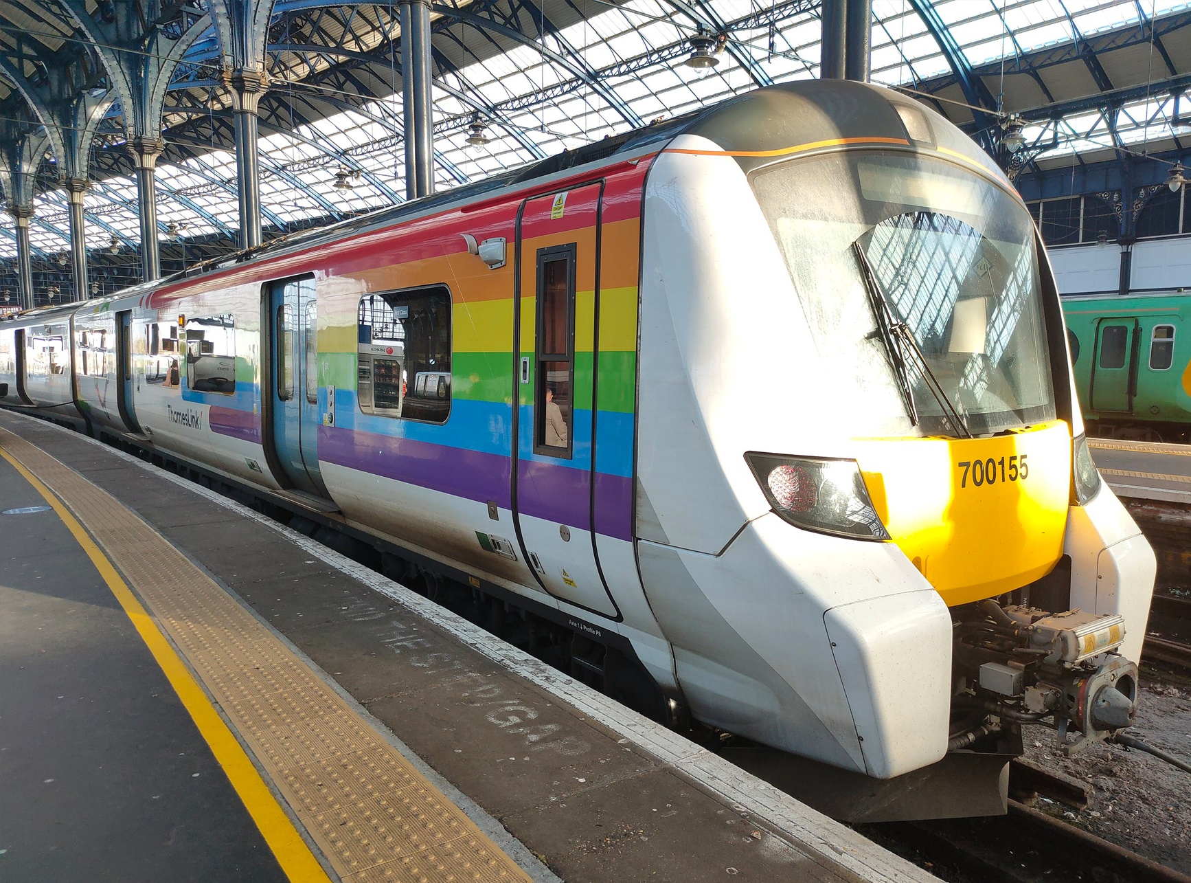
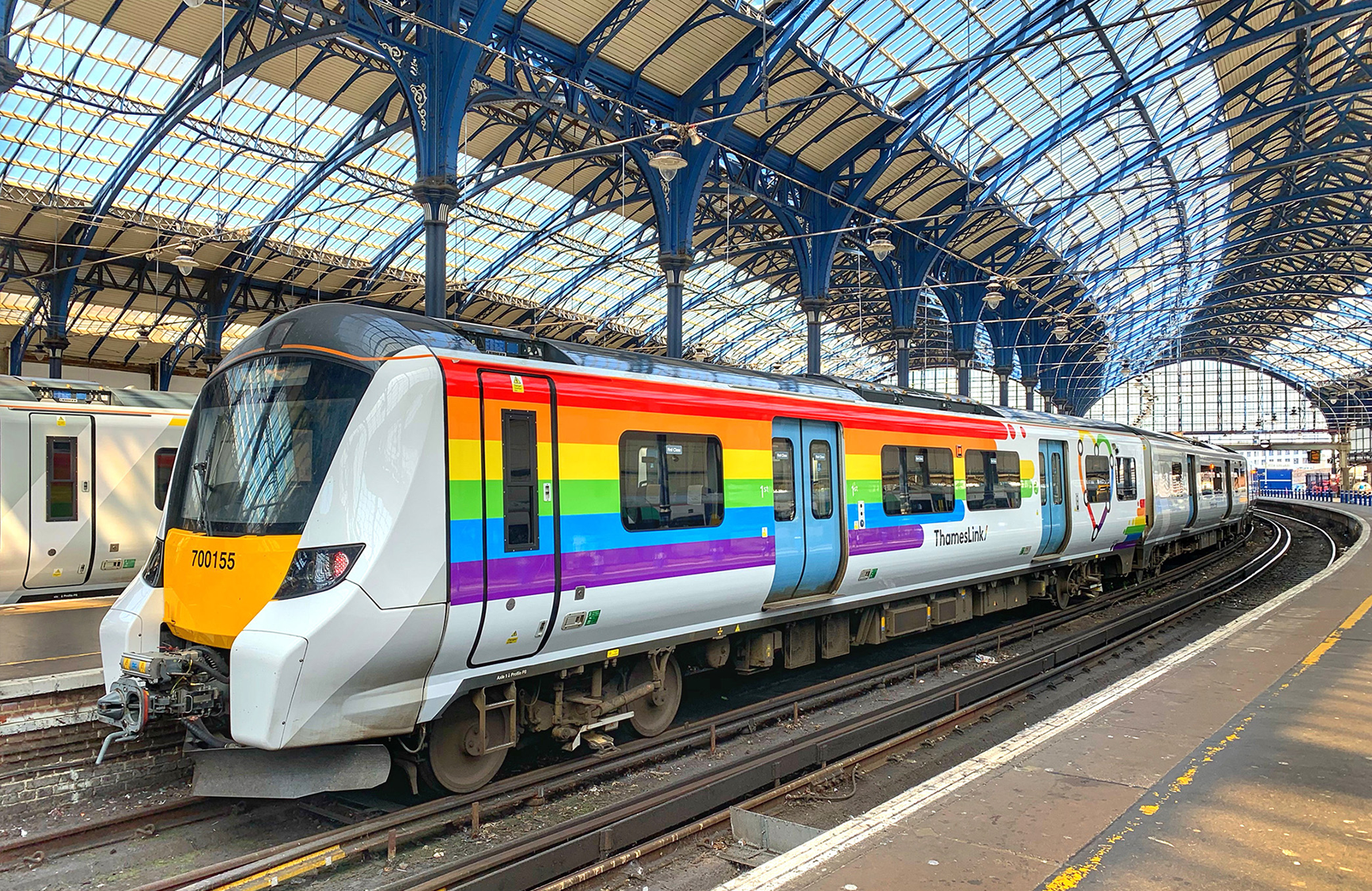
A Thameslink train

Another Thameslink train
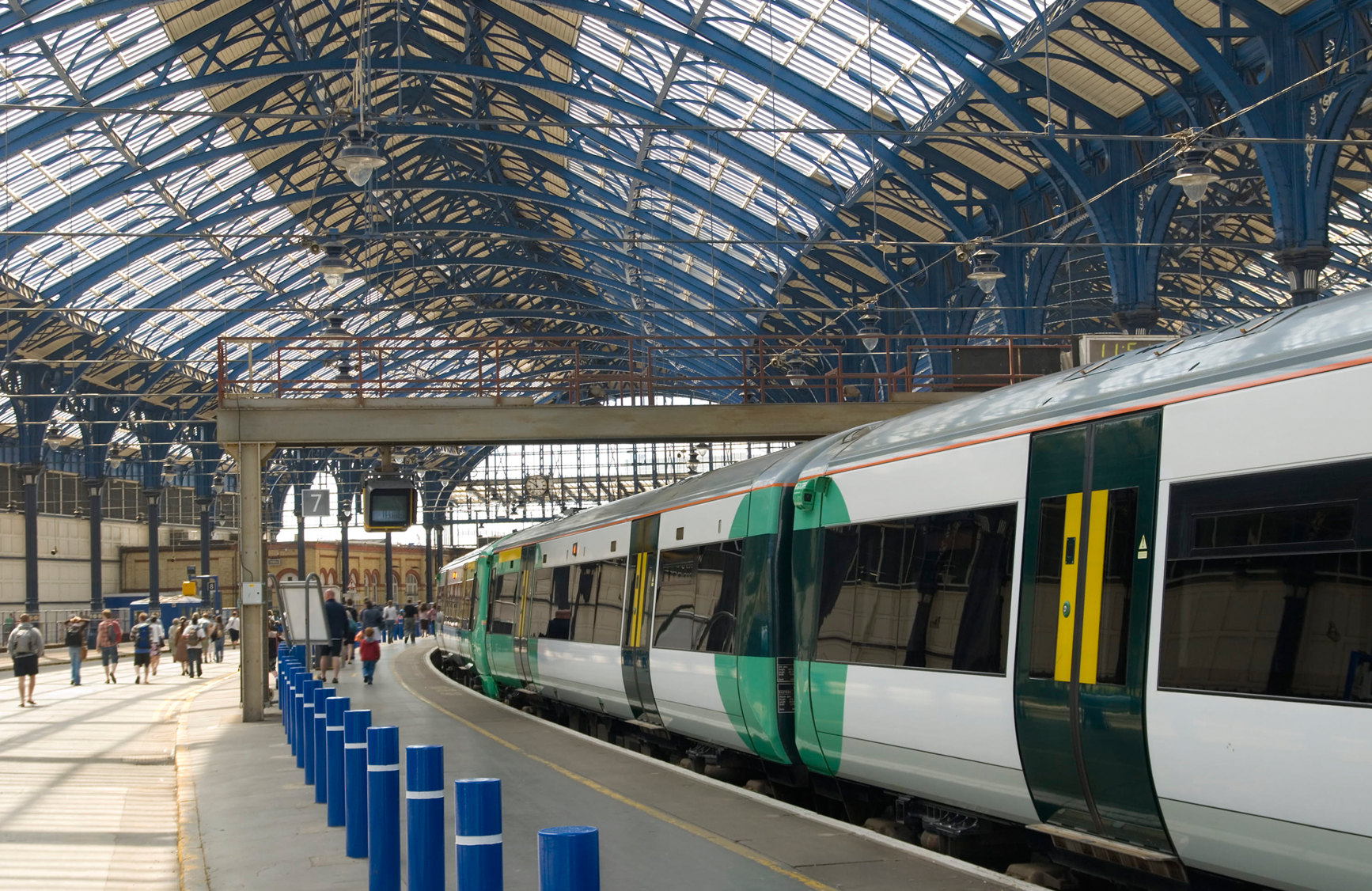
A Southern train
Winter chill
Summer warmth
print(“Hello, world!”);

Brighton Rock — an artistic impression
Maps of Brighton
OS Explorer (scale: 1:50,000)

Image: 22 MB (4,751 by 3,557 pixels)
OS Explorer (scale: 1:40,000)

Image: 22 MB (4,751 by 3,557 pixels)
OS Explorer (scale: 1:25,000)

Image: 22 MB (4,751 by 3,557 pixels)
OS Explorer (scale: 1:12,500)
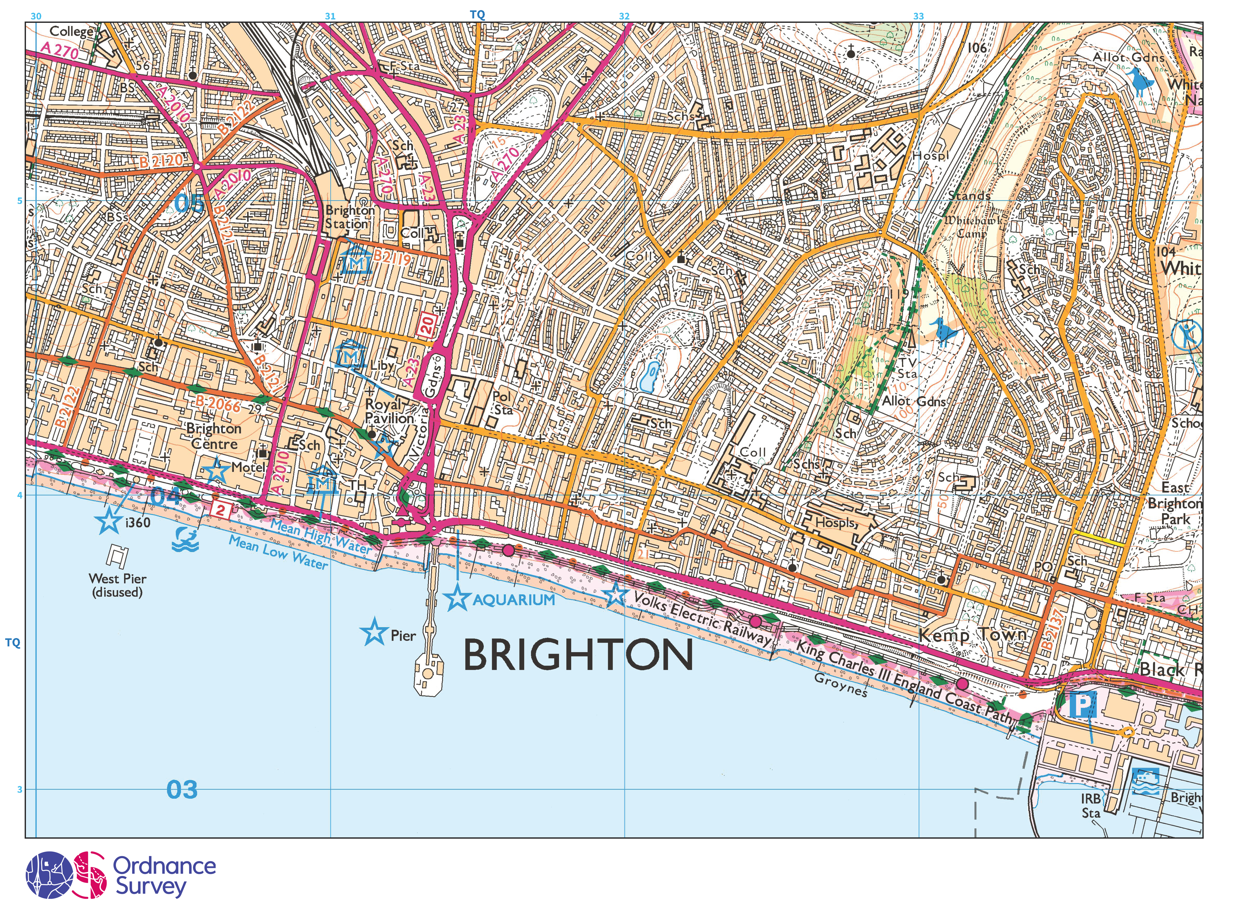
Image: 22 MB (4,751 by 3,557 pixels)
Footnotes
- The large bronze sculpture is based on William Blake’s 1795 print of Newton: Personification of Man Limited by Reason, which depicts a nude Isaac Newton sitting on ledge beside a mossy rock face while measuring with a pair of compasses or dividers. The print was intended by Blake to criticise Newton’s profane knowledge, usurping the sacred knowledge and power of the creator Urizen, with the scientist turning away from nature to focus on his books (Paolozzi had admired Blake since viewing a large print of Newton at the Tate Gallery in the 1940s). ↩︎
- An acre is a unit of land area used in the British imperial and the United States customary systems. It is traditionally defined as the area of one chain by one furlong (66 by 660 feet), which is exactly equal to 10 square chains (see following footnote), 1⁄640 of a square mile, 4,840 square yards, or 43,560 square feet, and approximately 4,047 square metres, or about 40 per cent of a hectare. Based upon the international yard and pound agreement of 1959, an acre may be declared as exactly 4,046.8564224m2 (explore: the ancient English Avoirdupois measuring system; a word that’s etymology is decidedly French: aveir de peis (later avoir du pois), literally “goods of weight”). The acre was conceived in England during the so called dark ages and it equates to an area of land that could be ploughed by one person using 8 cows in one day. The rectangular shape of this measure came about because arable fields were made up of long strips of land, each containing furrows running lengthwise. One ‘furrow long’ = 1 furlong. Consider: Gatwick Race Course and its final furlong in 1940 (Horley town’s last hurrah). ↩︎
- The chain (abbreviated ch) is a unit of length equal to 66 feet (22 yards), originating in the UK, still used in the USA and India. Chains are subdivided into 100 links. There are 10 chains in a furlong, and 80 chains in one statute mile. In metric terms, a chain is 20.1168 metres long. By extension, chainage (running distance) is the distance along a curved or straight survey line from a fixed commencing point. ↩︎
Contact HH&M
HH&M’s services
- Assembling things →
- Building & Maintenance →
- Decorating & Painting →
- Gardening & Groundworks →
- Moving things →
Get a free quote
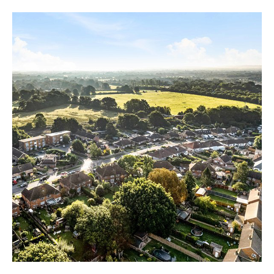
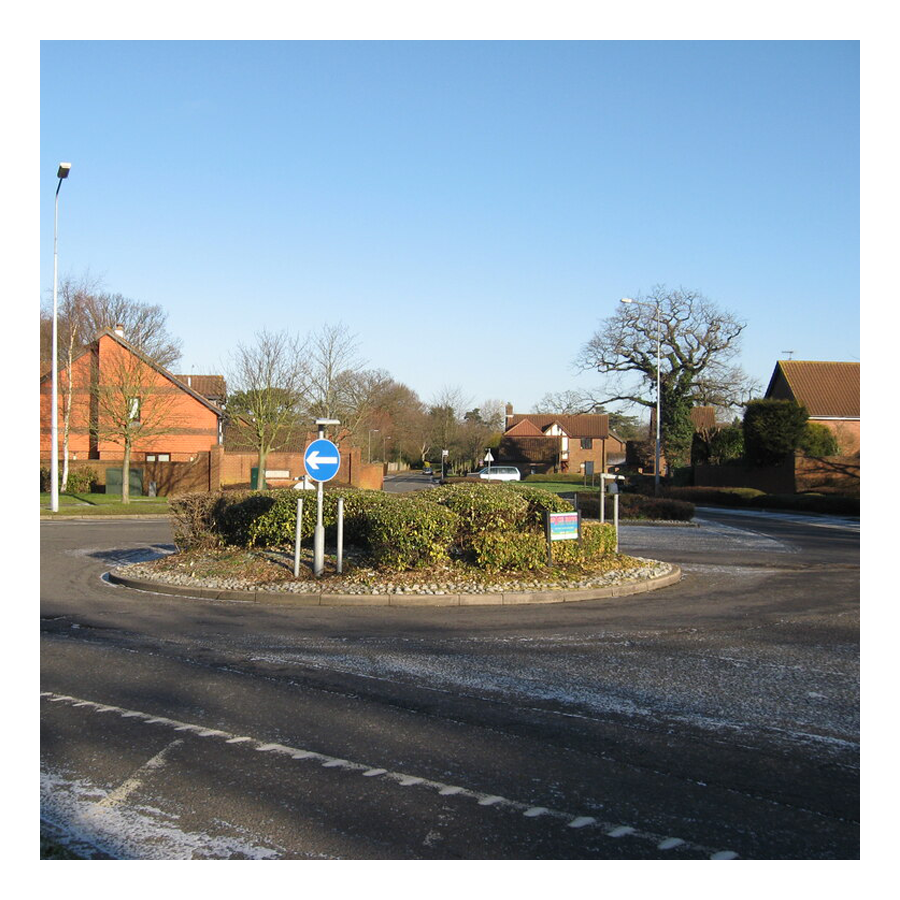
Horley by area
Although Horley does not have named-on-road-sign neighbourhoods—like Crawley does—the following areas are commonly referred to:
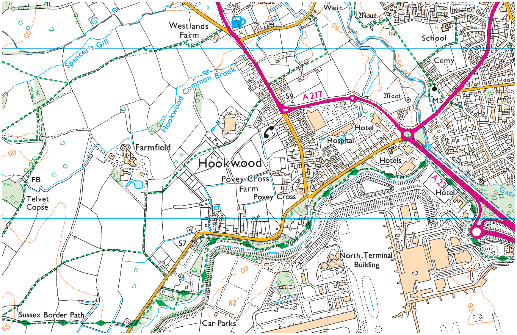
01. Hookwood/Povey Cross
Hookwood/Povey Cross →
Hookwood and Povey Cross are on the western outskirts of Horley. Many international hotels are situated here as is Tesco Hookwood. Several large housing developments are planned here. Hookwood and Povey Cross are directly beside the airport.
02. Gardens Estate
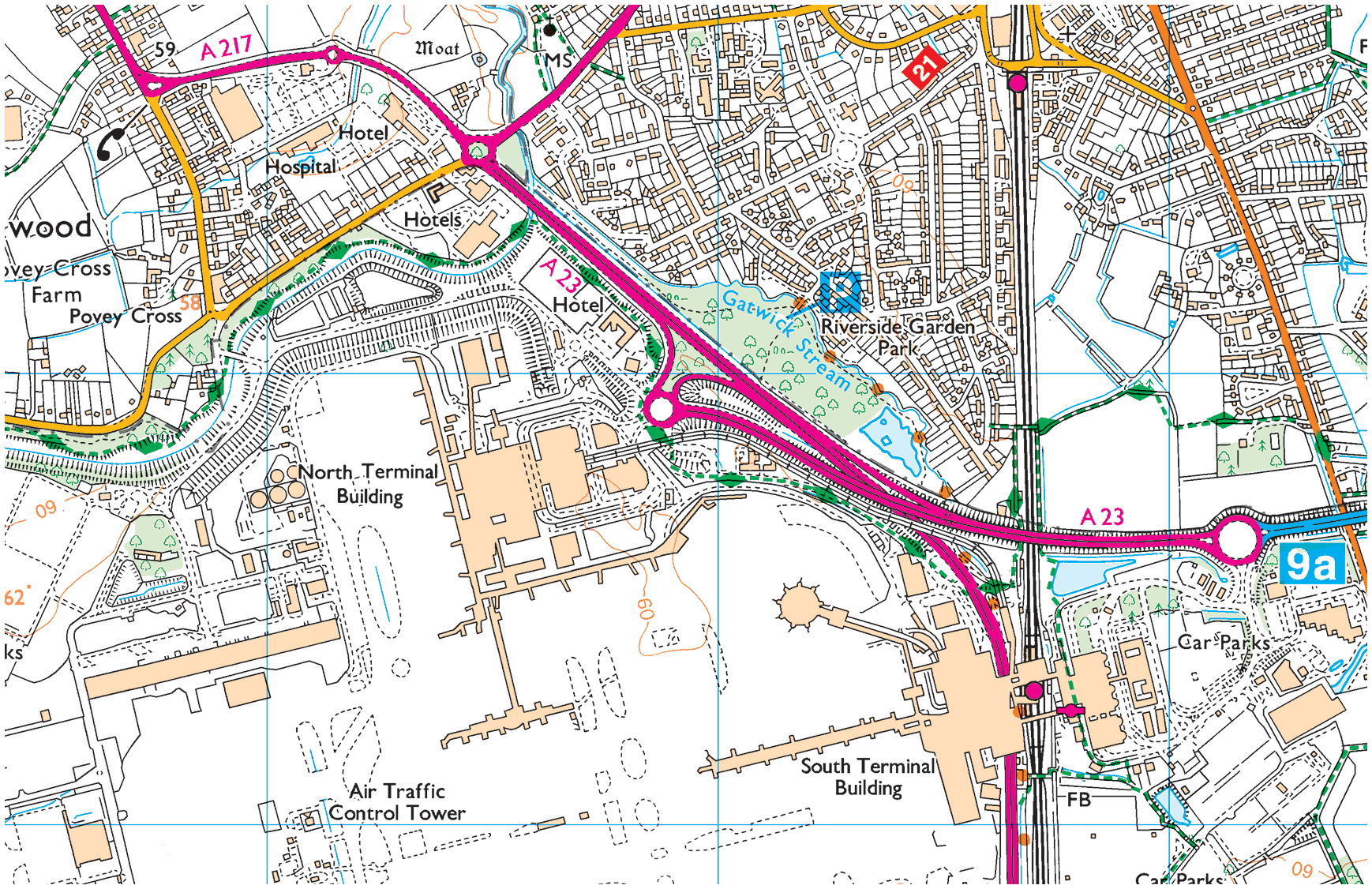
Gardens Estate →
Gardens Estate is very close to Gatwick airport and those working at LGW can easily access the terminal building via footpaths from the recreational area, Riverside Garden Park via the underpass of Gatwick airport station.
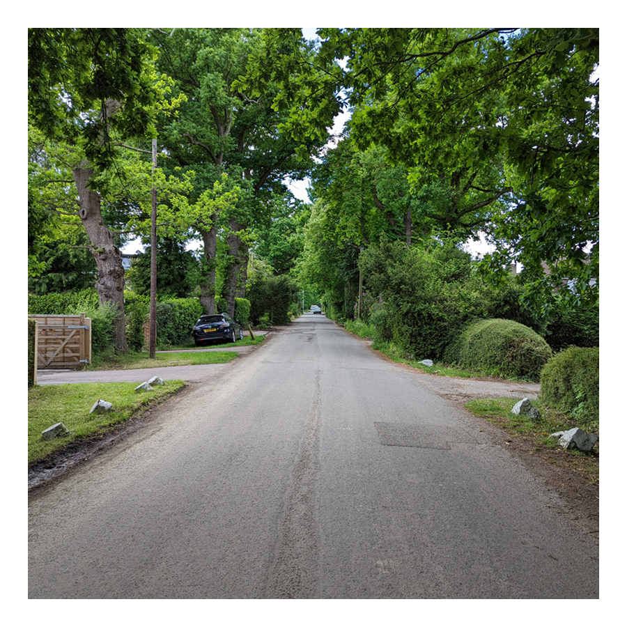
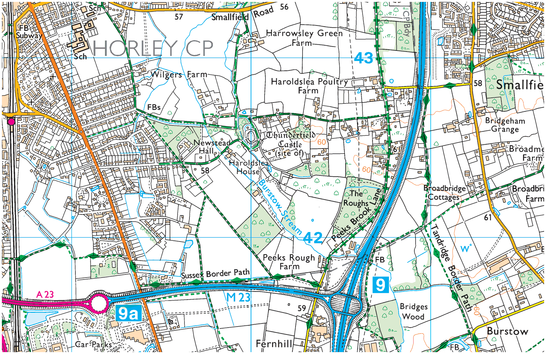
03. Haroldslea
Haroldslea →
This area comprises: The Balcombe Road (B2036) and the roads leading from it between Oakwood School and the A23/M23 link road flyover. For example, Limes Avenue which was originally laid out in 1936 and still retains some of the Lime trees planted at that time.
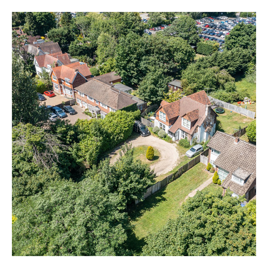
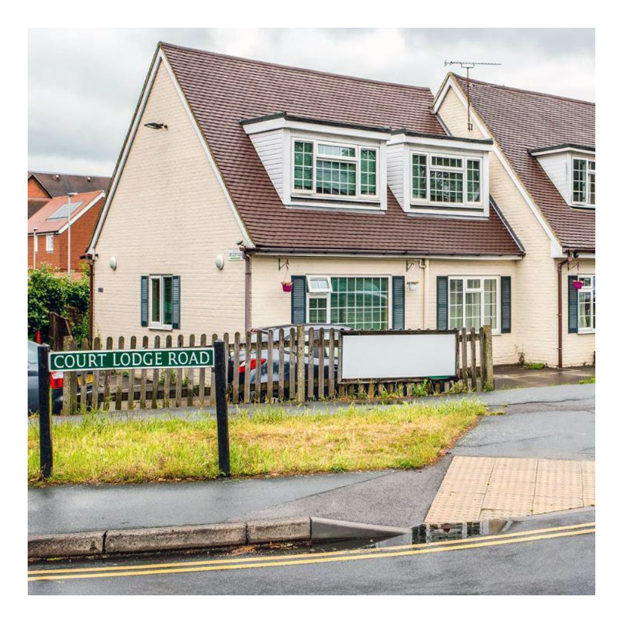
04. Court Lodge
Court Lodge →
This neighbourhood was set out in the 1950s and 1960s. It has a mixture of flats and houses. It is home to Horley leisure centre, several airport hotels and a couple of places of worship.
05. Horley Central
Horley Central →
This area includes the town centre which has quite a lot of purpose built residential flats and roads such as Church Road, Massetts Road, Pine Gardens, Ringley Avenue and, Russells Crescent.
06. Langshott
Langshott →
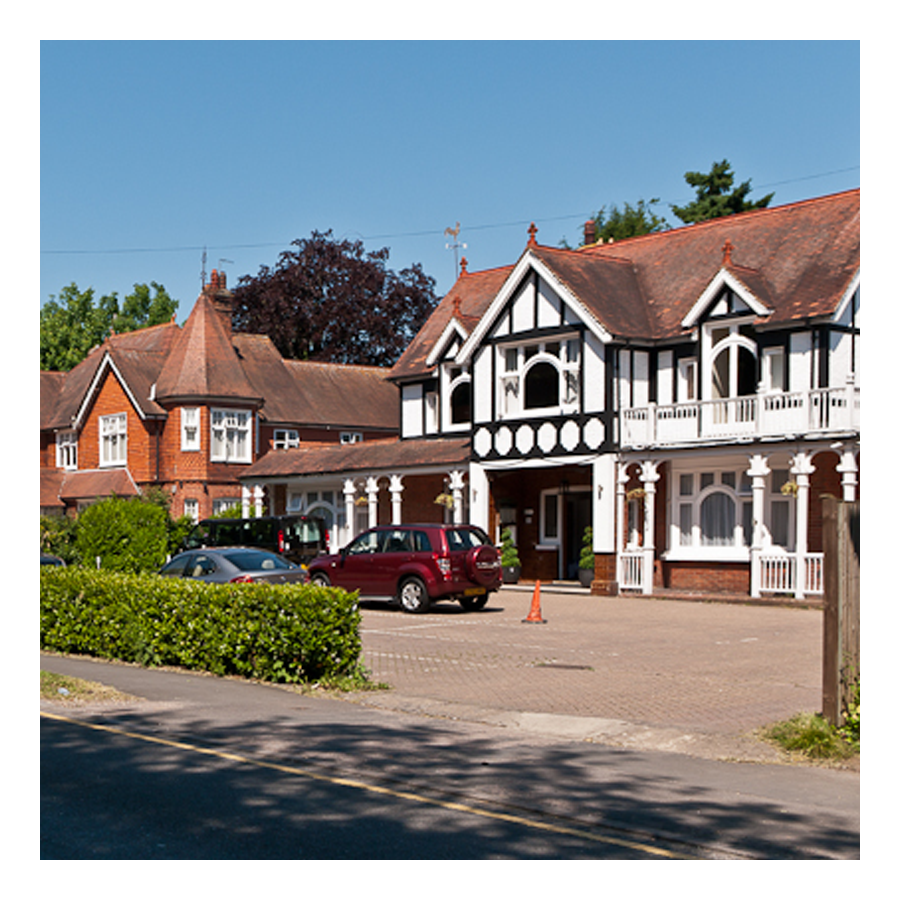
This area of Horley stretches eastward towards Smallfield. Immediately to its north is the new estate called The Acres. This area is home to Langshott Manor, which was built in 1580; it is now a luxury hotel.
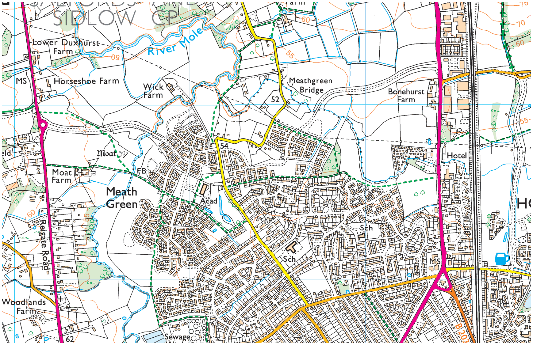
07. Meath Green
Meath Green →
Once upon a time this area was called Moy Grene, and it has some of Horley’s oldest homes. Today, the vast majority of the homes in this area where built from the late 1950s onwards.
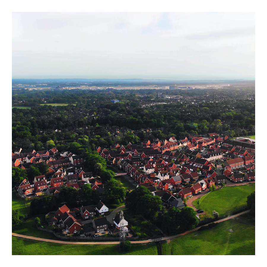
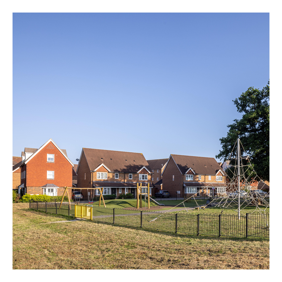
08. The Acres
The Acres →
This new neighbourhood of over 700 homes is in the north east of Horley and Langshott. The development was built mostly by Barratt and Bovis Homes between 2010 and 2016.
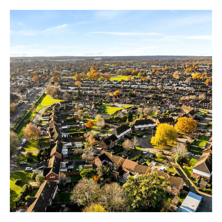
09. West Vale Park
West Vale Park →
This new neighbourhood is to the north west of Horley and joins onto Meath Green. To date, around 1,600 new homes have been constructed:
• Crest Nicholson brochure →
• Fabrica brochure →
• Taylor Wimpey brochure →
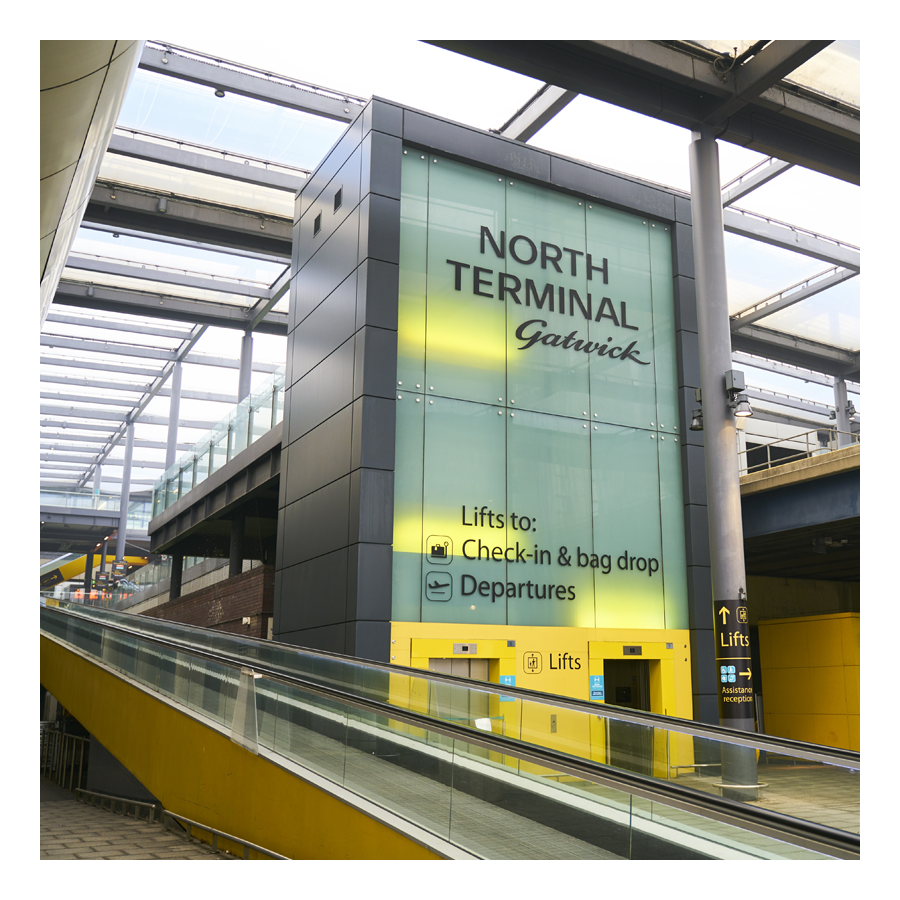
10. Gatwick
Explore Gatwick→
Gatwick airport is included as an area of Horley because historically it was part of Horley and, it remains adjacent to this day. Gatwick, before becoming a major international airport, was a famous horse racetrack which hosted the Grand National on several occasions.
Horley neighbourhoods
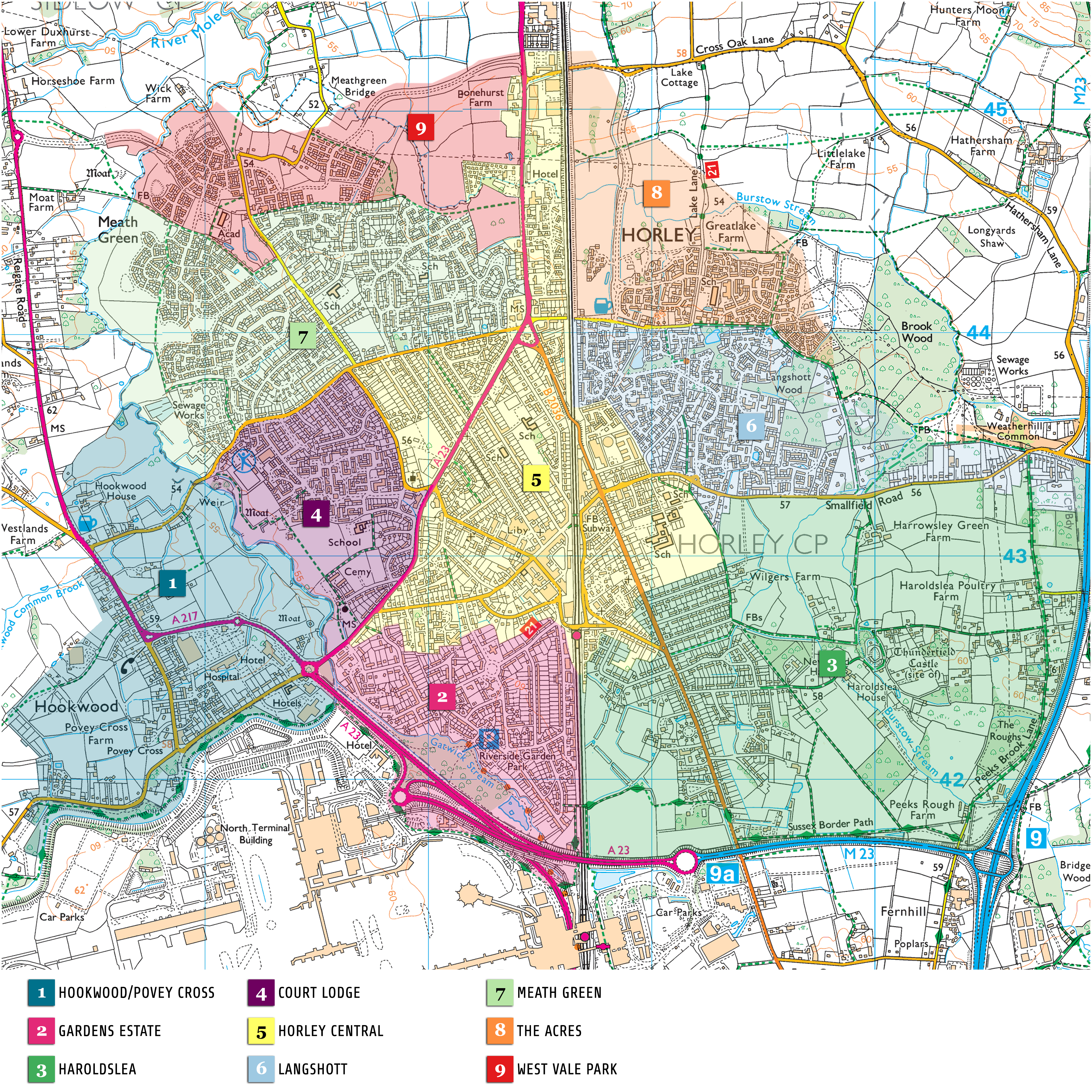
Horley Town
01. Hookwood/Povey Cross
02. Gardens Estate
03. Haroldslea
04. Court Lodge
05. Horley Central
06. Langshott
07. Meath Green
08. The Acres
09. West Vale Park
10. Gatwick